United States Volcanoes
-
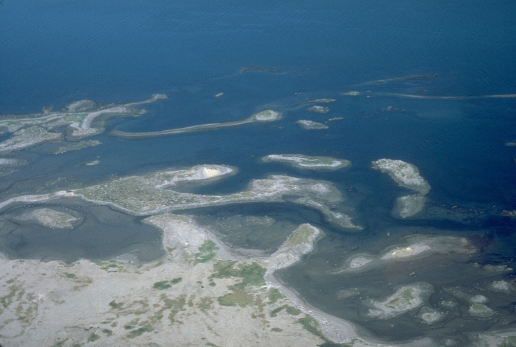
Kilauea
-
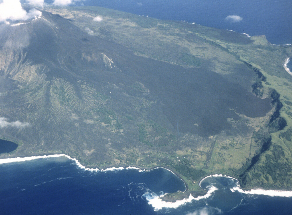
Pagan
-

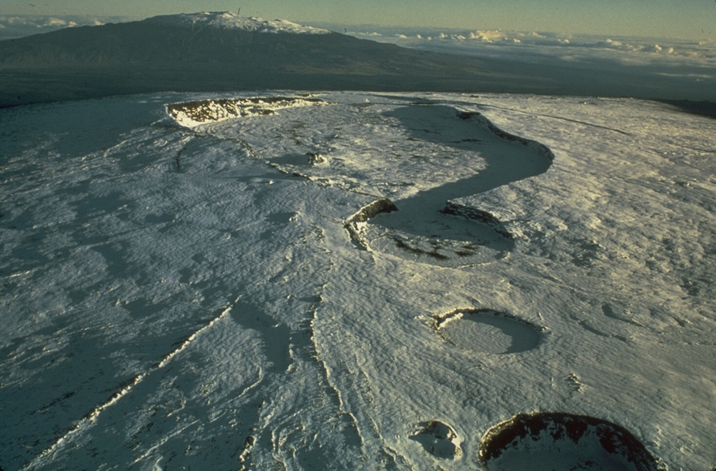
Mauna Loa
-
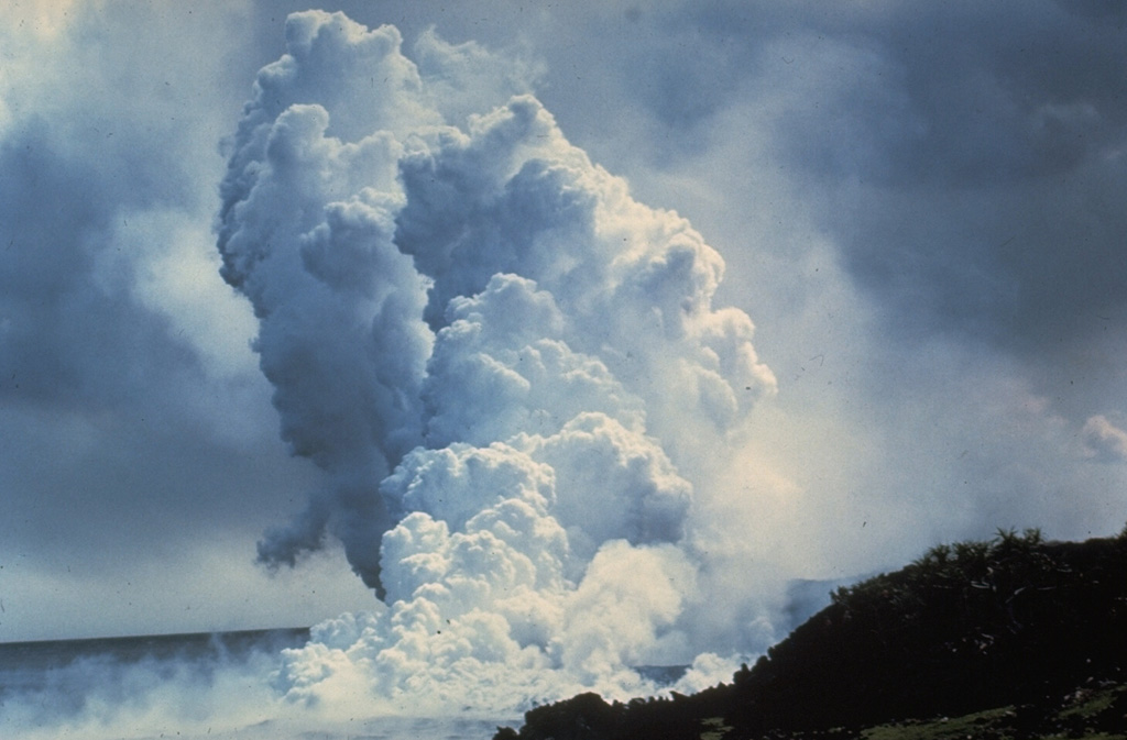
Kilauea
-
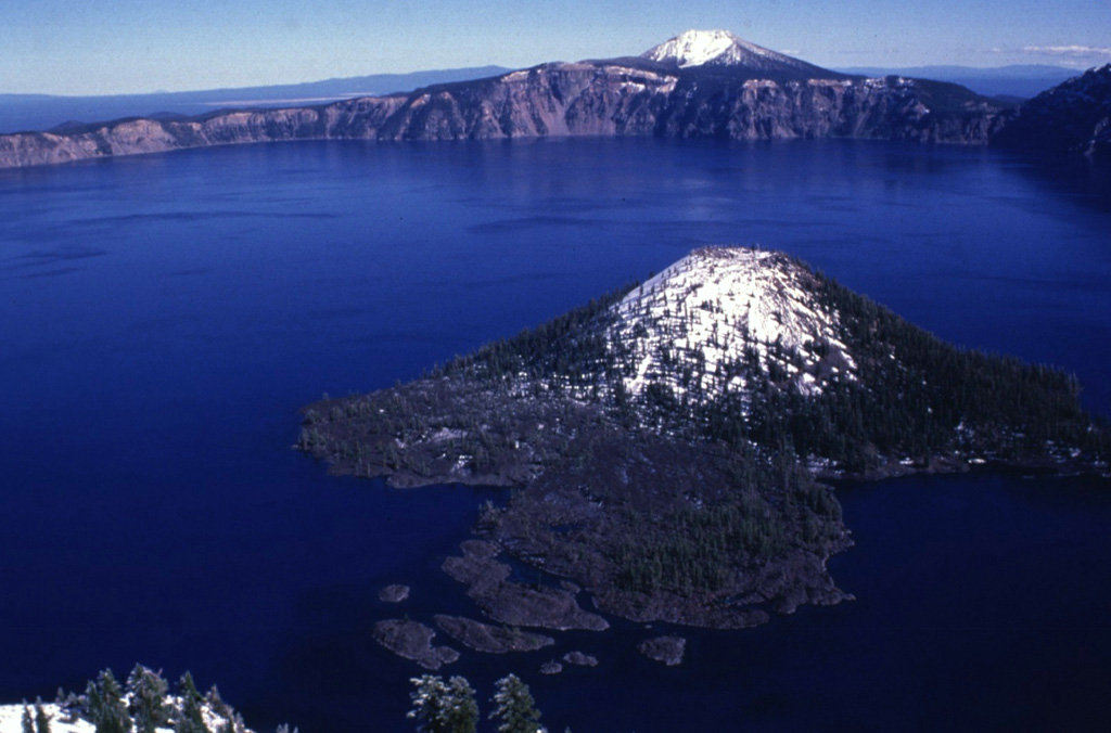
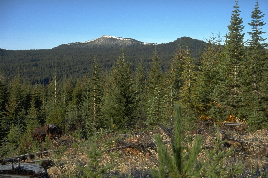
Crater Lake
-
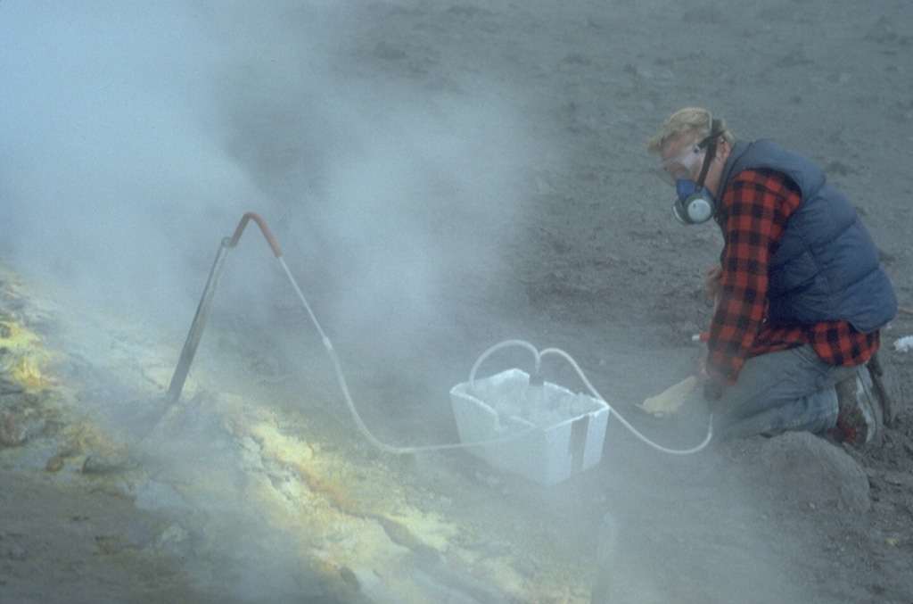
Augustine
-
Mauna Loa
-

Hayes
-
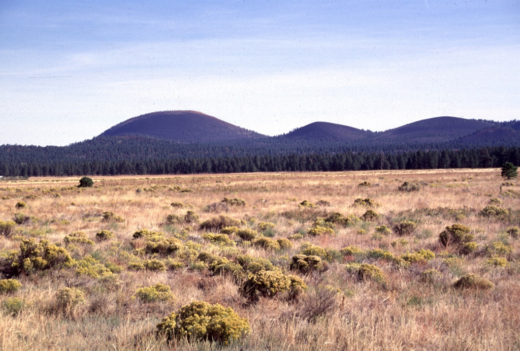
San Francisco Volcanic Field
-
Augustine
-

Shishaldin
-
Indian Heaven
-
West Crater
-
Sand Mountain Field
-
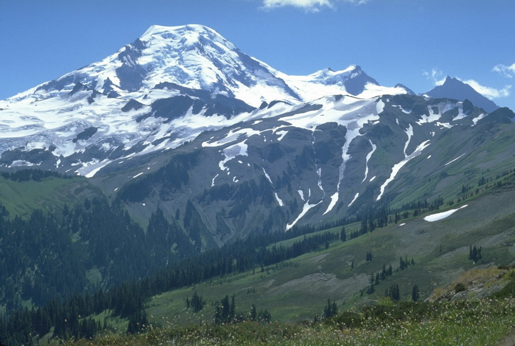
Baker
-

Katmai
-
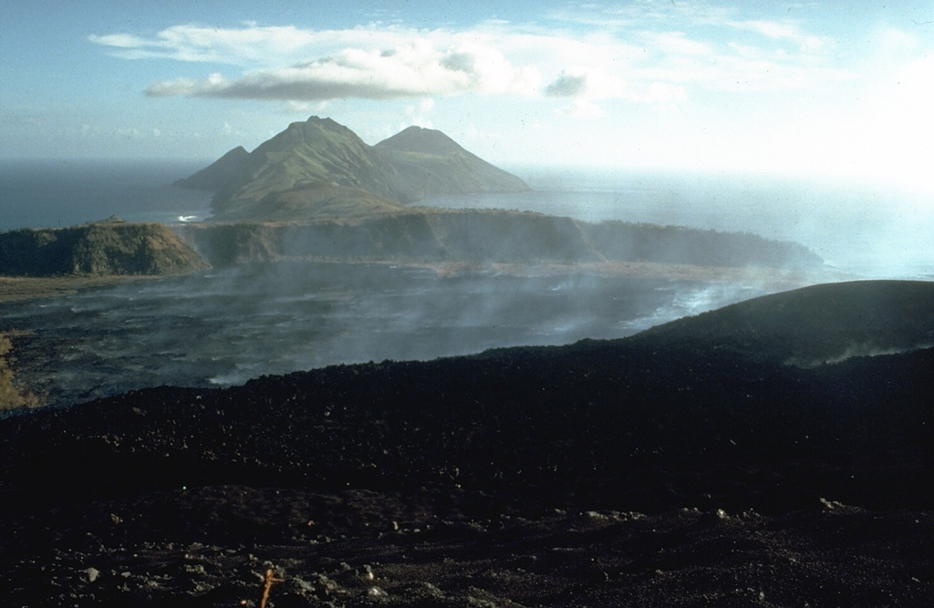
Pagan
-
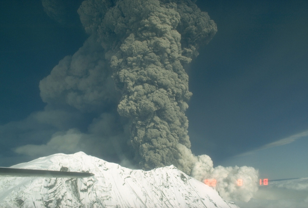
Spurr
-

Duncan Canal
-

Kilauea
United States has 165 Holocene volcanoes. Note that as a scientific organization we provide these listings for informational purposes only, with no international legal or policy implications. Volcanoes will be included on this list if they are within the boundaries of a country, on a shared boundary or area, in a remote territory, or within a maritime Exclusive Economic Zone. Bolded volcanoes have erupted within the past 20 years. Suggestions and data updates are always welcome ().
| Volcano Name | Location | Last Eruption | Primary Volcano Type |
|---|---|---|---|
| Adams | Washington | 950 CE | Stratovolcano |
| Agrigan | Mariana Islands (USA) | 1917 CE | Stratovolcano |
| Ahyi | Mariana Islands (USA) | 2024 CE | Stratovolcano |
| Akutan | Fox Islands (USA) | 1992 CE | Stratovolcano |
| Alamagan | Mariana Islands (USA) | 870 CE | Stratovolcano |
| Amak | Fox Islands (USA) | 1796 CE | Stratovolcano |
| Amukta | Islands of the Four Mountains (USA) | 1997 CE | Stratovolcano |
| Anatahan | Mariana Islands (USA) | 2008 CE | Stratovolcano |
| Aniakchak | Alaska Peninsula, Alaska | 1931 CE | Caldera |
| Asuncion | Mariana Islands (USA) | 1906 CE | Stratovolcano |
| Atka Volcanic Complex | Andreanof Islands (USA) | 2024 CE | Stratovolcano(es) |
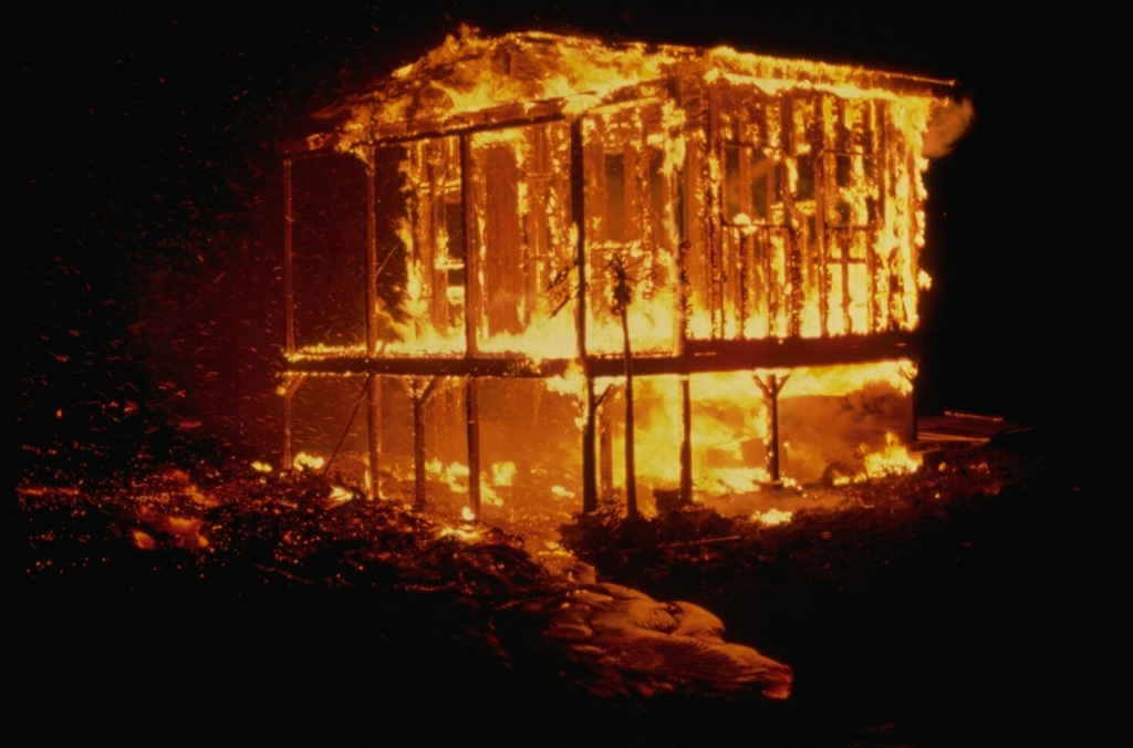
| Augustine | Alaska Peninsula | 2006 CE | Lava dome(s) |
| Bachelor | Oregon | 5800 BCE | Stratovolcano |
| Baker | Washington | 1880 CE | Stratovolcano(es) |
| Behm Canal-Rudyerd Bay | Southeastern Alaska (USA) | Unknown - Evidence Uncertain | Volcanic field |
| Belknap | Oregon | 480 CE | Shield(s) |
| Black Butte Crater Lava Field | Eastern Snake River Plain | 8400 BCE | Shield |
| Black Peak | Alaska Peninsula, Alaska | 1900 BCE | Stratovolcano |
| Black Rock Desert | Utah | 1290 CE | Volcanic field |
| Blue Lake Crater | Oregon | 680 CE | Maar |
| Bobrof | Andreanof Islands (USA) | Unknown - Evidence Uncertain | Stratovolcano |
| Bogoslof | Fox Islands (USA) | 2017 CE | Stratovolcano |
| Buldir | Aleutian Islands (USA) | Unknown - Evidence Uncertain | Stratovolcano |
| Buzzard Creek | Eastern Alaska | 1050 BCE | Tuff ring(s) |
| Carlisle | Islands of the Four Mountains (USA) | 1828 CE | Stratovolcano |
| Carrizozo | New Mexico | 3250 BCE | Pyroclastic cone(s) |
| Chagulak | Islands of the Four Mountains (USA) | Unknown - Evidence Credible | Stratovolcano |
| Chiginagak | Alaska Peninsula, Alaska | 1998 CE | Stratovolcano |
| Churchill | Eastern Alaska | 847 CE | Stratovolcano |
| Cinnamon Butte | Oregon | Unknown - Evidence Uncertain | Pyroclastic cone(s) |
| Clear Lake Volcanic Field | California | Unknown - Evidence Credible | Volcanic field |
| Cleveland | Chuginadak Island (USA) | 2020 CE | Stratovolcano |
| Crater Lake | Oregon | 2850 BCE | Caldera |
| Craters of the Moon | Eastern Snake River Plain | 130 BCE | Volcanic field |
| Daikoku | Mariana Islands (USA) | Unknown - Unrest / Holocene | Stratovolcano |
| Dana | Alaska Peninsula, Alaska | 1890 BCE | Stratovolcano |
| Davidof | Aleutian Islands (USA) | Unknown - Evidence Uncertain | Stratovolcano |
| Davis Lake | Oregon | 2790 BCE | Volcanic field |
| Denison | Alaska | Unknown - Evidence Uncertain | Stratovolcano |
| Devils Garden | High Lava Plains | Unknown - Evidence Uncertain | Volcanic field |
| Diamond Craters | High Lava Plains | 5610 BCE | Volcanic field |
| Dotsero | Colorado | 2200 BCE | Maar |
| Douglas | Alaska | Unknown - Evidence Credible | Stratovolcano |
| Duncan Canal | Southeastern Alaska (USA) | Unknown - Evidence Credible | Volcanic field |
| Dutton | Alaska Peninsula, Alaska | Unknown - Evidence Credible | Stratovolcano |
| East Diamante | Mariana Islands (USA) | Unknown - Unrest / Holocene | Stratovolcano |
| Edgecumbe | Southeastern Alaska (USA) | 2080 BCE | Volcanic field |
| Emmons Lake Volcanic Center | Alaska Peninsula, Alaska | Unknown - Evidence Credible | Caldera |
| Escanaba Segment | Gorda Ridge | 2260 BCE | Fissure vent(s) |
| Esmeralda Bank | Mariana Islands (USA) | Unknown - Unrest / Holocene | Stratovolcano |
| Farallon de Pajaros | Mariana Islands (USA) | 1953 CE | Stratovolcano |
| Fisher | Fox Islands (USA) | 1830 CE | Stratovolcano |
| Forecast Seamount | Mariana Islands (USA) | Unknown - Unrest / Holocene | Stratovolcano |
| Fourpeaked | Alaska | 2006 CE | Stratovolcano |
| Frosty | Alaska Peninsula, Alaska | Unknown - Evidence Credible | Stratovolcano(es) |
| Fukujin | Mariana Islands (USA) | 1974 CE | Stratovolcano |
| Gareloi | Aleutian Islands (USA) | 1989 CE | Stratovolcano |
| Glacier Peak | Washington | 1700 CE | Stratovolcano |
| Great Sitkin | Andreanof Islands (USA) | 2024 CE | Stratovolcano |
| Griggs | Alaska | 1790 BCE | Stratovolcano |
| Guguan | Mariana Islands (USA) | 1883 CE | Stratovolcano |
| Haleakala | Hawaiian Islands (USA) | 1750 CE | Shield |
| Hayes | Alaska Peninsula | 1200 CE | Stratovolcano |
| Hell's Half Acre | Eastern Snake River Plain | 3250 BCE | Shield |
| Herbert | Islands of the Four Mountains (USA) | Unknown - Evidence Credible | Stratovolcano |
| Hood | Oregon | 1866 CE | Stratovolcano |
| Hualalai | Hawaiian Islands (USA) | 1801 CE | Shield |
| Iliamna | Alaska Peninsula | 1876 CE | Stratovolcano |
| Imuruk Lake | Western Alaska | 300 CE | Volcanic field |
| Indian Heaven | Washington | 6250 BCE | Volcanic field |
| Ingakslugwat Hills | Western Alaska | Unknown - Evidence Credible | Volcanic field |
| Jackson Segment | Gorda Ridge | Unknown - Unrest / Holocene | Fissure vent(s) |
| Jefferson | Oregon | 950 CE | Stratovolcano |
| Jordan Craters | Western Snake River Plain | 1250 BCE | Volcanic field |
| Kagamil | Islands of the Four Mountains (USA) | 1929 CE | Stratovolcano |
| Kaguyak | Alaska | 3850 BCE | Lava dome(s) |
| Kama'ehuakanaloa | Hawaiian Islands (USA) | 1996 CE | Shield |
| Kanaga | Andreanof Islands (USA) | 2023 CE | Stratovolcano |
| Kasatochi | Andreanof Islands (USA) | 2008 CE | Stratovolcano |
| Kasuga 1 | Mariana Islands (USA) | 1959 CE | Stratovolcano |
| Kasuga 2 | Mariana Islands (USA) | Unknown - Evidence Credible | Stratovolcano |
| Katmai | Alaska | 1912 CE | Stratovolcano |
| Kialagvik | Alaska Peninsula, Alaska | Unknown - Evidence Credible | Stratovolcano |
| Kilauea | Hawaiian Islands (USA) | 2023 CE | Shield |
| Kiska | Aleutian Islands (USA) | 1990 CE | Stratovolcano |
| Koniuji | Andreanof Islands (USA) | 1150 BCE | Stratovolcano |
| Kukak | Alaska | Unknown - Unrest / Holocene | Stratovolcano |
| Kupreanof | Alaska Peninsula, Alaska | Unknown - Evidence Uncertain | Stratovolcano |
| Lassen Volcanic Center | California | 1917 CE | Stratovolcano |
| Little Sitkin | Aleutian Islands (USA) | 1830 CE | Stratovolcano |
| Mageik | Alaska | 500 BCE | Stratovolcano |
| Makushin | Fox Islands (USA) | 1995 CE | Stratovolcano |
| Malumalu | American Samoa (SW Pacific) | Unknown - Evidence Credible | Stratovolcano |
| Mammoth Mountain | California | 1260 CE | Lava dome(s) |
| Mariana Back-Arc Segment at 15.5°N | Mariana Islands (USA) | 2015 CE | Fissure vent |
| Markagunt Plateau | Utah | 1050 CE | Volcanic field |
| Martin | Alaska | 1953 CE | Stratovolcano |
| Maug Islands | Mariana Islands (USA) | Unknown - Unrest / Holocene | Stratovolcano |
| Mauna Kea | Hawaiian Islands (USA) | 2460 BCE | Shield |
| Mauna Loa | Hawaiian Islands (USA) | 2022 CE | Shield |
| Medicine Lake | California | 1060 CE | Shield |
| Moffett | Andreanof Islands (USA) | 1600 BCE | Stratovolcano |
| Mono Lake Volcanic Field | California | 1790 CE | Volcanic field |
| Mono-Inyo Craters | California | 1380 CE | Lava dome(s) |
| Newberry | Oregon | 690 CE | Shield |
| North Gorda Ridge Segment | Gorda Ridge | 1996 CE | Fissure vent(s) |
| Novarupta | Alaska | 1912 CE | Caldera |
| NW Eifuku | Mariana Islands (USA) | Unknown - Unrest / Holocene | Stratovolcano |
| NW Rota-1 | Mariana Islands (USA) | 2010 CE | Stratovolcano |
| Ofu-Olosega | American Samoa (SW Pacific) | 1866 CE | Shield(s) |
| Okmok | Fox Islands (USA) | 2008 CE | Shield |
| Pagan | Mariana Islands (USA) | 2021 CE | Stratovolcano(es) |
| Pavlof | Alaska Peninsula, Alaska | 2022 CE | Stratovolcano |
| Pavlof Sister | Alaska Peninsula, Alaska | Unknown - Evidence Credible | Stratovolcano |
| Rainier | Washington | 1450 CE | Stratovolcano |
| Recheschnoi | Fox Islands (USA) | Unknown - Evidence Credible | Stratovolcano |
| Red Hill | New Mexico | 9450 BCE | Volcanic field |
| Redoubt | Alaska Peninsula | 2009 CE | Stratovolcano |
| Roundtop | Fox Islands (USA) | 7600 BCE | Stratovolcano |
| Ruby | Mariana Islands (USA) | 2023 CE | Stratovolcano |
| Salton Buttes | California | 210 CE | Lava dome(s) |
| San Francisco Volcanic Field | Arizona | 1075 CE | Volcanic field |
| Sand Mountain Field | Oregon | 950 BCE | Volcanic field |
| Sarigan | Mariana Islands (USA) | Unknown - Evidence Credible | Stratovolcano |
| Seamount X | Mariana Islands (USA) | Unknown - Unrest / Holocene | Stratovolcano |
| Seguam | Andreanof Islands (USA) | 1993 CE | Stratovolcano(es) |
| Segula | Aleutian Islands (USA) | Unknown - Evidence Credible | Stratovolcano |
| Semisopochnoi | Aleutian Islands (USA) | 2023 CE | Stratovolcano |
| Shasta | California | 1250 CE | Stratovolcano |
| Shishaldin | Fox Islands (USA) | 2023 CE | Stratovolcano |
| Snowy Mountain | Alaska | 1710 CE | Stratovolcano(es) |
| Soda Lakes | Nevada | Unknown - Evidence Credible | Maar(s) |
| South Sarigan Seamount | Mariana Islands (USA) | 2010 CE | Stratovolcano |
| Spurr | Alaska Peninsula | 1992 CE | Stratovolcano |
| St. Helens | Washington | 2008 CE | Stratovolcano |
| St. Michael | Western Alaska | Unknown - Evidence Credible | Volcanic field |
| St. Paul Island | Western Alaska | 1280 BCE | Shield |
| Steller | Alaska | Unknown - Evidence Credible | Stratovolcano |
| Stepovak Bay Group | Alaska Peninsula, Alaska | Unknown - Evidence Credible | Volcanic field |
| Supply Reef | Mariana Islands (USA) | Unknown - Evidence Uncertain | Stratovolcano |
| Takawangha | Andreanof Islands (USA) | 1550 CE | Stratovolcano |
| Tana | Chuginadak Island (USA) | Unknown - Evidence Credible | Stratovolcano(es) |
| Tanaga | Andreanof Islands (USA) | 1914 CE | Stratovolcano(es) |
| Ta'u | American Samoa (SW Pacific) | Unknown - Evidence Credible | Shield |
| Three Sisters | Oregon | 439 CE | Complex |
| Tlevak Strait-Suemez Island | Southeastern Alaska (USA) | Unknown - Evidence Credible | Volcanic field |
| Trident | Alaska | 1974 CE | Stratovolcano |
| Tutuila | American Samoa (SW Pacific) | 440 CE | Tuff cone(s) |
| Ubehebe Craters | California | 150 BCE | Maar(s) |
| Ugashik-Peulik | Alaska Peninsula, Alaska | 1814 CE | Stratovolcano |
| Uinkaret Field | Arizona | 1100 CE | Volcanic field |
| Ukinrek Maars | Alaska Peninsula, Alaska | 1977 CE | Maar(s) |
| Uliaga | Islands of the Four Mountains (USA) | Unknown - Evidence Credible | Stratovolcano |
| Unnamed | Alaska Peninsula, Alaska | Unknown - Evidence Credible | Lava dome |
| Vailulu'u | American Samoa (SW Pacific) | 2003 CE | Shield |
| Veniaminof | Alaska Peninsula, Alaska | 2021 CE | Stratovolcano |
| Vsevidof | Fox Islands (USA) | 1878 CE | Stratovolcano |
| Wapi Lava Field | Eastern Snake River Plain | 300 BCE | Shield |
| West Crater | Washington | 5750 BCE | Volcanic field |
| Westdahl | Fox Islands (USA) | 1992 CE | Stratovolcano? |
| Wrangell | Eastern Alaska | 1912 CE | Shield |
| Yantarni | Alaska Peninsula, Alaska | 800 BCE | Stratovolcano |
| Yunaska | Islands of the Four Mountains (USA) | 1937 CE | Shield |
| Zealandia Bank | Mariana Islands (USA) | Unknown - Unrest / Holocene | Stratovolcano |
| Zuni-Bandera | New Mexico | 1170 BCE | Volcanic field |
Chronological listing of known Holocene eruptions (confirmed or uncertain) from volcanoes in United States. Bolded eruptions indicate continuing activity.
| Volcano Name | Start Date | Stop Date | Certainty | VEI | Evidence |
|---|---|---|---|---|---|
| Atka Volcanic Complex | 2024 Mar 27 | 2024 Mar 27 | Confirmed | Observations: Reported | |
| Ahyi | 2024 Jan 1 | 2024 Mar 27 | Confirmed | Observations: Satellite (visual) | |
| Kanaga | 2023 Dec 18 | 2023 Dec 18 | Confirmed | Observations: Reported | |
| Ruby | 2023 Sep 14 | 2023 Sep 15 | Confirmed | Observations: Reported | |
| Shishaldin | 2023 Jul 12 | 2023 Nov 3 | Confirmed | Observations: Reported | |
| Mauna Loa | 2022 Nov 27 | 2022 Dec 10 | Confirmed | 0 | Observations: Reported |
| Ahyi | 2022 Nov 18 ± 1 days | 2023 Jun 11 | Confirmed | 1 | Observations: Reported |
| Kilauea | 2021 Sep 29 | 2023 Sep 16 | Confirmed | 0 | Observations: Reported |
| Pavlof | 2021 Aug 5 | 2022 Dec 7 | Confirmed | 2 | Observations: Reported |
| Pagan | 2021 Jul 29 | 2021 Sep 6 | Confirmed | 2 | Observations: Reported |
| Great Sitkin | 2021 May 25 | 2024 Apr 19 (continuing) | Confirmed | 2 | Observations: Reported |
| Veniaminof | 2021 Feb 28 | 2021 Apr 5 | Confirmed | 1 | Observations: Reported |
| Semisopochnoi | 2021 Feb 2 ± 2 days | 2023 May 5 | Confirmed | 2 | Observations: Reported |
| Kilauea | 2020 Dec 20 | 2021 May 23 | Confirmed | 0 | Observations: Reported |
| Cleveland | 2020 Jun 1 | 2020 Jun 1 | Confirmed | 3 | Observations: Reported |
| Semisopochnoi | 2019 Dec 7 | 2020 Jun 19 | Confirmed | 1 | Observations: Reported |
| Cleveland | [2019 Nov 7] | [2019 Dec 7 (?)] | Uncertain | ||
| Shishaldin | 2019 Jul 23 | 2020 May 4 | Confirmed | 3 | Observations: Reported |
| Semisopochnoi | 2019 Jul 16 | 2019 Aug 24 | Confirmed | 1 | Observations: Reported |
| Great Sitkin | 2019 Jun 1 | 2019 Jun 7 | Confirmed | 1 | Observations: Reported |
| Semisopochnoi | 2018 Sep 8 | 2018 Oct 31 | Confirmed | 1 | Observations: Reported |
| Veniaminof | 2018 Sep 4 | 2018 Dec 23 | Confirmed | 1 | Observations: Reported |
| Great Sitkin | 2018 Jun 10 | 2018 Aug 11 | Confirmed | 1 | Observations: Reported |
| Bogoslof | 2016 Dec 20 | 2017 Aug 30 | Confirmed | 3 | Observations: Reported |
| Cleveland | 2016 Apr 16 | 2019 Jan 16 | Confirmed | 2 | Observations: Reported |
| Pavlof | 2016 Mar 27 | 2016 Jul 30 | Confirmed | 3 | Observations: Reported |
| Pavlof | 2014 Nov 12 | 2014 Nov 15 | Confirmed | 3 | Observations: Reported |
| Pavlof | 2014 May 31 | 2014 Jun 6 | Confirmed | 3 | Observations: Reported |
| Ahyi | 2014 Apr 24 | 2014 May 17 | Confirmed | 2 | Observations: Hydrophonic |
| Shishaldin | 2014 Jan 30 | 2015 Jul 3 | Confirmed | 1 | Observations: Reported |
| Veniaminof | 2013 Jun 13 | 2013 Oct 12 ± 1 days | Confirmed | 3 | Observations: Reported |
| Pavlof | 2013 May 13 | 2013 Jun 26 | Confirmed | 3 | Observations: Reported |
| Mariana Back-Arc Segment at 15.5°N | 2013 Feb 13 (after) | 2015 Dec 1 (in or before) | Confirmed | 0 | Observations: Reported |
| Pagan | 2012 Jul 10 | 2012 Jul 10 | Confirmed | 2 | Observations: Reported |
| Kanaga | 2012 Feb 18 | 2012 Feb 18 | Confirmed | 2 | Observations: Reported |
| Cleveland | 2011 Jul 19 ± 7 days | 2015 Aug 18 | Confirmed | 2 | Observations: Reported |
| Pagan | 2011 Apr 23 (?) | 2011 Sep 1 (?) | Confirmed | 2 | Observations: Reported |
| Cleveland | [2010 Sep 11] | [2010 Sep 12] | Uncertain | ||
| Cleveland | 2010 May 30 | 2010 Jun 2 (?) | Confirmed | 2 | Observations: Reported |
| South Sarigan Seamount | 2010 May 27 | 2010 May 29 | Confirmed | 3 | Observations: Reported |
| Pagan | 2010 May 3 | 2010 Aug 11 | Confirmed | 1 | Observations: Reported |
| Cleveland | 2009 Oct 2 | 2009 Dec 12 (?) | Confirmed | 2 | Observations: Reported |
| Cleveland | 2009 Jun 25 | 2009 Jun 25 | Confirmed | 2 | Observations: Reported |
| Pagan | [2009 Apr 15] | [Unknown] | Uncertain | ||
| Redoubt | 2009 Mar 15 | 2009 Jul 1 ± 30 days | Confirmed | 3 | Observations: Reported |
| Cleveland | 2009 Jan 2 | 2009 Jan 21 | Confirmed | 2 | Observations: Reported |
| Kasatochi | 2008 Aug 7 | 2008 Aug 9 (?) | Confirmed | 4 | Observations: Reported |
| Okmok | 2008 Jul 12 | 2008 Aug 19 | Confirmed | 4 | Observations: Reported |
| Veniaminof | 2008 Feb 22 | 2008 Mar 1 | Confirmed | 1 | Observations: Reported |
| Shishaldin | [2008 Feb 12] | [2008 Feb 12] | Uncertain | ||
| Anatahan | 2007 Nov 27 ± 3 days | 2008 Aug 9 (?) | Confirmed | 2 | Observations: Reported |
| Pavlof | 2007 Aug 15 | 2007 Sep 13 | Confirmed | 2 | Observations: Reported |
| Cleveland | 2007 Jun 17 (?) | 2008 Aug 12 (?) | Confirmed | 2 | Observations: Reported |
| Pagan | 2006 Dec 4 | 2006 Dec 8 | Confirmed | 1 | Observations: Reported |
| Atka Volcanic Complex | 2006 Nov 25 ± 5 days | 2007 Mar 3 (in or before) | Confirmed | 1 | Observations: Reported |
| Fourpeaked | 2006 Sep 17 | 2006 Sep 17 | Confirmed | 2 | Observations: Reported |
| Anatahan | 2006 Mar 20 (?) | 2006 Jun 26 (?) | Confirmed | 2 | Observations: Reported |
| Veniaminof | 2006 Mar 3 | 2006 Sep 7 | Confirmed | 1 | Observations: Reported |
| Cleveland | 2006 Feb 6 | 2006 Oct 28 | Confirmed | 3 | Observations: Reported |
| Augustine | 2005 Dec 9 (?) | 2006 Apr 27 (?) | Confirmed | 3 | Observations: Reported |
| Veniaminof | 2005 Sep 7 | 2005 Nov 4 (?) | Confirmed | 1 | Observations: Reported |
| Cleveland | 2005 Mar 13 (?) | 2005 Nov 27 ± 1 days | Confirmed | 2 | Observations: Reported |
| Atka Volcanic Complex | 2005 Feb 23 | 2005 May 5 ± 4 days | Confirmed | 1 | Observations: Reported |
| Veniaminof | 2005 Jan 4 | 2005 Feb 14 ± 3 days | Confirmed | 2 | Observations: Reported |
| St. Helens | 2004 Oct 1 | 2008 Jan 27 ± 10 days | Confirmed | 2 | Observations: Reported |
| Atka Volcanic Complex | 2004 Jul 4 (in or before) | Unknown | Confirmed | 1 | Observations: Reported |
| Anatahan | 2004 Apr 12 (in or before) | 2005 Sep 3 (?) | Confirmed | 3 | Observations: Reported |
| Shishaldin | 2004 Feb 17 | 2004 Jul 16 (in or after) ± 15 days | Confirmed | 2 | Observations: Reported |
| Veniaminof | 2004 Feb 16 | 2004 Sep 5 ± 4 days | Confirmed | 2 | Observations: Reported |
| NW Rota-1 | 2003 Jul 2 (?) ± 182 days | 2010 Mar 16 (in or after) ± 15 days | Confirmed | 0 | Observations: Reported |
| Anatahan | 2003 May 10 | 2003 Jul 12 ± 3 days | Confirmed | 3 | Observations: Reported |
| Vailulu'u | 2003 Apr 16 ± 2 years ± 15 days | Unknown | Confirmed | 0 | Observations: Reported |
| Veniaminof | 2002 Sep 24 | 2003 Mar 23 | Confirmed | 1 | Observations: Reported |
| Wrangell | [2002 Aug 1] | [2002 Aug 2] | Uncertain | ||
| Atka Volcanic Complex | 2002 Jul 16 (in or before) ± 15 days | Unknown | Confirmed | 1 | Observations: Reported |
| Pavlof | [2001 Jun 5 ± 4 days] | [Unknown] | Uncertain | ||
| Ahyi | 2001 Apr 24 | 2001 Apr 25 | Confirmed | 0 | Observations: Hydrophonic |
| Cleveland | 2001 Feb 2 (in or before) | 2001 Apr 15 (?) | Confirmed | 3 | Observations: Reported |
| Shishaldin | [2000 Aug 11] | [Unknown] | Uncertain | ||
| Shishaldin | [1999 Sep 25 ± 5 days] | [2000 Feb 4 (?)] | Uncertain | ||
| Wrangell | [1999 May 14] | [1999 May 14] | Uncertain | ||
| Shishaldin | 1999 Mar 13 | 1999 May 27 | Confirmed | 3 | Observations: Reported |
| Shishaldin | 1998 Nov 4 | 1998 Nov 4 | Confirmed | 1 | Observations: Reported |
| Chiginagak | 1998 Aug 13 | 1998 Aug 13 (?) | Confirmed | 1 | Observations: Reported |
| Atka Volcanic Complex | 1998 May 8 ± 1 days | 1998 Jul 8 (?) | Confirmed | 3 | Observations: Reported |
| Shishaldin | 1997 Jun 2 | 1997 Jun 2 | Confirmed | 1 | Observations: Reported |
| Cleveland | 1997 May 5 | 1997 May 5 | Confirmed | 2 | Observations: Reported |
| Amukta | 1997 Mar 3 | Unknown | Confirmed | 1 | Observations: Reported |
| Okmok | 1997 Feb 11 | 1997 May 19 ± 4 days | Confirmed | 3 | Observations: Reported |
| Gareloi | [1996 Sep 27] | [Unknown] | Uncertain | ||
| Amukta | 1996 Sep 17 | 1996 Sep 18 | Confirmed | 1 | Observations: Reported |
| Pavlof | 1996 Sep 11 | 1997 Jan 3 (?) | Confirmed | 2 | Observations: Reported |
| Pagan | 1996 Jul 2 ± 182 days | Unknown | Confirmed | 1 | Observations: Reported |
| Kanaga | [1996 Jun 11] | [Unknown] | Uncertain | ||
| North Gorda Ridge Segment | 1996 Feb 28 (?) | 1996 Mar 15 (?) | Confirmed | 0 | Observations: Reported |
| Kama'ehuakanaloa | 1996 Feb 25 ± 30 days | 1996 Aug 9 (?) | Confirmed | 0 | Observations: Reported |
| Shishaldin | 1995 Dec 23 | 1996 May 16 (in or before) | Confirmed | 3 | Observations: Reported |
| Veniaminof | 1995 Nov 15 | 1995 Nov 30 (?) | Confirmed | 1 | Observations: Reported |
| Ruby | 1995 Oct 11 (?) | 1995 Oct 25 | Confirmed | 0 | Observations: Reported |
| Kanaga | 1995 Jun 19 (?) | 1995 Jun 23 (?) | Confirmed | 2 | Observations: Reported |
| Atka Volcanic Complex | [1995 May 1] | [Unknown] | Uncertain | ||
| Veniaminof | 1995 Apr 17 | 1995 Apr 17 | Confirmed | 1 | Observations: Reported |
| Makushin | 1995 Jan 30 | 1995 Jan 30 | Confirmed | 1 | Observations: Reported |
| Vailulu'u | 1995 Jan 9 | 1995 Jan 29 | Confirmed | 0 | Observations: Hydrophonic |
| Cleveland | 1994 Oct 20 | 1994 Oct 20 | Confirmed | 1 | Observations: Reported |
| Cleveland | 1994 May 25 | 1994 May 25 | Confirmed | 3 | Observations: Reported |
| Ahyi | 1994 Apr 23 | Unknown | Confirmed | 0 | Observations: Reported |
| Kanaga | 1994 Jan 5 ± 4 days | 1994 Nov 26 ± 4 days | Confirmed | 2 | Observations: Reported |
| Shishaldin | 1993 Sep 4 | 1993 Oct 29 | Confirmed | 2 | Observations: Reported |
| Makushin | 1993 Aug 16 ± 15 days | 1994 Jan 19 (?) | Confirmed | 1 | Observations: Reported |
| Veniaminof | 1993 Jul 30 | 1994 Sep 28 (?) | Confirmed | 2 | Observations: Reported |
| Seguam | 1993 May 28 | 1993 Aug 31 (in or after) | Confirmed | 2 | Observations: Reported |
| Pagan | 1993 Jan 15 ± 5 days | 1993 Nov 16 (in or after) ± 15 days | Confirmed | 2 | Observations: Reported |
| Seguam | 1992 Dec 27 | 1992 Dec 30 | Confirmed | 2 | Observations: Reported |
| Akutan | 1992 Dec 18 | Unknown | Confirmed | 1 | Observations: Reported |
| Bogoslof | 1992 Jul 6 | 1992 Jul 24 | Confirmed | 3 | Observations: Reported |
| Spurr | 1992 Jun 27 | 1992 Sep 17 | Confirmed | 4 | Observations: Reported |
| Pagan | 1992 Apr 13 | 1992 Apr 13 | Confirmed | 1 | Observations: Reported |
| Akutan | 1992 Mar 8 | 1992 May 21 | Confirmed | 2 | Observations: Reported |
| Westdahl | 1991 Nov 29 | 1992 Jan 14 | Confirmed | 3 | Observations: Reported |
| Akutan | 1991 Sep 15 | 1991 Oct 29 ± 1 days | Confirmed | 2 | Observations: Reported |
| St. Helens | 1990 Nov 5 | 1991 Feb 14 | Confirmed | 3 | Observations: Reported |
| Akutan | 1990 Sep 6 | 1990 Oct 1 | Confirmed | 2 | Observations: Reported |
| Kiska | 1990 Jun 1 | 1990 Jun 1 (?) | Confirmed | 2 | Observations: Reported |
| Pavlof | 1990 Mar 5 | 1990 Mar 5 | Confirmed | 2 | Observations: Reported |
| Akutan | 1990 Jan 26 ± 5 days | 1990 Jan 26 ± 5 days | Confirmed | 2 | Observations: Reported |
| Redoubt | 1989 Dec 14 | 1990 Jun 20 (?) | Confirmed | 3 | Observations: Reported |
| St. Helens | 1989 Dec 7 | 1990 Jan 6 | Confirmed | 2 | Observations: Reported |
| Cleveland | [1989 Oct 25 ± 3 days] | [Unknown] | Uncertain | ||
| Ahyi | 1989 Sep 21 | 1989 Dec 27 | Confirmed | 0 | Observations: Hydrophonic |
| Gareloi | 1989 Aug 17 | Unknown | Confirmed | 1 | Observations: Reported |
| Akutan | 1989 Feb 27 | 1989 Mar 28 (in or before) | Confirmed | 2 | Observations: Reported |
| Pagan | 1988 Aug 24 | 1988 Oct 12 | Confirmed | 2 | Observations: Reported |
| Akutan | 1988 Mar 26 | 1988 Jul 20 | Confirmed | 2 | Observations: Reported |
| Pagan | [1988 Feb 16] | [Unknown] | Uncertain | ||
| Carlisle | [1987 Nov 16] | [Unknown] | Uncertain | ||
| Pagan | 1987 Sep 4 | 1987 Sep 4 | Confirmed | 1 | Observations: Reported |
| Amukta | 1987 Sep 4 (?) | Unknown | Confirmed | 1 | Observations: Reported |
| Gareloi | 1987 Sep 4 | Unknown | Confirmed | 1 | Observations: Reported |
| Cleveland | 1987 Jun 19 | 1987 Aug 28 | Confirmed | 3 | Observations: Reported |
| Esmeralda Bank | [1987 May 26] | [Unknown] | Uncertain | ||
| Kiska | [1987 Apr 15] | [Unknown] | Uncertain | ||
| Semisopochnoi | 1987 Apr 13 | Unknown | Confirmed | 2 | Observations: Reported |
| Veniaminof | 1987 Mar 19 | 1987 Mar 19 | Confirmed | 1 | Observations: Reported |
| Great Sitkin | [1987 Mar 18] | [Unknown] | Uncertain | ||
| Kupreanof | [1987 Mar 10] | [1987 Mar 10] | Uncertain | ||
| Atka Volcanic Complex | 1987 Mar 4 (?) | 1987 Mar 19 (?) | Confirmed | 2 | Observations: Reported |
| Makushin | 1987 Mar 2 | 1987 Mar 2 | Confirmed | 1 | Observations: Reported |
| Akutan | 1987 Jan 31 | 1987 Jun 24 | Confirmed | 2 | Observations: Reported |
| Okmok | 1986 Nov 18 | 1988 Feb 26 | Confirmed | 2 | Observations: Reported |
| Kama'ehuakanaloa | [1986 Sep 20] | [1986 Sep 20] | Uncertain | ||
| Atka Volcanic Complex | [1986 May 23] | [Unknown] | Uncertain | ||
| Cleveland | 1986 Apr 28 | 1986 May 27 (in or after) | Confirmed | 2 | Observations: Reported |
| Pavlof | 1986 Apr 16 | 1988 Aug 13 | Confirmed | 3 | Observations: Reported |
| Augustine | 1986 Mar 27 | 1986 Aug 31 | Confirmed | 4 | Observations: Reported |
| Shishaldin | 1986 Mar 19 | 1987 Feb 15 (?) | Confirmed | 2 | Observations: Reported |
| Akutan | 1986 Mar 18 | 1986 Jun 30 | Confirmed | 2 | Observations: Reported |
| Cleveland | [1985 Dec 10] | [Unknown] | Uncertain | ||
| Ahyi | 1985 Aug 2 | 1985 Sep 5 | Confirmed | 0 | Observations: Hydrophonic |
| Veniaminof | 1984 Nov 29 | 1984 Dec 6 (?) | Confirmed | 2 | Observations: Reported |
| Kama'ehuakanaloa | [1984 Nov 11] | [1985 Jan 21] | Uncertain | ||
| Cleveland | 1984 Jul 12 | 1984 Jul 12 | Confirmed | 1 | Observations: Reported |
| Mauna Loa | 1984 Mar 25 | 1984 Apr 15 | Confirmed | 0 | Observations: Reported |
| Pavlof | 1983 Nov 11 | 1983 Dec 18 | Confirmed | 3 | Observations: Reported |
| Pavlof | 1983 Jul 11 | 1983 Jul 18 | Confirmed | 2 | Observations: Reported |
| Okmok | 1983 Jul 8 | 1983 Jul 8 | Confirmed | 2 | Observations: Reported |
| Veniaminof | 1983 Jun 2 | 1984 Apr 17 | Confirmed | 3 | Observations: Reported |
| Kilauea | 1983 Jan 3 | 2018 Sep 5 | Confirmed | 3 | Observations: Reported |
| Fukujin | [1982 Dec 15] | [Unknown] | Uncertain | ||
| Akutan | 1982 Oct 5 ± 4 days | 1983 May 16 ± 15 days | Confirmed | 2 | Observations: Reported |
| Kilauea | 1982 Sep 25 | 1982 Sep 26 | Confirmed | 0 | Observations: Reported |
| Pavlof | [1982 Jul 15 ± 45 days] | [Unknown] | Uncertain | ||
| Kilauea | 1982 Apr 30 | 1982 May 1 | Confirmed | 0 | Observations: Reported |
| Esmeralda Bank | [1982 Apr 6] | [Unknown] | Uncertain | ||
| Gareloi | 1982 Jan 15 | 1982 Jan 15 | Confirmed | 3 | Observations: Reported |
| Fukujin | [1982 Jan 12] | [1982 Mar 16] | Uncertain | ||
| Pavlof | 1981 Sep 25 | 1981 Sep 27 | Confirmed | 3 | Observations: Reported |
| Shishaldin | [1981 Sep 25] | [Unknown] | Uncertain | ||
| Pagan | 1981 May 15 | 1985 May 1 (in or after) | Confirmed | 4 | Observations: Reported |
| Pavlof | 1981 Mar 30 (in or before) | 1981 May 28 | Confirmed | 1 | Observations: Reported |
| Okmok | 1981 Mar 24 | 1981 Mar 24 | Confirmed | 3 | Observations: Reported |
| Fukujin | [1981 Jan 7] | [1981 Jan 8] | Uncertain | ||
| Pavlof | 1980 Nov 8 | 1980 Nov 13 | Confirmed | 3 | Observations: Reported |
| Gareloi | 1980 Aug 7 | 1980 Sep 17 | Confirmed | 3 | Observations: Reported |
| Pavlof | 1980 Jul 6 ± 1 days | Unknown | Confirmed | 1 | Observations: Reported |
| Akutan | 1980 Jul 3 (in or before) | 1980 Jul 8 (?) | Confirmed | 2 | Observations: Reported |
| Makushin | 1980 May 1 ± 75 days | Unknown | Confirmed | 1 | Observations: Reported |
| St. Helens | 1980 Mar 27 | 1986 Oct 28 ± 3 days | Confirmed | 5 | Observations: Reported |
| Kilauea | 1980 Mar 11 | 1980 Mar 11 | Confirmed | 0 | Observations: Reported |
| Kilauea | 1979 Nov 16 | 1979 Nov 17 | Confirmed | 0 | Observations: Reported |
| Ahyi | [1979 Nov 15] | [1979 Nov 15] | Uncertain | ||
| Fukujin | [1979 Apr 26] | [1980 May 12] | Uncertain | ||
| Shishaldin | 1979 Feb 16 ± 15 days | Unknown | Confirmed | 2 | Observations: Reported |
| Westdahl | [1979 Feb 8] | [1979 Feb 9] | Uncertain | ||
| Akutan | 1978 Sep 25 ± 5 days | 1978 Oct 16 ± 15 days | Confirmed | 2 | Observations: Reported |
| Fukujin | [1978 Aug 24] | [1978 Aug 25] | Uncertain | ||
| Shishaldin | 1978 Feb 8 | 1978 Feb 9 (?) | Confirmed | 2 | Observations: Reported |
| Westdahl | 1978 Feb 4 | 1978 Feb 9 | Confirmed | 3 | Observations: Reported |
| Fukujin | [1977 Oct 14] | [1978 Mar 24] | Uncertain | ||
| Kilauea | 1977 Sep 13 | 1977 Oct 1 | Confirmed | 0 | Observations: Reported |
| Ukinrek Maars | 1977 Mar 30 | 1977 Apr 9 | Confirmed | 3 | Observations: Reported |
| Seguam | 1977 Mar 6 | 1977 Mar 8 (?) | Confirmed | 1 | Observations: Reported |
| Akutan | 1976 Oct 15 ± 45 days | 1977 May 9 (in or after) | Confirmed | 2 | Observations: Reported |
| Fukujin | [1976 Aug 2] | [1977 Apr 21] | Uncertain | ||
| Atka Volcanic Complex | [1976 Jul 2 ± 182 days] | [Unknown] | Uncertain | ||
| Augustine | 1976 Jan 22 (?) | 1977 May 14 (?) | Confirmed | 4 | Observations: Reported |
| Shishaldin | 1976 Jan 16 ± 15 days | 1976 Sep 28 | Confirmed | 2 | Observations: Reported |
| Kilauea | 1975 Nov 29 | 1975 Nov 29 | Confirmed | 0 | Observations: Reported |
| Kasuga 1 | [1975 Nov 16 ± 15 days] | [Unknown] | Uncertain | ||
| Cleveland | [1975 Sep 16 ± 15 days] | [Unknown] | Uncertain | ||
| Shishaldin | 1975 Sep 13 | 1975 Oct 26 ± 5 days | Confirmed | 2 | Observations: Reported |
| Pavlof | 1975 Sep 13 | 1977 Mar 16 (in or after) ± 15 days | Confirmed | 2 | Observations: Reported |
| Kama'ehuakanaloa | [1975 Aug 24 (?)] | [1975 Nov 16 ± 15 days] | Uncertain | ||
| Mauna Loa | 1975 Jul 5 | 1975 Jul 6 | Confirmed | 0 | Observations: Reported |
| Esmeralda Bank | [1975 Apr 26] | [1975 Apr 29] | Uncertain | ||
| Kilauea | 1974 Dec 31 | 1974 Dec 31 | Confirmed | 0 | Observations: Reported |
| Pavlof | 1974 Sep 1 (in or before) | 1975 Jan 13 | Confirmed | 3 | Observations: Reported |
| Trident | 1974 Jul 15 ± 45 days | Unknown | Confirmed | 3 | Observations: Reported |
| Pavlof | 1974 Mar 12 | 1974 Mar 24 (?) | Confirmed | 1 | Observations: Reported |
| Great Sitkin | 1974 Feb 19 | 1974 Sep 16 ± 15 days | Confirmed | 2 | Observations: Reported |
| Akutan | 1974 Feb 11 (in or before) | Unknown | Confirmed | 2 | Observations: Reported |
| Pavlof | 1973 Nov 12 | 1973 Nov 13 | Confirmed | 2 | Observations: Reported |
| Fukujin | 1973 Sep 27 | 1974 Mar 5 | Confirmed | 1 | Observations: Reported |
| Atka Volcanic Complex | 1973 Aug 25 ± 2 days | Unknown | Confirmed | 0 | Observations: Reported |
| Vailulu'u | 1973 Jul 10 | 1973 Jul 10 | Confirmed | 0 | Observations: Hydrophonic |
| Akutan | 1973 Mar 16 (?) ± 15 days | 1973 May 16 ± 15 days | Confirmed | 2 | Observations: Reported |
| Akutan | [1972 Sep 16 (?) ± 15 days] | [Unknown] | Uncertain | ||
| Augustine | 1971 Oct 7 | 1971 Oct 8 | Confirmed | 1 | Observations: Reported |
| Kama'ehuakanaloa | [1971 Sep 17] | [1972 Sep 16 ± 15 days] | Uncertain | ||
| Chiginagak | 1971 Jul 16 ± 15 days | 1971 Jul 16 ± 15 days | Confirmed | 2 | Observations: Reported |
| Esmeralda Bank | [1970 Jul 2 ± 1 years ± 182 days] | [Unknown] | Uncertain | ||
| Kiska | 1969 Sep 11 | 1969 Sep 16 | Confirmed | 2 | Observations: Reported |
| Wrangell | [1969 Aug 16 ± 15 days] | [Unknown] | Uncertain | ||
| Ahyi | 1969 Mar 11 | 1969 Mar 13 | Confirmed | 0 | Observations: Hydrophonic |
| Kilauea | 1969 Feb 22 | 1974 Sep 19 | Confirmed | 0 | Observations: Reported |
| Trident | 1968 Nov 13 | 1968 Nov 13 | Confirmed | 3 | Observations: Reported |
| Fukujin | 1968 Sep 16 ± 15 days | Unknown | Confirmed | 0 | Observations: Reported |
| Redoubt | 1967 Dec 6 | 1968 Apr 28 (in or after) | Confirmed | 3 | Observations: Reported |
| Kilauea | 1967 Nov 5 | 1968 Oct 22 | Confirmed | 0 | Observations: Reported |
| Trident | 1967 Sep 5 | 1968 Feb 25 | Confirmed | 3 | Observations: Reported |
| Ahyi | 1967 Mar 27 | 1967 Apr 10 | Confirmed | 0 | Observations: Hydrophonic |
| Shishaldin | 1967 Jan 28 | Unknown | Confirmed | 2 | Observations: Reported |
| Redoubt | 1966 Oct 7 | 1967 Jan 15 | Confirmed | 3 | Observations: Reported |
| Trident | 1966 Jul 2 (?) ± 182 days | Unknown | Confirmed | 0 | Observations: Reported |
| Ruby | 1966 Apr 21 ± 7 days | 1966 May 16 ± 15 days | Confirmed | 0 | Observations: Hydrophonic |
| Pavlof | 1966 Mar 15 | Unknown | Confirmed | 2 | Observations: Reported |
| Redoubt | 1966 Jan 24 | 1966 Feb 20 | Confirmed | 3 | Observations: Reported |
| Kilauea | 1965 Dec 24 | 1965 Dec 25 | Confirmed | 0 | Observations: Reported |
| Kilauea | 1965 Mar 5 | 1965 Mar 15 | Confirmed | 0 | Observations: Reported |
| Trident | 1964 May 31 | Unknown | Confirmed | 3 | Observations: Reported |
| Esmeralda Bank | [1964 Apr 14] | [Unknown] | Uncertain | ||
| Kiska | 1964 Mar 18 | Unknown | Confirmed | 0 | Observations: Reported |
| Westdahl | 1964 Mar 10 | 1964 Apr 16 | Confirmed | 2 | Observations: Reported |
| Shishaldin | 1963 Dec 28 | Unknown | Confirmed | 2 | Observations: Reported |
| Trident | 1963 Oct 17 | 1963 Nov 17 (?) | Confirmed | 3 | Observations: Reported |
| Augustine | 1963 Oct 11 | 1964 Aug 19 | Confirmed | 2 | Observations: Reported |
| Kilauea | 1963 Aug 21 | 1963 Oct 6 | Confirmed | 0 | Observations: Reported |
| Trident | 1963 Apr 1 | 1963 Apr 3 | Confirmed | 3 | Observations: Reported |
| Amukta | 1963 Feb 13 | Unknown | Confirmed | 3 | Observations: Reported |
| Kilauea | 1962 Dec 7 | 1962 Dec 9 | Confirmed | 0 | Observations: Reported |
| Akutan | 1962 Nov 5 ± 4 days | Unknown | Confirmed | 2 | Observations: Reported |
| Trident | 1962 Jun 9 | 1962 Jun 9 | Confirmed | 3 | Observations: Reported |
| Kiska | 1962 Jan 24 | Unknown | Confirmed | 3 | Observations: Reported |
| Kilauea | 1961 Jul 10 | 1961 Sep 24 | Confirmed | 1 | Observations: Reported |
| Trident | 1961 Jun 30 (?) | Unknown | Confirmed | 2 | Observations: Reported |
| Kilauea | 1961 Feb 24 | 1961 Mar 25 | Confirmed | 1 | Observations: Reported |
| Okmok | 1960 Oct 15 ± 45 days | 1961 Apr 15 ± 45 days | Confirmed | 3 | Observations: Reported |
| Pavlof | 1960 Jul 2 (?) ± 182 days | 1963 Jun 16 (?) ± 15 days | Confirmed | 2 | Observations: Reported |
| Kilauea | 1959 Nov 14 | 1960 Feb 19 | Confirmed | 2 | Observations: Reported |
| Fukujin | [1959 Aug 16 ± 15 days] | [1959 Oct 16 ± 15 days] | Uncertain | ||
| Kasuga 1 | 1959 Jul 15 ± 45 days | Unknown | Confirmed | 0 | Observations: Reported |
| Fukujin | [1958 Aug 16 ± 15 days] | [1958 Sep 16 ± 15 days] | Uncertain | ||
| Okmok | 1958 Aug 14 | 1958 Aug 25 ± 10 days | Confirmed | 3 | Observations: Reported |
| Pavlof | 1958 May 17 | 1958 Aug 28 | Confirmed | 2 | Observations: Reported |
| Trident | 1957 Jul 2 ± 182 days | 1960 Aug 10 (?) | Confirmed | 2 | Observations: Reported |
| Vsevidof | [1957 Mar 11] | [1957 Mar 12] | Uncertain | ||
| Trident | 1956 Sep 8 | 1956 Sep 9 | Confirmed | 2 | Unknown |
| Kaena | [1956 May 22] | [1956 May 23] | Uncertain | ||
| Veniaminof | 1956 Mar 16 ± 15 days | 1956 May 23 | Confirmed | 3 | Observations: Reported |
| Shishaldin | 1955 Jul 16 ± 15 days | Unknown | Confirmed | 2 | Observations: Reported |
| Kilauea | 1955 Feb 28 | 1955 May 26 | Confirmed | 0 | Observations: Reported |
| Kilauea | 1954 May 31 | 1954 Jun 3 | Confirmed | 0 | Observations: Reported |
| Pavlof | 1953 Nov 25 | 1954 Aug 16 ± 15 days | Confirmed | 1 | Observations: Reported |
| Shishaldin | 1953 Oct 4 ± 3 days | Unknown | Confirmed | 2 | Observations: Reported |
| Spurr | 1953 Jul 9 | 1953 Jul 16 | Confirmed | 4 | Observations: Reported |
| Atka Volcanic Complex | [1953 Jul 2 ± 182 days] | [1954 Jul 2 ± 182 days] | Uncertain | ||
| Akutan | 1953 Jul 2 ± 182 days | Unknown | Confirmed | 2 | Observations: Reported |
| Cleveland | [1953 Jun 25] | [Unknown] | Uncertain | ||
| Iliamna | [1953 Mar 1] | [Unknown] | Uncertain | ||
| Martin | 1953 Feb 17 | Unknown | Confirmed | Unknown | |
| Trident | 1953 Feb 15 | 1954 Oct 5 (?) | Confirmed | 3 | Observations: Reported |
| Farallon de Pajaros | 1952 Oct 26 ± 5 days | 1953 Apr 15 | Confirmed | 2 | Observations: Reported |
| Fukujin | [1952 Jul 2 ± 182 days] | [Unknown] | Uncertain | ||
| Iliamna | [1952 Jul 2 ± 182 days] | [Unknown] | Uncertain | ||
| Makushin | [1952 Jul 2 ± 182 days] | [Unknown] | Uncertain | ||
| Kilauea | 1952 Jun 27 | 1952 Nov 10 | Confirmed | 0 | Observations: Reported |
| Gareloi | 1952 Jan 17 | Unknown | Confirmed | 2 | Observations: Reported |
| Makushin | 1951 Dec 20 | Unknown | Confirmed | 1 | Observations: Reported |
| Cleveland | [1951 Nov 1] | [1951 Dec 16 ± 15 days] | Uncertain | ||
| Akutan | 1951 Oct 16 ± 15 days | Unknown | Confirmed | 2 | Observations: Reported |
| Pavlof | 1951 Oct 16 ± 15 days | 1952 Feb 16 (?) ± 15 days | Confirmed | 2 | Observations: Reported |
| Bogoslof | [1951 Sep 21] | [Unknown] | Uncertain | ||
| Farallon de Pajaros | 1951 Aug 16 ± 15 days | Unknown | Confirmed | 2 | Observations: Reported |
| Martin | 1951 Jul 22 | Unknown | Confirmed | Unknown | |
| Fukujin | 1951 Jul 15 ± 45 days | 1951 Oct 15 ± 45 days | Confirmed | 0 | Observations: Reported |
| Atka Volcanic Complex | [1951 Jul 2 ± 182 days] | [Unknown] | Uncertain | ||
| Shishaldin | 1951 Apr 16 ± 15 days | 1951 Oct 5 ± 4 days | Confirmed | 2 | Observations: Reported |
| Great Sitkin | 1950 Nov 5 | 1950 Nov 29 | Confirmed | Observations: Reported | |
| Pavlof | 1950 Jul 31 | 1951 May 16 ± 15 days | Confirmed | 2 | Observations: Reported |
| Trident | 1950 Jul 2 | 1950 Aug 18 | Confirmed | 2 | Unknown |
| Gareloi | 1950 Jul 2 ± 182 days | 1951 Jul 2 ± 182 days | Confirmed | 1 | Observations: Reported |
| Mauna Loa | 1950 Jun 1 | 1950 Jun 23 | Confirmed | 0 | Observations: Reported |
| Great Sitkin | 1949 Dec 30 | 1950 Jan 7 | Confirmed | 1 | Observations: Reported |
| Trident | 1949 Jun | Unknown | Confirmed | Observations: Reported | |
| Mauna Loa | 1949 Jan 6 | 1949 May 31 | Confirmed | 0 | Observations: Reported |
| Akutan | 1948 Apr 29 | 1948 Aug 7 (in or after) | Confirmed | 2 | Observations: Reported |
| Shishaldin | 1948 | Unknown | Confirmed | 2 | Observations: Reported |
| Iliamna | [1947 Jun] | [Unknown] | Uncertain | ||
| Farallon de Pajaros | [1947 Jan (?)] | [Unknown] | Uncertain | ||
| Akutan | 1946 Dec | 1947 Jan | Confirmed | 2 | Observations: Reported |
| Great Sitkin | [1946 Aug 14] | [Unknown] | Uncertain | ||
| Shishaldin | 1946 Aug | 1947 Jan | Confirmed | 2 | Observations: Reported |
| Mageik | [1946] | [Unknown] | Uncertain | ||
| Okmok | 1945 Jun 4 | 1945 Dec | Confirmed | 2 | Observations: Reported |
| Great Sitkin | 1945 Mar | Unknown | Confirmed | 2 | Observations: Reported |
| Esmeralda Bank | [1944 Aug 20 ± 10 days] | [Unknown] | Uncertain | ||
| Cleveland | 1944 Jun 10 | 1944 Jun 12 | Confirmed | 3 | Observations: Reported |
| Veniaminof | 1944 Mar 28 | Unknown | Confirmed | 2 | Observations: Reported |
| Okmok | 1943 Jun | Unknown | Confirmed | 1 | Observations: Reported |
| Farallon de Pajaros | 1943 | Unknown | Confirmed | 2 | Observations: Reported |
| St. Paul Island | [1943] | [Unknown] | Uncertain | ||
| Mauna Loa | 1942 Apr 26 | 1942 May 10 | Confirmed | 0 | Observations: Reported |
| Kanaga | 1942 | Unknown | Confirmed | 1 | Observations: Reported |
| Aniakchak | [1942] | [Unknown] | Uncertain | ||
| Farallon de Pajaros | 1941 Mar 28 | Unknown | Confirmed | 1 | Observations: Reported |
| Mauna Loa | 1940 Apr 7 | 1940 Aug 18 | Confirmed | 0 | Observations: Reported |
| Veniaminof | 1939 Nov | Unknown | Confirmed | 2 | Observations: Reported |
| Veniaminof | 1939 May 23 | 1939 Jun 26 (?) | Confirmed | 3 | Observations: Reported |
| Farallon de Pajaros | 1939 | Unknown | Confirmed | 1 | Observations: Reported |
| Makushin | 1938 Oct | Unknown | Confirmed | 2 | Observations: Reported |
| Okmok | 1938 | Unknown | Confirmed | Observations: Reported | |
| Cleveland | 1938 | Unknown | Confirmed | Observations: Reported | |
| Yunaska | 1937 Nov 3 | 1937 Nov 4 | Confirmed | 3 | Observations: Reported |
| Mageik | [1936 Jul 4] | [1936 Jul 5] | Uncertain | ||
| Farallon de Pajaros | 1936 Apr 15 ± 45 days | Unknown | Confirmed | 1 | Observations: Reported |
| Pavlof | 1936 | 1948 May (?) | Confirmed | 3 | Observations: Reported |
| Okmok | [1936] | [Unknown] | Uncertain | ||
| Mauna Loa | 1935 Nov 21 | 1936 Jan 2 | Confirmed | 0 | Observations: Reported |
| Augustine | 1935 Mar 13 | 1935 Aug 18 | Confirmed | 3 | Observations: Reported |
| Kilauea | 1934 Sep 6 | 1934 Oct 8 | Confirmed | 0 | Observations: Reported |
| Ahyi | 1934 Jul 15 ± 45 days | Unknown | Confirmed | 1 | Observations: Reported |
| Farallon de Pajaros | [1934] | [Unknown] | Uncertain | ||
| Mauna Loa | 1933 Dec 2 | 1933 Dec 18 | Confirmed | 0 | Observations: Reported |
| Great Sitkin | 1933 Nov | Unknown | Confirmed | 2 | Observations: Reported |
| Redoubt | [1933 May 25] | [Unknown] | Uncertain | ||
| Iliamna | [1933 May 5] | [Unknown] | Uncertain | ||
| Farallon de Pajaros | 1932 Sep 7 | 1932 Oct 7 | Confirmed | 2 | Observations: Reported |
| Shishaldin | 1932 Feb 1 | 1932 May 21 | Confirmed | 2 | Observations: Reported |
| Cleveland | 1932 Jan 1 | Unknown | Confirmed | Observations: Reported | |
| Kilauea | 1931 Dec 23 | 1932 Jan 5 | Confirmed | 0 | Observations: Reported |
| Bogoslof | 1931 Oct 31 | Unknown | Confirmed | 1 | Observations: Reported |
| Aniakchak | 1931 May 1 | 1931 Jun 13 (in or after) | Confirmed | 4 | Observations: Reported |
| Akutan | 1931 May | 1931 Aug | Confirmed | 2 | Observations: Reported |
| Okmok | 1931 Mar 21 | 1931 May 13 (in or after) | Confirmed | 2 | Observations: Reported |
| Kilauea | 1930 Nov 19 | 1930 Dec 7 | Confirmed | 0 | Observations: Reported |
| Wrangell | [1930 Jun 30] | [Unknown] | Uncertain | ||
| Veniaminof | 1930 Jun | Unknown | Confirmed | 2 | Observations: Reported |
| Chiginagak | [1929 Dec] | [Unknown] | Uncertain | ||
| Kagamil | 1929 Dec | Unknown | Confirmed | Observations: Reported | |
| Mageik | [1929 Aug 19] | [1929 Dec] | Uncertain | ||
| Kilauea | 1929 Jul 25 | 1929 Jul 28 | Confirmed | 0 | Observations: Reported |
| Shishaldin | 1929 May 28 | 1929 Jun 23 (in or after) | Confirmed | 2 | Observations: Reported |
| Akutan | 1929 May (?) | Unknown | Confirmed | 2 | Observations: Reported |
| Gareloi | 1929 Apr | 1930 | Confirmed | 3 | Observations: Reported |
| Cleveland | [1929 Mar] | [Unknown] | Uncertain | ||
| Pavlof | 1929 Mar | 1931 Aug | Confirmed | 2 | Observations: Reported |
| Kilauea | 1929 Feb 20 | 1929 Feb 21 | Confirmed | 0 | Observations: Reported |
| Pagan | [1929] | [1930] | Uncertain | ||
| Yunaska | [1929] | [Unknown] | Uncertain | ||
| Farallon de Pajaros | 1928 Dec 15 ± 5 days | Unknown | Confirmed | 2 | Observations: Reported |
| Shishaldin | 1928 Aug | Unknown | Confirmed | 2 | Observations: Reported |
| Mageik | [1927 Aug 26 ± 5 days] | [Unknown] | Uncertain | ||
| Kilauea | 1927 Jul 7 | 1927 Jul 20 | Confirmed | 0 | Observations: Reported |
| Shishaldin | 1927 | Unknown | Confirmed | Observations: Reported | |
| Seguam | [1927] | [Unknown] | Uncertain | ||
| Akutan | 1927 | 1928 | Confirmed | 2 | Observations: Reported |
| Gareloi | [1927] | [Unknown] | Uncertain | ||
| Kiska | [1927] | [Unknown] | Uncertain | ||
| Makushin | 1926 Dec 30 | Unknown | Confirmed | 2 | Observations: Reported |
| Bogoslof | 1926 Jul | 1928 | Confirmed | 2 | Observations: Reported |
| Mauna Loa | 1926 Apr 10 | 1926 Apr 28 (?) | Confirmed | 0 | Observations: Reported |
| Pagan | 1925 Feb | 1925 May 5 | Confirmed | 2 | Observations: Reported |
| Farallon de Pajaros | 1925 | Unknown | Confirmed | 2 | Observations: Reported |
| Shishaldin | 1925 | Unknown | Confirmed | Observations: Reported | |
| Kilauea | 1924 May 10 | 1924 Jul 29 | Confirmed | 2 | Observations: Reported |
| Pavlof | 1924 Jan 17 | Unknown | Confirmed | 2 | Observations: Reported |
| Asuncion | [1924] | [Unknown] | Uncertain | ||
| Pagan | 1923 Feb (?) | 1923 Mar 26 ± 5 days | Confirmed | 3 | Observations: Reported |
| Pavlof | 1922 Dec 24 | 1923 Feb 28 ± 60 days | Confirmed | 2 | Observations: Reported |
| Shishaldin | 1922 Oct 15 ± 45 days | Unknown | Confirmed | 2 | Observations: Reported |
| Gareloi | 1922 | Unknown | Confirmed | 3 | Observations: Reported |
| Wrangell | [1921 Jul 3] | [1921 Jul 3] | Uncertain | ||
| St. Helens | [1921 Mar 18] | [Unknown] | Uncertain | ||
| Mauna Loa | 1919 Sep 26 | 1919 Nov 5 (?) | Confirmed | 0 | Observations: Reported |
| Pavlof | 1917 Oct | Unknown | Confirmed | 2 | Observations: Reported |
| Agrigan | 1917 Apr 9 | Unknown | Confirmed | 4 | Observations: Reported |
| Pagan | 1917 | Unknown | Confirmed | 2 | Observations: Reported |
| Mauna Loa | 1916 May 19 | 1916 May 30 | Confirmed | 0 | Observations: Reported |
| Mauna Loa | 1914 Nov 25 | 1915 Jan 11 | Confirmed | 0 | Observations: Reported |
| Pavlof | 1914 Jul 6 | Unknown | Confirmed | 2 | Observations: Reported |
| Lassen Volcanic Center | 1914 May 30 | 1917 Jun 29 | Confirmed | 3 | Observations: Reported |
| Tanaga | 1914 | Unknown | Confirmed | 0 | Observations: Reported |
| Trident | 1913 Sep | Unknown | Confirmed | 1 | Observations: Reported |
| Bogoslof | [1913 Jul] | [Unknown] | Uncertain | ||
| Katmai | 1912 Jun 6 | 1912 Jul 21 (in or after) | Confirmed | 3 | Observations: Reported |
| Novarupta | 1912 Jun 6 | 1912 Oct (?) | Confirmed | 6 | Observations: Reported |
| Farallon de Pajaros | 1912 | Unknown | Confirmed | 2 | Observations: Reported |
| Shishaldin | [1912] | [Unknown] | Uncertain | ||
| Makushin | [1912] | [Unknown] | Uncertain | ||
| Akutan | [1912] | [Unknown] | Uncertain | ||
| Wrangell | 1911 Apr 14 | 1912 Sep 14 (?) | Confirmed | 1 | Observations: Reported |
| Akutan | 1911 | Unknown | Confirmed | 2 | Observations: Reported |
| Medicine Lake | [1910 Jan] | [Unknown] | Uncertain | ||
| Bogoslof | 1909 Sep | 1910 Sep 19 | Confirmed | 2 | Observations: Reported |
| Pagan | 1909 | Unknown | Confirmed | 2 | Observations: Reported |
| Akutan | 1908 Feb 22 | Unknown | Confirmed | 0 | Observations: Reported |
| Bogoslof | [1908 Jan 15 ± 45 days] | [Unknown] | Uncertain | ||
| Augustine | 1908 | Unknown | Confirmed | 1 | Observations: Reported |
| Wrangell | [1907 Apr 1 (in or before)] | [Unknown] | Uncertain | ||
| Mauna Loa | 1907 Jan 9 | 1907 Jan 24 (in or after) | Confirmed | 0 | Observations: Reported |
| Kiska | [1907] | [Unknown] | Uncertain | ||
| Makushin | 1907 | Unknown | Confirmed | Observations: Reported | |
| Akutan | 1907 | Unknown | Confirmed | Observations: Reported | |
| Atka Volcanic Complex | 1907 | Unknown | Confirmed | Observations: Reported | |
| Kilauea | 1906 Dec 2 | 1924 Feb | Confirmed | 0 | Observations: Reported |
| Kanaga | 1906 May | Unknown | Confirmed | Observations: Reported | |
| Bogoslof | 1906 Mar 1 ± 30 days | 1907 Sep 1 | Confirmed | 3 | Observations: Reported |
| Pavlof | 1906 | 1911 Dec 7 (?) | Confirmed | 3 | Observations: Reported |
| Asuncion | 1906 | Unknown | Confirmed | 2 | Observations: Reported |
| Kilauea | 1905 Feb 22 | 1906 Apr | Confirmed | 0 | Observations: Reported |
| Kanaga | 1904 | Unknown | Confirmed | 0 | Observations: Reported |
| Great Sitkin | [1904] | [Unknown] | Uncertain | ||
| Kilauea | 1903 Nov 25 | 1904 Jan 10 | Confirmed | 0 | Observations: Reported |
| St. Helens | [1903 Sep 15] | [Unknown] | Uncertain | ||
| Mauna Loa | 1903 Sep 1 | 1903 Dec 7 (?) | Confirmed | 0 | Observations: Reported |
| Wrangell | 1902 Jul 15 ± 45 days | Unknown | Confirmed | 2 | Observations: Reported |
| Kilauea | 1902 Jun 3 | 1903 Mar 5 ± 5 days | Confirmed | 0 | Observations: Reported |
| Kilauea | 1902 Feb 14 (in or before) | 1902 Feb | Confirmed | 0 | Observations: Reported |
| Redoubt | 1902 Jan 18 | Unknown | Confirmed | 3 | Observations: Reported |
| Seguam | 1902 | Unknown | Confirmed | 3 | Observations: Reported |
| Farallon de Pajaros | 1901 Jan (?) | 1902 Dec | Confirmed | 2 | Uncertain |
| Pavlof | 1901 | Unknown | Confirmed | 2 | Observations: Reported |
| Shishaldin | 1901 | Unknown | Confirmed | Observations: Reported | |
| Wrangell | 1900 Jun (in or before) | Unknown | Confirmed | 2 | Observations: Reported |
| Wrangell | 1899 Sep 3 | Unknown | Confirmed | 2 | Observations: Reported |
| Mauna Loa | 1899 Jul 1 | 1899 Jul 23 | Confirmed | 1 | Observations: Reported |
| Shishaldin | [1899] | [Unknown] | Uncertain | ||
| Kasatochi | [1899 (?)] | [Unknown] | Uncertain | ||
| Okmok | 1899 | Unknown | Confirmed | 3 | Observations: Reported |
| St. Helens | [1898 Apr 5] | [Unknown] | Uncertain | ||
| Shishaldin | 1898 | Unknown | Confirmed | 2 | Observations: Reported |
| Kilauea | 1897 Jun 24 | 1897 Jun 27 | Confirmed | 0 | Observations: Reported |
| Cleveland | 1897 | Unknown | Confirmed | Observations: Reported | |
| Shishaldin | [1897] | [Unknown] | Uncertain | ||
| Kilauea | 1896 Jul 11 | 1896 Sep 25 ± 5 days | Confirmed | 0 | Observations: Reported |
| Mauna Loa | 1896 Apr 21 | 1896 May 6 | Confirmed | 0 | Observations: Reported |
| Kilauea | 1896 Jan 3 | 1896 Jan 28 | Confirmed | 0 | Observations: Reported |
| Akutan | 1896 | Unknown | Confirmed | Observations: Reported | |
| Akutan | 1895 Aug 1 | 1895 Aug 14 | Confirmed | 2 | Observations: Reported |
| Rainier | [1894 Nov 21 (?)] | [1894 Dec 24 (?)] | Uncertain | ||
| Pavlof | 1894 | Unknown | Confirmed | 2 | Observations: Reported |
| Cleveland | 1893 | Unknown | Confirmed | Observations: Reported | |
| Mauna Loa | 1892 Nov 30 | 1892 Dec 3 | Confirmed | 0 | Observations: Reported |
| Akutan | 1892 Sep 23 | Unknown | Confirmed | 1 | Observations: Reported |
| Veniaminof | 1892 Aug 28 | 1892 Aug 30 | Confirmed | 3 | Observations: Reported |
| Seguam | 1892 Apr 15 ± 45 days | Unknown | Confirmed | 3 | Observations: Reported |
| Pavlof | 1892 | Unknown | Confirmed | 2 | Observations: Reported |
| Seguam | 1891 Dec | Unknown | Confirmed | 2 | Observations: Reported |
| Mono Lake Volcanic Field | [1890 Aug 23 (?)] | [1890 Aug 23 (?)] | Uncertain | ||
| Alamagan | [1887 Nov 29] | [Unknown] | Uncertain | ||
| Mauna Loa | 1887 Jan 16 | 1887 Jan 28 (?) | Confirmed | 0 | Observations: Reported |
| Akutan | 1887 | Unknown | Confirmed | 0 | Observations: Reported |
| Pavlof | 1886 | Unknown | Confirmed | 2 | Observations: Reported |
| Wrangell | [1884 Oct 26] | [1885 Feb 4] | Uncertain | ||
| Baker | [1884] | [Unknown] | Uncertain | ||
| Augustine | 1883 Oct 6 | 1884 (?) | Confirmed | 4 | Observations: Reported |
| Bogoslof | 1883 Sep 27 (in or before) | 1895 ± 2 years | Confirmed | 3 | Observations: Reported |
| Guguan | 1883 ± 1 years | Unknown | Confirmed | 2 | Observations: Reported |
| Makushin | 1883 | Unknown | Confirmed | 2 | Observations: Reported |
| Akutan | 1883 | Unknown | Confirmed | 2 | Observations: Reported |
| Shishaldin | 1883 | Unknown | Confirmed | 2 | Observations: Reported |
| Rainier | [1882] | [Unknown] | Uncertain | ||
| Mauna Loa | 1880 Nov 5 | 1881 Aug 10 | Confirmed | 1 | Observations: Reported |
| Baker | 1880 Sep 7 | 1880 Nov 27 | Confirmed | 2 | Observations: Reported |
| Mauna Loa | 1880 May 1 | 1880 May 6 | Confirmed | 1 | Observations: Reported |
| Shishaldin | [1880] | [1881] | Uncertain | ||
| Vsevidof | [1880] | [Unknown] | Uncertain | ||
| Pavlof | 1880 | Unknown | Confirmed | 1 | Observations: Reported |
| Mauna Loa | 1879 Mar 9 | 1879 Mar 9 (?) | Confirmed | 0 | Observations: Reported |
| Rainier | [1879] | [Unknown] | Uncertain | ||
| Vsevidof | 1878 | Unknown | Confirmed | 2 | Observations: Reported |
| Okmok | 1878 | Unknown | Confirmed | 2 | Observations: Reported |
| Amukta | 1878 | Unknown | Confirmed | Observations: Reported | |
| Mauna Loa | 1877 Feb 14 | 1877 Feb 24 | Confirmed | 0 | Observations: Reported |
| Mauna Loa | 1876 Feb 13 | 1876 Feb 14 (?) | Confirmed | 0 | Observations: Reported |
| Farallon de Pajaros | 1876 Jan 1 (?) | 1876 Jan 3 (?) | Confirmed | 2 | Observations: Reported |
| Amukta | [1876] | [Unknown] | Uncertain | ||
| Iliamna | 1876 | Unknown | Confirmed | 3 | Observations: Reported |
| Mauna Loa | 1875 Aug 11 | 1875 Aug 18 (?) | Confirmed | 0 | Observations: Reported |
| Mauna Loa | 1875 Jan 10 | 1875 Feb 9 (?) | Confirmed | 0 | Observations: Reported |
| Veniaminof | 1874 Jul 15 ± 45 days | Unknown | Confirmed | 2 | Observations: Reported |
| Mauna Loa | 1873 Apr 20 | 1874 Oct 19 (?) | Confirmed | 1 | Observations: Reported |
| Mauna Loa | 1873 Jan 6 | 1873 Jan 7 (?) | Confirmed | 0 | Observations: Reported |
| Yunaska | [1873] | [Unknown] | Uncertain | ||
| Gareloi | 1873 | Unknown | Confirmed | 2 | Observations: Reported |
| Semisopochnoi | 1873 | Unknown | Confirmed | Observations: Reported | |
| Pagan | 1873 (?) | Unknown | Confirmed | 3 | Observations: Reported |
| Mauna Loa | 1872 Aug 9 | 1872 Sep | Confirmed | 1 | Observations: Reported |
| Farallon de Pajaros | 1872 Jul 11 | Unknown | Confirmed | 2 | Observations: Reported |
| Mauna Loa | 1871 Aug 10 | 1871 Aug 30 (?) | Confirmed | 0 | Observations: Reported |
| Mauna Loa | [1870 Jan 1 (?)] | [1870 Jan 15 (?)] | Uncertain | ||
| Rainier | [1870] | [Unknown] | Uncertain | ||
| Baker | 1870 | Unknown | Confirmed | 2 | Observations: Reported |
| Baker | [1869 Jun] | [Unknown] | Uncertain | ||
| Hood | [1869] | [Unknown] | Uncertain | ||
| Mauna Loa | 1868 Mar 27 | 1868 Apr 22 | Confirmed | 2 | Observations: Reported |
| Baker | [1867 Mar] | [Unknown] | Uncertain | ||
| Akutan | 1867 | Unknown | Confirmed | Observations: Reported | |
| Makushin | [1867] | [Unknown] | Uncertain | ||
| Iliamna | 1867 | Unknown | Confirmed | 2 | Observations: Reported |
| Ofu-Olosega | 1866 Sep 12 | 1866 Nov 15 ± 5 days | Confirmed | 2 | Observations: Reported |
| Pavlof | 1866 Mar 14 | Unknown | Confirmed | 2 | Observations: Reported |
| Mauna Loa | 1865 Dec 30 | 1866 Apr 29 (?) | Confirmed | 0 | Observations: Reported |
| Hood | 1865 Sep 21 | 1866 Jan (?) | Confirmed | 2 | Observations: Reported |
| Makushin | 1865 | Unknown | Confirmed | Observations: Reported | |
| Akutan | 1865 | Unknown | Confirmed | Observations: Reported | |
| Shishaldin | [1865] | [Unknown] | Uncertain | ||
| Baker | [1865] | [Unknown] | Uncertain | ||
| Farallon de Pajaros | 1864 Jan 7 | Unknown | Confirmed | 2 | Observations: Reported |
| Alamagan | [1864 Jan] | [Unknown] | Uncertain | ||
| Pagan | 1864 | Unknown | Confirmed | 1 | Observations: Reported |
| Baker | 1863 Jul | Unknown | Confirmed | 2 | Observations: Reported |
| Akutan | [1862] | [Unknown] | Uncertain | ||
| Baker | [1860 Dec] | [Unknown] | Uncertain | ||
| Baker | 1859 Nov | 1860 Apr 26 (?) | Confirmed | 2 | Observations: Reported |
| Hood | 1859 Aug 15 | 1859 Aug 17 | Confirmed | 2 | Observations: Reported |
| Mauna Loa | 1859 Jan 23 | 1859 Nov 25 | Confirmed | 1 | Observations: Reported |
| Baker | 1858 | Unknown | Confirmed | 2 | Observations: Reported |
| Rainier | [1858] | [Unknown] | Uncertain | ||
| St. Helens | 1857 Apr | Unknown | Confirmed | 2 | Observations: Reported |
| Baker | [1856] | [Unknown] | Uncertain | ||
| Mauna Loa | 1855 Aug 11 | 1856 Nov | Confirmed | 1 | Observations: Reported |
| Hood | [1854 Aug] | [Unknown] | Uncertain | ||
| St. Helens | 1854 Feb | 1854 Apr | Confirmed | 2 | Observations: Reported |
| Baker | 1854 | Unknown | Confirmed | 2 | Observations: Reported |
| Rainier | [1854] | [Unknown] | Uncertain | ||
| St. Helens | 1853 Mar 15 ± 5 days | 1853 Aug (?) | Confirmed | 2 | Observations: Reported |
| Hood | [1853] | [Unknown] | Uncertain | ||
| Baker | 1852 Dec 1 ± 30 days | 1853 Jan (?) | Confirmed | 2 | Observations: Reported |
| Mauna Loa | 1852 Feb 17 | 1852 Mar 11 (?) | Confirmed | 2 | Observations: Reported |
| Akutan | 1852 | Unknown | Confirmed | Observations: Reported | |
| Pavlof | [1852] | [Unknown] | Uncertain | ||
| Veniaminof | [1852] | [Unknown] | Uncertain | ||
| Ugashik-Peulik | [1852] | [Unknown] | Uncertain | ||
| Mauna Loa | 1851 Aug 8 | 1851 Aug 11 ± 1 days | Confirmed | 0 | Observations: Reported |
| Baker | [1850 Mar] | [Unknown] | Uncertain | ||
| St. Helens | 1850 Mar | 1850 May (?) | Confirmed | 2 | Observations: Reported |
| Mauna Loa | 1849 May | Unknown | Confirmed | 0 | Observations: Reported |
| St. Helens | [1849] | [Unknown] | Uncertain | ||
| St. Helens | 1848 Apr 1 (in or before) | Unknown | Confirmed | 2 | Observations: Reported |
| Akutan | 1848 Mar 5 ± 4 days | Unknown | Confirmed | 2 | Observations: Reported |
| St. Helens | 1847 Mar 26 | 1847 Mar 30 | Confirmed | 2 | Observations: Reported |
| Pavlof | 1846 Aug | 1846 Aug | Confirmed | 2 | Observations: Reported |
| Baker | [1846] | [Unknown] | Uncertain | ||
| Pavlof | 1845 Aug 12 | Unknown | Confirmed | 2 | Observations: Reported |
| Akutan | [1845] | [Unknown] | Uncertain | ||
| Makushin | [1844 ± 1 years] | [Unknown] | Uncertain | ||
| Atka Volcanic Complex | [1844] | [Unknown] | Uncertain | ||
| Mauna Loa | 1843 Jan 9 | 1843 Apr 10 (?) | Confirmed | 0 | Observations: Reported |
| Baker | 1843 | Unknown | Confirmed | 3 | Observations: Reported |
| Rainier | [1843] | [Unknown] | Uncertain | ||
| Iliamna | [1843] | [Unknown] | Uncertain | ||
| St. Helens | 1842 Nov 22 | 1845 Sep 18 (?) | Confirmed | 3 | Observations: Reported |
| Shishaldin | 1842 | Unknown | Confirmed | 2 | Observations: Reported |
| Veniaminof | 1838 Aug 4 | 1839 Apr | Confirmed | 3 | Observations: Reported |
| Pavlof | 1838 | Unknown | Confirmed | 1 | Observations: Reported |
| Shishaldin | 1838 | Unknown | Confirmed | 2 | Observations: Reported |
| Akutan | [1838] | [Unknown] | Uncertain | ||
| Carlisle | [1838] | [Unknown] | Uncertain | ||
| St. Helens | 1835 Mar (?) | Unknown | Confirmed | 2 | Observations: Reported |
| Mauna Loa | 1832 Jun 20 | 1832 Jul 15 ± 7 days | Confirmed | 0 | Observations: Reported |
| St. Helens | 1831 Aug | Unknown | Confirmed | 3 | Observations: Reported |
| Shishaldin | 1830 Nov 16 ± 15 days | 1831 Mar 16 ± 15 days | Confirmed | 3 | Observations: Reported |
| Fisher | 1830 Aug | Unknown | Confirmed | 2 | Observations: Reported |
| Yunaska | 1830 | Unknown | Confirmed | 2 | Observations: Reported |
| Vsevidof | 1830 | Unknown | Confirmed | Observations: Reported | |
| Veniaminof | [1830] | [1838] | Uncertain | ||
| Semisopochnoi | [1830] | [Unknown] | Uncertain | ||
| Kanaga | [1829] | [Unknown] | Uncertain | ||
| Tanaga | 1829 | Unknown | Confirmed | Observations: Reported | |
| Atka Volcanic Complex | [1829] | [1830] | Uncertain | ||
| Great Sitkin | [1829] | [Unknown] | Uncertain | ||
| Great Sitkin | [1828] | [Unknown] | Uncertain | ||
| Kasatochi | [1828] | [Unknown] | Uncertain | ||
| Carlisle | 1828 | Unknown | Confirmed | Observations: Reported | |
| Akutan | [1828] | [Unknown] | Uncertain | ||
| Gareloi | [1828] | [1829] | Uncertain | ||
| Little Sitkin | 1828 | 1830 | Confirmed | Observations: Reported | |
| Kanaga | [1827] | [Unknown] | Uncertain | ||
| Makushin | [1827] | [1838] | Uncertain | ||
| Westdahl | 1827 | 1830 | Confirmed | 2 | Observations: Reported |
| Shishaldin | 1827 | 1829 | Confirmed | 2 | Observations: Reported |
| Kasatochi | [1827] | [Unknown] | Uncertain | ||
| Seguam | [1827] | [Unknown] | Uncertain | ||
| Fisher | 1826 Oct 11 | 1827 Jan (?) | Confirmed | 3 | Observations: Reported |
| Makushin | 1826 Jun | Unknown | Confirmed | 3 | Observations: Reported |
| Shishaldin | 1826 | Unknown | Confirmed | 0 | Observations: Reported |
| Pavlof | 1825 | Unknown | Confirmed | 2 | Observations: Reported |
| Shishaldin | 1825 | Unknown | Confirmed | 2 | Observations: Reported |
| Pagan | 1825 ± 5 years | Unknown | Confirmed | 2 | Observations: Reported |
| Shishaldin | 1824 | Unknown | Confirmed | 3 | Observations: Reported |
| Yunaska | 1824 | Unknown | Confirmed | 3 | Observations: Reported |
| Okmok | 1824 | 1830 | Confirmed | Observations: Reported | |
| Kilauea | 1823 Feb | 1894 Dec 6 | Confirmed | 0 | Observations: Reported |
| Kilauea | 1820 (?) | Unknown | Confirmed | 2 | Observations: Reported |
| Baker | 1820 (?) | Unknown | Confirmed | 2 | Observations: Reported |
| Westdahl | 1820 | Unknown | Confirmed | 2 | Observations: Reported |
| Wrangell | [1819] | [Unknown] | Uncertain | ||
| Redoubt | [1819] | [Unknown] | Uncertain | ||
| Makushin | [1818] | [Unknown] | Uncertain | ||
| Okmok | 1817 Mar 1 | 1820 | Confirmed | 3 | Observations: Reported |
| Vsevidof | 1817 | Unknown | Confirmed | 3 | Observations: Reported |
| Yunaska | [1817] | [Unknown] | Uncertain | ||
| Pavlof | 1817 | Unknown | Confirmed | 2 | Observations: Reported |
| Ugashik-Peulik | 1814 | Unknown | Confirmed | 3 | Observations: Reported |
| Augustine | 1812 | Unknown | Confirmed | 3 | Observations: Reported |
| Atka Volcanic Complex | 1812 | Unknown | Confirmed | 3 | Observations: Reported |
| Bogoslof | 1806 | 1823 | Confirmed | 2 | Observations: Reported |
| Okmok | 1805 | Unknown | Confirmed | Observations: Reported | |
| Makushin | 1802 | Unknown | Confirmed | 3 | Observations: Reported |
| St. Helens | 1800 Jan 15 ± 120 days | Unknown | Confirmed | 5 | Sidereal: Dendrochronology |
| Hualalai | 1800 | 1801 | Confirmed | 0 | Observations: Reported |
| Pagan | 1800 ± 50 years | Unknown | Confirmed | Isotopic: 14C (uncalibrated) | |
| Bogoslof | 1796 May | 1804 | Confirmed | 3 | Observations: Reported |
| Westdahl | 1796 | Unknown | Confirmed | 0 | Observations: Reported |
| Amak | 1796 | Unknown | Confirmed | Observations: Reported | |
| Fisher | 1795 (in or before) | Unknown | Confirmed | Observations: Reported | |
| Westdahl | 1795 | Unknown | Confirmed | 4 | Observations: Reported |
| Iliamna | [1793] | [Unknown] | Uncertain | ||
| Baker | [1792 Jun] | [Unknown] | Uncertain | ||
| Great Sitkin | 1792 May 26 ± 5 days | Unknown | Confirmed | Observations: Reported | |
| Makushin | [1792 Feb 14] | [Unknown] | Uncertain | ||
| Semisopochnoi | [1792] | [Unknown] | Uncertain | ||
| Gareloi | 1792 | Unknown | Confirmed | 2 | Observations: Reported |
| Tanaga | [1791 Jun 7] | [Unknown] | Uncertain | ||
| Gareloi | 1791 | Unknown | Confirmed | 2 | Observations: Reported |
| Kilauea | 1790 Nov (?) | Unknown | Confirmed | 4 | Observations: Reported |
| Makushin | [1790 Jun 7] | [Unknown] | Uncertain | ||
| Vsevidof | [1790 May 30] | [Unknown] | Uncertain | ||
| Akutan | [1790] | [Unknown] | Uncertain | ||
| Shishaldin | [1790] | [Unknown] | Uncertain | ||
| Pavlof | 1790 | Unknown | Confirmed | 2 | Observations: Reported |
| Gareloi | 1790 | Unknown | Confirmed | 2 | Observations: Reported |
| Semisopochnoi | [1790] | [Unknown] | Uncertain | ||
| Kilauea | 1790 (?) | Unknown | Confirmed | 0 | Observations: Reported |
| Mono Lake Volcanic Field | 1790 ± 75 years | Unknown | Confirmed | Correlation: Tephrochronology | |
| Amukta | 1786 Jun | 1791 | Confirmed | 3 | Observations: Reported |
| Seguam | 1786 | 1790 | Confirmed | Observations: Reported | |
| Iliamna | [1786] | [Unknown] | Uncertain | ||
| Wrangell | [1784 Jul] | [Unknown] | Uncertain | ||
| Hualalai | 1784 ± 7 years | Unknown | Confirmed | 0 | Observations: Reported |
| Great Sitkin | [1784] | [Unknown] | Uncertain | ||
| Vsevidof | [1784] | [Unknown] | Uncertain | ||
| Kanaga | 1783 (?) | 1787 (?) | Confirmed | Observations: Reported | |
| Hood | 1781 Oct 15 ± 45 days | 1801 (?) | Confirmed | Sidereal: Dendrochronology | |
| Iliamna | 1778 | 1779 | Confirmed | Observations: Reported | |
| Little Sitkin | 1776 | Unknown | Confirmed | 1 | Observations: Reported |
| Shishaldin | [1775] | [1778] | Uncertain | ||
| Asuncion | [1775 ± 10 years] | [Unknown] | Uncertain | ||
| Carlisle | 1774 Jul 2 ± 182 days | Unknown | Confirmed | Observations: Reported | |
| Semisopochnoi | [1772] | [Unknown] | Uncertain | ||
| Amukta | [1770] | [Unknown] | Uncertain | ||
| Makushin | 1768 | 1769 | Confirmed | 3 | Observations: Reported |
| Iliamna | [1768] | [Unknown] | Uncertain | ||
| Kanaga | [1763] | [Unknown] | Uncertain | ||
| Tanaga | [1763] | [1770] | Uncertain | ||
| Pavlof | 1762 | 1786 | Confirmed | 4 | Unknown |
| Great Sitkin | [1760] | [Unknown] | Uncertain | ||
| Kasatochi | 1760 | Unknown | Confirmed | 0 | Observations: Reported |
| Gareloi | [1760] | [Unknown] | Uncertain | ||
| Mauna Loa | 1750 (?) | Unknown | Confirmed | 0 | Observations: Reported |
| Haleakala | 1750 (?) | Unknown | Confirmed | Correlation: Anthropology | |
| Kilauea | 1750 (?) | Unknown | Confirmed | 0 | Observations: Reported |
| Mauna Loa | 1730 (?) | Unknown | Confirmed | 0 | Isotopic: 14C (uncalibrated) |
| Snowy Mountain | 1710 ± 200 years | Unknown | Confirmed | Isotopic: 14C (calibrated) | |
| Amak | 1700 | 1710 | Confirmed | Observations: Reported | |
| Kilauea | 1700 ± 25 years | Unknown | Confirmed | 0 | Correlation: Magnetism |
| Glacier Peak | 1700 ± 100 years | Unknown | Confirmed | 2 | Correlation: Tephrochronology |
| Asuncion | [1690 ± 10 years] | [Unknown] | Uncertain | ||
| Mauna Loa | 1685 (?) | Unknown | Confirmed | 0 | Isotopic: 14C (uncalibrated) |
| Mauna Loa | 1680 (?) | Unknown | Confirmed | 0 | Isotopic: 14C (uncalibrated) |
| Pagan | 1669 | Unknown | Confirmed | Observations: Reported | |
| Lassen Volcanic Center | 1666 (?) | Unknown | Confirmed | 3 | Sidereal: Dendrochronology |
| Iliamna | 1650 (?) | Unknown | Confirmed | Isotopic: 14C (uncalibrated) | |
| Augustine | 1650 ± 100 years | Unknown | Confirmed | Correlation: Tephrochronology | |
| Mauna Loa | 1650 (?) | Unknown | Confirmed | 0 | Isotopic: 14C (uncalibrated) |
| Hualalai | 1650 ± 50 years | Unknown | Confirmed | 1 | Isotopic: 14C (uncalibrated) |
| Lassen Volcanic Center | [1650 (?)] | [Unknown] | Uncertain | ||
| Kilauea | 1650 ± 50 years | Unknown | Confirmed | 0 | Correlation: Tephrochronology |
| Redoubt | 1650 ± 75 years | Unknown | Confirmed | Sidereal: Varve Count | |
| Spurr | 1650 ± 50 years | Unknown | Confirmed | Correlation: Tephrochronology | |
| Mauna Loa | 1640 (?) | Unknown | Confirmed | 0 | Isotopic: 14C (uncalibrated) |
| Kilauea | 1610 ± 50 years | Unknown | Confirmed | 1 | Isotopic: 14C (uncalibrated) |
| St. Helens | 1610 ± 40 years | Unknown | Confirmed | Isotopic: 14C (calibrated) | |
| Mono Lake Volcanic Field | 1550 ± 300 years | Unknown | Confirmed | Correlation: Tephrochronology | |
| Tanaga | 1550 (?) | Unknown | Confirmed | Isotopic: 14C (uncalibrated) | |
| Takawangha | 1550 (?) | Unknown | Confirmed | Isotopic: 14C (uncalibrated) | |
| Mauna Loa | 1540 (?) | Unknown | Confirmed | 0 | Isotopic: 14C (uncalibrated) |
| Augustine | 1540 ± 100 years | Unknown | Confirmed | 4 | Isotopic: 14C (calibrated) |
| Aniakchak | 1540 ± 100 years | Unknown | Confirmed | 4 | Isotopic: 14C (calibrated) |
| Redoubt | 1530 ± 75 years | Unknown | Confirmed | Sidereal: Varve Count | |
| St. Helens | 1525 ± 25 years | Unknown | Confirmed | Sidereal: Dendrochronology | |
| Mauna Loa | 1510 (?) | Unknown | Confirmed | 0 | Isotopic: 14C (uncalibrated) |
| Redoubt | 1510 ± 75 years | Unknown | Confirmed | Sidereal: Varve Count | |
| Kilauea | 1510 ± 50 years | Unknown | Confirmed | 0 | Isotopic: 14C (uncalibrated) |
| Mauna Loa | 1500 (?) | Unknown | Confirmed | 0 | Isotopic: 14C (uncalibrated) |
| Kilauea | 1500 (?) | Unknown | Confirmed | 1 | Isotopic: 14C (calibrated) |
| Kilauea | 1490 ± 16 years | Unknown | Confirmed | 1 | Isotopic: 14C (calibrated) |
| St. Helens | 1482 Jan 15 ± 120 days | Unknown | Confirmed | 5 | Sidereal: Dendrochronology |
| St. Helens | 1480 Jan 15 ± 120 days | Unknown | Confirmed | 5 | Sidereal: Dendrochronology |
| Mauna Loa | 1470 (?) | Unknown | Confirmed | 0 | Isotopic: 14C (uncalibrated) |
| Aniakchak | 1470 ± 20 years | Unknown | Confirmed | Isotopic: 14C (calibrated) | |
| Haleakala | 1460 ± 75 years | Unknown | Confirmed | Isotopic: 14C (uncalibrated) | |
| Kilauea | 1460 ± 50 years | Unknown | Confirmed | 0 | Isotopic: 14C (uncalibrated) |
| Rainier | 1450 ± 100 years | Unknown | Confirmed | Isotopic: 14C (calibrated) | |
| Mauna Loa | 1440 (?) | Unknown | Confirmed | 0 | Isotopic: 14C (uncalibrated) |
| Akutan | 1420 ± 100 years | Unknown | Confirmed | Isotopic: 14C (calibrated) | |
| Haleakala | 1420 ± 100 years | Unknown | Confirmed | Isotopic: 14C (calibrated) | |
| Kilauea | 1410 (?) | 1470 (?) | Confirmed | 0 | Isotopic: 14C (calibrated) |
| Redoubt | 1400 ± 75 years | Unknown | Confirmed | Sidereal: Varve Count | |
| Kanaga | 1400 ± 50 years | Unknown | Confirmed | Isotopic: 14C (calibrated) | |
| Mauna Loa | 1390 (?) | Unknown | Confirmed | 0 | Isotopic: 14C (uncalibrated) |
| Mono-Inyo Craters | 1380 ± 50 years | Unknown | Confirmed | Isotopic: 14C (calibrated) | |
| Mauna Loa | 1370 (?) | Unknown | Confirmed | 0 | Isotopic: 14C (uncalibrated) |
| Aniakchak | 1370 ± 55 years | Unknown | Confirmed | Isotopic: 14C (calibrated) | |
| Mauna Loa | 1360 (?) | Unknown | Confirmed | 0 | Isotopic: 14C (uncalibrated) |
| Haleakala | 1360 ± 100 years | Unknown | Confirmed | Isotopic: 14C (calibrated) | |
| Redoubt | 1360 ± 75 years | Unknown | Confirmed | Sidereal: Varve Count | |
| Haleakala | 1350 ± 150 years | Unknown | Confirmed | Isotopic: 14C (calibrated) | |
| Mono-Inyo Craters | 1350 ± 20 years | Unknown | Confirmed | 4 | Sidereal: Dendrochronology |
| Kilauea | 1340 ± 40 years | Unknown | Confirmed | 0 | Correlation: Anthropology |
| Pagan | 1340 ± 100 years | Unknown | Confirmed | Isotopic: 14C (calibrated) | |
| Mauna Loa | 1310 (?) | Unknown | Confirmed | 0 | Isotopic: 14C (uncalibrated) |
| Glacier Peak | [1300 ± 300 years] | [Unknown] | Uncertain | ||
| Black Rock Desert | 1290 ± 150 years | Unknown | Confirmed | Isotopic: 14C (uncalibrated) | |
| Aniakchak | 1280 ± 145 years | Unknown | Confirmed | Isotopic: 14C (calibrated) | |
| Mammoth Mountain | 1260 ± 40 years | Unknown | Confirmed | Isotopic: 14C (calibrated) | |
| Shasta | 1250 (?) | Unknown | Confirmed | Isotopic: 14C (uncalibrated) | |
| Hualalai | 1240 ± 150 years | Unknown | Confirmed | 2 | Isotopic: 14C (uncalibrated) |
| Augustine | 1230 ± 50 years | Unknown | Confirmed | Isotopic: 14C (calibrated) | |
| Shasta | 1200 (?) | Unknown | Confirmed | Isotopic: 14C (uncalibrated) | |
| Hayes | 1200 ± 300 years | Unknown | Confirmed | Correlation: Tephrochronology | |
| Redoubt | 1200 ± 75 years | Unknown | Confirmed | Sidereal: Varve Count | |
| Haleakala | 1200 ± 75 years | Unknown | Confirmed | Isotopic: 14C (calibrated) | |
| Mauna Loa | 1190 (?) | Unknown | Confirmed | 0 | Isotopic: 14C (uncalibrated) |
| Aniakchak | 1190 ± 30 years | Unknown | Confirmed | Isotopic: 14C (calibrated) | |
| Mauna Loa | 1170 (?) | Unknown | Confirmed | 0 | Isotopic: 14C (uncalibrated) |
| Redoubt | 1160 ± 75 years | Unknown | Confirmed | Sidereal: Varve Count | |
| Hualalai | 1150 (?) | Unknown | Confirmed | 0 | Correlation: Tephrochronology |
| Mono Lake Volcanic Field | 1150 ± 200 years | Unknown | Confirmed | Chem/Bio: Hydration Rind | |
| Makushin | 1150 ± 500 years | Unknown | Confirmed | Correlation: Tephrochronology | |
| Kanaga | 1150 ± 100 years | Unknown | Confirmed | Isotopic: 14C (calibrated) | |
| Kilauea | 1140 ± 75 years | Unknown | Confirmed | 0 | Isotopic: 14C (calibrated) |
| Mauna Loa | 1130 (?) | Unknown | Confirmed | 0 | Isotopic: 14C (uncalibrated) |
| Redoubt | 1120 ± 75 years | Unknown | Confirmed | Sidereal: Varve Count | |
| Aniakchak | 1120 ± 80 years | Unknown | Confirmed | Isotopic: 14C (calibrated) | |
| Uinkaret Field | 1100 ± 75 years | Unknown | Confirmed | 1 | Correlation: Anthropology |
| Haleakala | 1080 ± 40 years | Unknown | Confirmed | Isotopic: 14C (uncalibrated) | |
| San Francisco Volcanic Field | 1075 ± 25 years | Unknown | Confirmed | 4 | Correlation: Magnetism |
| Mauna Loa | 1070 (?) | Unknown | Confirmed | 0 | Isotopic: 14C (uncalibrated) |
| Medicine Lake | 1060 (?) | Unknown | Confirmed | 3 | Isotopic: 14C (calibrated) |
| Markagunt Plateau | 1050 (in or before) | Unknown | Confirmed | Unknown | |
| Kilauea | 1050 ± 75 years | Unknown | Confirmed | 1 | Isotopic: 14C (uncalibrated) |
| Hualalai | 1050 ± 100 years | Unknown | Confirmed | 1 | Isotopic: 14C (uncalibrated) |
| Ugashik-Peulik | 1050 ± 100 years | Unknown | Confirmed | Isotopic: 14C (uncalibrated) | |
| Aniakchak | 1050 (?) | Unknown | Confirmed | Correlation: Tephrochronology | |
| Tanaga | 1050 (?) | Unknown | Confirmed | Isotopic: 14C (uncalibrated) | |
| Mauna Loa | 1040 (?) | Unknown | Confirmed | 0 | Isotopic: 14C (uncalibrated) |
| Redoubt | 1030 ± 75 years | Unknown | Confirmed | Sidereal: Varve Count | |
| Haleakala | 1020 ± 50 years | Unknown | Confirmed | Isotopic: 14C (uncalibrated) | |
| Haleakala | 1010 ± 40 years | Unknown | Confirmed | Isotopic: 14C (uncalibrated) | |
| Medicine Lake | 1010 (?) | Unknown | Confirmed | 3 | Isotopic: 14C (calibrated) |
| Mono-Inyo Craters | 1000 ± 200 years | Unknown | Confirmed | Chem/Bio: Hydration Rind | |
| Haleakala | 0990 ± 50 years | Unknown | Confirmed | Isotopic: 14C (uncalibrated) | |
| Haleakala | 0980 ± 50 years | Unknown | Confirmed | Isotopic: 14C (uncalibrated) | |
| Lassen Volcanic Center | 0980 ± 300 years | Unknown | Confirmed | Isotopic: 14C (calibrated) | |
| Shishaldin | 0950 (?) | Unknown | Confirmed | Isotopic: 14C (uncalibrated) | |
| Jefferson | 0950 (?) | Unknown | Confirmed | Sidereal: Varve Count | |
| Adams | 0950 (?) | Unknown | Confirmed | 2 | Correlation: Tephrochronology |
| Mauna Loa | 0940 (?) | Unknown | Confirmed | 0 | Isotopic: 14C (uncalibrated) |
| Augustine | 0930 ± 150 years | Unknown | Confirmed | Isotopic: 14C (calibrated) | |
| Hualalai | 0920 ± 50 years | Unknown | Confirmed | 0 | Isotopic: 14C (uncalibrated) |
| Haleakala | 0910 ± 40 years | Unknown | Confirmed | Isotopic: 14C (uncalibrated) | |
| Rainier | 0910 ± 500 years | Unknown | Confirmed | Isotopic: 14C (calibrated) | |
| Glacier Peak | 0900 ± 50 years | Unknown | Confirmed | 3 | Isotopic: 14C (uncalibrated) |
| Kilauea | 0900 ± 50 years | Unknown | Confirmed | Correlation: Tephrochronology | |
| Lassen Volcanic Center | 0880 ± 300 years | Unknown | Confirmed | Isotopic: 14C (calibrated) | |
| Alamagan | 0870 ± 100 years | Unknown | Confirmed | 4 | Isotopic: 14C (uncalibrated) |
| Shasta | 0850 (?) | Unknown | Confirmed | Isotopic: 14C (uncalibrated) | |
| Kilauea | 0850 ± 150 years | Unknown | Confirmed | 0 | Isotopic: 14C (calibrated) |
| Kanaga | 0850 ± 200 years | Unknown | Confirmed | Isotopic: 14C (calibrated) | |
| Churchill | 0847 ± 1 years | Unknown | Confirmed | 6 | Correlation: Tephrochronology |
| Medicine Lake | 0840 (?) | Unknown | Confirmed | Isotopic: 14C (calibrated) | |
| Medicine Lake | 0830 (?) | Unknown | Confirmed | Isotopic: 14C (calibrated) | |
| Mauna Loa | 0830 (?) | Unknown | Confirmed | 0 | Isotopic: 14C (uncalibrated) |
| Mauna Loa | 0810 (?) | Unknown | Confirmed | 0 | Isotopic: 14C (uncalibrated) |
| Lassen Volcanic Center | 0800 ± 300 years | Unknown | Confirmed | Isotopic: 14C (calibrated) | |
| Haleakala | 0790 ± 50 years | Unknown | Confirmed | Isotopic: 14C (uncalibrated) | |
| Medicine Lake | 0780 (?) | Unknown | Confirmed | Isotopic: 14C (calibrated) | |
| St. Helens | 0780 ± 300 years | Unknown | Confirmed | Isotopic: 14C (uncalibrated) | |
| Hualalai | 0770 ± 200 years | Unknown | Confirmed | 1 | Isotopic: 14C (uncalibrated) |
| Redoubt | 0720 ± 75 years | Unknown | Confirmed | Sidereal: Varve Count | |
| Aniakchak | 0700 ± 250 years | Unknown | Confirmed | 0 | Correlation: Tephrochronology |
| Newberry | 0690 ± 100 years | Unknown | Confirmed | 4 | Isotopic: 14C (calibrated) |
| Blue Lake Crater | 0680 ± 200 years | Unknown | Confirmed | Isotopic: 14C (calibrated) | |
| Kilauea | 0680 ± 75 years | Unknown | Confirmed | 1 | Isotopic: 14C (uncalibrated) |
| Mauna Loa | 0680 (?) | Unknown | Confirmed | 0 | Isotopic: 14C (uncalibrated) |
| Redoubt | 0640 ± 75 years | Unknown | Confirmed | Sidereal: Varve Count | |
| Mauna Loa | 0630 (?) | Unknown | Confirmed | 0 | Isotopic: 14C (uncalibrated) |
| Mono-Inyo Craters | 0620 ± 27 years | Unknown | Confirmed | 4 | Isotopic: 14C (calibrated) |
| Mauna Loa | 0600 (?) | Unknown | Confirmed | 0 | Isotopic: 14C (uncalibrated) |
| Redoubt | 0580 ± 75 years | Unknown | Confirmed | Sidereal: Varve Count | |
| Augustine | 0570 ± 150 years | Unknown | Confirmed | Isotopic: 14C (calibrated) | |
| Akutan | 0550 (?) | Unknown | Confirmed | Isotopic: 14C (uncalibrated) | |
| Mauna Loa | 0550 (?) | Unknown | Confirmed | 0 | Isotopic: 14C (uncalibrated) |
| Kilauea | 0540 ± 200 years | Unknown | Confirmed | Isotopic: 14C (calibrated) | |
| Alamagan | 0540 ± 75 years | Unknown | Confirmed | Isotopic: 14C (uncalibrated) | |
| Redoubt | 0520 ± 75 years | Unknown | Confirmed | Sidereal: Varve Count | |
| Mono-Inyo Craters | 0490 ± 100 years | Unknown | Confirmed | Isotopic: 14C (uncalibrated) | |
| Newberry | 0490 ± 100 years | Unknown | Confirmed | 4 | Isotopic: 14C (calibrated) |
| Belknap | 0480 (?) | Unknown | Confirmed | 2 | Isotopic: 14C (calibrated) |
| Hood | 0480 ± 37 years | Unknown | Confirmed | Isotopic: 14C (calibrated) | |
| Mauna Loa | 0480 (?) | Unknown | Confirmed | 0 | Isotopic: 14C (uncalibrated) |
| Aniakchak | 0460 (?) | Unknown | Confirmed | Isotopic: 14C (uncalibrated) | |
| Mauna Loa | 0450 (?) | Unknown | Confirmed | 0 | Isotopic: 14C (uncalibrated) |
| Kilauea | 0450 (in or before) | Unknown | Confirmed | 0 | Correlation: Magnetism |
| Mono-Inyo Craters | 0440 ± 100 years | Unknown | Confirmed | Isotopic: 14C (uncalibrated) | |
| Rainier | 0440 ± 100 years | Unknown | Confirmed | Isotopic: 14C (calibrated) | |
| Redoubt | 0440 ± 75 years | Unknown | Confirmed | Sidereal: Varve Count | |
| Tutuila | 0440 ± 200 years | Unknown | Confirmed | 3 | Isotopic: 14C (calibrated) |
| Three Sisters | 0439 ± 108 years | Unknown | Confirmed | 2 | Isotopic: 14C (calibrated) |
| Kilauea | 0420 ± 20 years | Unknown | Confirmed | Correlation: Tephrochronology | |
| St. Helens | 0420 (?) | Unknown | Confirmed | Isotopic: 14C (calibrated) | |
| Fisher | 0400 ± 50 years | Unknown | Confirmed | Isotopic: 14C (uncalibrated) | |
| Mauna Loa | 0350 (?) | Unknown | Confirmed | 0 | Isotopic: 14C (uncalibrated) |
| Mono Lake Volcanic Field | 0350 ± 100 years | Unknown | Confirmed | Correlation: Tephrochronology | |
| Akutan | 0340 (?) | Unknown | Confirmed | 5 | Isotopic: 14C (uncalibrated) |
| Augustine | 0340 ± 40 years | Unknown | Confirmed | Isotopic: 14C (calibrated) | |
| Mono-Inyo Craters | 0320 ± 200 years | Unknown | Confirmed | Isotopic: 14C (calibrated) | |
| Mauna Loa | 0300 (?) | Unknown | Confirmed | 0 | Isotopic: 14C (uncalibrated) |
| Imuruk Lake | 0300 (?) | Unknown | Confirmed | Isotopic: 14C (uncalibrated) | |
| Redoubt | 0290 ± 75 years | Unknown | Confirmed | Sidereal: Varve Count | |
| Mono-Inyo Craters | 0290 ± 50 years | Unknown | Confirmed | Isotopic: 14C (calibrated) | |
| St. Helens | 0270 (?) | Unknown | Confirmed | Isotopic: 14C (calibrated) | |
| Seguam | 0250 ± 500 years | Unknown | Confirmed | Isotopic: Uranium-series | |
| St. Helens | 0230 (?) | Unknown | Confirmed | 0 | Correlation: Tephrochronology |
| Salton Buttes | 0210 ± 100 years | Unknown | Confirmed | Correlation: Magnetism | |
| Mauna Loa | 0200 (?) | Unknown | Confirmed | 0 | Isotopic: 14C (uncalibrated) |
| Adams | 0200 (?) | Unknown | Confirmed | 2 | Correlation: Tephrochronology |
| Glacier Peak | 0200 ± 50 years | Unknown | Confirmed | 4 | Isotopic: 14C (uncalibrated) |
| Kanaga | 0200 ± 150 years | Unknown | Confirmed | Isotopic: 14C (calibrated) | |
| Aniakchak | 0200 ± 255 years | Unknown | Confirmed | Correlation: Tephrochronology | |
| St. Helens | 0190 (?) | Unknown | Confirmed | Isotopic: 14C (calibrated) | |
| Redoubt | 0190 ± 75 years | Unknown | Confirmed | Sidereal: Varve Count | |
| Wrangell | 0190 ± 200 years | Unknown | Confirmed | 4 | Isotopic: 14C (uncalibrated) |
| Mauna Loa | 0150 (?) | Unknown | Confirmed | 0 | Isotopic: 14C (uncalibrated) |
| Shasta | 0150 (?) | Unknown | Confirmed | Isotopic: 14C (uncalibrated) | |
| Kilauea | 0150 ± 300 years | Unknown | Confirmed | 0 | Correlation: Magnetism |
| Redoubt | 0110 ± 50 years | Unknown | Confirmed | Isotopic: 14C (uncalibrated) | |
| St. Helens | 0100 (?) | Unknown | Confirmed | 0 | Isotopic: 14C (calibrated) |
| Mauna Loa | 0100 (?) | Unknown | Confirmed | 0 | Isotopic: 14C (uncalibrated) |
| Haleakala | 0080 ± 40 years | Unknown | Confirmed | Isotopic: 14C (uncalibrated) | |
| Redoubt | 0070 ± 75 years | Unknown | Confirmed | Sidereal: Varve Count | |
| Churchill | 0063 ± 200 years | Unknown | Confirmed | 6 | Isotopic: 14C (uncalibrated) |
| Shasta | 0050 (?) | Unknown | Confirmed | 0 | Correlation: Tephrochronology |
| Mauna Loa | 0050 (?) | Unknown | Confirmed | 0 | Isotopic: 14C (uncalibrated) |
| Three Sisters | 0040 ± 202 years | Unknown | Confirmed | 2 | Isotopic: 14C (calibrated) |
| Mono-Inyo Craters | 0010 ± 200 years | Unknown | Confirmed | Isotopic: 14C (calibrated) | |
| Salton Buttes | 0010 ± 100 years | Unknown | Confirmed | Correlation: Magnetism | |
| Mauna Loa | 0030 BCE (?) | Unknown | Confirmed | 0 | Isotopic: 14C (uncalibrated) |
| Three Sisters | 0050 BCE (?) | Unknown | Confirmed | 3 | Isotopic: 14C (uncalibrated) |
| Kilauea | 0050 BCE ± 150 years | Unknown | Confirmed | Isotopic: 14C (calibrated) | |
| Kama'ehuakanaloa | 0050 BCE ± 3000 years | Unknown | Confirmed | 0 | Isotopic: K/Ar |
| Mauna Loa | 0060 BCE (?) | Unknown | Confirmed | 0 | Isotopic: 14C (uncalibrated) |
| Mauna Loa | 0080 BCE (?) | Unknown | Confirmed | 0 | Isotopic: 14C (uncalibrated) |
| Hualalai | 0080 BCE ± 75 years | Unknown | Confirmed | 0 | Isotopic: 14C (uncalibrated) |
| Redoubt | 0090 BCE ± 75 years | Unknown | Confirmed | Sidereal: Varve Count | |
| Redoubt | 0100 BCE ± 75 years | Unknown | Confirmed | Sidereal: Varve Count | |
| St. Helens | 0100 BCE (?) | Unknown | Confirmed | Isotopic: 14C (calibrated) | |
| Okmok | 0100 BCE ± 50 years | Unknown | Confirmed | 6 | Isotopic: 14C (uncalibrated) |
| Augustine | 0120 BCE ± 40 years | Unknown | Confirmed | Isotopic: 14C (calibrated) | |
| Craters of the Moon | 0130 BCE ± 50 years | Unknown | Confirmed | 0 | Isotopic: 14C (uncalibrated) |
| Ubehebe Craters | 0150 BCE (?) | Unknown | Confirmed | Correlation: Magnetism | |
| Shasta | 0150 BCE (?) | Unknown | Confirmed | Isotopic: 14C (uncalibrated) | |
| Rainier | 0150 BCE (?) | Unknown | Confirmed | Correlation: Tephrochronology | |
| Redoubt | 0160 BCE ± 75 years | Unknown | Confirmed | Sidereal: Varve Count | |
| Kilauea | 0200 BCE ± 150 years | Unknown | Confirmed | 0 | Isotopic: 14C (calibrated) |
| Mauna Loa | 0200 BCE (?) | Unknown | Confirmed | 0 | Isotopic: 14C (uncalibrated) |
| Redoubt | 0210 BCE ± 200 years | Unknown | Confirmed | Correlation: Tephrochronology | |
| Redoubt | 0220 BCE ± 75 years | Unknown | Confirmed | Sidereal: Varve Count | |
| St. Helens | 0220 BCE (?) | Unknown | Confirmed | Isotopic: 14C (calibrated) | |
| St. Helens | 0250 BCE (?) | Unknown | Confirmed | Correlation: Tephrochronology | |
| Rainier | 0250 BCE ± 200 years | Unknown | Confirmed | 4 | Isotopic: 14C (calibrated) |
| Craters of the Moon | 0260 BCE ± 25 years | Unknown | Confirmed | 0 | Isotopic: 14C (uncalibrated) |
| Kilauea | 0270 BCE ± 75 years | Unknown | Confirmed | 0 | Isotopic: 14C (calibrated) |
| Redoubt | 0270 BCE ± 75 years | Unknown | Confirmed | Sidereal: Varve Count | |
| St. Helens | 0280 BCE (?) | Unknown | Confirmed | Isotopic: 14C (calibrated) | |
| Haleakala | 0290 BCE (?) | Unknown | Confirmed | Isotopic: 14C (calibrated) | |
| Salton Buttes | 0290 BCE ± 100 years | Unknown | Confirmed | Correlation: Magnetism | |
| Wapi Lava Field | 0300 BCE (?) | Unknown | Confirmed | 2 | Correlation: Tephrochronology |
| Adams | 0300 BCE (?) | Unknown | Confirmed | 2 | Correlation: Tephrochronology |
| Mauna Loa | 0300 BCE (?) | Unknown | Confirmed | 0 | Isotopic: 14C (uncalibrated) |
| Augustine | 0310 BCE ± 100 years | Unknown | Confirmed | Isotopic: 14C (calibrated) | |
| Augustine | 0350 BCE ± 200 years | Unknown | Confirmed | Correlation: Tephrochronology | |
| Ukinrek Maars | 0350 BCE (?) | Unknown | Confirmed | Isotopic: 14C (uncalibrated) | |
| Hualalai | 0350 BCE ± 75 years | Unknown | Confirmed | 0 | Isotopic: 14C (uncalibrated) |
| Redoubt | 0350 BCE ± 75 years | Unknown | Confirmed | Sidereal: Varve Count | |
| Craters of the Moon | 0350 BCE (?) | Unknown | Confirmed | 0 | Correlation: Magnetism |
| Three Sisters | 0350 BCE (?) | Unknown | Confirmed | 4 | Isotopic: 14C (uncalibrated) |
| Aniakchak | 0370 BCE ± 210 years | Unknown | Confirmed | Isotopic: 14C (calibrated) | |
| Redoubt | 0380 BCE ± 75 years | Unknown | Confirmed | Sidereal: Varve Count | |
| Redoubt | 0390 BCE ± 75 years | Unknown | Confirmed | Sidereal: Varve Count | |
| Haleakala | 0390 BCE ± 40 years | Unknown | Confirmed | Isotopic: 14C (uncalibrated) | |
| Hualalai | 0400 BCE ± 75 years | Unknown | Confirmed | 0 | Isotopic: 14C (uncalibrated) |
| Redoubt | 0400 BCE ± 75 years | Unknown | Confirmed | Sidereal: Varve Count | |
| Adams | 0400 BCE (?) | Unknown | Confirmed | 2 | Correlation: Tephrochronology |
| Rainier | 0400 BCE ± 50 years | Unknown | Confirmed | Correlation: Tephrochronology | |
| Mauna Loa | 0400 BCE (?) | Unknown | Confirmed | 0 | Isotopic: 14C (uncalibrated) |
| Kilauea | 0410 BCE ± 100 years | Unknown | Confirmed | 0 | Isotopic: 14C (uncalibrated) |
| Redoubt | 0420 BCE ± 75 years | Unknown | Confirmed | Sidereal: Varve Count | |
| Hualalai | 0440 BCE ± 50 years | Unknown | Confirmed | 0 | Isotopic: 14C (uncalibrated) |
| Redoubt | 0450 BCE ± 75 years | Unknown | Confirmed | Sidereal: Varve Count | |
| Iliamna | 0450 BCE (?) | Unknown | Confirmed | Isotopic: 14C (uncalibrated) | |
| Redoubt | 0470 BCE ± 75 years | Unknown | Confirmed | Sidereal: Varve Count | |
| Rainier | 0500 BCE ± 50 years | Unknown | Confirmed | Correlation: Tephrochronology | |
| Mauna Loa | 0500 BCE (?) | Unknown | Confirmed | 0 | Isotopic: 14C (uncalibrated) |
| Mageik | 0500 BCE ± 50 years | Unknown | Confirmed | Isotopic: 14C (uncalibrated) | |
| St. Helens | 0530 BCE (?) | Unknown | Confirmed | 5 | Isotopic: 14C (calibrated) |
| Adams | 0550 BCE ± 1000 years | Unknown | Confirmed | 2 | Correlation: Tephrochronology |
| Shasta | 0550 BCE ± 500 years | Unknown | Confirmed | Correlation: Tephrochronology | |
| Tanaga | 0550 BCE ± 2500 years | Unknown | Confirmed | Correlation: Tephrochronology | |
| Mageik | 0550 BCE (?) | Unknown | Confirmed | Isotopic: 14C (uncalibrated) | |
| Makushin | 0550 BCE ± 900 years | Unknown | Confirmed | Correlation: Tephrochronology | |
| Haleakala | 0580 BCE ± 50 years | Unknown | Confirmed | Isotopic: 14C (uncalibrated) | |
| Mauna Loa | 0600 BCE (?) | Unknown | Confirmed | 0 | Isotopic: 14C (uncalibrated) |
| Redoubt | 0600 BCE ± 75 years | Unknown | Confirmed | Sidereal: Varve Count | |
| Redoubt | 0610 BCE ± 100 years | Unknown | Confirmed | Sidereal: Varve Count | |
| Rainier | 0610 BCE ± 100 years | Unknown | Confirmed | Isotopic: 14C (calibrated) | |
| Redoubt | 0620 BCE ± 100 years | Unknown | Confirmed | Sidereal: Varve Count | |
| Rainier | 0650 BCE ± 50 years | Unknown | Confirmed | Correlation: Tephrochronology | |
| Shasta | 0650 BCE ± 800 years | Unknown | Confirmed | Isotopic: 14C (uncalibrated) | |
| Mageik | 0650 BCE (?) | Unknown | Confirmed | Isotopic: 14C (uncalibrated) | |
| Redoubt | 0670 BCE ± 100 years | Unknown | Confirmed | Sidereal: Varve Count | |
| Rainier | 0700 BCE ± 50 years | Unknown | Confirmed | Correlation: Tephrochronology | |
| Mono-Inyo Craters | 0700 BCE ± 800 years | Unknown | Confirmed | Chem/Bio: Hydration Rind | |
| Hualalai | 0720 BCE ± 75 years | Unknown | Confirmed | 0 | Isotopic: 14C (uncalibrated) |
| Redoubt | 0770 BCE ± 100 years | Unknown | Confirmed | Sidereal: Varve Count | |
| Redoubt | 0790 BCE ± 100 years | Unknown | Confirmed | Sidereal: Varve Count | |
| St. Helens | 0800 BCE (?) | Unknown | Confirmed | Isotopic: 14C (calibrated) | |
| Three Sisters | 0800 BCE (?) | Unknown | Confirmed | 2 | Correlation: Tephrochronology |
| Belknap | 0800 BCE ± 300 years | Unknown | Confirmed | 2 | Isotopic: 14C (calibrated) |
| Kilauea | 0800 BCE (?) | Unknown | Confirmed | 0 | Isotopic: 14C (calibrated) |
| Martin | 0800 BCE ± 50 years | Unknown | Confirmed | Isotopic: 14C (uncalibrated) | |
| Yantarni | 0800 BCE ± 500 years | Unknown | Confirmed | 5 | Correlation: Tephrochronology |
| St. Helens | 0830 BCE ± 75 years | Unknown | Confirmed | Isotopic: 14C (uncalibrated) | |
| Redoubt | 0830 BCE ± 100 years | Unknown | Confirmed | Sidereal: Varve Count | |
| Glacier Peak | 0850 BCE (?) | Unknown | Confirmed | Isotopic: 14C (uncalibrated) | |
| Shasta | 0850 BCE (?) | Unknown | Confirmed | Isotopic: 14C (uncalibrated) | |
| Redoubt | 0870 BCE ± 100 years | Unknown | Confirmed | Sidereal: Varve Count | |
| Mauna Loa | 0950 BCE (?) | Unknown | Confirmed | 0 | Isotopic: 14C (uncalibrated) |
| Sand Mountain Field | 0950 BCE ± 200 years | Unknown | Confirmed | 4 | Correlation: Magnetism |
| Medicine Lake | 1000 BCE (?) | Unknown | Confirmed | Isotopic: 14C (calibrated) | |
| St. Helens | 1010 BCE (?) | Unknown | Confirmed | Isotopic: 14C (calibrated) | |
| Belknap | 1030 BCE ± 300 years | Unknown | Confirmed | 0 | Isotopic: 14C (calibrated) |
| Redoubt | 1040 BCE ± 100 years | Unknown | Confirmed | Sidereal: Varve Count | |
| Redoubt | 1050 BCE (?) | Unknown | Confirmed | Sidereal: Varve Count | |
| Buzzard Creek | 1050 BCE (?) | Unknown | Confirmed | 2 | Isotopic: 14C (uncalibrated) |
| Tanaga | 1050 BCE (?) | Unknown | Confirmed | 0 | Isotopic: Ar/Ar |
| Hualalai | 1080 BCE ± 200 years | Unknown | Confirmed | 0 | Isotopic: 14C (uncalibrated) |
| Redoubt | 1080 BCE ± 150 years | Unknown | Confirmed | Correlation: Tephrochronology | |
| Redoubt | 1100 BCE ± 100 years | Unknown | Confirmed | Sidereal: Varve Count | |
| St. Helens | 1100 BCE (?) | Unknown | Confirmed | Isotopic: 14C (calibrated) | |
| Medicine Lake | 1130 BCE (?) | Unknown | Confirmed | 0 | Isotopic: 14C (calibrated) |
| Haleakala | 1140 BCE ± 30 years | Unknown | Confirmed | Isotopic: 14C (uncalibrated) | |
| Hualalai | 1150 BCE ± 75 years | Unknown | Confirmed | 0 | Isotopic: 14C (uncalibrated) |
| Shasta | 1150 BCE (?) | Unknown | Confirmed | Isotopic: 14C (uncalibrated) | |
| Redoubt | 1150 BCE ± 100 years | Unknown | Confirmed | Sidereal: Varve Count | |
| Koniuji | 1150 BCE ± 1900 years | Unknown | Confirmed | Isotopic: Ar/Ar | |
| Zuni-Bandera | 1170 BCE ± 300 years | Unknown | Confirmed | 0 | Isotopic: 14C (calibrated) |
| St. Helens | 1180 BCE (?) | Unknown | Confirmed | Isotopic: 14C (calibrated) | |
| Redoubt | 1210 BCE ± 100 years | Unknown | Confirmed | Sidereal: Varve Count | |
| Haleakala | 1240 BCE (?) | Unknown | Confirmed | Isotopic: 14C (calibrated) | |
| Jordan Craters | 1250 BCE (after) | Unknown | Confirmed | 2 | Isotopic: 14C (uncalibrated) |
| St. Paul Island | 1280 BCE ± 40 years | Unknown | Confirmed | Isotopic: 14C (uncalibrated) | |
| Mauna Loa | 1300 BCE (?) | Unknown | Confirmed | 0 | Isotopic: 14C (uncalibrated) |
| Redoubt | 1310 BCE ± 100 years | Unknown | Confirmed | Sidereal: Varve Count | |
| Haleakala | 1310 BCE (?) | Unknown | Confirmed | Isotopic: 14C (calibrated) | |
| Redoubt | 1350 BCE ± 100 years | Unknown | Confirmed | Sidereal: Varve Count | |
| Newberry | 1450 BCE (?) | Unknown | Confirmed | Chem/Bio: Hydration Rind | |
| Redoubt | 1510 BCE ± 100 years | Unknown | Confirmed | Sidereal: Varve Count | |
| Redoubt | 1540 BCE ± 100 years | Unknown | Confirmed | Sidereal: Varve Count | |
| Kanaga | 1550 BCE ± 100 years | Unknown | Confirmed | Isotopic: 14C (calibrated) | |
| Redoubt | 1550 BCE ± 150 years | Unknown | Confirmed | Isotopic: 14C (uncalibrated) | |
| Hayes | 1550 BCE (?) | Unknown | Confirmed | 5 | Correlation: Tephrochronology |
| Kilauea | 1550 BCE (?) | Unknown | Confirmed | 0 | Isotopic: 14C (uncalibrated) |
| Redoubt | 1560 BCE ± 100 years | Unknown | Confirmed | Sidereal: Varve Count | |
| Moffett | 1600 BCE (?) | Unknown | Confirmed | Isotopic: 14C (calibrated) | |
| St. Helens | 1610 BCE (?) | Unknown | Confirmed | Isotopic: 14C (calibrated) | |
| Aniakchak | 1645 BCE ± 10 years | Unknown | Confirmed | 6 | Sidereal: Ice Core |
| Mageik | 1650 BCE (?) | Unknown | Confirmed | Isotopic: 14C (uncalibrated) | |
| Kilauea | 1650 BCE (?) | Unknown | Confirmed | 0 | Isotopic: 14C (uncalibrated) |
| Mauna Loa | 1650 BCE (?) | Unknown | Confirmed | 0 | Isotopic: 14C (uncalibrated) |
| Hualalai | 1650 BCE ± 200 years | Unknown | Confirmed | 0 | Isotopic: 14C (uncalibrated) |
| Craters of the Moon | 1680 BCE ± 150 years | Unknown | Confirmed | 0 | Isotopic: 14C (uncalibrated) |
| St. Helens | 1680 BCE (?) | Unknown | Confirmed | Isotopic: 14C (calibrated) | |
| Redoubt | 1690 BCE ± 100 years | Unknown | Confirmed | Sidereal: Varve Count | |
| Redoubt | 1700 BCE ± 100 years | Unknown | Confirmed | Sidereal: Varve Count | |
| Mauna Loa | 1700 BCE (?) | Unknown | Confirmed | 0 | Isotopic: 14C (uncalibrated) |
| Martin | 1750 BCE (?) | Unknown | Confirmed | Isotopic: 14C (uncalibrated) | |
| Veniaminof | 1750 BCE (?) | Unknown | Confirmed | 6 | Isotopic: 14C (uncalibrated) |
| Makushin | 1750 BCE (?) | Unknown | Confirmed | Isotopic: 14C (uncalibrated) | |
| Mauna Loa | 1750 BCE (?) | Unknown | Confirmed | 0 | Isotopic: 14C (uncalibrated) |
| St. Helens | 1770 BCE ± 100 years | Unknown | Confirmed | 5 | Correlation: Tephrochronology |
| Griggs | 1790 BCE ± 40 years | Unknown | Confirmed | Isotopic: 14C (calibrated) | |
| Mauna Loa | 1800 BCE (?) | Unknown | Confirmed | 0 | Isotopic: 14C (uncalibrated) |
| Haleakala | 1800 BCE ± 50 years | Unknown | Confirmed | Isotopic: 14C (uncalibrated) | |
| Redoubt | 1810 BCE ± 150 years | Unknown | Confirmed | Sidereal: Varve Count | |
| Augustine | 1820 BCE ± 300 years | Unknown | Confirmed | Isotopic: 14C (calibrated) | |
| Hayes | 1850 BCE (?) | Unknown | Confirmed | Correlation: Tephrochronology | |
| Adams | 1850 BCE (after) | Unknown | Confirmed | 1 | Correlation: Tephrochronology |
| Haleakala | 1850 BCE (?) | Unknown | Confirmed | Isotopic: 14C (calibrated) | |
| St. Helens | 1860 BCE (?) | Unknown | Confirmed | 6 | Isotopic: 14C (calibrated) |
| Redoubt | 1870 BCE ± 150 years | Unknown | Confirmed | Sidereal: Varve Count | |
| Dana | 1890 BCE (?) | Unknown | Confirmed | 5 | Isotopic: 14C (uncalibrated) |
| Black Peak | 1900 BCE ± 150 years | Unknown | Confirmed | 6 | Correlation: Tephrochronology |
| Kanaga | 1900 BCE ± 300 years | Unknown | Confirmed | Isotopic: 14C (calibrated) | |
| Haleakala | 1900 BCE ± 50 years | Unknown | Confirmed | Isotopic: 14C (uncalibrated) | |
| Mauna Loa | 1900 BCE (?) | Unknown | Confirmed | 0 | Isotopic: 14C (uncalibrated) |
| Haleakala | 1940 BCE ± 40 years | Unknown | Confirmed | Isotopic: 14C (uncalibrated) | |
| Mageik | 1950 BCE ± 100 years | Unknown | Confirmed | Isotopic: 14C (uncalibrated) | |
| Mauna Loa | 2000 BCE (?) | Unknown | Confirmed | 0 | Isotopic: 14C (uncalibrated) |
| Hualalai | 2040 BCE ± 75 years | Unknown | Confirmed | 0 | Isotopic: 14C (uncalibrated) |
| Redoubt | 2040 BCE ± 150 years | Unknown | Confirmed | Sidereal: Varve Count | |
| Augustine | 2040 BCE ± 300 years | Unknown | Confirmed | Isotopic: 14C (calibrated) | |
| Iliamna | 2050 BCE (?) | Unknown | Confirmed | 4 | Isotopic: 14C (uncalibrated) |
| Mauna Loa | 2050 BCE (?) | Unknown | Confirmed | 0 | Isotopic: 14C (uncalibrated) |
| Shasta | 2050 BCE (?) | Unknown | Confirmed | Isotopic: 14C (uncalibrated) | |
| Kilauea | 2080 BCE (?) | Unknown | Confirmed | 0 | Isotopic: 14C (calibrated) |
| St. Helens | 2100 BCE ± 300 years | Unknown | Confirmed | Correlation: Tephrochronology | |
| Haleakala | 2120 BCE ± 50 years | Unknown | Confirmed | Isotopic: 14C (uncalibrated) | |
| Mauna Loa | 2150 BCE (?) | Unknown | Confirmed | 0 | Isotopic: 14C (uncalibrated) |
| Kanaga | 2150 BCE ± 200 years | Unknown | Confirmed | Isotopic: 14C (calibrated) | |
| Kilauea | 2200 BCE ± 500 years | Unknown | Confirmed | Correlation: Tephrochronology | |
| Dotsero | 2200 BCE ± 300 years | Unknown | Confirmed | 2 | Isotopic: 14C (uncalibrated) |
| Haleakala | 2210 BCE ± 40 years | Unknown | Confirmed | Isotopic: 14C (uncalibrated) | |
| Redoubt | 2230 BCE ± 150 years | Unknown | Confirmed | Sidereal: Varve Count | |
| Mauna Loa | 2250 BCE (?) | Unknown | Confirmed | 0 | Isotopic: 14C (uncalibrated) |
| Escanaba Segment | 2260 BCE (?) | Unknown | Confirmed | 0 | Isotopic: Uranium-series |
| Haleakala | 2260 BCE ± 40 years | Unknown | Confirmed | Isotopic: 14C (uncalibrated) | |
| Kanaga | 2300 BCE ± 150 years | Unknown | Confirmed | Isotopic: 14C (calibrated) | |
| St. Helens | 2340 BCE (?) | Unknown | Confirmed | 5 | Isotopic: 14C (calibrated) |
| Redoubt | 2350 BCE ± 150 years | Unknown | Confirmed | Sidereal: Varve Count | |
| Mauna Loa | 2350 BCE (?) | Unknown | Confirmed | 0 | Isotopic: 14C (uncalibrated) |
| Edgecumbe | 2360 BCE ± 140 years | 2080 BCE ± 90 years | Confirmed | Isotopic: 14C (uncalibrated) | |
| Hualalai | 2440 BCE ± 75 years | Unknown | Confirmed | 0 | Isotopic: 14C (uncalibrated) |
| Mauna Kea | 2460 BCE ± 100 years | Unknown | Confirmed | Isotopic: 14C (uncalibrated) | |
| Haleakala | 2470 BCE ± 50 years | Unknown | Confirmed | Isotopic: 14C (calibrated) | |
| Mauna Kea | 2540 BCE ± 200 years | Unknown | Confirmed | Isotopic: 14C (uncalibrated) | |
| Rainier | 2550 BCE (?) | Unknown | Confirmed | 3 | Isotopic: 14C (uncalibrated) |
| Shasta | 2550 BCE (?) | Unknown | Confirmed | Isotopic: 14C (uncalibrated) | |
| Aniakchak | 2550 BCE ± 500 years | Unknown | Confirmed | Correlation: Tephrochronology | |
| Amak | 2550 BCE ± 500 years | Unknown | Confirmed | Correlation: Tephrochronology | |
| Craters of the Moon | 2560 BCE ± 100 years | Unknown | Confirmed | 0 | Isotopic: 14C (uncalibrated) |
| Haleakala | 2580 BCE ± 40 years | Unknown | Confirmed | Isotopic: 14C (uncalibrated) | |
| Koniuji | 2650 BCE ± 2000 years | Unknown | Confirmed | Isotopic: Ar/Ar | |
| Adams | 2650 BCE ± 300 years | Unknown | Confirmed | 2 | Correlation: Tephrochronology |
| Mauna Kea | 2750 BCE ± 200 years | Unknown | Confirmed | Isotopic: 14C (uncalibrated) | |
| Rainier | 2750 BCE (?) | Unknown | Confirmed | 2 | Isotopic: 14C (uncalibrated) |
| Mauna Loa | 2750 BCE (?) | Unknown | Confirmed | 0 | Isotopic: 14C (uncalibrated) |
| Hualalai | 2770 BCE ± 75 years | Unknown | Confirmed | 0 | Isotopic: 14C (uncalibrated) |
| Davis Lake | 2790 BCE (?) | Unknown | Confirmed | Isotopic: 14C (uncalibrated) | |
| Redoubt | 2830 BCE ± 200 years | Unknown | Confirmed | Sidereal: Varve Count | |
| Crater Lake | 2850 BCE (?) | Unknown | Confirmed | Isotopic: 14C (calibrated) | |
| Kilauea | 2850 BCE (?) | Unknown | Confirmed | 0 | Isotopic: 14C (uncalibrated) |
| Redoubt | 2860 BCE ± 200 years | Unknown | Confirmed | Sidereal: Varve Count | |
| Redoubt | 2920 BCE ± 200 years | Unknown | Confirmed | Sidereal: Varve Count | |
| Adams | 2950 BCE ± 100 years | Unknown | Confirmed | 1 | Correlation: Tephrochronology |
| North Gorda Ridge Segment | 3020 BCE (?) | Unknown | Confirmed | 0 | Isotopic: Uranium-series |
| Redoubt | 3030 BCE ± 200 years | Unknown | Confirmed | Sidereal: Varve Count | |
| Shasta | 3050 BCE ± 1000 years | Unknown | Confirmed | 0 | Correlation: Tephrochronology |
| Haleakala | 3070 BCE ± 40 years | Unknown | Confirmed | Isotopic: 14C (uncalibrated) | |
| Medicine Lake | 3090 BCE | Unknown | Confirmed | Isotopic: 14C (calibrated) | |
| Redoubt | 3150 BCE ± 200 years | Unknown | Confirmed | Sidereal: Varve Count | |
| Glacier Peak | 3150 BCE (?) | Unknown | Confirmed | Isotopic: 14C (uncalibrated) | |
| Fisher | 3170 BCE ± 75 years | Unknown | Confirmed | 5 | Isotopic: 14C (uncalibrated) |
| Redoubt | 3180 BCE ± 200 years | Unknown | Confirmed | Sidereal: Varve Count | |
| Medicine Lake | 3190 BCE (?) | Unknown | Confirmed | 0 | Isotopic: 14C (calibrated) |
| Hell's Half Acre | 3250 BCE ± 150 years | Unknown | Confirmed | 0 | Isotopic: 14C (uncalibrated) |
| Carrizozo | 3250 BCE ± 500 years | Unknown | Confirmed | Isotopic: Cosmic Ray Exposure | |
| Mauna Loa | 3250 BCE (?) | Unknown | Confirmed | 0 | Isotopic: 14C (uncalibrated) |
| Spurr | 3250 BCE (?) | Unknown | Confirmed | Isotopic: 14C (uncalibrated) | |
| Adams | 3250 BCE ± 300 years | Unknown | Confirmed | 2 | Correlation: Tephrochronology |
| Kilauea | 3300 BCE (?) | Unknown | Confirmed | 0 | Isotopic: 14C (calibrated) |
| Mauna Loa | 3350 BCE (?) | Unknown | Confirmed | 0 | Isotopic: 14C (uncalibrated) |
| Mauna Kea | 3370 BCE ± 150 years | Unknown | Confirmed | Isotopic: 14C (uncalibrated) | |
| Adams | 3550 BCE (?) | Unknown | Confirmed | 2 | Correlation: Tephrochronology |
| Glacier Peak | 3550 BCE (?) | Unknown | Confirmed | Isotopic: 14C (uncalibrated) | |
| Redoubt | 3600 BCE ± 150 years | Unknown | Confirmed | Sidereal: Varve Count | |
| Redoubt | 3650 BCE ± 150 years | Unknown | Confirmed | Sidereal: Varve Count | |
| Rainier | 3650 BCE (?) | Unknown | Confirmed | 3 | Isotopic: 14C (calibrated) |
| Makushin | 3650 BCE ± 1850 years | Unknown | Confirmed | 4 | Correlation: Tephrochronology |
| Mauna Kea | 3680 BCE ± 200 years | Unknown | Confirmed | Isotopic: 14C (uncalibrated) | |
| Redoubt | 3690 BCE ± 150 years | Unknown | Confirmed | Sidereal: Varve Count | |
| Redoubt | 3730 BCE ± 150 years | Unknown | Confirmed | Sidereal: Varve Count | |
| Moffett | 3750 BCE (?) | Unknown | Confirmed | Isotopic: 14C (calibrated) | |
| Mauna Loa | 3750 BCE (?) | Unknown | Confirmed | 0 | Isotopic: 14C (uncalibrated) |
| Adams | 3800 BCE ± 1950 years | Unknown | Confirmed | 1 | Correlation: Tephrochronology |
| Edgecumbe | 3810 BCE ± 70 years | Unknown | Confirmed | Isotopic: 14C (uncalibrated) | |
| Rainier | 3850 BCE ± 200 years | Unknown | Confirmed | Isotopic: 14C (calibrated) | |
| Mono-Inyo Craters | 3850 BCE ± 1160 years | Unknown | Confirmed | Chem/Bio: Hydration Rind | |
| Koniuji | 3850 BCE ± 3100 years | Unknown | Confirmed | Isotopic: Ar/Ar | |
| Kaguyak | 3850 BCE (?) | Unknown | Confirmed | 5 | Isotopic: 14C (uncalibrated) |
| Redoubt | 3890 BCE ± 150 years | Unknown | Confirmed | Sidereal: Varve Count | |
| Redoubt | 4010 BCE ± 150 years | Unknown | Confirmed | Sidereal: Varve Count | |
| Seguam | 4050 BCE ± 4000 years | Unknown | Confirmed | 0 | Isotopic: Uranium-series |
| Shasta | 4050 BCE (?) | Unknown | Confirmed | Isotopic: 14C (uncalibrated) | |
| Adams | 4050 BCE ± 500 years | Unknown | Confirmed | 2 | Correlation: Tephrochronology |
| Spurr | 4050 BCE (?) | Unknown | Confirmed | Correlation: Tephrochronology | |
| Mono-Inyo Craters | 4050 BCE (?) | Unknown | Confirmed | Chem/Bio: Hydration Rind | |
| Kaguyak | 4060 BCE ± 150 years | Unknown | Confirmed | Isotopic: 14C (uncalibrated) | |
| Craters of the Moon | 4070 BCE ± 50 years | Unknown | Confirmed | 0 | Isotopic: 14C (uncalibrated) |
| Augustine | 4150 BCE ± 100 years | Unknown | Confirmed | Isotopic: 14C (calibrated) | |
| Akutan | 4150 BCE (?) | Unknown | Confirmed | Isotopic: 14C (uncalibrated) | |
| Craters of the Moon | 4250 BCE (?) | Unknown | Confirmed | 0 | Correlation: Tephrochronology |
| Mauna Loa | 4250 BCE (?) | Unknown | Confirmed | 0 | Isotopic: 14C (uncalibrated) |
| Redoubt | 4360 BCE ± 150 years | Unknown | Confirmed | Sidereal: Varve Count | |
| Mageik | 4400 BCE ± 300 years | Unknown | Confirmed | Isotopic: 14C (uncalibrated) | |
| Hualalai | 4410 BCE ± 100 years | Unknown | Confirmed | 0 | Isotopic: 14C (uncalibrated) |
| Newberry | 4450 BCE (?) | Unknown | Confirmed | Chem/Bio: Hydration Rind | |
| Jefferson | 4500 BCE ± 50 years | Unknown | Confirmed | Sidereal: Varve Count | |
| Redoubt | 4510 BCE ± 150 years | Unknown | Confirmed | Sidereal: Varve Count | |
| Adams | 4550 BCE (?) | Unknown | Confirmed | 2 | Correlation: Tephrochronology |
| Baker | 4550 BCE (?) | Unknown | Confirmed | 3 | Isotopic: 14C (calibrated) |
| Craters of the Moon | 4600 BCE ± 100 years | Unknown | Confirmed | 0 | Isotopic: 14C (uncalibrated) |
| Kilauea | 4650 BCE (?) | Unknown | Confirmed | 0 | Isotopic: 14C (uncalibrated) |
| Newberry | 4690 BCE ± 150 years | Unknown | Confirmed | 0 | Isotopic: 14C (calibrated) |
| Kanaga | 4700 BCE ± 150 years | Unknown | Confirmed | Isotopic: 14C (calibrated) | |
| Haleakala | 4760 BCE ± 40 years | Unknown | Confirmed | Isotopic: 14C (uncalibrated) | |
| Newberry | 4770 BCE ± 75 years | Unknown | Confirmed | Isotopic: 14C (calibrated) | |
| Redoubt | 4810 BCE ± 150 years | Unknown | Confirmed | Sidereal: Varve Count | |
| North Gorda Ridge Segment | 4840 BCE (?) | Unknown | Confirmed | 0 | Isotopic: Uranium-series |
| Rainier | 4850 BCE (?) | Unknown | Confirmed | 2 | Isotopic: 14C (calibrated) |
| Newberry | 4860 BCE ± 150 years | Unknown | Confirmed | 0 | Isotopic: 14C (calibrated) |
| Redoubt | 4900 BCE ± 150 years | Unknown | Confirmed | Sidereal: Varve Count | |
| Hood | 4940 BCE ± 150 years | Unknown | Confirmed | 2 | Isotopic: 14C (uncalibrated) |
| Newberry | 4960 BCE ± 100 years | Unknown | Confirmed | Isotopic: 14C (calibrated) | |
| Redoubt | 4960 BCE ± 150 years | Unknown | Confirmed | Sidereal: Varve Count | |
| Iliamna | 5050 BCE (?) | Unknown | Confirmed | 4 | Isotopic: 14C (uncalibrated) |
| Kama'ehuakanaloa | 5050 BCE ± 5000 years | Unknown | Confirmed | 0 | Isotopic: K/Ar |
| Rainier | 5050 BCE (?) | Unknown | Confirmed | 3 | Isotopic: 14C (calibrated) |
| Sand Mountain Field | 5050 BCE (?) | Unknown | Confirmed | 2 | Correlation: Magnetism |
| Belknap | 5050 BCE (?) | Unknown | Confirmed | Correlation: Magnetism | |
| Newberry | 5070 BCE ± 150 years | Unknown | Confirmed | 3 | Isotopic: 14C (calibrated) |
| Seguam | 5100 BCE ± 2000 years | Unknown | Confirmed | 0 | Isotopic: Uranium-series |
| Spurr | 5110 BCE ± 100 years | Unknown | Confirmed | Isotopic: 14C (uncalibrated) | |
| Adams | 5150 BCE ± 500 years | Unknown | Confirmed | 2 | Correlation: Tephrochronology |
| Mauna Kea | 5150 BCE ± 150 years | Unknown | Confirmed | Isotopic: 14C (uncalibrated) | |
| Redoubt | 5240 BCE ± 150 years | Unknown | Confirmed | Sidereal: Varve Count | |
| Crater Lake | 5250 BCE (?) | Unknown | Confirmed | Correlation: Tephrochronology | |
| Newberry | 5260 BCE ± 150 years | Unknown | Confirmed | 0 | Isotopic: 14C (calibrated) |
| Mauna Loa | 5350 BCE (?) | Unknown | Confirmed | 0 | Isotopic: 14C (uncalibrated) |
| Rainier | 5350 BCE (?) | Unknown | Confirmed | 3 | Isotopic: 14C (calibrated) |
| Augustine | 5420 BCE ± 50 years | Unknown | Confirmed | Isotopic: 14C (calibrated) | |
| Craters of the Moon | 5470 BCE ± 150 years | Unknown | Confirmed | 0 | Isotopic: 14C (uncalibrated) |
| Crater Lake | 5550 BCE (?) | Unknown | Confirmed | 0 | Correlation: Tephrochronology |
| Rainier | 5550 BCE (?) | Unknown | Confirmed | 2 | Isotopic: 14C (calibrated) |
| Redoubt | 5580 BCE ± 150 years | Unknown | Confirmed | Sidereal: Varve Count | |
| Diamond Craters | 5610 BCE ± 470 years | Unknown | Confirmed | 4 | Isotopic: 14C (calibrated) |
| Mauna Loa | 5650 BCE (?) | Unknown | Confirmed | 0 | Isotopic: 14C (uncalibrated) |
| Crater Lake | 5680 BCE ± 150 years | Unknown | Confirmed | 7 | Sidereal: Ice Core |
| West Crater | 5750 BCE (?) | Unknown | Confirmed | 2 | Isotopic: 14C (uncalibrated) |
| Bachelor | 5800 BCE ± 750 years | Unknown | Confirmed | Correlation: Magnetism | |
| Redoubt | 5820 BCE ± 150 years | Unknown | Confirmed | Sidereal: Varve Count | |
| Mauna Loa | 5850 BCE (?) | Unknown | Confirmed | 0 | Isotopic: 14C (uncalibrated) |
| Ugashik-Peulik | 5850 BCE (?) | Unknown | Confirmed | Isotopic: 14C (uncalibrated) | |
| Haleakala | 5860 BCE ± 40 years | Unknown | Confirmed | Isotopic: 14C (uncalibrated) | |
| Craters of the Moon | 5890 BCE ± 150 years | Unknown | Confirmed | 0 | Isotopic: 14C (uncalibrated) |
| Crater Lake | 5900 BCE ± 50 years | Unknown | Confirmed | 6 | Isotopic: 14C (calibrated) |
| Redoubt | 5910 BCE ± 150 years | Unknown | Confirmed | Sidereal: Varve Count | |
| Aniakchak | 5930 BCE ± 240 years | Unknown | Confirmed | Isotopic: 14C (calibrated) | |
| Redoubt | 5940 BCE ± 150 years | Unknown | Confirmed | Sidereal: Varve Count | |
| Redoubt | 5950 BCE ± 150 years | Unknown | Confirmed | Sidereal: Varve Count | |
| Haleakala | 6030 BCE ± 40 years | Unknown | Confirmed | Isotopic: 14C (uncalibrated) | |
| Shasta | 6050 BCE (?) | Unknown | Confirmed | Isotopic: 14C (uncalibrated) | |
| Spurr | 6050 BCE (?) | Unknown | Confirmed | Isotopic: 14C (uncalibrated) | |
| Redoubt | 6050 BCE ± 150 years | Unknown | Confirmed | Sidereal: Varve Count | |
| Makushin | 6100 BCE ± 50 years | Unknown | Confirmed | 5 | Isotopic: 14C (uncalibrated) |
| West Crater | 6110 BCE (?) | Unknown | Confirmed | 2 | Isotopic: 14C (uncalibrated) |
| Redoubt | 6150 BCE ± 150 years | Unknown | Confirmed | Sidereal: Varve Count | |
| Redoubt | 6190 BCE ± 150 years | Unknown | Confirmed | Sidereal: Varve Count | |
| Haleakala | 6220 BCE ± 50 years | Unknown | Confirmed | Isotopic: 14C (uncalibrated) | |
| Indian Heaven | 6250 BCE ± 100 years | Unknown | Confirmed | Isotopic: 14C (uncalibrated) | |
| Mauna Loa | 6250 BCE (?) | Unknown | Confirmed | 0 | Isotopic: 14C (uncalibrated) |
| Redoubt | 6280 BCE ± 150 years | Unknown | Confirmed | Sidereal: Varve Count | |
| Aniakchak | 6300 BCE ± 1250 years | Unknown | Confirmed | 6 | Correlation: Tephrochronology |
| Okmok | 6310 BCE ± 500 years | Unknown | Confirmed | 4 | Isotopic: 14C (uncalibrated) |
| Mammoth Mountain | 6540 BCE ± 90 years | Unknown | Confirmed | 2 | Isotopic: 14C (uncalibrated) |
| Mauna Loa | 6550 BCE (?) | Unknown | Confirmed | 0 | Isotopic: 14C (uncalibrated) |
| Ugashik-Peulik | 6550 BCE (?) | Unknown | Confirmed | Isotopic: 14C (uncalibrated) | |
| Makushin | 6650 BCE ± 200 years | Unknown | Confirmed | Isotopic: 14C (uncalibrated) | |
| Mauna Loa | 6650 BCE (?) | Unknown | Confirmed | 0 | Isotopic: 14C (uncalibrated) |
| Shasta | 6650 BCE (?) | Unknown | Confirmed | Correlation: Tephrochronology | |
| Haleakala | 6700 BCE ± 100 years | Unknown | Confirmed | Isotopic: 14C (uncalibrated) | |
| Mono-Inyo Craters | 6750 BCE ± 1740 years | Unknown | Confirmed | Chem/Bio: Hydration Rind | |
| Haleakala | 6760 BCE ± 40 years | Unknown | Confirmed | Isotopic: 14C (uncalibrated) | |
| Hualalai | 6820 BCE ± 200 years | Unknown | Confirmed | 0 | Isotopic: 14C (uncalibrated) |
| Kama'ehuakanaloa | 7050 BCE ± 7000 years | Unknown | Confirmed | 0 | Isotopic: K/Ar |
| Adams | 7050 BCE ± 1000 years | Unknown | Confirmed | 2 | Correlation: Tephrochronology |
| Shishaldin | 7050 BCE (?) | Unknown | Confirmed | Isotopic: 14C (uncalibrated) | |
| Mauna Loa | 7150 BCE (?) | Unknown | Confirmed | 0 | Isotopic: 14C (uncalibrated) |
| Haleakala | 7210 BCE (?) | Unknown | Confirmed | Isotopic: 14C (calibrated) | |
| Redoubt | 7210 BCE ± 200 years | Unknown | Confirmed | Sidereal: Varve Count | |
| Edgecumbe | 7215 BCE ± 165 years | Unknown | Confirmed | Isotopic: 14C (uncalibrated) | |
| Shasta | 7250 BCE (?) | Unknown | Confirmed | Correlation: Tephrochronology | |
| Redoubt | 7270 BCE ± 200 years | Unknown | Confirmed | Sidereal: Varve Count | |
| Kanaga | 7300 BCE ± 500 years | Unknown | Confirmed | Isotopic: 14C (calibrated) | |
| Seguam | 7300 BCE ± 2250 years | Unknown | Confirmed | 5 | Isotopic: Ar/Ar |
| Shasta | 7350 BCE (?) | Unknown | Confirmed | 0 | Correlation: Tephrochronology |
| Three Sisters | 7350 BCE ± 2700 years | Unknown | Confirmed | 2 | Correlation: Tephrochronology |
| Mauna Loa | 7350 BCE (?) | Unknown | Confirmed | 0 | Isotopic: 14C (uncalibrated) |
| Redoubt | 7380 BCE ± 200 years | Unknown | Confirmed | Sidereal: Varve Count | |
| Mageik | 7380 BCE ± 150 years | Unknown | Confirmed | Isotopic: 14C (calibrated) | |
| Fisher | 7420 BCE ± 200 years | Unknown | Confirmed | 6 | Isotopic: 14C (uncalibrated) |
| Shasta | 7420 BCE ± 300 years | Unknown | Confirmed | Isotopic: 14C (uncalibrated) | |
| Redoubt | 7430 BCE ± 200 years | Unknown | Confirmed | Sidereal: Varve Count | |
| Haleakala | 7450 BCE ± 300 years | Unknown | Confirmed | Isotopic: 14C (uncalibrated) | |
| Hualalai | 7540 BCE ± 200 years | Unknown | Confirmed | 0 | Isotopic: 14C (uncalibrated) |
| Mauna Loa | 7550 BCE (?) | Unknown | Confirmed | 0 | Isotopic: 14C (uncalibrated) |
| Shishaldin | 7550 BCE (?) | Unknown | Confirmed | Isotopic: 14C (uncalibrated) | |
| Haleakala | 7570 BCE ± 75 years | Unknown | Confirmed | Isotopic: 14C (uncalibrated) | |
| Roundtop | 7600 BCE ± 500 years | Unknown | Confirmed | 5 | Correlation: Tephrochronology |
| Akutan | 7620 BCE ± 300 years | Unknown | Confirmed | Isotopic: 14C (calibrated) | |
| Shasta | 7650 BCE ± 100 years | Unknown | Confirmed | 4 | Isotopic: 14C (uncalibrated) |
| Shasta | 7750 BCE (?) | Unknown | Confirmed | Isotopic: 14C (uncalibrated) | |
| Redoubt | 7800 BCE ± 200 years | Unknown | Confirmed | Sidereal: Varve Count | |
| Rainier | 7800 BCE ± 300 years | Unknown | Confirmed | Isotopic: 14C (calibrated) | |
| Baker | 7850 BCE (?) | Unknown | Confirmed | Isotopic: 14C (calibrated) | |
| Mauna Loa | 7850 BCE (?) | Unknown | Confirmed | 0 | Isotopic: 14C (uncalibrated) |
| Moffett | 7850 BCE (?) | Unknown | Confirmed | Isotopic: 14C (calibrated) | |
| Haleakala | 7950 BCE ± 200 years | Unknown | Confirmed | Isotopic: 14C (calibrated) | |
| Mauna Loa | 8050 BCE (?) | Unknown | Confirmed | 0 | Isotopic: 14C (uncalibrated) |
| Shasta | 8050 BCE (?) | Unknown | Confirmed | Correlation: Tephrochronology | |
| Rainier | 8050 BCE (?) | Unknown | Confirmed | 3 | Isotopic: 14C (calibrated) |
| Craters of the Moon | 8290 BCE | Unknown | Confirmed | Isotopic: 14C (uncalibrated) | |
| Black Butte Crater Lava Field | 8400 BCE ± 300 years | Unknown | Confirmed | 0 | Isotopic: 14C (uncalibrated) |
| Mageik | 8670 BCE ± 300 years | Unknown | Confirmed | Isotopic: 14C (calibrated) | |
| Zuni-Bandera | 8710 BCE ± 300 years | Unknown | Confirmed | Isotopic: 14C (calibrated) | |
| Craters of the Moon | 8720 BCE | Unknown | Confirmed | Isotopic: 14C (uncalibrated) | |
| Craters of the Moon | 9050 BCE | Unknown | Confirmed | Isotopic: 14C (uncalibrated) | |
| Newberry | 9210 BCE ± 1200 years | Unknown | Confirmed | Isotopic: 14C (calibrated) | |
| Edgecumbe | 9300 BCE ± 50 years | Unknown | Confirmed | Isotopic: 14C (uncalibrated) | |
| Redoubt | 9310 BCE ± 300 years | Unknown | Confirmed | Sidereal: Varve Count | |
| Red Hill | 9450 BCE ± 400 years | Unknown | Confirmed | Isotopic: Cosmic Ray Exposure | |
| Red Hill | 9700 BCE ± 450 years | Unknown | Confirmed | Isotopic: Cosmic Ray Exposure | |
| Red Hill | 9850 BCE ± 500 years | Unknown | Confirmed | Isotopic: Cosmic Ray Exposure | |
| Craters of the Moon | 10060 BCE | Unknown | Confirmed | Isotopic: 14C (uncalibrated) | |
| Golden Trout Creek | 55500 BCE ± 3500 years | Unknown | Confirmed | Isotopic: Cosmic Ray Exposure |
United States has 174 Pleistocene volcanoes. Note that as a scientific organization we provide these listings for informational purposes only, with no international legal or policy implications. Volcanoes will be included on this list if they are within the boundaries of a country, on a shared boundary or area, in a remote territory, or within a maritime Exclusive Economic Zone. Suggestions and data updates are always welcome ().
| Volcano Name | Location | Primary Volcano Type |
|---|---|---|
| Adagdak | Andreanof Islands (USA) | Stratovolcano |
| Albuquerque | USA (New Mexico) | Volcanic field |
| Amboy | California | Pyroclastic cone |
| Aurora-Bodie | USA (Nevada) | Volcanic field |
| Bailey | USA (Oregon) | Shield |
| Bald Knoll | USA (Utah) | Pyroclastic cone(s) |
| Basalt Knob | Southeastern Alaska (USA) | Cone |
| Big Bunchgrass | Oregon | Pyroclastic cone |
| Big Cave | USA (California) | Shield |
| Big Pine Volcanic Field | California | Pyroclastic cone(s) |
| Black Butte | USA (California) | Pyroclastic cone |
| Black Butte | USA (Oregon) | Stratovolcano |
| Black Crater | USA (Oregon) | Shield(s) |
| Blackfoot Lava Field | USA (Idaho) | Volcanic field |
| Blacks Mountain | USA (California) | Shield |
| Blue Mountain | Alaska | Volcanic field |
| Boring Lava | USA (Oregon) | Volcanic field |
| Broken Top | USA (Oregon) | Stratovolcano |
| Brown Mountain | Oregon | Shield |
| Brushy Butte | USA (California) | Shield |
| Buffalo Valley | USA (Nevada) | Volcanic field |
| Burney Mountain | USA (California) | Lava dome(s) |
| Capital | Alaska (eastern) | Shield |
| Cappy Mountain | USA (Oregon) | Stratovolcano |
| Caribou | USA (California) | Volcanic field |
| Cat Hills | USA (New Mexico) | Volcanic field |
| Central Segment | Gorda Ridge | Fissure vent |
| Chamorro | Mariana Islands (USA) | Unknown |
| Cheref | Mariana Islands (USA) | Stratovolcano |
| China Hat-East Butte | High Lava Plains | Lava dome(s) |
| Cima Lava Field | California | Volcanic field |
| Cinder Butte | USA (California) | Shield |
| Clayton Valley | Nevada | Pyroclastic cone |
| Copco Lake | USA (California) | Pyroclastic cone(s) |
| Coso Volcanic Field | California | Lava dome(s) |
| Cowhorn Mountain | USA (Oregon) | Shield(s) |
| Crater Flat | USA (Nevada) | Volcanic field |
| Cultus Mountain | USA (Oregon) | Shield |
| Cupit Mary Mountain | USA (Oregon) | Shield |
| Defiance | USA (Oregon) | Shield |
| Devils Desk | Alaska | Stratovolcano |
| Diamond Peak | USA (Oregon) | Shield |
| Dittmar | USA (California) | Stratovolcano |
| Double Glacier | Alaska | Lava dome(s) |
| Drum | Alaska (eastern) | Stratovolcano |
| Eagle Lake Field | USA (California) | Fissure vent(s) |
| East Molokai | Hawaiian Islands (USA) | Shield |
| Eifuku | Mariana Is | Stratovolcano |
| Espenberg | Alaska | Volcanic field |
| Fort Rock Volcanic Field | High Lava Plains | Maar(s) |
| Four Craters Lava Field | High Lava Plains | Volcanic field |
| Fuji Mountain | USA (Oregon) | Shield(s) |
| Fumarole Butte | USA (Utah) | Shield |
| Geronimo | USA (Arizona) | Volcanic field |
| Gertrude Creek | Alaska Peninsula | Pyroclastic cone |
| Gilbert | Fox Islands (USA) | Stratovolcano |
| Goat Rocks | USA (Washington) | Stratovolcano |
| Golden Trout Creek | California | Volcanic field |
| Goose Nest | Oregon | Shield |
| Goosenest | USA (California) | Shield |
| Gordon | Alaska | Pyroclastic cone(s) |
| Cerro Grande | Eastern Snake River Plain | Fissure vent(s) |
| Hackamore | USA (California) | Volcanic field |
| Imagination Peak | Oregon | Pyroclastic cone |
| Ingrichuak Hills | Alaska | Pyroclastic cone(s) |
| Inskip Hill | USA (California) | Pyroclastic cone(s) |
| Irish Mountain | USA (Oregon) | Shield |
| Isanotski Peaks | Fox Islands (USA) | Stratovolcano |
| Jackies Butte | Western Snake River Plain | Volcanic field |
| Jarvis | Alaska (eastern) | Stratovolcano |
| Jornada del Muerto | USA (New Mexico) | Shield |
| Jumbo Dome | Alaska (eastern) | Lava dome |
| Kaena | Hawaiian Islands (USA) | Shield |
| Kahoolawe | Hawaiian Islands (USA) | Shield |
| Kasuga 3 | Mariana Is | Stratovolcano |
| Kauai | Hawaiian Islands (USA) | Shield |
| Kaula | Hawaiian Islands (USA) | Shield |
| Kohala | Hawaiian Islands (USA) | Shield |
| Kolob | USA (Utah) | Volcanic field |
| Kookooligit Mountains | Alaska | Shield |
| Koolau | Hawaiian Islands (USA) | Shield |
| Lanai | Hawaiian Islands (USA) | Shield |
| Latour Butte | USA (California) | Lava cone |
| Lava Butte | Western Snake River Plain | Shield(s) |
| Lava Mountain | High Lava Plains | Volcanic field |
| Lava Mountains Volcanic Field | California | Lava dome(s) |
| Lavic Lake | California | Volcanic field |
| Leucite Hills | USA (Wyoming) | Volcanic field |
| Long Valley | California | Caldera |
| Lost Lake Butte | USA (Oregon) | Shield |
| Lucero | USA (New Mexico) | Volcanic field |
| Lunar Crater | USA (Nevada) | Pyroclastic cone(s) |
| Magee Peak | USA (California) | Stratovolcano |
| Mahukona | Hawaiian Islands (USA) | Cone |
| Maiden Peak | USA (Oregon) | Shield(s) |
| Maidu | USA (California) | Stratovolcano |
| Malutut | American Samoa (SW Pacific) | Stratovolcano |
| Marble Mountain | USA (Washington) | Shield |
| McCoy | USA (Colorado) | Pyroclastic cone(s) |
| McLoughlin | Oregon | Stratovolcano |
| Menan Buttes | Eastern Snake River Plain | Tuff cone(s) |
| Mineral Mountains-Cove Fort | USA (Utah) | Volcanic field |
| Mountain Home-Kuna Lava Field | Western Snake River Plain | Pyroclastic cone(s) |
| Mountain Lakes | Oregon | Volcanic field |
| Niihau | Hawaiian Islands (USA) | Shield |
| Northeast Bank | American Samoa (SW Pacific) | Stratovolcano |
| Nunivak Island | Alaska | Shield |
| Ocate | USA (New Mexico) | Volcanic field |
| Olallie Butte | USA (Oregon) | Shield(s) |
| Pelican Butte | Oregon | Shield |
| Phoenix Segment | Gorda Ridge | Fissure vent |
| Pinto Basin-Salton Creek | California | Volcanic field |
| Potato Butte | USA (California) | Shield(s) |
| Potrillo Volcanic Field | USA (New Mexico) | Pyroclastic cone(s) |
| Poyo | Mariana Islands (USA) | Stratovolcano |
| Prindle | Eastern Alaska (USA) | Pyroclastic cone |
| Quartz Mountain | High Lava Plains | Lava dome |
| Rainbow Mountain | USA (California) | Stratovolcano |
| Raton-Clayton | New Mexico | Volcanic field |
| Red Lake Mountain | USA (California) | Pyroclastic cone |
| Red Top Mountain | USA (Oregon) | Shield(s) |
| Saddle Butte | Western Snake River Plain | Volcanic field |
| San Carlos | USA (Arizona) | Volcanic field |
| Sanford | Alaska | Shield |
| Santa Clara | USA (Utah) | Volcanic field |
| Savonovski River Cluster | Alaska | Stratovolcano(es) |
| Scott Mountain | USA (Oregon) | Shield |
| Selawik Hills | Alaska | Pyroclastic cone(s) |
| Sentinel Plain | USA (Arizona) | Volcanic field |
| Sergief | Andreanof Islands (USA) | Stratovolcano |
| Sheldon-Antelope | USA (Nevada) | Volcanic field |
| Sifford Mountain | USA (California) | Shield |
| Silver Creek | High Lava Plains | Volcanic field |
| Silver Lake Volcanic Field | USA (California) | Volcanic field |
| Simcoe | USA (Washington) | Volcanic field |
| Sinker Butte | Western Snake River Plain | Shield |
| Skookum Creek | Alaska (eastern) | Lava dome(s) |
| Smelter Knolls | USA (Utah) | Lava dome(s) |
| Snow Mountain | USA (California) | Stratovolcano |
| Soso | American Samoa (SW Pacific) | Stratovolcano |
| South Daikoku | Mariana Islands (USA) | Stratovolcano |
| Sprague River Valley | Oregon | Shield(s) |
| Springerville Volcanic Field | USA (Arizona) | Volcanic field |
| St. George | Alaska | Volcanic field |
| Steamboat Springs | Nevada | Lava dome(s) |
| Sutter Buttes | USA (California) | Lava dome(s) |
| Table Mountain | USA (California) | Stratovolcano |
| Tamai | American Samoa (SW Pacific) | Stratovolcano |
| Tanada | Alaska (eastern) | Shield |
| Taos Plateau | USA (New Mexico) | Volcanic field |
| Taylor Butte | USA (Oregon) | Shield |
| Taylor Volcanic Field | USA (New Mexico) | Stratovolcano |
| Thielsen | USA (Oregon) | Shield |
| Three Fingered Jack | USA (Oregon) | Shield(s) |
| Tisa | American Samoa (SW Pacific) | Stratovolcano |
| Togiak Valley | Alaska | Volcanic field |
| Tracey Seamount | Mariana Islands (USA) | Stratovolcano |
| Trader Mountain | Alaska | Stratovolcano |
| Tulaga | American Samoa (SW Pacific) | Unknown |
| Tumac Mountain | USA (Washington) | Pyroclastic cone |
| Tumalo | USA (Oregon) | Lava dome(s) |
| Tumble Buttes | USA (California) | Pyroclastic cone(s) |
| Twin Buttes | USA (California) | Pyroclastic cone(s) |
| Valles Caldera | USA (New Mexico) | Caldera |
| Waianae | Hawaiian Islands (USA) | Shield |
| Washington | USA (Oregon) | Shield |
| West Maui | Hawaiian Islands (USA) | Shield |
| West Molokai | Hawaiian Islands (USA) | Shield |
| Whaleback | USA (California) | Shield |
| Williamson Mountain | USA (Oregon) | Shield(s) |
| Willow Peak | USA (Colorado) | Pyroclastic cone |
| Wilson | USA (Oregon) | Shield(s) |
| Wuksi Butte-Twin Lakes | USA (Oregon) | Volcanic field |
| Yellowstone | Eastern Snake River Plain | Caldera(s) |
There are 958 photos available for volcanoes in United States.
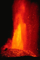 A lava fountain, fed by gas pressure within the basaltic magma of the 1984 Mauna Loa eruption, produces vertical jets of molten lava. Still-fluid, incandescent lava bombs litter the slopes of a cone that was contructed by ejecta that accumulated around the vent. This April photo was taken during a late stage of the eruption that began on March 25 and lasted until April 15.
Copyrighted photo by Katia and Maurice Krafft, 1984.
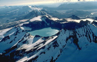 This 1978 aerial view from the NE looks down the SW-trending chain of closely spaced volcanoes in Katmai National Park. Katmai volcano, in the foreground, is truncated by a 4.5-km-wide caldera created by collapse of the volcano in 1912 at the time of the major eruption at Novarupta volcano, 10 km to the west and below the far rim of Katmai caldera. Beyond Katmai, in line with the 250-m-deep caldera lake, are the dark-colored peaks of the Trident complex and the broad, glacier-covered slopes of Mageik volcano.
Copyrighted photo by Katia and Maurice Krafft, 1978.
 The sparsely vegetated lava flow filling a broad valley is the Carrizozo lava flow, which was erupted from a low shield volcano topped by the Little Black Peak cinder cone. The massive lava flow, which was dated at about 5200 years Before Present, traveled 75 km down the Tularosa Basin in south-central New Mexico. The extremely lengthy travel distance of the flow (one of the longest on Earth during Holocene time) was facilitated by movement within lava tubes, which thermally insulated the flow.
 Photo by Lee Siebert, 1999 (Smithsonian Institution).
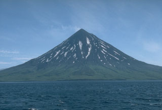 Mount Cleveland forms the western half of Chuginadak Island. This 24 July 1994 view from the west shows the summit region darkened by ashfall that may have originated from an eruption reported on 25 May. Dark lava flows from earlier eruptions can be seen on the flanks.
Photo by Michelle Harbin, 1994 (courtesy of Alaska Volcano Observatory, U.S. Geological Survey).
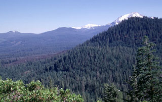 Bear Wallow Butte, the forested peak at the right, was the source of the youthful-looking unvegetated lava flows seen at the left-center. Bear Wallow Butte lies at the southern end of a N-S-trending chain of vents known as Tumble Buttes. Snow-capped Lassen Peak is visible to the south just beyond the summit of Bear Wallow Butte.
Photo by Lee Siebert, 1998 (Smithsonian Institution).
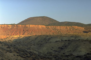 The morphologically youthful Crater Hill cinder cone near the SW boundary of Zion National Park was formed during the latest eruptions of the Kolob volcanic field at the end of the Pleistocene. Lava flows from Crater Hill blocked the Virgin River, forming an ephemeral lake that extended past the town of Springdale into the national park. Other cinder cones of the Kolob field to the north are of earlier Pleistocene age and fed lava flows extending 10-15 km down valleys to the south.
Photo by Lee Siebert, 1987 (Smithsonian Institution).
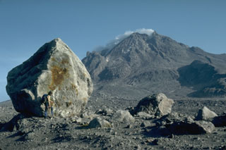 A volcanologist next to a 6-m-high block that was carried about 4 km down the north flank of Augustine volcano in Alaska during the 1976 eruption. Blocks of this size and larger are fragments of the summit lava dome that were carried within block-and-ash flows produced by periodic collapse of the growing dome. This photo was taken during a quiet phase of the 1986 eruption and shows the steaming summit lava dome.
Photo by Harry Glicken, 1986 (U.S. Geological Survey).
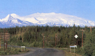 Alaska's Mount Wrangell is one of the most voluminous shield volcanoes in the world and is more than three times the volume of Rainier. It has a diameter of 30 km at 2,000 m elevation and a volume of about 900 km3. Eruption of unusually-low viscosity andesitic lavas at high eruption rates produced long lava flows that contributed to its low-angle morphology. The small snow-covered peak on the left is Mount Zanetti, a flank vent with about the same volume as St. Helens. Wrangell is seen here from Glennallen, 80 km to the west.
Photo by Chris Nye (Alaska Division of Geological and Geophysical Surveys).
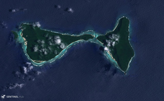 Ofu (left) and Olosega (right) in eastern Samoa are parts of the same volcano separated by the Asaga Strait, with the island group reaching nearly 9 km across (including the smaller island to the west), shown in this 29 October 2018 Sentinel-2 satellite image (N is at the top). The islands have likely been shaped by flank failures with resulting debris avalanches below sea level.
Satellite image courtesy of Copernicus Sentinel Data, 2018.
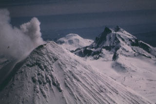 Unimak Island has three volcanoes constructed along an E-W line. Shishaldin is in the foreground and is the highest of the three in this 1987 photo. Isanotski is to the right and Roundtop is in the far distance.
Photo by Clayton and Marcia Brown, 1987 (courtesy of John Reeder, Alaska Div. Geology & Geophysical Surveys).
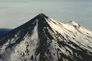 Pavlof volcano is the most active of the Aleutian arc and one of the most prominent landmarks of the southern Alaska Peninsula. A small steam plume rises from the 2519-m summit of Pavlof in this aerial view from the NW with the flank cone of Little Pavlof on the right. The conical volcano was constructed NE of the rim of Emmons Lake caldera and has active vents high on the north and east sides near the summit. Its frequent eruptions are typically strombolian and vulcanian in character, with occasional spatter-fed lava flows.
Copyrighted photo by Katia and Maurice Krafft, 1978.
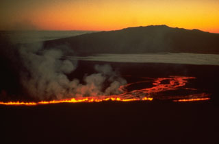 This view from the south on 5 March 1984 shows lava fountains producing a lava flow down the NE flank of Mauna Loa, with Mauna Kea in the background. The eruption began at 0126 at the summit and upper SW rift zone, but the fissure soon extended across the summit caldera and down the NE rift zone. Several hours later a new fissure opened 7 km to the east.
Copyrighted photo by Katia and Maurice Krafft, 1984 (courtesy of Hawaii Volcano Observatory).
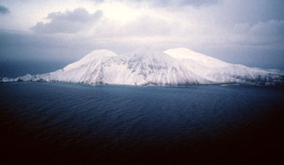 Buldir is the westernmost Quaternary volcanic center of the Aleutian Arc. It lies at the center of the island and the younger East Cape volcano forms the NE portion. The age of the recent eruptions is not known precisely but has been estimated to be late Pleistocene or Holocene.
Photo by Fred Deines, 1987 (U.S. Fish & Wildlife Service).
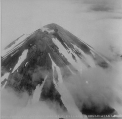 This aerial view of Mount Cleveland volcano from a generally eastward direction shows a small crater at the summit of the stratovolcano. Cleveland is one of the most active volcanoes of the Aleutian arc.
From the collection of Maurice and Katia Krafft.
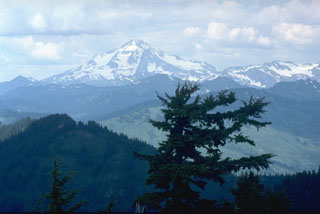 Glacier Peak has produced large explosive eruptions that have dispersed major tephra deposits over broad distances and has been frequently active during the past 5,500 years. Its eruptions were accompanied by lava dome growth, pyroclastic flows, and lahars that traveled to lowland areas far from the volcano.
 Photo by Lee Siebert, 1990 (Smithsonian Institution).
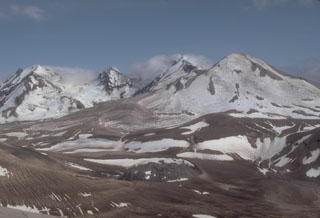 Trident, seen here from Baked Mountain to its NW, was initially named for its three prominent summits. A series of eruptions from 1953 until 1968 constructed a fourth cone, which forms the smoother peak to the right. As many as 23 lava domes are found in the Trident volcanic complex. The 1912 Novarupta lava dome is visible to the lower center.
Photo by Game McGimsey (U.S. Geological Survey, Alaska Volcano Observatory).
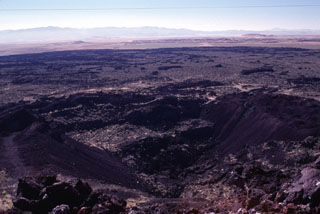 The Terrace, a crater seen here in the foreground from the rim of Mitre Crater, was the source of the voluminous lava flows seen extending toward the SE. The crater derives its name from several terraces, now partly removed by quarrying operations, that were formed by cooled lava lakes. These SE flows from The Terrace are the youngest of a series of eruptions at the Ice Springs volcanic field about 660 years ago. The Ice Springs volcanic field is one of several closely spaced volcanic fields in the Black Rock Desert of south-central Utah.
Photo by Lee Siebert, 1996 (Smithsonian Institution).
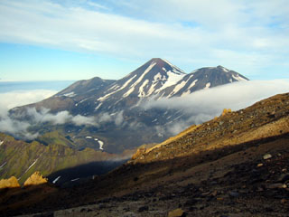 The three E-W-trending summit cones of the Tanaga volcanic complex, Sajaka, Tanaga, and East Tanaga (from left to right) are seen from the summit of Takawangha volcano. Tanaga is the central and highest of three at the NW tip of Tanaga Island. The ridge to the lower left is part of a caldera rim that formed by the collapse of an ancestral Tanaga edifice during the Pleistocene.
Photo by Michelle Coombs, 2003 (Alaska Volcano Observatory, U.S. Geological Survey).
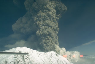 The second of three large explosive eruptions from Crater Peak, a satellite cone of Mount Spurr, 3.2 km south of the peak, occurred on 18 August 1992. This aerial view from the west shows the base of the vertical eruption plume that reached an altitude of about 13.5 km. This eruption lasted about 4.5 hours and resulted in ashfall in Anchorage, 125 km E, that resulted in closure of the international airport for 20 hours.
 Photo by Game McGimsey, 1992 (Alaska Volcano Observatory, U.S. Geological Survey).
 The uninhabited island of Kahoolawe is seen here rising to the SW across a narrow channel from Oneloa beach on the island of Maui. Kahoolawe consists of a broad, low shield volcano formed by Pleistocene eruptions along a rift zone that extends SW from a buried, 5-km-wide caldera at the eastern side of the island. The eastern rim of the caldera lies beneath the waters of Kanapou Bay, which forms the indistinct embayment at the left side of the photo.
 Photo by Lee Siebert, 1998 (Smithsonian Institution).
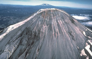 Rocks of the pre-1980 summit lava dome are visible in this 1978 photo of the west side of Mount St. Helens with Mount Adams in the background. Growth of the Summit Dome occurred between about 1630-1720 CE at the end of the Kalama eruptive period. The dome produced pyroclastic flows and lahars down all the flanks.
Photo by Rick Hoblitt, 1978 (U.S. Geological Survey).
 Mount Denison lies in a poorly known section of Katmai National Park that contains one or more mostly ice-covered vents. The slopes of Mount Denison are seen on the right half of the photo, between the pointed summit in the center and the flatter peak to the far right, between which a glacier descends towards the middle of the image. The rounded peak on the horizon beyond the slopes of Denison is Mount Steller, and the summit ridge of Snowy volcano forms the far-left skyline in this long-distance NE-looking view.
Photo courtesy of Alaska Volcano Observatory, U.S. Geological Survey, 1997.
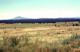 The forested area extending across the middle of the photo is a series of lava flows erupted from the low Brushy Butte shield volcano between Medicine Lake and Lassen volcanoes. In this view from Little Hot Springs Valley to the NW, Soldier Mountain is the prominent peak in the background, Brushy Butte forms a barely detectable topographic high on the center horizon, and flat-topped Timbered Crater is an older Pleistocene crater near the rifht margin of the photo.
Photo by Lee Siebert, 1998 (Smithsonian Institution).
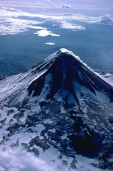 An almost constant steam plumes pours down the north flank of Shishaldin volcano, the highest in the Aleutian Islands. The symmetrical volcano is the most prominent landmark on Unimak Island and is referred to by the Aleut Indians as Sisquk, meaning "mountain which points the way when I am lost." A large monogenetic cinder cone field is found on the NW flank of the basaltic volcano. The two large lakes in the distance are within Fisher caldera, a low-lying volcanic structure to the SW.
Copyrighted photo by Katia and Maurice Krafft, 1978.
 Two overlapping craters are at the summit of Mount Rainier. Continued high heat flux has produced fumaroles that have formed ice tunnels in the 100-m-deep icecap filling the eastern summit crater, shown in this 1958 photo. Ice caves are also present in the smaller western crater, which contains a small crater lake beneath the ice.
Photo by Richard Fiske, 1958 (Smithsonian Institution).
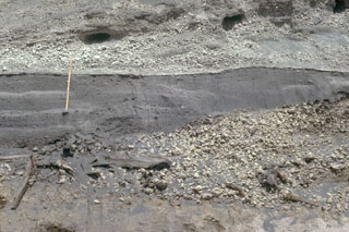 The fine-grained gray layer behind the ruler was produced by the 18 May 1980 lateral blast of Mount St. Helens. The deposit is about 50 cm thick at this location, 13 km NE of the volcano. The blast deposit is overlain by airfall pumice that was erupted later on 18 May and underlain by a pumice deposit from an eruption in 1482 CE.
Photo by Lee Siebert, 1982 (Smithsonian Institution).
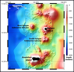 Sidescan sonar imagery taken in 2003 shows South Sarigan seamount rising to within about 184 m of the ocean surface 12 km S of Sarigan Island. It was the site of an explosive submarine eruption in May 2010 that sent a plume of ash and steam to 12 km altitude. The seamount has an irregular summit with multiple peaks, including a possibly young cone at about 350 m depth, and flank morphology suggests it is frequently active.
Map courtesy Bill Embley and William Chadwick (NOAA: http://oceanexplorer.noaa.gov/explorations/03fire/logs/feb17/feb17.html)
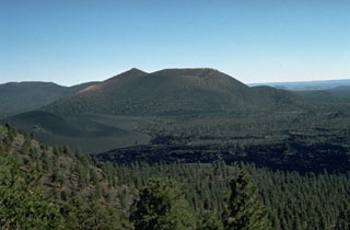 The Bonita lava flow in the foreground of this view from O'Leary Peak, NW of Sunset Crater, was erupted from two or more vents on the western to NW flank of Sunset Crater. The flow contains both scoria-mantled portions erupted concurrently with major explosive activity from Sunset Crater and darker, scoria-free portions erupted during later stages of the eruption. Portions of the scoria-mantled flow were broken away and rafted along during the late-stage lava extrusion.
Photo by Ed Wolfe, 1977 (U.S. Geological Survey).
 The multi-colored scoria deposits of the eastern side of Crescent Crater, part of the cinder and spatter cone complex at Ice Springs volcanic field, are the object of a mining operation to produce road aggregate. Ice Springs was the source of Utah's youngest lava flow about 660 years ago.
 Photo by Lee Siebert, 1996 (Smithsonian Institution).
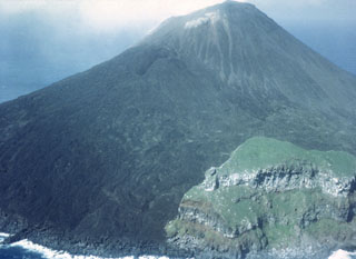 This 1980 photo from the SE of the small island volcano of Farallón de Pájaros shows unvegetated lava flows that diverted around the vegetated peak to the lower right, which is a remant of a caldera that formed prior to the formation of the present cone.
Photo by Winfrey, 1980 (U.S. Navy).
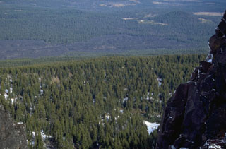 The lava flow across the upper part of the photo, seen here from Black Crater, originated from Yapoah cone on the north flank of North Sister about 2,600-2,900 years ago. The flow traveled 5 km N before being diverted by lavas from Little Belknap shield volcano and flowing an additional 8 km NE.
Photo by Lee Siebert, 1995 (Smithsonian Institution).
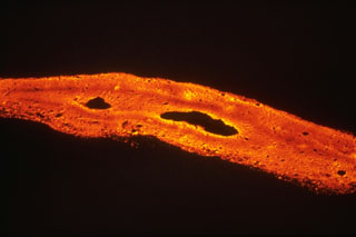 Lava flows are produced when magma reaches the surface and is erupted non-explosively. Basaltic lava flows, such as this September 1979 flow from the East Rift Zone of Kīlauea volcano, are Earth's most common volcanic product. Basaltic lava flows typically have initial temperatures of 1,000-1,250°C with a range of flow velocities.
 Photo by Richard Moore, 1977 (U.S. Geological Survey).
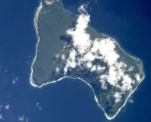 Steep sea cliffs surround the 6 x 10 km Ta'u Island, located at the eastern end of the Samoan islands. The island is the exposed portion of the large Lata shield volcano. Collapse and landslide erosion of the southern portion of the shield volcano have left an arcuate, south-facing embayment (bottom) with a steep headwall. A tuff-cone complex is partially visible at the extreme NW tip of the island (top). The historic village of Fitiiuta lies at the NE tip of the island (far right).
NASA International Space Station image ISS002-E-9892, 2001 (http://eol.jsc.nasa.gov/).
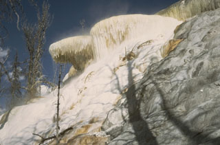 The terraces of Mammoth Hot Springs in NW Yellowstone consist of shallow pools with ledges draped with ribbons of travertine. Rapid deposition encroaches on nearby forests and can produce changes visible within a period of weeks.
Photo by Lee Siebert, 1968 (Smithsonian Institution).
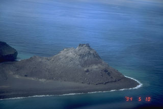 An aerial view shows the 1992 lava dome of Bogoslof Island, the summit of a largely submarine located in the Bering Sea 50 km behind the main Aleutian arc. The 1992 lava dome grew to a height of 100 m in July at the northern tip of the island. In May 1994, when this photograph was taken, the island was about 1.5 x 0.6 km wide, and due to frequent eruptive activity and energetic wave action, has changed shape dramatically since first mapped in the late 1700's.
Photo by Tom Miller, 1994 (Alaska Volcano Observatory, U.S. Geological Survey).
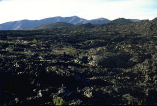 The Blue Dragon lava flow covers about 280 km2 of Craters of the Moon lava field with flat-lying pahoehoe lava. The 3.4 cu km flow, erupted about 2075 years ago, is the largest in the Craters of the Moon volcanic field. It traveled up to 25 km to the east and 15 km to the SW from fissure vents near the center of this photo. The largely pahoehoe lava flow is named for a characteristic iridescent dark- to light-blue, glassy crust.
Photo by Lee Siebert. 1994 (Smithsonian Institution).
 Pillow lavas on the western rift of Vailulu'u volcano with exotic marine life, photographed during a NOAA Ocean Explorer expedition in 2005. Two principal rift zones extend E and W from the summit of the submarine volcano, parallel to the trend of the Samoan hotspot. Not discovered until 1975, this seamount rises 4,200 m from the sea floor to a depth of about 600 m and displays evidence of hydrothermal venting.
Image courtesy of Vailulu'u 2005 Exploration (NOAA Ocean Explorer).
 Housing development on a mudflow deposit that originated from Mount Rainier, partially obscured by clouds in the center background. The tree stump in the foreground was buried by the Electron mudflow about 500 years ago, that began as an avalanche of hydrothermally altered rock on Rainier's W flank.
Photo by Lee Siebert, 1994 (Smithsonian Institution).
 This aerial photo shows the lobate morphology of the Glass Mountain obsidian flow, which erupted around 950 years ago from a series of vents near the buried east rim of Medicine Lake caldera. The eruption originated from a series of NW-SE-trending vents, seen here diagonally across the photo from the upper left. Three dacite flows to the east are overlain by rhyolite flows towards the west. The flow at lower left is the dacitic Hoffman flow, erupted only a few hundred years prior to the Glass Mountain flow.
 Photo by U.S. Geological Survey (published in Green and Short, 1971).
 The blocky Parkdale lava flow, which traveled 6 km from a scoria cone located along the Middle Fork Hood River near the N flank of Mount Hood, towers above houses in the agricultural Hood River valley. The Parkdale flow has been radiocarbon dated at about 6,890 years.
Photo by Lee Siebert, 1995 (Smithsonian Institution).
 The Yellowstone River slowly meanders through the Hayden Valley, which is underlain by glacial lake sediments capping thick lava flows on the floor of Yellowstone caldera. Mount Washburn, in the center background, is part of an ancient Absaroka volcano that predates the caldera. The northern margin of the Yellowstone caldera lies at the base of the mountain range.
Photo by Lee Siebert, 1974 (Smithsonian Institution).
 The trees in the foreground along Kautz Creek were killed by a debris flow from the SW flank of Mount Rainier in 1947, which covered a road with 8.5 m of mud and debris. Relatively small debris flows occur relatively frequently, with deposits of a half dozen or more debris flow deposits exposed in the Kautz Creek valley walls.
Photo by Lee Siebert, 1980 (Smithsonian Institution).
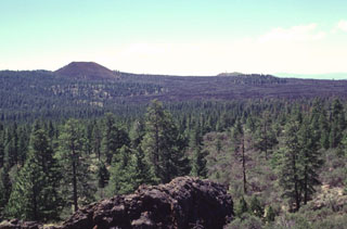 Cinder Butte (upper left) on the north side of massive Medicine Lake volcano was the source of a voluminous lava flow that is the most recent on the volcano's north flank. The cone is seen here from the east from the rim of Mammoth Crater in Lava Beds National Monument. Cinder Butte was formed during an eruption about 800 CE that also produced the sparsely vegetated Callahan lava flow, which can be seen extending down the north flank to the right.
Photo by Lee Siebert, 1998 (Smithsonian Institution).
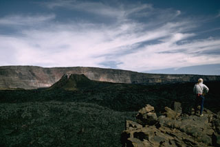 The spatter cone that formed during the 1940 eruption of Mauna Loa is seen in Moku'aweoweo caldera in this 1966 view from the southern rim of the caldera with the western caldera wall in the background. The eruption began along a 6-km-long fissure that extended across the caldera and down the SW rift zone. Activity soon became focused within the caldera and lava flows covered two-thirds of the caldera floor.
Photo by Richard Fiske, 1966 (Smithsonian Institution).
 Scoria cones and columnar-jointed lava flows of the Behm Canal-Rudyerd Bay volcanic field occur on either side of Behm Canal (down the center of this image), shown in this October 2020 Planet Labs satellite image monthly mosaic (N is at the top; this image is approximately 20 km across). The majority of outcrops have been found on Revillagigedo Island (left), and additional features are on Rudyerd Island (near the center).
Satellite image courtesy of Planet Labs Inc., 2020 (https://www.planet.com/).
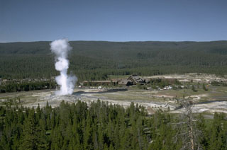 An eruption of Old Faithful, perhaps the world's best known geyser, rises above Yellowstone's Upper Geyser Basin. Old Faithful is a periodic geyser, with eruptions to heights of about 40 m at intervals of 30 to 100 minutes. Old Faithful Lodge to the right provides a rustic backdrop to the Upper Geyser Basin, which contains more geysers than are known altogether in the rest of the world. The forested ridge in the background is underlain by massive post-caldera rhyolitic lava flows of the Madison Plateau.
Photo by Lee Siebert, 1968 (Smithsonian Institution).
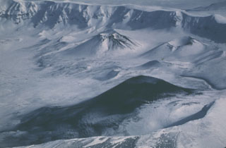 This 2 March 1987 view from the west shows the ash deposition on the flanks of a cone in the SW corner of Okmok caldera. Intermittent explosive eruptions took place from November 1986 to February 1988 from Cone A. Cone C and Cone F are visible in the background.
Photo by Harold Wilson (Peninsula Airways), 1987 (courtesy of John Reeder, Alaska Div. Geological Geophysical Surveys).
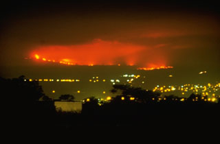 This nighttime view from the city of Hilo shows lava flows from Mauna Loa descending its NE flank on 4 April 1984. The flows traveled 42 km from vents on the upper NE rift zone of Mauna Loa, finally stopping only 5 km from the Hilo city limits. The 1984 lava flows were among the longest during historical time from Mauna Loa, matching the length of the 1942 flows. The 1855 and 1881 lava flows traveled significantly further, with the latter reaching within 2 km of Hilo Bay.
 Photo by David Little, 1984 (U.S. Geological Survey).
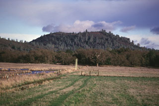 Round Mountain, seen here from the west, rises above the floor of High Valley. Round Mountain is the northernmost of a N-S-trending chain of basaltic-andesite cinder cones at the eastern end of the Clear Lake volcanic field. A lava flow from Round Mountain underlies part of the High Valley. Many of the basaltic-andesite and andesitic lava flows of the Clear Lake field are contaminated with crustal materials. They often contain xenocrysts of quartz up to several cm in size that are known locally as "Lake County Diamonds."
Photo by Paul Kimberly, 1997 (Smithsonian Institution).
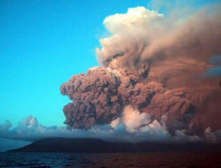 The first historical eruption of Anatahan is seen here on 10 May 2003, with an ash plume from activity that began earlier that day. The plume rose to about 4.6 km and originated from the eastern crater. Intermittent explosive eruptions took place until 16 June. Lava flows were emplaced on the floor of the caldera beginning on 4 June and later coalesced to form a small lava dome in the new 300-m-wide crater. This view is toward the SW.
Photo courtesy of Commonwealth of Northern Mariana Islands, 2003.
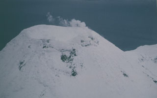 This March 1987 view from the W shows typical emission from the summit crater of Kanaga.
 Photo by Harold Wilson (Peninsula Airways), 1987 (courtesy of John Reeder, Alaska Div. Geology & Geophysical Surveys).
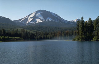 Lassen Peak, rising above Manzanita Lake on the NW, is the focal point of the Lassen volcanic center, a concentration of volcanic features covering much of Lassen National Park. The massive lava dome forming Lassen Peak was constructed about 25,000 years ago and was the site of California's most recent eruption during 1914-1917. Chaos Crags, a lava dome complex on the north flank, and the aptly named Cinder Cone to the NE, have also erupted within the past 1200 years.
Photo by Dave Wieprecht, 1995 (U.S. Geological Survey).
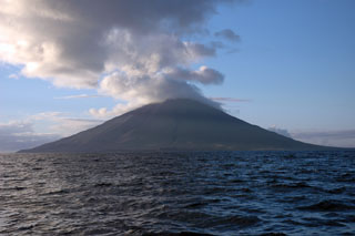 The 6 x 7 km Segula island is seen offshore from the SW. It has a prominent NNW-SSE-trending fissure that extends to sea level at both ends of the island. The summit contains a small, poorly defined caldera that has a scoria cone forming the high point of the island.
 Photo by Christina Neal, 2005 (Alaska Volcano Observatory, U.S. Geological Survey).
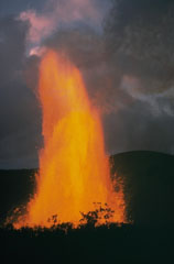 A powerful lava fountain towers above Kīlauea Iki on 11 December 1959. Lava fountains reached heights up to 580 m on the 17th, the tallest recorded from any Hawaiian volcano at the time. The temperature at the core of the fountain sometimes reached 1,200°C, another record in Hawaii for the highest temperature of erupting lavas at the time. Ejecta built a conical spatter cone around the vent.
Photo by Jerry Eaton, 1959 (U.S. Geological Survey).
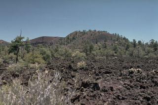 Bandera Crater, one of the youngest features of the Zuni-Bandera lava field, is a breached cinder cone that fed a lava flow dated about 9000 BCE. The Bandera lava flow forms part of El Malpais (Spanish for "badlands"), the largely unvegetated, youngest Quaternary basaltic lava flows that cover a broad area south of Grants, New Mexico.
Photo by Lee Siebert, 1987 (Smithsonian Institution).
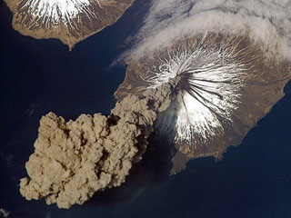 Eruption of Cleveland on 23 May 2006 as photographed from the International Space Station at an orbital altitude of approximately 400 km. The photograph shows the ash plume moving SW from the summit with N at the top and Carlisle Island to the NW.
Courtesy of Jeffrey N. Williams, Flight Engineer and NASA Science Officer, International Space Station Expedition 13 Crew, NASA Earth Observatory.
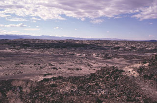 The 70-sq-km Amboy lava field in southern California is composed mostly of vesicular pahoehoe lava flows that form a hummocky terrain with a surface relief of 2-5 m. Lava tubes are not present in the Amboy flows, which display abundant tumuli and pressure ridges. Light-colored deposits of aeolian sand, thicker to thw SW, fill depressions in the lava flow.
 Photo by Paul Kimberly, 1997 (Smithsonian Institution).
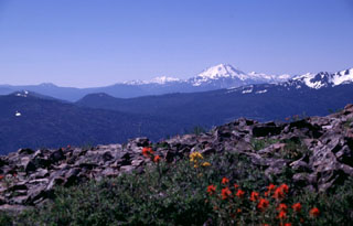 Eiler Butte, the small flat-topped cinder cone at left-center just below the low point on the horizon, is the northermost of a chain of cinder cones forming the Tumble Buttes volcanic field. Eiler Butte, located within the Thousand Lake Wilderness Area, is seen here from Burney Mountain, with snow-capped Lassen Peak in the background to the south. The Tumble Buttes are a N-S-trending chain of cinder cones and lava flows that form some of the youngest volcanic features north of Mount Lassen.
Photo by Lee Siebert, 1998 (Smithsonian Institution).
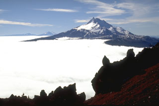 Mount Jefferson is seen to the south from Olallie Butte. The Three Sisters and Broken Top volcanoes are on the horizon to the left. Within 15 km from the main edifice domes and lava flows have erupted from at least 35 vents.
Photo by Lee Siebert, 1995 (Smithsonian Institution).
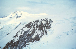 Hayes, located in a remote part of the Alaska Range, is almost totally covered by glacial ice and was not discovered until 1975. The volcano, named for the Hayes glacier, consists of remnants of a mostly snow-and-ice covered edifice that has been largely destroyed by catastrophic eruptions. The exposed rock in the foreground is South Dome. Hayes produced the most voluminous Holocene eruptions in the Cook Inlet area between about 3,800 and 3,400 years ago, and as recently as about 1,000 years ago.
Photo courtesy of U.S. Geological Survey, Alaska Volcano Observatory.
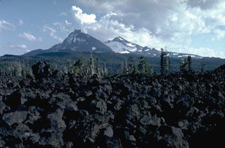 The McKenzie Pass area contains one of the largest concentrations of recent volcanism in the continental United States. Fresh lava flows in the foreground from the Belknap shield volcano merge with unvegetated lava flows from scoria cones on the north flank of North Sister in the background, with Middle Sister to its right.
Photo by Lee Siebert, 1982 (Smithsonian Institution).
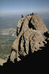 Hikers perch on a small pinnacle of dacitic lava that forms the high point of Lassen Peak, the southernmost major volcano in the Cascade Range that stretches from southern British Columbia to northern California. Lassen Peak is a large dacitic lava dome that last erupted from 1914 to 1917.
Photo by Lee Siebert, 1968 (Smithsonian Institution).
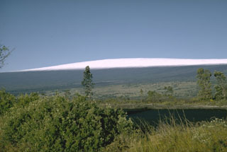 The low-angle flanks of Mauna Loa rise nearly 9 km from the sea floor. The elongated profile was created by repeated eruptions of thin lava flows, primarily from fissure vents along NE- and SW-trending rift zones. Almost 90% of the surface consists of lava flows less than 4,000 years old.
Photo by Richard Fiske (Smithsonian Institution).
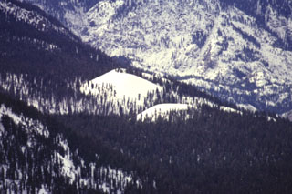 Red Cones, here mantled in winter white in a telephoto view looking SW from Mammoth Mountain, are two young basaltic cinder cones in the eastern Sierra Nevada Mountains near Devils Postpile National Monuement. The youthful-looking cones are Holocene in age.
Photo by Paul Kimberly, 1997 (Smithsonian Institution).
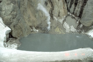 In early June 1992, this lake inside Crater Peak vent at Mount Spurr had a temperature of 49.7°C and a pH of 2.5. Note a circular upwelling zone about 5 m across to the upper right, and the plume rising from the talus pile on the far shore. This photo was taken on 11 June, a little more than two weeks prior to a major explosive eruption that ejected the crater lake.
 Photo by Game McGimsey, 1992 (Alaska Volcano Observatory, U.S. Geological Survey).
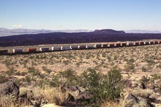 A freight train passes Pisgah Crater and its associated lava field. The 100-m-high cone is the most prominent feature of a lava field that covers 100 km2. The irregular shape of the cone results from the mining of aggregate. The composite lava flows extend up to 8 km to the SE and in a narrow lobe 18 km to the NW. Most of the flows are pahoehoe, but some of the eastern flows are aa. Other cones and lava flows of the Lavic Lake volcanic field are located nearby.
Photo by Lee Siebert, 1997 (Smithsonian Institution).
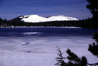 The Sand Mountain scoria cones rise to the WNW in late Spring across the partially frozen surface of Big Lake. South (left) and North Sand Mountain cones are the largest of a group of 23 scoria cones along a N-S line immediately west of the Cascade crest, NW of Mount Washington. A series of young, sparsely vegetated lava flows reaching the McKenzie River valley originated from vents to the west side and erupted primarily during about 3,000-4,000 years ago.
Photo by Lee Siebert, 2000 (Smithsonian Institution).
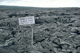 Lava flows from the East Rift Zone eruption that began in 1983 at Hawaii's Kīlauea volcano frequently overran the coastal highway, enveloping traffic signs such as this one. Lava flows can travel fast enough to block roads and evacuation routes, closing off access to communities and trapping residents.
Photo by Lee Siebert, 1987 (Smithsonian Institution).
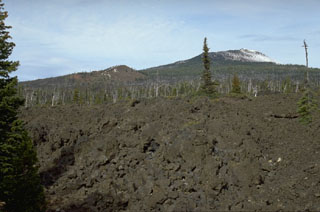 The South Belknap scoria cone on the left skyline was constructed on the SW flank of Belknap shield volcano (upper right) about 2,600 years ago during an eruption that produced lava flows towards the south. The foreground lava flows originated from Belknap.
Photo by Lee Siebert, 1995 (Smithsonian Institution).
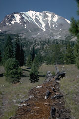 The tree stump and strip of red bark fragments in the foreground are the remnants of one of the many trees blown down radially away from the volcano by a pyroclastic surge on May 22, 1915, during the paroxysmal phase of the 1914-1917 eruption of Lassen Peak. The Devastated Area in the background remained sparsely vegetated for many decades following the eruption.
Photo by Lee Siebert, 1982 (Smithsonian Institution).
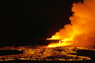 An eruption lasting 5 hours took place in the Kaʻū Desert region SW of Kīlauea caldera on 31 December 1974, producing lava flows that traveled 12 km SW. This was the first eruption on Kīlauea's SW rift zone since the 1920 Mauna Iki eruption.
 Photo by Robin Holcomb, 1974 (U.S. Geological Survey).
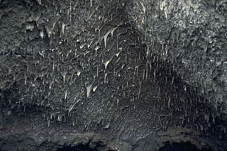 Lava stalactites are abundant on the ceiling of a 1984 fissure within the Mauna Loa Moku’aweoweo caldera. They formed when molten lava was flowing through, dripping and solidifying as they cooled. This section of the 1984 fissure erupted through the 1949 scoria cone located on the SW caldera rim.
 Photo by Paul Kimberly, 1994 (Smithsonian Institution).
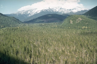 The flat-bottomed, forested floor of the upper Sandy River is underlain by debris flow deposits associated with growth of the Crater Rock lava dome on the upper SW flank of Mount Hood. Tree-ring dating places the age of these deposits during the mid-1780's. The lahars traveled as far as the Columbia River and the shallow, sediment-choked lower Sandy River was observed shortly after emplacement of the lahars by the Lewis and Clark expedition.
Photo by Richard Fiske, 1959 (Smithsonian Institution).
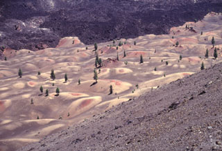 The colorful Painted Dunes at Cinder Cone in NE Lassen Volcanic National Park were formed when ash deposits from Cinder Cone were oxidized by a still-hot underlying lava flow. The mounded surface of the ash reflects the irregular topography of the underlying Painted Dunes lava flow. A black ash-free lava flow, also erupted from Cinder Cone at a later date during the same eruption, can be seen at the top of the photo.
Photo by Lee Siebert, 1998 (Smithsonian Institution).
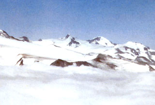 The rounded peak of Mount Steller is visible on the horizon at right-center beyond the slopes of Denison; the summit ridge of Snowy volcano forms the far-left skyline in this long-distance NE-looking view. The slopes of Mount Denison are seen on the right half of the photo, between the pointed summit in the center and the flatter peak to the far right, between which a glacier descends towards the middle of the image.
 Photo courtesy of Alaska Volcano Observatory, U.S. Geological Survey, 1997.
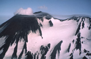 Two peaks form the summit ridge of Gareloi. The active NE-most crater (left) forms the high point of the island. A SE-trending 4-km-long fissure formed during an eruption in 1929, extends from the summit (right) to the sea and contains 13 vents. Phreatic explosions were followed by the ejection of pumice, lapilli, scoria, and lithics, as well as by the emission of four short lava flows.
Photo by Fred Zeillemaker, 1986 (U.S. Fish & Wildlife Service, courtesy of Alaska Volcano Observatory).
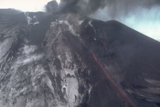 Incandescent lava flows down the side of a scoria cone in Veniaminof caldera on 7 October 1983 as ash plumes rise above the vent. This view from the SW shows the upper flanks of the cone, which is located on the west side of the glacier-covered caldera.
Photo by Betsy Yount, 1983 (Alaska Volcano Observatory, U.S. Geological Survey).
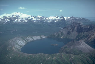 Fourpeaked volcano to the upper left is one of a group of volcanoes NE of Katmai National Park, beyond the 2.5-km-wide Kaguyak caldera in the foreground. Much of the surface is hidden beneath Fourpeaked Glacier; the few exposed outcrops are lava flows interlayered with volcanic agglomerate. Deposits near the summit are extensively hydrothermally altered.
Photo by Chris Nye (Alaska Division of Geological and Geophysical Surveys, Alaska Volcano Observatory).
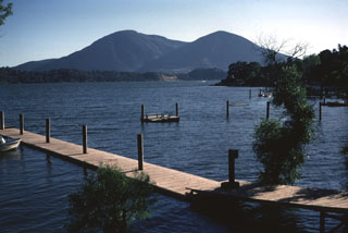 Mount Konocti, a twin-peaked complex dacitic volcano of Pleistocene age on the south-central shore of Clear Lake, is the most prominent feature of the Clear Lake volcanic field. Wright Peak (left) is a rhyodacitic and dacitic lava dome with associated lava flows, and Buckingham Peak (right) is composed of dacitic lava flows capped by an eroded basaltic-andesite cinder cone. The flat ridge extending across the photo in front of Mount Konocti is a peninsula of Cretaceous-Jurrasic rocks of the Franciscan formation.
Photo by Lee Siebert, 1967 (Smithsonian Institution).
 Forested Thirsty Point is the central of three young scoria cones constructed along a N-S-trending line NNE of Diamond Lake. Each of the cones is older than the roughly 7,700 -year-old Mazama tephra from Crater Lake.
Photo by Lee Siebert, 1997 (Smithsonian Institution).
 An ash plume rises above the scoria cone in the Akutan summit caldera of on 2 March 1987. This view from the WSW shows Mount Gilbert, a Pleistocene volcano on Akun Island and the peaks of Westdahl, Shishaldin, and Isanotski (left to right) on distant Unimak Island.
Photo by Harold Wilson (Peninsula Airways), 1987 (courtesy of John Reeder, Alaska Div. Geology & Geophysical Surveys).
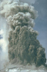 A series of phreatic eruptions beginning 27 March 1980 preceded the major eruption of 18 May. These relatively small steam-driven eruptions ejected ash and gas from the summit, creating a new crater and blanketing the flanks with ash. The material ejected consisted of fragments from the 350-year-old lava dome that formed the summit.
Photo by Don Swanson, 1980 (U.S. Geological Survey).
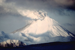 A gas-and-ash plume, seen here from the E, rises from a fissure across the summit of Kanaga on 27 January 1994. Eruptive activity began in mid-1993 and continued intermittently through most of 1995. Ash fell on the village of Adak 25 km to the E on at least one occasion. On 27-28 July incandescent lava flows were first visible on the flank and by the end of the month they reached the NW coast.
Photo by E.V. Kleff, 1994 (U.S. Fish and Wildlife Service, courtesy of Alaska Volcano Observatory).
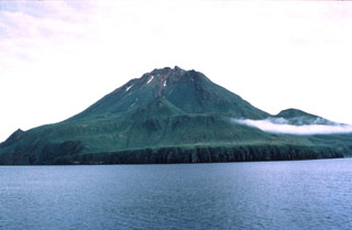 The 3-km-wide Uliaga island, at the NE end of the Islands of Four Mountains archipelago immediately NW of Kagamil Island, is the smallest volcano of the group. Little is known geologically about this volcano, and there are no reports of observed eruptions.
Photo by Michelle Harbin (courtesy of U.S. Geological Survey, Alaska Volcano Observatory).
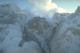 The 1989-90 eruption of Redoubt was characterized by repeated growth and destruction of lava domes from a vent on steep slopes in the summit crater. This view from the north on 2 February 1990 shows the second largest lava dome, which was destroyed during an explosive eruption on 15 February.
Photo by Game McGimsey, 1990 (Alaska Volcano Observatory, U.S. Geological Survey).
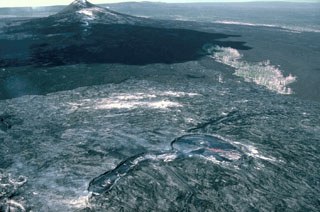 This 13 January 1987 view from the east shows the principal vents of the current eruption on Kīlauea's East Rift Zone, taken four years after the start of the eruption. The Pu‘u ‘Ō‘ō scoria cone to the left formed during the early stages of the eruption. Kūpaianaha to the lower right contains an actively convecting lava lake in this photo. The linear extension in the center foreground is at the head of a lava tube system, which insulated lava flows that reached the coast.
 Photo by J.D. Griggs, 1987 (U.S. Geological Survey).
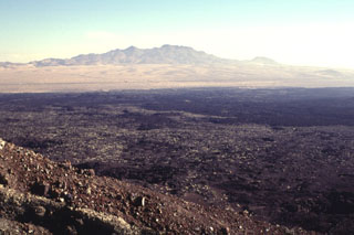 The NE rim of Pisgah Crater provides a view of the 100-sq-km lava field surrounding the crater. The basaltic lava field was erupted from the crater and nearby vents and is dominantly formed of pahoehoe lava, although aa lavas were erupted on the eastern side. Interstate highway 40 skirts the northern margins of the lava flow, below the Cady Mountains in the distance. The lavas were erupted onto alluvial-fan and playa-lake deposits.
 Photo by Lee Siebert, 1997 (Smithsonian Institution).
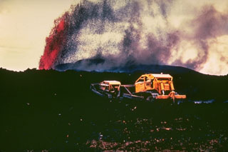 A bulldozer works to create a barrier to lava flows threatening areas below the village of Kapoho, on the lower East Rift Zone of Kīlauea, in January 1960. Lava fountains tower in the background from the eruptive vent, which was less than 1 km from the center of the village. Lava flows eventually engulfed the entire village, but the 5 km of walls that were constructed may have helped prevent the flows from reaching houses and a lighthouse at the coast.
Photo by Hawaii Volcanoes National Park, 1960.
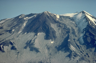 The snow-covered ridge at the right in this view from the south of Mount Griggs is the margin of a large, 1.5-km-wide breached crater formed during the early Holocene during collapse of the volcano's summit. Remnants of the resulting debris-avalanche deposit reach WSW across the valley to Broken Mountain. The young central cone on the center skyline filled the collapse amphitheater and displays nested craters.
Copyrighted photo by Katia and Maurice Krafft, 1978.
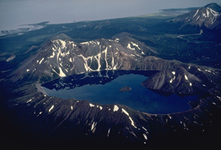 The small, but dramatic Kaguyak caldera on the northern Alaska Peninsula contains a lake more than 180-m deep whose surface is 550-m below the caldera rim. Two post-caldera lava domes form the large peak that rises above the rim of the 2.5-km-wide caldera at the right. The small island in the center of the lake is another lava dome. Collapse of the caldera occurred following powerful dacitic explosive eruptions about 5800 years ago. Shelikof Strait is visible at the top of the photo.
Copyrighted photo by Katia and Maurice Krafft, 1978.
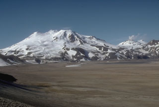 Mount Mageik (left) and Mount Martin (distant right) tower above the flat floor of the Valley of Ten Thousand Smokes. The deposits in the valley are pyroclastic flows that formed during the 1912 eruption of Novarupta, the largest eruption of the 20th century. Glacier-covered Mageik has a broad summit containing multiple cones and vents.
Photo by Game McGimsey (U.S. Geological Survey, Alaska Volcano Observatory).
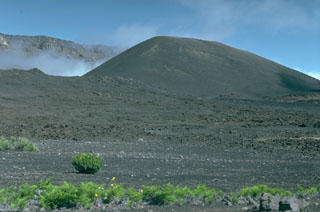 Pu’u o Maui is the largest of a group of scoria cones erupted along a rift zone that passes across Haleakalā crater, with the western crater rim to the upper left. The large summit crater formed through erosion and collapse events.
Photo by Lee Siebert, 1987 (Smithsonian Institution).
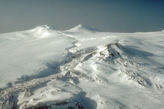 The summit area of Westdahl, located on the southwestern part of Unimak Island in the eastern Aleutians, is seen here from the east. Westdahl Peak (left) and Faris Peak (right) formed on the broad main edifice. The scoria cone in the center was the principal eruption site for the 1991-92 activity, producing the snow-covered lava flow in the foreground. . The sinuous fissure cutting across the glacial icecap from the summit formed in the opening phases of the eruption and produced lava fountaining.
Photo by C.F. Zeillemaker, 1993 (U.S. Fish and Wildlife Service, courtesy of Alaska Volcano Observatory).
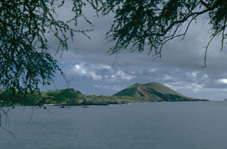 Pu’u Olai is a scoria cone on the west flank of Haleakalā that formed during the late-stage Hana Series eruptions, which produced a large number of scoria cones and lava flows along the SW and E rift zones.
 Photo by Lee Siebert, 1987 (Smithsonian Institution).
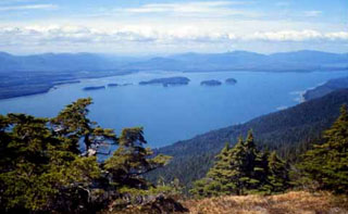 The Castle Islands (center) lie within Duncan Canal on Kupreanof Island in SE Alaska, as seen looking NW from the Lindenberg Peninsula. The Castle Islands mostly consist of Tertiary sedimentary and volcanic rocks, but the northernmost island (far-right side of the island group) contains Quaternary basalts. Pahoehoe and aa lava flows are also found at the south end of Kupreanof Island, where they overlie glacial till.
Photo by Susan Karl (Alaska Volcano Observatory, U S Geological Survey).
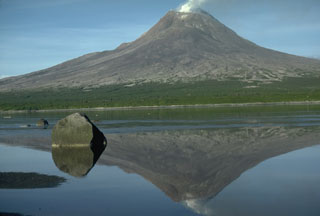 Augustine in Kamishak Bay in the southern Cook Inlet is the most active volcano of the eastern Aleutian arc. It consists of a complex of overlapping summit lava domes surrounded by an apron of volcaniclastic deposits that descend to the sea on all sides. This 1986 view from the NW shows Augustine reflected in a shallow lagoon separating the small west island from the main island. Twentieth-century eruptions have included explosive activity with pyroclastic flows and lava dome growth.
Photo by Lee Siebert, 1986 (Smithsonian Institution).
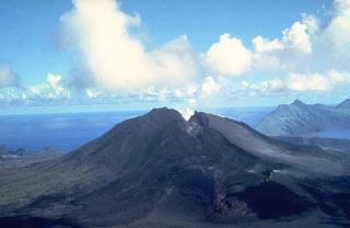 A fissure that formed during an eruption of North Pagan volcano in the Mariana Islands in 1981 cuts across the summit of the volcano. Three principal vents were active along the fissure. A scoria cone (foreground) was constructed at the northernmost vent, and vents on the north and south rims of the summit crater fed lava flows that traveled down the flanks. Blocks as large as 1 m in diameter were ejected to distances of 2 km from the vent. This 16 June 1981 photo shows South Pagan volcano at the upper right.
Photo by U.S. Navy, 1981.
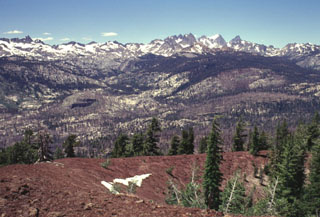 The rugged Sierra Nevada mountain range rises beyond the reddish rim of the southern cone of the twin Red Cones. The southern cone is breached to the NW and fed a lava flow that joined with one erupted from the SW breach of the northern cone to form a flow 2 km long and 2 km wide that traveled west to Crater Creek. Devils Postpile National Monument, with its spectacular columnar-jointed basaltic lava flow, lies along the Middle Fork of the San Joaquin River, below the rugged Minarets and Banner Peak on the horizon.
Photo by Lee Siebert, 1998 (Smithsonian Institution)
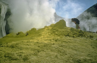 A geologist examines a fumarole surrounded by sulfur mineralization at Sherman Crater in 1981. Greatly increased thermal emission beginning in 1975 melted glacial ice in Sherman Crater and created many new fumaroles. Plumes are occasionally visible from the Puget lowlands.
Photo by Bill Chadwick, 1981 (U.S. Geological Survey).
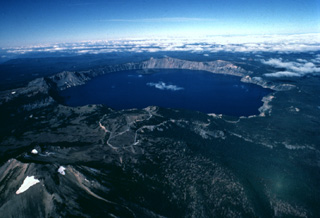 The dramatic 8 x 10 km wide Crater Lake caldera is seen here in an aerial view from the east. The caldera was formed about 6850 years ago during a major eruption that caused the collapse of ancestral Mount Mazama, a complex of overlapping stratovolcanoes and shield volcanoes. Mount Scott, a pre-collapse stratovolcano, is the peak with small snowfields at the lower left. Wizard Island, a post-caldera cinder cone, can be seen near the far side of Crater Lake.
Copyrighted photo by Katia and Maurice Krafft, 1984.
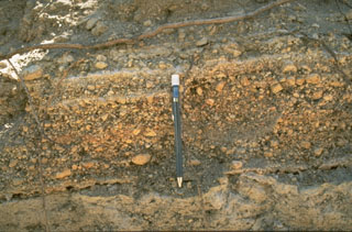 The Mono-Inyo craters produced explosive eruptions and effusive lava flows. The pumice layers above the bottom of the pen originated from the South Deadman vent of Inyo Craters about 600 years ago. Interbedded finer layers record brief pauses during the course of the eruption.
Photo by Larry Mastin, 1986 (U.S. Geological Survey).
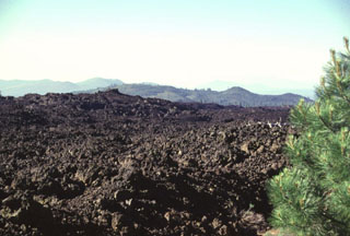 The most voluminous Holocene lava flow on the southern flank of Medicine Lake volcano is known as the Burnt Lava flow. The flow, which originated from High Hole Crater and nearby fissure vents, covers 37 km2. The flow is dominantly aa lava, but also includes some pahoehoe. This photo shows the NW margin of the flow, which was erupted about 2750 years ago.
Photo by Lee Siebert, 1998 (Smithsonian Institution).
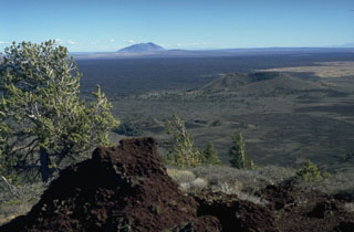 The vast extent of the Blue Dragon lava flow, forming the flat area in the middle of the photo, can be appreciated in this view from Big Cinder Butte with Big Southern Butte in the background to the east. The Blue Dragon flow, the largest volume lava flow at Craters of the Moon, covers 280 km2 with 3.4 cu km of lava. The flow was erupted about 2075 years ago and covers broad areas as far as 25 km to the east and 15 km to the SW of its vent area.
Photo by Lee Siebert, 1994 (Smithsonian Institution).
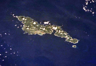 The elongated, 32-km-long island of Tutuila in the center of the Samoan Islands is seen in this International Space Station view (with north to the upper right). Five Pliocene-to-Pleistocene volcanoes were constructed along rift zones, and the Pago shield volcano in the center of the island was truncated by an eroded, 9-km-wide caldera that incorporates Pago Pago harbor (right-center). Following a lengthy period of erosion, the Leone tuff cones and cinder cones were erupted during the Holocene across the southernmost portion of the island (left-center).
NASA International Space Station image ISS002-701-263, 2001 (http://eol.jsc.nasa.gov/).
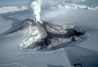 On 23 January 1984 this black lava flow erupted from a scoria cone in the west side of Veniaminof caldera, traveled down the south flank, and diverged into two lobes as it melted through glacial ice on the caldera floor. Strombolian eruptions began on 2 June 1983 and continued until the end of the eruption on 17 April 1984. By the time of this photo the lava flow had melted a depression about 1 x 2 km wide and 120 m deep. The NE caldera wall rises 500 m above the icecap in the distance.
Photo by Betsy Yount, 1984 (Alaska Volcano Observatory, U.S. Geological Survey).
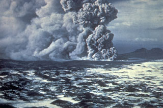 Phreatomagmatic eruptions produced when magma came in contact with groundwater eject an ash plume at the Ukinrek Maars on the Alaska Peninsula. This photo from the south on 5 April 1977 shows explosive eruptions from East Maar, one of two new craters that formed in glacial sediments, in an area without previous volcanic activity. The hummocky, snow-covered surface in the foreground is a debris avalanche deposit from Peulik.
Photo by Jim Faro (Alaska Department of Fish and Game).
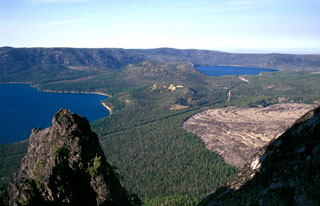 Newberry volcano, one of the largest Quaternary volcanoes in the conterminous United States, lies 60 km E of the crest of the Cascade Range in central Oregon. The shield volcano contains a 5 x 7 km caldera with two lakes, Paulina Lake (left) and East Lake (right). Newberry has been active during the Holocene at vents within the caldera that have produced pumice cones and obsidian lava flows (like Obsidian flow to the lower right), and outside the caldera forming scoria cones on its broad flanks.
Photo by Lee Siebert, 2002 (Smithsonian Institution).
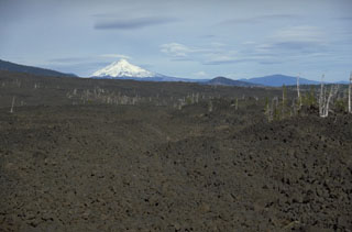 The lava flow in the foreground, with snow-capped Mount Jefferson in the background, was emplaced about 2,600-2,900 years ago from Yapoah scoria cone on the north flank of North Sister. Lava flows in the middle of the photo originated from the Little Belknap shield volcano, part of one of the largest concentrations of recent volcanism in the continental United States: the McKenzie Pass area of the central Oregon Cascade Range.
Photo by Lee Siebert, 1995 (Smithsonian Institution).
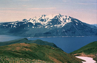 Mount Moffett has several flank lava domes and is seen here across Andrew Bay to the SW from Mount Adagdak. Andrew Bay volcano is the oldest of three volcanic centers on northern Adak Island. Mount Moffett rises above Adak (out of view to the left), the largest town of the Aleutians.
 Photo courtesy of Alaska Volcano Observatory, U.S. Geological Survey.
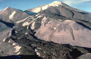 A blocky andesitic lava flow, its margins marked by prominent flow levees, descends the SW flank of Trident volcano in Katmai National Park, Alaska. The lava flow, seen here from the WSW in 1978, was part of a series of eruptions from 1953 to 1968 that constructed the snow-covered cone in the background. The lava flows diverge around the lighter-colored surface of an older lava dome at the right center.
Copyrighted photo by Katia and Maurice Krafft, 1978.
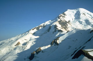 The north flank of Mount Baker towers above Cockscomb Ridge, with the Roosevelt Glacier descending from the summit. The Dole Fumarole Field on the northern flank is located below a point around halfway down the left-hand horizon, near where the shadow line on the Mazama Glacier (center) takes a sharp bend. William Henry Dorr reported vapor emission at this location in 1884 and fumarolic activity continues today.
Photo by Bill Chadwick, 1981 (U.S. Geological Survey).
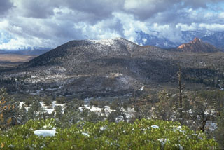 Firepit Knoll cinder cone is the largest of a cluster of cones at the northern end of the Kolob volcanic field on the upper Kolob Plateau. The northern cinder cones, of Pleistocene age, produced lava flows that traveled 10-15 km to the south. The cones were erupted through rocks of the Navajo Sandstone, forming the red-colored pinnacle to the right.
Photo by Lee Siebert, 1987 (Smithsonian Institution).
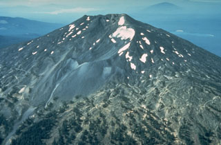 Mount Bachelor, SW of Bend, Oregon, is seen here from the north with a neoglacial moraine in the center. No known summit eruptions have occurred during the Holocene, although it was active until the latest Pleistocene and a N-flank vent produced a series of lava flows immediately preceding the eruption of the Mazama ash about 7,700 years ago.
Photo by Willie Scott, 1981 (U.S. Geological Survey).
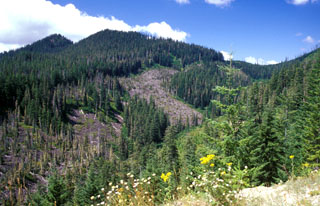 West Crater is a Quaternary volcanic field in the southern Cascades of Washington between Mount St. Helens and Mount Hood. West Crater itself, seen here from the NE, is an andesite lava dome with two small lava flows, one of which forms the bare area in the center. The 290-m-high dome formed about 8,000 years ago on the floor of a cirque carved into older Tertiary volcanic rocks. The West Crater volcanic field consists of a series of small shield volcanoes and scoria cones along a NW-SE zone.
Photo by Lee Siebert, 2002 (Smithsonian Institution).
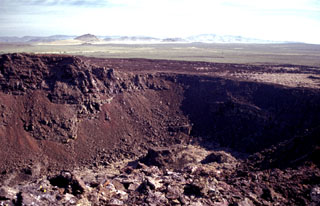 One of a series of interlocking craters forming the complex summit of Black Butte, the vent of the Shoshone lava field, is seen here from the summit of the butte. The broad, low Shoshone shield volcano fed voluminous lava flows that traveled a small distance north towards the Mount Bennett Hills in the background, but the bulk of the flows traveled initially south and then west for a total distance of 60 km. The Shoshone lava field, erupted about 10,000 years ago, is the westernmost of the young volcanic fields of the Snake River Plain.
Photo by Lee Siebert, 2002 (Smithsonian Institution).
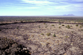 A broad frozen lava lake rises almost to the rim of the 800 x 300 m wide summit crater of Hell's Half Acre shield volcano, the easternmost of the young basaltic lava fields of the Snake River Plain. The 300 x 800 m wide lava lake is seen from the summit of the low shield volcano, with East Butte and Middle Butte visible to the west on the upper right horizon. Dominantly pahoehoe lava flows were erupted from a 3-km-long, NW-SE trending vent system in the NW part of Hells Half Acre lava field about 5200 years ago.
 Photo by Lee Siebert, 2002 (Smithsonian Institution).
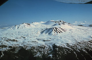 Scoria cones across the snow-covered Mauna Kea summit are some of the most recent features of this volcano, seen here from the SW. The high altitude makes it the only Hawaiian volcano that is known to have had glaciers.
Photo by Don Swanson (U.S. Geological Survey).
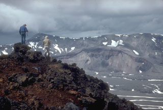 Volcanologists from the U.S. Geological Survey on the rim of the intra-caldera Vent Mountain at Aniakchak look NW towards Half Cone, a prominent feature on the caldera floor and the source of an explosive post-caldera eruption. The NW caldera rim of Aniakchak caldera forms the skyline.
Photo by Christina Neal, 1992 (Alaska Volcano Observatory, U.S. Geological Survey).
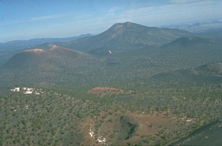 The 60-m-deep Gyp Crater in the foreground is located at about the midpoint of a 10-km-long eruptive fissure extending SE from Sunset Crater, the unvegetated cinder cone at the left-center. Paleomagnetic evidence places the age of the Sunset Crater eruption at between about 1080 and 1150 CE. O'Leary Peak, a Pleistocene lava dome, forms the prominent peak in the right background.
Photo by Ed Wolfe, 1973 (U.S. Geological Survey).
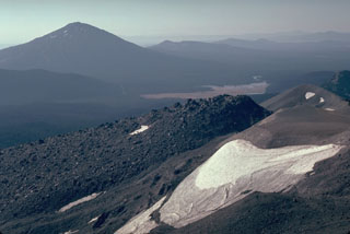 The Newberry lava flow in the foreground is the northernmost and largest of a series of 15 lava domes and flows erupted from a N-S fissure on the SE flank of South Sister volcano. It was preceded by an explosive eruption that produced pyroclastic flows. Another Holocene volcano, Mount Bachelor, is the peak to the left.
Photo by Lee Siebert, 1981 (Smithsonian Institution).
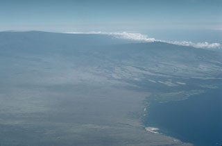 Hualalai volcano (upper right), the smallest of the young shield volcanoes on the island of Hawaii, rises above Kawaihae Bay in this aerial view from the north. Hualalai shield volcano is perched on the western flank of the massive Mauna Loa shield volcano (upper left). The latest eruption of Hualalai, during 1800-1801, produced lava flows from flank vents that reached the sea.
Photo by Lee Siebert, 1987 (Smithsonian Institution).
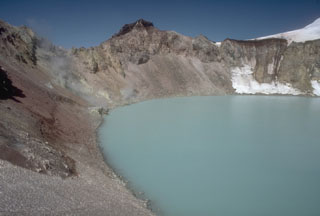 A plume emitting from active fumaroles is on the N side (left center) of the summit lake at Douglas volcano on the northern tip of the Alaska Peninsula. The small, 160-m-wide crater is one of the few ice-free areas on Douglas volcano. In 1992, the lake had a pH of 1.1 and a temperature of 21°C.
Photo by Chris Nye (Alaska Division of Geological and Geophysical Surveys).
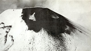 Ash surrounds a small crater on the NE side of the summit in 1942. Pavlof was in a period of almost continuous minor explosive activity from 1936 to 1948. Significant eruptions took place in 1936, July 1937, and 1942. By 1942 eruptions had filled the fissure that formed during the 1911 eruption.
 Photo by U.S. Army Air Force, 1942.
 South Fork cinder cone (center) is seen from the NW with Ramshaw Meadow (upper left) behind it. Templeton Mountain is the rounded peak beyond South Fork cone, and Olancha Peak on the crest of the Sierra Nevada is on the center horizon. South Fork (Red Hill) cone was formed about 176,000 years ago and produced a lava flow 10 km to the west that may have reached as far as the Kern River. The cinder cone was erupted through a bedrock ridge of the Sierra Nevada, and inclusions of quartz monzonite are common near the vents.
Photo by Rick Howard, 2002 (courtesy of Del Hubbs, U S Forest Service).
 Steam rises from hot springs on the floor of the Long Valley caldera. Hot springs, fumaroles and active hydrothermal alteration are found throughout much of the caldera, but are particularly prevalent in the SE caldera moat area and on the flanks of the resurgent dome. The Sierra Nevada Range towers above the SW caldera margin in the background.
Photo by Larry Mastin, 1991 (U.S. Geological Survey).
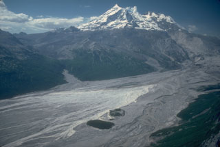 An aerial view shows the upper Drift River valley following the 1989-90 eruptions of Redoubt. Two bedrock islands (informally called the "Dumbbell Hills") are visible at the bottom-center, surrounded by fresh lahar deposits. This photo was taken from the NE on 28 June 1990, shortly after the end of the eruption.
Photo by Cynthia Gardner, 1990 (U.S. Geological Survey).
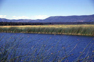 A series of lava flows erupted from Brushy Butte volcano form the dark forested line extending across the photo below the Big Valley Mountain fault scarp in the background. Lava Springs State Park north of the town of MacArthur marks the location of numerous springs that issue from the margin of the Brushy Butte lava flows to form Big Lake, the Little Tule River, and Falls River.
Photo by Lee Siebert, 1998 (Smithsonian Institution).
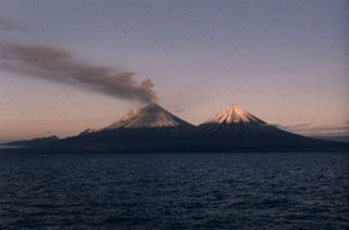 An ash plume disperses to the south in mid-July 1986, three months after the start of an eruption of Pavlof that lasted nearly 2.5 years. This photo was taken from the west on a fishing boat in Pavlof Bay, with Pavlof Sister to the right. The 1986-88 eruption produced intermittent ashfall and lava flows from two vents near the summit, one halfway down the SE flank, and another 600 m below the summit on the NE flank. Lava flows traveled to the N, NE, SE, ESE, and SSE, the latter to within 600 m of the Pavlof Bay shoreline.
Photo by Richard Mack, 1986.
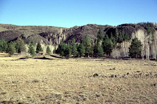 The thick blocky lava flow in the background near Panguitch Lake is the northern lobe of a voluminous flow that originated near Miller Knoll. This flow is only one of several very youthful flows scattered over the Markagunt Plateau volcanic field of SW Utah.
 Photo by Lee Siebert, 1996 (Smithsonian Institution)
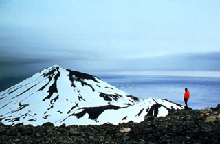 Korovin is seen here from the S, with the smaller Konia cone on its SE flank. Korovin is one of the most frequently active centers of the large complex at the NE tip of Atka Island, and contains two craters near the summit. The SE cone has a 1-km-wide crater, larger than the NW summit.
Photo by Jim Myers, 1997 (University of Wyoming; courtesy of Alaska Volcano Observatory).
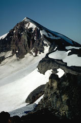 Middle Sister, seen here from the NE near the saddle between North Sister and Middle Sister, is younger than North Sister. The steep cliffs forming the eastern flank are due to glacial erosion that exposed part of its dacite plug.
Photo by Lee Siebert, 1984 (Smithsonian Institution).
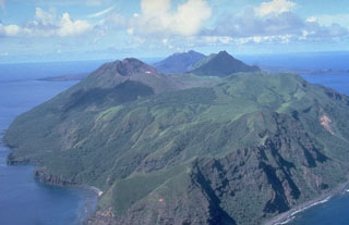 South Pagan volcano occupies the SW end of Pagan Island and has four craters. The ridge in the foreground is the eroded rim of a 4-km-wide caldera containing the cone. Eruptions occurred during the 19th century, and North Pagan at the far center on the NE tip of the island has been frequently active.
Photo by U.S. Navy, 1981.
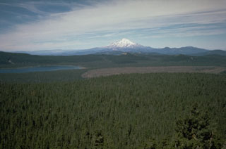 Medicine Lake volcano is seen here looking over the summit crater from the east with Mount Shasta in the background. The barren Medicine Glass Flow on the right was erupted about 5,200 years ago. During the Holocene, obsidian flows were erupted from summit and flank vents, and voluminous basaltic lava flows originated from vents on the north and south flanks.
Photo by Dan Dzurisin, 1985 (U.S. Geological Survey).
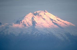 The glaciated Mount Baker is the northernmost of Washington's active volcanoes in the northern Cascade Range, seen here from the SE above Baker Lake. Historical eruptions have originated from Sherman Crater to the left of the summit. Minor phreatic explosions were observed during the 19th century by early settlers in the Puget Sound area as far away as Victoria, British Columbia.
Photo by Lee Siebert, 1981 (Smithsonian Institution).
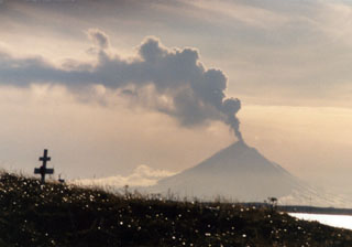 An ash plume rises above Pavlof volcano on 13 November 1996, as seen from Nelson Lagoon about 70 km NE. Intermittent small ash and Strombolian eruptions began on 15 September and lava fountains produced a lava flow. Eruption plumes rose above 6.7 km altitude on four days between 18 October and 11 December 1996.
Photo by Elgin Cook, 1996 (U.S. Geological Survey, Alaska Volcano Observatory).
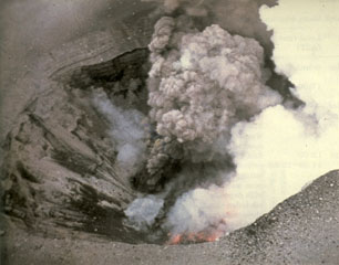 An aerial view into East Maar on 3 April 1977 shows incandescent lava on the floor of the crater and a small vent above it that is producing an ash plume. The 1977 eruptions of Ukinrek Maars began on 30 March at West Maar, which formed during the first three days of the eruption. East Maar formed during the next seven days at a location 600 m E. A lava dome, now covered by a crater lake, formed on the floor of East Maar.
Photo by Ken Parker, 1977 (Alaska Department of Fish and Game).
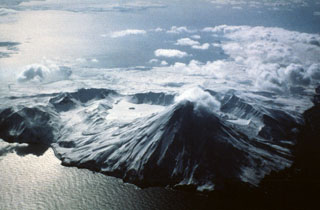 The arcuate ridge in the center of the photo is the southern rim of Kanaton caldera that contains a snow-covered lake in the SE part (center) with a small island. The post-caldera Kanaga cone is in the foreground. Recent lava flows descend the flanks, particularly on the SW, S, and E.
Photo by Fred Deines, 1993 (U.S. Fish & Wildlife Service, courtesy of Alaska Volcano Observatory).
 During the late Pleistocene or early Holocene Mount Spurr underwent flank collapse, resulting in the 5-6 km crater that opens to the south shown here in 1993. The collapse produced a debris avalanche that traveled at least 25 km from the summit. The snow-covered peak (center) is a post-collapse lava dome. Crater Peak, in front of it, has been the source of frequent Holocene eruptions.
Photo by Christina Neal, 1993 (U.S. Geological Survey, Alaska Volcano Observatory).
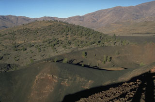 Silent Cone, the partially forested cinder cone in the background, was the source of lava flows primarily to the south about 6500 years ago. The well-preserved cone of Big Craters in the foreground is one of the youngest features of Craters of the Moon.
Photo by Lee Siebert, 1994 (Smithsonian Institution).
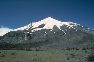 East Dome, the rounded lava dome to the left, is seen in this 1978 view from the Plains of Abraham on the NE side of Mount St. Helens. An explosive eruption accompanied emplacement of the dome on the lower E flank. This eruption took place near the during the Sugar Bowl Eruptive Period during 900 to 850 CE.
Photo by Rick Hoblitt, 1978 (U.S. Geological Survey).
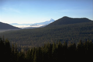 The youngest eruption of the Indian Heaven volcanic field, midway between Mount St. Helens and Mount Adams, produced a large scoria cone and a voluminous lava flow about 9,000 years ago. The source of the flow is the cone to the right, with Mount Hood visible in the background. The Big Lava Bed flow, which forms the slope in the foreground, banked against higher slopes to the north and traveled 13 km S to within 8 km of the Columbia River.
Photo by Lee Siebert, 1995 (Smithsonian Institution).
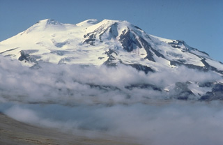 Glacier-covered Mount Mageik, seen here from the north, is a broad stratovolcano that is the SW-most of a group of volcanoes encircling Novarupta volcano. Despite its extensive glacial cover, it is only moderately dissected, and most of its exposed lava flows are of Holocene age. Its elongated summit contains four knobs that were spatter and lava-flow vents. Reports of historical eruptions during the 20th century are of variable certainty.
 Copyrighted photo by Katia and Maurice Krafft, 1978.
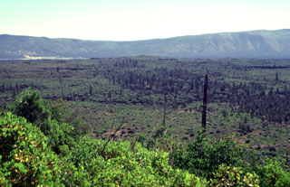 The broad inconspicuous volcano in the center of the photo is Brushy Butte, a small shield volcano SSE of the Medicine Lake Highlands. The Brushy Butte complex has produced a broad apron of basaltic lava flows, seen here from Timbered Crater with the Big Valley Mountain fault scarp in the background. Fresh-looking flows extend preferentially down the regional gradient to the south as far as the Falls River valley, but the age of Brushy Butte is not well known. The volcano may be of late-Pleistocene or early Holocene age.
Photo by Lee Siebert, 1998 (Smithsonian Institution).
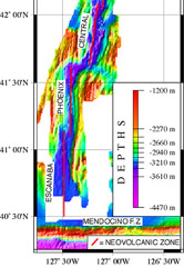 A NOAA/PMEL map shows the setting of the Escanaba Segment at the southern end of the Gorda Ridge west of the coast of northern California. The linear N-S-trending segment is the southernmost of the five segments of the Gorda Ridge, and lies immediately north of the Mendocino Fracture Zone. The axial crest of the 130-km-long segment, also known as the Escanaba Trough, is about 3-5 km wide at the northern end and widens to 18 km in the south near the junction with the Mendocino Fracture Zone.
Courtesy of NOAA NeMo Observatory.
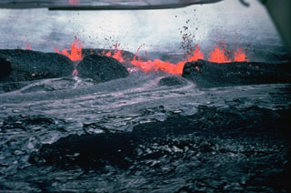 A 19-hour eruption of Kīlauea began on 30 April 1982, from fissures east of Halema’uma’u crater. This view from the north shows lava spatter feeding a lava flow two hours after the start of the eruption. Spatter ramparts of the 1964 eruption are partly buried by 1982 spatter.
Photo by Jack Lockwood, 1982 (U.S. Geological Survey).
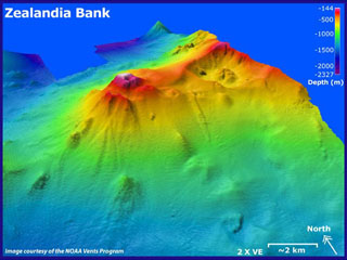 Zealandia Bank submarine volcano is seen in this NOAA Vents Program bathymetric model from the SW with 2x vertical exaggeration. It consists of two peaks about 1 km apart that rise to near the ocean surface between Guguan and Sarigan Islands. The 2004 survey detected fumarolic activity.
Image courtesy of Susan Merle (Oregon State University/ NOAA Vents Program).
 The small dark hill in the middle distance right of center is Little Black Peak, a cinder cone topping a broad low shield volcano that was the source of the massive Carrizozo lava flow, which forms the dark streak extending across the photo. Most of the ~4.2 cu km pahoehoe flow extended off the photo to the right down the low-angle gradient of the Tularosa Basin to the SE for a distance of 75 km.
 Photo by Lee Siebert, 1999 (Smithsonian Institution).
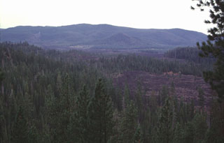 Three lava flows that erupted from fissure vents on the NW rift zone of Newberry volcano about 7,000 years ago can be seen in this photo. The Forest Road Flow in the foreground was one of the smallest. Behind it are the Lava Cast Forest and Lava Cascades flows. The latter traveled about 8 km from its vent. The northern rim of Newberry caldera forms the ridge on the horizon.
Photo by Lee Siebert, 1997 (Smithsonian Institution).
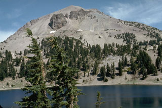 The massive dacitic lava dome of Lassen Peak rises above Lake Helen on the south side of the volcano. Plugs of dark dacitic lava exposed near the summit are surrounded by vast aprons of lighter-colored talus associated with growth of the lava dome.
Photo by Lee Siebert, 1972 (Smithsonian Institution).
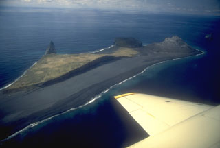 Lava dome remnants from three historical eruptions can be seen in this NW-looking aerial view of Bogoslof Island in the Aleutians. The pinnacle on the left is Castle Rock, also referred to as Old Bogoslof, a remnant of a 1796 lava dome. The circular, flat-topped area to its right is a remnant of a 1927 lava dome. The 1992 eruption produced the light-colored conical lava dome forming the tip of the island at top right. Regular eruptions and vigorous wave erosion frequently modify the island.
Photo by Chris Nye, 1994 (Alaska Division of Geological & Geophysical Surveys).
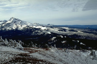 The north flank of North Sister contains young scoria cones that have produced lava flows during the past few thousand years, seen here covered with light snow. Yapoah cone, the symmetrical snow-covered cone in the center of the photo, produced a lava flow about 2,600-2,900 years ago that traveled beyond the margin of the photo for 13 km to the NE.
Photo by Lee Siebert, 1995 (Smithsonian Institution).
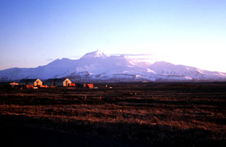 Frosty is the youngest of two large volcanic structures of the Cold Bay volcanic complex, about 15 km SW of Cold Bay at the tip of the Alaska Peninsula. Frosty Peak was constructed within the southernmost of two coalescing craters during the late-Pleistocene to Holocene, and forms the high point of the complex.
Photo by Christina Neal, 1997 (Alaska Volcano Observatory, U.S. Geological Survey).
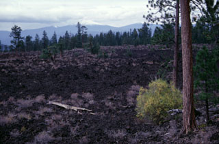 The Lava Cast Forest Flow was one of several lava flows erupted from the upper NW rift zone of Newberry volcano about 7,000 years ago. The flow is named for its abundant casts of trees that formed when lava chilled and cooled around standing or fallen tree trunks.
Photo by Lee Siebert, 1997 (Smithsonian Institution).
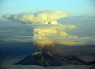 An ash plume from Pavlof on the evening of 30 August 2007 at 2120 local time. This view is to the S, out of the right side of a plane flying to Anchorage from Cold Bay. The ash plume height was approximately 5.2-5.5 km.
Photo by Chris Waythomas, 2007 (Alaska Volcano Observatory, U.S. Geological Survey).
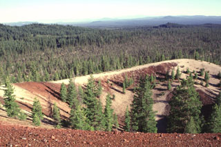 Paint Pot Crater on the lower SW flank of Medicine Lake volcano derives its name from the mantle of white pumice from nearby Little Glass Mountain that covers the reddish oxidized scoria of the cinder cone. Paint Pot Crater emitted a lava flow from its breached crater that traveled to the south, where it forms the sparsely vegetated area seen in the photo beyond the far rim of the cone. The crater and lava flow are among the youngest products of Medicine Lake volcano, and were erupted about 1100-1150 years ago.
 Photo by Lee Siebert, 1998 (Smithsonian Institution).
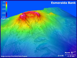 A bathymetric model with 2x vertical exaggeration shows the Esmeralda Bank submarine volcano, as seen from the NW. Depths in this image range from 54 to 2,052 m. Bathymetry data (~25 m resolution) is overlaid on SeaBat data (~50 m resolution) courtesy of Yoshihiko Tamura (JAMSTEC). The main central edifice seen here has a 3-km summit crater open to the W. Sulfur and water discoloration from eruptive or geothermal activity have frequently been observed.
Image courtesy of Susan Merle (Oregon State University/NOAA Vents Program).
 The view WNW from the western side of Little Sitkin Island includes the broad Davidof island, part of the rim of a largely submerged caldera across the right-center. The snow-capped peak behind Davidof is Segula volcano. In the background to the far left is the Kiska volcano.
Photo by Steve Ebbert, 2000 (U.S. Fish and Wildlife Service).
 Mount Adams in the Cascade Range is seen here in 1981 from High Knob to the NW. Its base is at a lower elevation than its neighbor Mount Rainier and it has a larger volume. Numerous flank vents surround the volcano and a series of lava flows have erupted on the N, NW, S and E flanks.
Photo by Lee Siebert, 1981 (Smithsonian Institution).
 Lavas of the Big Lava Bed flow, erupted about 9,000 years ago from the scoria cone in the background and dammed local drainages, forming Goose Lake. The Big Lava Bed flow is the most recent eruption of the Indian Heaven volcanic field, which lies between Mount St. Helens and Mount Adams.
Photo by Lee Siebert, 1995 (Smithsonian Institution).
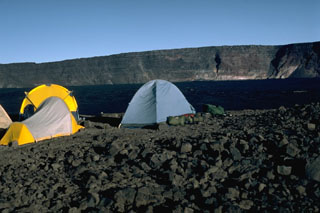 A campsite on the E rim of Mauna Loa's Moku’aweoweo caldera in 1987 has a view of the W rim that rises about 180 m above the lava flows from the 1984 eruption that covered the caldera floor. Lava flows from the 1975 eruption had also almost covered the entire floor. By this time, incremental filling of the caldera had almost halved the maximum recorded caldera depth of 320 m.
Photo by Lee Siebert, 1987 (Smithsonian Institution).
 The massive Medicine Lake volcano in NE California, seen here from the NE, encompasses a 50 x 80 km wide area. Holocene eruptions included obsidian flows from summit and flank vents, and voluminous basaltic lava flows from vents on the north and south flanks. Recent eruptions took place about 900 years ago. The summit area includes a 7 x 11 km caldera.
Photo by Julie Donnely-Nolan, 1982 (U.S. Geological Survey).
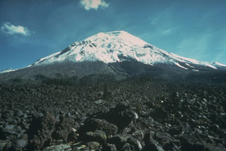 The Floating Island lava flow on the NNW flank of Mount St. Helens is in the foreground of this 1978 photo, before it was buried by the collapse in 1980. This lava flow has been dated using tree-ring evidence to an eruption in 1801, shortly after a major explosive eruption from a vent near the former Goat Rocks lava dome, halfway up the left-hand skyline in this photo.
Photo by Rick Hoblitt, 1978 (U.S. Geological Survey).
 The St. Michael volcanic field consists of more than 55 cones and craters across Stuart Island (upper left) and the peninsula in the center of this 18 August 2020 Sentinel-2 satellite image (N is at the top; this image is approximately 40 km across). The field covers more than 3,000 km2. The Stuart Hill cone is visible in the eastern side of Stuart island, and St. Michael Mountain is in the center of the peninsula area.
Satellite image courtesy of Copernicus Sentinel Data, 2019.
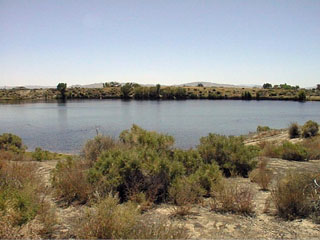 Little Soda Lake, the smaller of two maars NW of the town of Fallon in west-central Nevada, is about 300 m wide. The two maars were formed by eruptions through sediments of glacial Lake Lahontan.
Photo by Nevada Bureau of Mines and Geology.
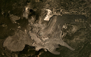 The Medicine Lake volcanic center covers around 2,200 km2, with recent lava flows shown in this August 2019 Planet Labs satellite image monthly mosaic (N is at the top; this image is approximately 10 km across). These lava flows at Big Glass Mountain erupted along the eastern caldera rim and ten lava domes formed in a NW trend, with one lava dome to the south. The western lava flow in this view flowed into the caldera and the eastern flows traveled down the flank.
Satellite image courtesy of Planet Labs Inc., 2019 (https://www.planet.com/).
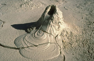 A small mudpot vent in Pocket Basin at the north end of Yellowstone's Lower Geyser Basin produced this intriguing feature that mimics a spatter cone that issued a lava flow. Mudpots form in areas of intense, clay-rich hydrothermal alteration where the thermal system is dominated by gases.
Photo by Dan Dzurisin, 1983 (U.S. Geological Survey).
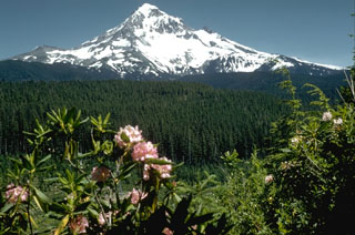 Mount Hood, one of Oregon's highest peaks, rises above the Lolo Pass area on its NW side. Hood is a prominent landmark on both sides of the Columbia River. The summit of the glacially eroded volcano contains several lava domes. At least four major eruptive periods have occurred during the past 15,000 years, including in the late 1700s. Minor 19th century eruptions were witnessed from the city of Portland.
Photo by Richard Fiske (Smithsonian Institution).
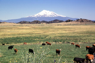 The forested hills and rolling pasture lands near the town of Montague are part of a massive debris avalanche deposit that originated from Mount Shasta during the Pleistocene. The hills consist of remnants of the former edifice of Mount Shasta that were transported relatively intact to this point, about 40 km NW of the volcano. The origin of the hills remained enigmatic until volcanologists noticed the resemblance to the avalanche deposit produced at Mount St. Helens in 1980.
Photo by Lee Siebert, 1998 (Smithsonian Institution).
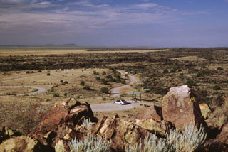 The Carrizozo lava flow surrounds the southern end of a kipuka providing a campground site in the Valley of Fires Recreation Area. This massive tube-fed pahoehoe lava flow, with a volume of about 4.3 cubic km, traveled 75 km down the extremely low-angle floor of the Tularosa Basin, with slopes of less than half a degree. The flow was inferred to have been emplaced during low-effusion-rate, long-duration eruption lasting 2-3 decades.
Photo by Lee Siebert, 1999 (Smithsonian Institution).
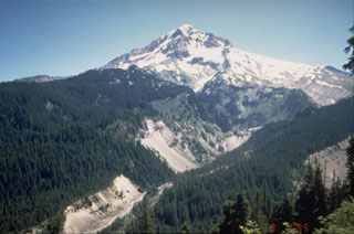 The upper Sandy River valley on the SW side of Mount Hood has been one of the primary channels for lahars and block-and-ash flows during the past 1,800 years. These late-stage eruptions originated from vents and lava domes high on the SW flank.
Photo by Willie Scott, 1995 (U.S. Geological Survey).
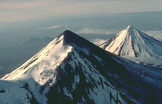 The twin volcanoes of Pavlof (left) and Pavlof Sister (right) are prominent landmarks on the southern Alaska Peninsula. The summits of the two conical stratovolcanoes are only 5 km apart. This 1978 view from the SW shows a steam plume rising from the 2519-m summit of Pavlof, the most active volcano of the Aleutian arc. Pavlof Sister, somewhat more eroded than Pavlof, has had only a single historical eruption, in the 18th century.
Copyrighted photo by Katia and Maurice Krafft, 1978.
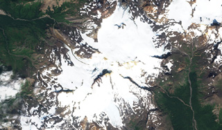 Stepovak Bay 4 is part of the Stepovak Bay Group on the western Alaska Peninsula. The group is located along a NE-trending ridge, seen here in this 17 August 2019 Sentinel-2 satellite image (N is at the top), which is approximately 14 km across. Several of the volcanoes have produced debris flows and lava flows in the Holocene.
Satellite image courtesy of Copernicus Sentinel Data, 2019.
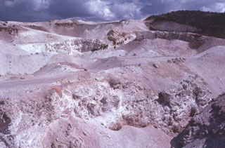 Extensive areas of hydrothermally altered rock occur at Steamboat Springs, a small volcanic field of rhyolitic lava domes and flows south of Reno, Nevada. Volcanism ranges in age from 2.53 to 1.14 million years. No eruptive activity has occurred during the Holocene, although the Steamboat Springs area contains about 50 active hot springs, numerous steam vents and fumaroles, and is an actively producing geothermal field.
 Photo by Bill Rose, 1976 (Michigan Technological University).
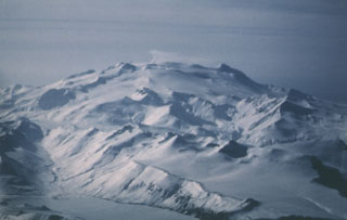 Makushin is a glaciated volcano on northern Unalaska Island. This 2 March 1987 view from the NE shows a small plume originating from a vent on the left side of the broad summit and drifting about 3 km WNW. The summit contains a 2-km-wide caldera. Minor explosive eruptions have occurred during historical time.
Photo by Harold Wilson (Peninsula Airways), 1987 (courtesy of John Reeder, Alaska Div. Geology Geophysical Surveys).
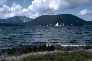 The Central Pumice Cone at the right formed during a major rhyolitic eruption about 6,400 years ago. Many other vents on the north and south caldera walls and the caldera floor were also active at this time, producing pumice rings and obsidian flows. Paulina Peak forms the high point on the south caldera rim at the left.
Photo by Lee Siebert, 1984 (Smithsonian Institution).
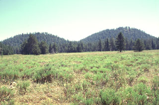 Twin Buttes are part of a group of cinder cones near Pleistocene Burney Mountain volcano. North Twin Butte (left) and South Twin Butte (right) rise above flat-lying forests and meadows SE of Burney Mountain. The cones are part of an area of extensive Quaternary volcanism north of the Lassen volcanic field. Twin Buttes and associated lava flows are of late-Pleistocene or early Holocene age.
Photo by Lee Siebert, 1998 (Smithsonian Institution).
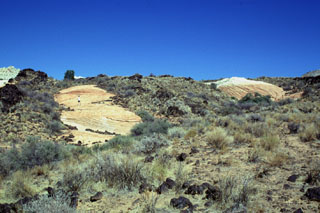 The Santa Clara lava flow in SW Utah split into several lobes and diverted around two islands (kipukas) of colorful cross-bedded Navajo Sandstone. Note the person standing on the left kipuka for scale. The largest kipuka of the Santa Clara flow is about 1 km in length.
Photo by Lee Siebert, 1996 (Smithsonian Institution).
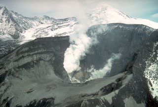 Crater Peak crater on Mount Spurr is seen here producing a plume on 18 June 1992, the day after a brief violent explosion. Fresh deposits are on the interior of the crater and the pre-eruption crater lake is gone. The summit is visible behind the plume to the upper right in this view from the south.
Photo by Chris Nye, 1992 (Alaska Division of Geological and Geophysical Surveys).
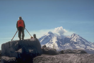 An Alaska Volcano Observatory geologist uses a laser-surveying instrument to measure precise distances to targets installed on the flanks of Redoubt. Minute changes in distances to the targets can reflect ground deformation that may indicate magma movement or other processes. Steam rises above a lava dome in the crater of Redoubt in this photo taken on 5 May 1990, near the end of an eruption that had begun the previous December.
Photo by Game McGimsey, 1990 (Alaska Volcano Observatory, U.S. Geological Survey).
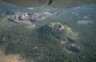 An aerial view from the south shows the North and South Inyo Craters phreatic explosion craters diagonally cutting forested Deer Mountain from the right center to lower right, and the unvegetated South Deadman lava dome and obsidian flow and the forested mound of North Deadman dome at the upper left. Eruption of magmatic tephra and the formation of the phreatic explosion craters preceded emplacement of the lava domes and flows about 600 years ago.
Photo by Larry Mastin, 1988 (U.S. Geological Survey).
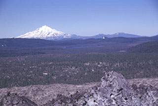 The broad partially forested lava flow extending across the center of the photo into Medicine Lake caldera is the Hoffman lava flow, which erupted about 1,170 years ago. The massive rhyolite lava flow and an adjacent smaller one were erupted from vents on the NE rim of the caldera. The larger of the two flows, seen here with the unvegetated Glass Mountain flow in the foreground, was erupted near the caldera rim and flowed both west into the caldera and down the east flank. Snow-capped Mount Shasta rises to the west.
Photo by Lee Siebert, 1998 (Smithsonian Institution).
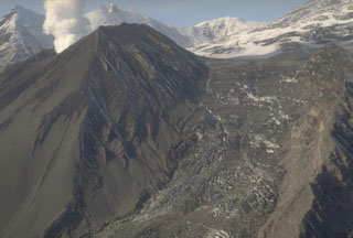 The last of three brief 1992 explosive eruptions at the Crater Peak vent of Mount Spurr showered hot debris onto the Kidazgeni Glacier immediately east of the cone. In this 23 September view, six days after the end of the eruption, a plume rises from Crater Peak and dark pyroclastic material covers the flanks of the cone and adjacent glacial ice.
Photo by Cynthia Gardner, 1992 (U.S. Geological Survey).
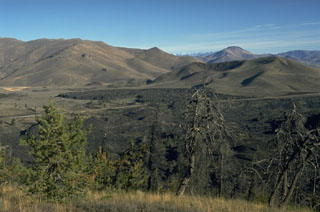 The Highway lava flow forming the black lobe in the center of the photo at the base of the Pioneer Mountains was erupted about 2300 years ago from a vent at or near North Crater, out of view to the right. Two other Craters of the Moon flows, the Devils Orchard and Serrate lava flows, were also erupted at about the same time. The complex vegetated cinder cone to the right of the Highway lava flow is the late Pleistocene Sunset Cone.
Photo by Lee Siebert, 1994 (Smithsonian Institution).
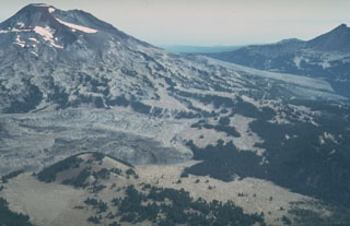 An aerial view from the SW with Le Conte crater in the left foreground shows lava flows from two major Holocene flank eruptions of South Sister volcano. The Rock Mesa flow, immediately behind Le Conte crater and the Newberry lava flow on the South Sister lower SE flank, were erupted between about 2,300 and 2,000 years ago. They were also accompanied by explosive eruptions.
Photo by Willie Scott, 1981 (U.S. Geological Survey).
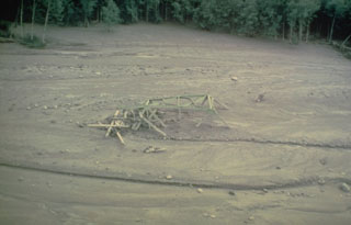 The twisted girders of a highway bridge within lahar deposits from Mount St. Helens. This 18 May 1980 mudflow was produced by dewatering (meltwater coming out) of the debris avalanche deposit in the North Fork Toutle River that traveled as far as the Columbia River, decreasing the depth of the navigational channel from 11 to 4 m.
Photo by Dan Miller, 1980 (U.S. Geological Survey).
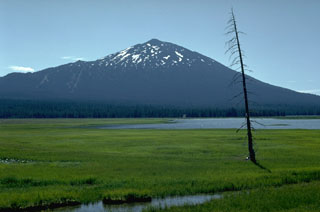 Mount Bachelor is seen here beyond Sparks Lake to the west. It is a late Pleistocene-to-Holocene stratovolcano at the northern end of a 25-km-long chain of scoria cones and small shield volcanoes.
 Photo by Lee Siebert, 1982 (Smithsonian Institution).
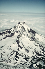 Isanotski volcano, sometimes referred to as "Ragged Jack," has been extensively dissected by glaciers. Although historical eruptions in the 18th and 19th centuries have been attributed to Isanotski, these reports from an infrequently visited region with notoriously poor weather must be considered somewhat suspect.
Copyrighted photo by Katia and Maurice Krafft, 1978.
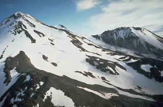 The prominent lava dome of Shastina, seen here on the right from the north, formed on the west flank of Shasta between about 9,700 and 9,400 years ago. The Shastina summit contains several overlapping domes. Hotlum cone to the left forms the main summit of Shasta and is likely younger than Shastina.
Photo by Dan Dzurisin, 1982 (U.S. Geological Survey).
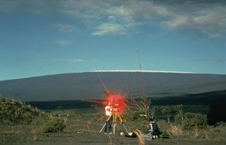 Hawaiian Volcano Observatory scientists conduct an electronic-distance measurement (EDM) survey on the rim of Kīlauea caldera in 1988, with snow-capped Mauna Loa in the background. The procedure uses a laser beam, which is reflected back to the EDM instrument from a distant cluster of reflectors. A precise determination of the distance between the two points is made by a small computer in the EDM instrument. These measurements allow scientists to detect inflation or deflation of the volcano due to changes in the magmatic or hydrothermal systems.
Photo by J.D. Griggs, 1988 (U.S. Geological Survey).
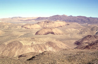 The Coso volcanic field at the western edge of the Basin and Range province consists of largely Pliocene to late-Pleistocene rhyolitic lava domes and basaltic cinder cones covering a 400 km2 area. This view looks south across the range from Cactus Peak with some of the 38 light-colored rhyolitic lava domes of the Coso volcanic field in the foreground and dark-colored basaltic cinder cones and associated lava flows in the background. Active fumaroles and thermal springs are present in an area that is a producing geothermal field.
 Photo by Paul Kimberly, 1997 (Smithsonian Institution).
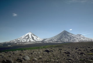 The summits of Pavlof Sister (left) and Pavlof (right) rise above a roughly 1,100-m-elevation saddle. They are viewed here in 1975 from lowlands to the NW. Pavlof is darkened by recent ash deposition and has been the source of frequent eruptions in historical time. Little Pavlof, a cone on the right flank of Pavlof, was also constructed along a line of vents trending NE from Emmons Lake caldera.
Photo by Tom Miller, 1975 (Alaska Volcano Observatory, U.S. Geological Survey).
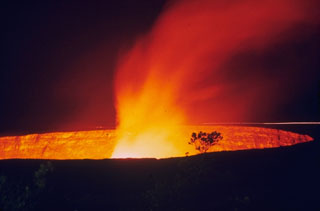 A lava lake within Halema‘uma‘u produces a gas plume on 23 November 1968, shortly after activity began. This period of lava lake activity continued through to July 1968.
Photo by Richard Fiske, 1967 (Smithsonian Institution).
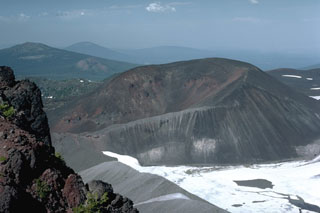 The horseshoe-shaped Collier Cone on the NNW flank of North Sister, partially covered by the Collier Glacier in this 1984 photo, was the source about 1,600 years ago of the youngest dated eruption in the North Sister volcanic field. Lava flows traveled 5 km NW and 13.5 km W down the White Branch Creek. The foreground portion of the cone in this view looking NE has been partially eroded by Collier Glacier when it was at the level of the gray glacial moraine in the foreground on the left margin of the glacier.
Photo by Lee Siebert, 1984 (Smithsonian Institution).
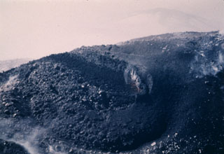 An eruption of Cleveland in 1987 began with explosive activity on 19 June that deposited ash onto snow on the flanks. On 23 June, the date of this photo, a lava flow from the summit eventually extended 2.5 km down the ESE flank. Lava fountaining was observed on 22 July, and on 28 August a large explosive eruption produced an ash plume that reached over 10 km altitude.
Photo by Harold Wilson (Peninsula Airways), 1987, courtesy of John Reeder (Alaska Div. Geology & Geophysical Surveys).
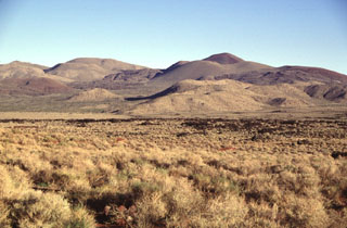 A series of basaltic cinder cones and related lava flows at the southern end of the Coso volcanic field form some of the youngest volcanic products at Coso. The cones and flows are concentrated along the south edge of a NE-trending horst that is capped by rhyolitic lava domes and flows. Many of the flows, such as the one left of center, are intracanyon flows that traveled down existing drainages.
Photo by Lee Siebert, 1997 (Smithsonian Institution).
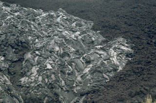 Two types of lava flows, pahoehoe (left) and `a`a (right), are different textural forms of otherwise identical lava. The different textures relate to different flow dynamics and both can form in the same lava flow. Because of differential weathering rates, the overlying pahoehoe flows look younger than the associated aa flows, and the two flows are easily mistaken for flows of greatly differing age.
Photo by Lee Siebert, 1987 (Smithsonian Institution).
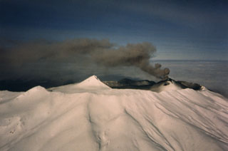 Akutan has a 2-km-wide summit caldera with a large scoria cone that rises above the caldera rim. It is seen here from the south in eruption on 11 February 1987. A small lake occupies part of the caldera floor. The caldera rim is breached narrowly on the north side through which a 1978 lava flow traveled to within 2 km of the sea.
Photo by Jerry Chisum (Mark Airways), 1987 (courtesy of John Reeder, Alaska Div. Geology & Geophysical Surveys).
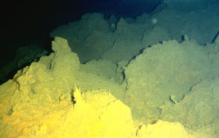 Sulfur deposited from fumarolic vents coats lava flows on Lōʻihi seamount. Lōʻihi, the youngest Hawaiian volcano, rises to within 975 m of the sea surface 35 km off the SE coast of the island of Hawaii. Two rift zones, oriented N-S, give the volcano an elongated form, and prompted its name, which is the Hawaiian word for "long." Fresh, sediment-free lava flows indicate the young age of the submarine volcano, and seismic swarms related to intrusive or eruptive activity have been recorded frequently.
Photo by the Hawaii Undersea Research Laboratory (University of Hawaii).
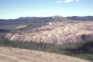 The Little Glass Mountain obsidian flow is seen here from Pumice Stone Mountain, named for the mantle of white pumice (foreground) from Little Glass Mountain. The 0.4 km3 obsidian flow was erupted from a currently buried vent below the Little Mt. Hoffman cone seen here behind the flow. The Little Glass Mountain pumice eruption and obsidian flow occurred about 950 years ago during one of the more recent eruptions from Medicine Lake.
Photo by Lee Siebert, 1998 (Smithsonian Institution).
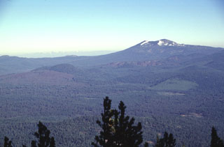 A N-S-trending chain of vents extending across the center of the photo forms Tumble Buttes, a young volcanic field north of Lassen Volcanic National Park. A large area of unvegetated lava flows at the left margin originated from Bear Wallow Butte at the southern end of the chain. Other young unvegetated flows form the Devils Rock Garden at right-center, below Crater Mountain, the prominent snow-dappled peak on the horizon. This view looks to the NW across the Hat Creek valley from West Prospect Mountain.
Photo by Lee Siebert, 1998 (Smithsonian Institution).
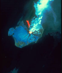 This Landsat thematic mapper image was acquired on 28 August 1986, as Augustine produced a powerful explosive eruption. An 11-km-high ash plume rises from the summit crater to the top of the false-color image. The red area in this false-color image is a hot pyroclastic flow deposit down the north flank. Snow and ice show up as shades of blue and vegetated areas along the coast are green. The dark areas descending the flanks are the paths of lahars and cooled pyroclastic flows.
NASA Landsat image, 1990.
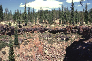 This crater on the SE rim of Medicine Lake caldera formed around 5,100 years ago. The eruption produced tephra and spatter with localized lava flows from a NE-trending alignment of pit craters.
Photo by Lee Siebert, 1998 (Smithsonian Institution).
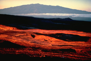 Broad streams of incandescent lava travel down the NE rift zone of Mauna Loa volcano early in the morning of March 25, 1984, with Mauna Kea volcano in the background to the north. The eruptive fissure initially opened in the summit caldera and SW rift zone, but soon migrated down the NE rift zone, where activity continued until the eruption ended on April 15. Lava flows from the NE rift zone traveled down the NE and SE flanks, reaching to within about 5 km of the city limits of Hilo.
Copyrighted photo by Katia and Maurice Krafft, 1984.
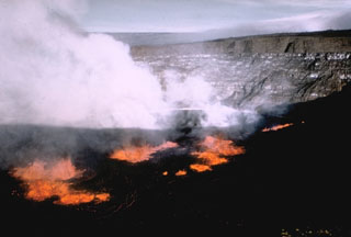 A lava lake formed within Halema‘uma‘u crater on 5 November 1967. In the background of this view from the SE can be seen thin, light-colored lava flows exposed in the crater walls, with the Kīlauea caldera wall above it, and the flank of Mauna Loa in the distance. Lava lake activity continued until 13 July 1968.
Photo by U.S. Geological Survey, 1967.
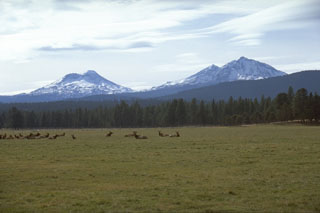 The Three Sisters volcanoes form the most prominent landmarks of the central Oregon Cascades. All three volcanoes ceased erupting during the Pleistocene, but flank vents of South Sister to the left and North Sister to the right have erupted in the past few thousand years.
Photo by Lee Siebert, 1995 (Smithsonian Institution).
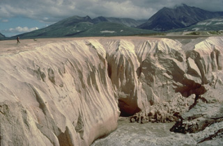 Alaska's Valley of Ten Thousand Smokes is filled with deposits from one of Earth's largest ash flows during historical time. They were emplaced during a powerful eruption on June 6, 1912, from Novarupta volcano, a newly formed volcano 10 km west of Katmai volcano. Stream dissection of the easily eroded, unwelded ash-flow deposit since 1912 provides a cross-sectional view of its interior. The person standing on its surface at the left provides scale for the deposit, which covers an area of 120 cu km and has a volume 11-15 cu km.
Copyrighted photo by Katia and Maurice Krafft, 1978.
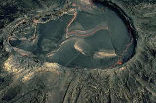 The Kupaianaha lava pond was active for many years during the east rift zone eruption of Kīlauea, which began in 1983. This February 1987 aerial view shows the crusted-over surface of the pond, with incandescent lava visible between segments of the crust. Convection of the lava lake produces lateral movement and descent of the solidified crust, which mimic many plate tectonic processes. The smooth slopes surrounding Kupaianaha were formed by overflows of pahoehoe lava.
Copyrighted photo by Katia and Maurice Krafft, 1987.
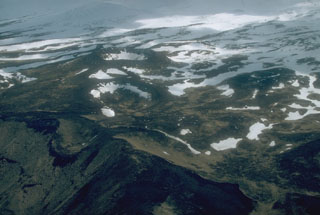 The Point Kadin vents low on the NW flank of Makushin are a dozen or so craters and small scoria cones. They erupted along a WNW-trending fracture zone that extends to the coast.
Photo by Chris Nye, 1994 (Alaska Division of Geological & Geophysical Surveys, Alaska Volcano Observatory).
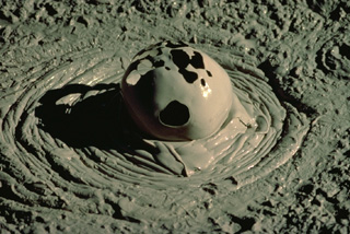 Gas escaping from a mudpot at Yellowstone creates an ephemeral spherical bubble. Mudpots form in hydrothermal systems where the gas phase dominates the thermal system in areas of intense, clay-rich hydrothermal alteration.
Copyrighted photo by Katia and Maurice Krafft, 1984.
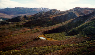 A small lake partially fills a 300-m-wide tuff ring, the larger of two craters of Buzzard Creek. Both craters formed during phreatomagmatic eruptions about 3,000 years ago, and are 320 km NE of their nearest neighbor in the Aleutian arc, Hayes volcano.
Photo by Chris Nye (Alaska Division of Geological & Geophysical Surveys, Alaska Volcano Observatory).
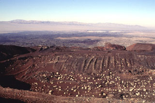 The cone of Pisgah Crater has been modified by mining operations that provide a source of road aggregate. The cone is the most prominent feature of the Lavic Lake volcanic field in southern California. A broad lava field erupted from nearby vents surrounds the cone; a narrow lobe that extends up to 18 km to the NW can be seen in this view.
Photo by Lee Siebert, 1997 (Smithsonian Institution).
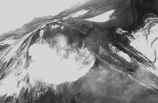 The Kanaga summit crater of is seen here in 1942. Both explosive and effusive eruptions have been recorded, and in 1906 lava flows reached the sea along the SW coast. In 1994 lava flows reached the NW coast. Kanaga is constructed within the Kanaton caldera.
Photo by R. Katchadoorian, 1942 (from the collection of Maurice and Katia Krafft).
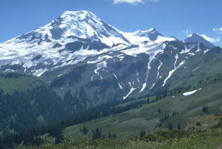 The north flank of Mount Baker is seen from Skyline Divide with the two peaks of the Pleistocene Black Buttes on the right horizon. Chowder Ridge extends across the middle of the image in front of Black Buttes towards Mt. Hadley, the peak below the flat-topped Mount Baker summit. The ridge is named for its marine brachiopod fossils and contains numerous dikes, the feeders for a large early and mid-Pleistocene volcanic center that has been almost entirely eroded away by Pleistocene continental ice sheets.
Photo by Lee Siebert, 1979 (Smithsonian Institution).
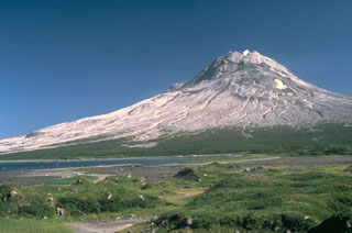 Augustine, seen here from the NW, is the most active volcano of the eastern Aleutian arc. It consists of a complex of overlapping lava domes surrounded by an apron of volcaniclastic debris that reach the sea on all sides. The hummocky deposit in the foreground is a roughly 450-year-old debris avalanche deposit, one of many that surround the island as a result of repetitive collapse of the summit lava dome. Twentieth-century eruptions included explosive activity with pyroclastic flows and lava dome extrusion.
Photo by Lee Siebert, 1987 (Smithsonian Institution).
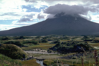 These small hills in the foreground of Alaska's Augustine volcano show a morphology common to debris avalanche deposits. The hummocks consist of relatively intact segments of the volcanic edifice that were transported long distances without disaggregating. This debris avalanche traveled roughly 11 km from the summit about 450 years ago.
Photo by Lee Siebert, 1987 (Smithsonian Institution).
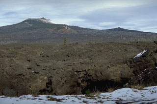 Lava flows in the foreground originated about 1,500 years ago from the South Belknap scoria cone below the skyline near the center of this photo. South Belknap scoria cone lies below Belknap Crater, a cone on the Belknap shield volcano. The lower peak on the right skyline is Little Belknap, a shield volcano constructed on the E flank of Belknap. Largely unvegetated lava flows cover nearly 100 km2 in the McKenzie Pass area.
Photo by Lee Siebert, 1995 (Smithsonian Institution).
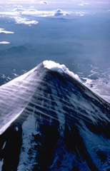 The small summit crater of symmetrical Shishaldin volcano produces an almost constant steam plume. Strong winds in this 1978 view from the east also sweep streams of linear atmospheric clouds across the flanks of the volcano. The dominantly basaltic volcano is built atop an older volcano, remnants of which can be seen on the west and NE sides.
Copyrighted photo by Katia and Maurice Krafft, 1978.
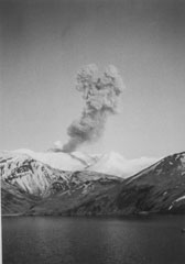 An ash plume rises about 1.5 km above the scoria cone in the Akutan summit caldera on 20 April 1988. This view from Akutan Harbor east of the volcano shows typical explosive activity. Intermittent ash eruptions began on 26 March and continued until 20 July.
Photo by Charlotte Jones, 1988 (courtesy of John Reeder, Alaska Div. Geology & Geophysical Surveys).
 Hanauma Bay partially fills a breached crater near the SE tip of the island of Oahu. The crater is part of the Honolulu Series, a group of late-Pleistocene and possibly Holocene tuff cones, cinder cones, and spatter cones (many with associated lava flows) constructed on the eastern flank of the massive Koolau shield volcano. This elongated shield volcano is of Pliocene-to-Pleistocene age and forms much of the eastern half of Oahu.
 Photo by Lee Siebert, 1998 (Smithsonian Institution).
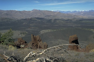 The Craters of the Moon lava field covers 1600 km2 of the Snake River Plain with lava flows erupted from NW-SE-trending fissures and cinder cones. The northern part of the lava field, seen from Big Cinder Butte with the Pioneer Mountains in the background to the north, contains many flows and cinder cones formed during the most recent eruptions about 2300 to 2100 years ago.
Photo by Lee Siebert, 1994 (Smithsonian Institution).
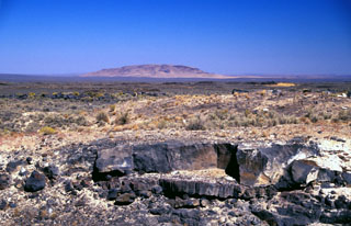 Basaltic lava flows from Saddle Butte volcanic field in SE Oregon descend low-angle slopes towards Saddle Butte on the horizon. The volcanic field consists of an 1100 km2 area of Pleistocene basalts with a superposed 240 km2 area of younger Pleistocene basalts. Oregon State Highway 78, from where this photo was taken, cuts across the western side of the isolated lava field, which reaches nearly to the southern base of Saddle Butte. Lava tubes are prominent in the younger flows.
Photo by Lee Siebert, 2002 (Smithsonian Institution).
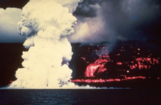 A laze plume (hydrochloric acid, steam, and fine glass particles) rises from the west coast of the Island of Hawai’i on 2 June 1950 where a lava flow from Mauna Loa enters the sea. The Ka’apuna lava flow (right) was the last of three lobes that entered the sea on the second day of an eruption that originated high on the SW rift zone. The lava flow crossed the road encircling the island near Heku Point and destroyed a new restaurant and several buildings. The eruption lasted until 23 June.
Photo by Gordon Macdonald (U.S. Geological Survey).
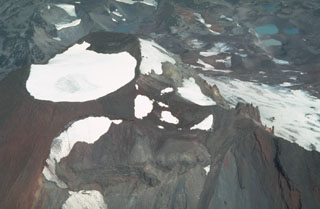 An aerial view of the summit of South Sister from the south, seen here in 1981, shows a snow-filled summit crater that seasonally contains a small melt-water lake. Fissure eruptions occurred during the Holocene from flank vents including some near Carver Lakes on the NE flank, seen here to the upper right.
Photo by Willie Scott, 1981 (U.S. Geological Survey).
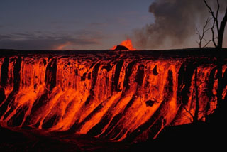 Lava flows from fountains at the Mauna Ulu cone in the background cascade down the Aloi crater walls on 30 December 1969. The 1969-74 Mauna Ulu eruption eventually filled both Aloi crater west of Mauna Ulu, and Alae crater to the east.
Photo by Don Swanson, 1969 (U.S. Geological Survey).
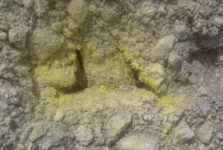 Sulfur mineralization surrounds a fumarole near the margin of a summit lake at Douglas volcano on the northern tip of the Alaska Peninsula.
Photo by Chris Nye (Alaska Division of Geological and Geophysical Surveys).
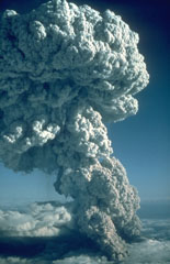 An explosive eruption from Mount St. Helens on 22 July 1980, seen here from the north, produced a Plinian eruption column that rose 16 km above the volcano. At the base of the column ash can be seen rising above a pyroclastic flow traveling down the N flank towards Spirit Lake. This was the third of three explosive pulses on July 22 and lasted more than two hours.
Photo by Jim Vallance, 1980 (U.S. Geological Survey).
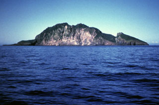 A steep, arcuate cliff drops nearly 300 m to the coast on the western side of Koniuji Island. This small, 1 x 1.5 km wide island, located between Atka Island and Kasatochi volcano, is the emergent top of a mostly-submarine volcano. A NE-trending fault is visible on the SE side of the island (right).
 Photo by E. Bailey, 1982 (U.S. Fish and Wildlife Service).
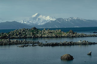 Iliamna rises across Kamishak Bay, 75 km N of Augustine Island. The features in the foreground are hummocks of a debris avalanche from the summit of Augustine in 1883 that reached the sea and extended the shoreline of the island by up to 2 km.
Photo by Lee Siebert, 1987 (Smithsonian Institution).
 Dark lava flows extend from the 6-km-long Kings Bowl Rift SE of Craters of the Moon. These flows were erupted at the same time as the much more massive Wapi lava field flows immediately to the south that covered about 300 km2, forming a broad, low shield volcano about 2250 years ago. The light-colored area overlying the lava flows at the lower center of the photo is an ash deposit produced by explosions from Kings Bowl crater.
Photo courtesy U.S. Geological Survey.
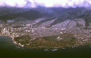 The city of Honolulu drapes the lower flanks of the massive Koolau shield volcano on the island of Oahu. Most of Koolau volcano is of Pliocene-to-Pleistocene age, but a series of late-Pleistocene to perhaps early Holocene explosive eruptions formed a chain of tuff cones, cinder cones, and spatter cones at the SE end of the island. The largest of these is the Diamond Head tuff cone (lower right), which forms a dramatic backdrop to the city of Honolulu.
 Photo by Jeff Plaut, 1990 (Jet Propulsion Laboratory, courtesy of Richard Fiske, Smithsonian Institution).
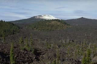 Lava flows from Little Belknap shield volcano in the central Cascade Range of Oregon on the right skyline diverge around a kipuka, a forested island of pre-eruption terrain in the center of the photo. Kipuka is a Hawaiian term for older land surrounded by lava flows.
 Photo by Lee Siebert, 1995 (Smithsonian Institution).
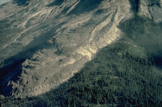 The prominent lava flow known informally as "The Mitten" was part of a large complex of lava flows erupted from the summit of Mount St. Helens that traveled down the SE flank to the base of the volcano. Stratigraphic evidence dates these flows to the first half of the 16th century.
Copyrighted photo by Katia and Maurice Krafft, 1980.
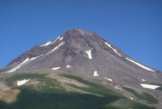 The summit lava dome complex of Augustine volcano is seen here above its SW flank. The upper part of the summit is a lava dome from the 1963-64 eruption. Pre-Augustine sedimentary basement rocks of Jurassic to Tertiary age are exposed on the south flank to an elevation of 320 m.
Photo by Game McGimsey, 1994 (Alaska Volcano Observatory, U.S. Geological Survey).
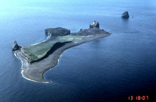 Lava dome remnants from four historical eruptions can be seen in this NW-looking aerial view of Bogoslof in the Aleutians. The pinnacle to the left is Castle Rock, a remnant of a 1796 lava dome. The circular, flat-topped area to its right is a remnant of a 1927 lava dome. An eruption in 1992 produced the light-colored rounded lava dome forming upper right part of the island. The island to the upper right formed in 1883.
Photo by John Sease, 1998 (NMS/NOAA).
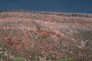 Thick deposits of welded pumice form cliffs along the Jemez River valley SW of the Valles caldera, capping darker-red, bedded sedimentary rocks at the base of the canyon. The lowermost pyroclastic-flow deposit, showing pronounced columnar jointing, is the Otowi member of the Bandelier Tuff. The top of the section is the Tshirege member of the Bandelier Tuff. The two eruptions, about 1.45 and 1.1 million years ago, ejected about 600 cu km of magma and resulted in the formation of Valles caldera.
 Photo by Lee Siebert, 1989 (Smithsonian Institution).
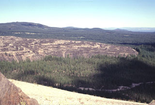 The steep-sided SW margin of the Little Glass Mountain obsidian flow rises above the surrounding forested flanks of Medicine Lake volcano. Eruption of the rhyolitic lava flow was preceded by a pumice eruption that mantled the surrounding area (including the basaltic cone of Pumice Stone Mountain in the foreground) with white pumice. The 0.4 km3 Little Glass Mountain lava flow is the second largest silicic lava flow at Medicine Lake.
Photo by Lee Siebert, 1998 (Smithsonian Institution).
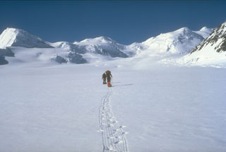 A U.S. Geological Survey climbing party ascends the Klutlan Glacier headed towards Mount Churchill. Their field studies led to the discovery that this volcano was the site of two of the most voluminous eruptions in North America in the past 2,000 years. The White River Ash originated from the summit caldera of Churchill next to Mount Bona and comprises two voluminous ash units that extend across most of Canada and traces reached Europe.
Photo by Game McGimsey (U.S. Geological Survey, Alaska Volcano Observatory).
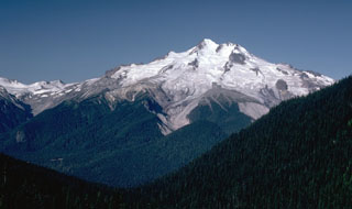 Glacier Peak rises above the forested slopes of the Suiattle River valley in this east side view from Buck Creek Pass. It has had frequent powerful explosive eruptions that deposited ash and pumice over wide areas, and produced pyroclastic flows and lahars that traveled long distances A recent eruption occurred only a few hundred years ago.
Photo by Lee Siebert, 1985 (Smithsonian Institution).
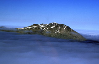 The youngest activity known on Adagdak, at the NE tip of Adak Island, is a lava dome from about 210,000 years ago. Andrew Bay Hot Springs lie along the coast west of Mount Adagdak, and the northern part of Adak Island has been investigated for geothermal power potential.
Photo by Chris Waythomas, 2000 (Alaska Volcano Observatory, U.S. Geological Survey).
 The East Lake Fissure (center) cutting through the northern rim of Newberry caldera is part of the northwest rift zone. The basaltic lava flow (the unvegetated area in the center of the photo) can be seen descending into the NE corner of East Lake.
 Photo by Lee Siebert, 1997 (Smithsonian Institution).
 Scientists from the U.S. Geological Survey take gas samples at Devils Kitchen near the Crater Rock lava dome on the upper SW flank of Mount Hood. The Crater Rock area produces vigorous gas emission and results in extensive hydrothermal alteration of rock masses over broad areas.
Photo by Bill Chadwick, 1982 (U.S. Geological Survey).
 Trout Creek Hill, a small Quaternary shield volcano in the West Crater volcanic field, is seen here from the NW with Mount Hood across the Columbia River in Oregon in the background. Lava flows from Trout Creek Hill traveled 13 km to the SE, reaching the Columbia River.
Photo by Lee Siebert, 1995 (Smithsonian Institution).
 The western slopes of Mount Jefferson rise above forested hills composed of older Pleistocene volcanic rocks. Scoria cones younger than the eroded main edifice, which ceased activity during the late Pleistocene, are located to the south.
Photo by Lee Siebert, 1982 (Smithsonian Institution).
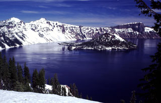 Volcanoes form some of Earth's most spectacular scenery and have been designated as national parks in many countries. The natural landscapes in these parks are a source of visual inspiration and varied recreational opportunities, and can also provide economic benefit to surrounding communities. Crater Lake National Park in the Oregon Cascade Range was established in 1902. This image looks across to Wizard Island and the western caldera rim from near the park visitor center and the Crater Lake Lodge.
Photo by Lee Siebert, 1997 (Smithsonian Institution)
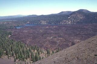 Lava flows traveled about 3.5 km to the north and south from Cinder Cone, blocking drainages and forming two lakes. The northern lake, Butte Lake, is seen here from the summit of Cinder Cone. The quartz-bearing basaltic lava flows originated from vents at the SE flank of the pyroclastic cone. The old Emigrant Trail connecting Nevada with the Sacremento Valley winds through the trees at the left base of the cone.
Photo by Lee Siebert, 1998 (Smithsonian Institution).
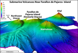 Ahyi seamount (upper right) is a large submarine volcano that rises to within about 150 m of the sea surface about 18 km SE of the island of Farallon de Pajaros (left-center). At various times since 1979, water discoloration, felt seismicity followed by upwelling of sulfur-bearing water, and a seismically detected submarine eruption have been reported at or near the seamount. Two submarine volcanoes on the flanks of Farallon de Pajaros, Northwest Uracas and Makhahnas, are seen in this NOAA bathymetric image.
Image courtesy of NOAA, 2003 (http://oceanexplorer.noaa.gov/explorations/03fire/logs/mar02/media/nikko.html).
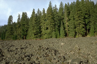 A lava flow, still largely unvegetated, was emplaced about 3,850 years ago from Nash Crater in the Sand Mountain volcanic field of the central Oregon Cascades. This and contemporaneous lava flows blocked local drainages, forming Lava Lake and Fish Lake.
Photo by Lee Siebert, 1995 (Smithsonian Institution).
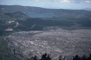 The Big Obsidian Flow lava flow in the foreground covers about 2.6 km2 of the floor of Newberry caldera and was emplaced about 1,300 years ago. The eruption occurred at a vent at the base of the southern caldera wall, out of view to the right.
Photo by Lee Siebert, 1984 (Smithsonian Institution).
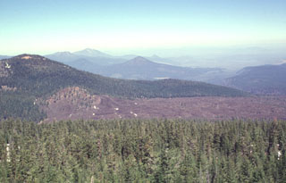 This view from Prospect Peak shows perhaps the youngest lava flow immediately north of the Lassen volcanic center. This sparsely vegetated flow originated from a small cinder cone (left-center) between Prospect and West Prospect (upper left) peaks, two young basaltic lava cones straddling the NE border of Lassen Volcanic National Park. The young, but undated andesitic flow traveled initially to the NE and then around the flank of West Prospect Peak to the NW.
Photo by Lee Siebert, 1998 (Smithsonian Institution).
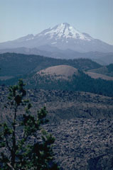 Mount Shasta one of the largest volcanoes of the Cascade Range, is located in northern California at the southern end of the Cascades. It is seen here beyond the Little Glass Mountain obsidian flow from Medicine Lake volcano to the NE.
Photo by Lee Siebert, 1981 (Smithsonian Institution).
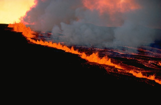 A long line of lava fountains several tens of meters high rise along a NE-flank fissure of Hawaii's Mauna Loa volcano on March 25, 1984. The fissure-fed eruption began within the Mokuaweoweo summit caldera and on the upper SW flank and then was concentrated on the NE flank. Single discrete segments of the eruptive fissure are offset, forming an en-echelon pattern. Activity commonly migrates along a fissure during the course of an eruption. Cinder cones may form where eruptive activity becomes localized at one or more points.
Copyrighted photo by Katia and Maurice Krafft, 1984.
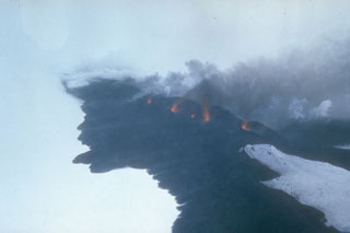 Lava fountains rise above a fissure on Seguam volcano on 8 March 1977. This view from the south shows part of the 1.5-km-long eruptive fissure SE of Pyre Peak. Black lava flows move across the snow from the fissure and diverge around an older cone to the lower right. Pyre Peak, within the westernmost of two calderas, is surrounded by fresh lava fields.
Photo by U.S. Coast Guard, 1977 (courtesy of Alaska Volcano Observatory).
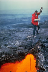 A volcanologist from the Hawaiian Volcano Observatory extracts a sample of fresh lava from an active lava tube during the 1969-74 Mauna Ulu eruption. Asbestos gloves were used for protection against the intense radiant heat. Sampling at various stages of an eruption is used to determine changes in the chemistry and mineralogy of erupted lavas.
Photo by Bob Tilling, 1973 (U.S. Geological Survey).
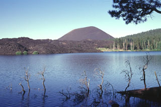 The aptly named Cinder Cone, a symmetrical pyroclastic cone at the NE end of the Lassen volcanic center, is seen here from the NE across Butte Lake. The unvegetated lava flow at the left originated from the cone. Although there is a report of an eruption from Cinder Cone in 1850 CE, recent work suggests that the cone and associated lava flows all formed during a brief eruptive interval lasting at most a few decades about 230-425 radiocarbon years ago. Lava flows traveled to the NE and SE, forming Snag Lake and Butte Lake.
 Photo by Lee Siebert, 1998 (Smithsonian Institution).
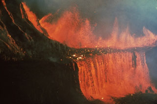 A brief eruption lasting five days in February 1969 took place along a fissure system between Alae and Nāpau craters on Kīlauea's East Rift Zone. Lava fountains produced flows that cascaded into Makaopuhi and Nāpau craters. Lava flows buried 5 km of the Chain of Craters Road.
Photo by Don Swanson, 1969 (U.S. Geological Survey).
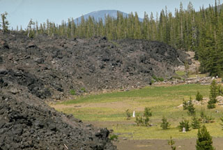 This blocky lava flow in the McKenzie Pass area of the central Oregon Cascades originated from Yapoah scoria cone on the north flank of North Sister about 2,600-2,900 years ago. The flow traveled 5 km to the north before being deflected by lava flows from the Belknap and Little Belknap shield volcanoes and then flowed an additional 8 km to the NE.
Photo by Lee Siebert, 1972 (Smithsonian Institution).
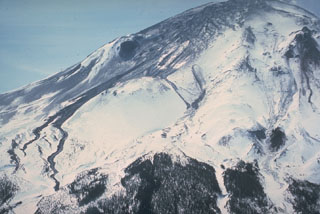 On 11 April 1980, two weeks after the 27 March beginning of the eruption of Mount St. Helens, an area of fractured glacial ice is visible at the top of the volcano. Thin black streaks of volcanic mudflows are visible at the center and lower left that diverge around the undisturbed snowpack on Sugar Bowl lava dome.
Photo by William Melson, 1980 (Smithsonian Institution).
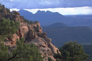 The cinder cone at the right center is Crater Hill, the southernmost and youngest feature of the Kolob volcanic field, a line of cinder cones near the western margin of Zion National Park. Cross-bedded sandstones of the Jurassic-age Navajo Sandstone form the cliffs in the foreground.
Photo by Lee Siebert, 1987 (Smithsonian Institution).
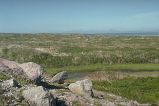 The vegetated terrain seen here is the surface of the Rocky Point debris avalanche deposit, produced by collapse of the summit of Augustine about 250-450 years ago. The avalanche traveled into Cook Inlet, visible at the upper left with the Chigmit Mountains in the background, for a distance of 8 km and extended the shoreline by 2 km.
Photo by Lee Siebert, 1990 (Smithsonian Institution).
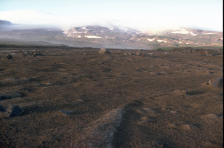 A lahar produced by the melting of snow and ice during a February 4-9, 1978 eruption of Westdahl volcano in the Aleutians is seen in the foreground of this summer 1978 photo taken near Scotch Cap on the SW coast. The lahar traveled 12 km from the summit, visible at the upper left. The 1978 eruption blasted a 1.5-km wide, 500-m deep crater through the summit icecap.
Copyrighted photo by Katia and Maurice Krafft, 1978.
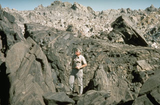 The Obsidian Flow, a lava flow with a hackly surface showing prominent flow banding, was erupted at the northern end of a chain of lava domes and flows during a dike-fed eruption about 600 years ago at Inyo Craters. The Obsidian Flow was the largest of four flows and domes emplaced during this eruption.
Photo by Larry Mastin, 1992 (U.S. Geological Survey).
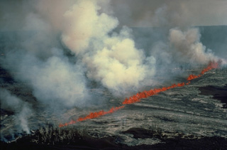 Many volcanic eruptions originate from fractures that reach the Earth's surface. Eruptive fissures, such as producing this curtain of fire along the east rift zone of Kīlauea volcano in July 1986, often extend radially away from the summit of a volcano. Light-colored lava flows fed by the lava fountains move downslope on both sides of the fissure. At some volcanoes fissures follow the direction of regional faults, and circumferential fissures can open around the rim of a volcanic caldera.
 Copyrighted photo by Katia and Maurice Krafft, 1986.
 During the mid-Holocene a maar was formed in central Colorado near the junction of the Colorado and Eagle Rivers west of the Gore Range. The quarry in the foreground is cut into basaltic tephra deposits on the rim of the maar. The 700 m wide maar is 400 m deep and cuts a ridge of evaporites and reddish oxidized sandstones of Pennsylvanian age, which can be seen on the far crater wall. The maar was erupted about 4150 radiocarbon years ago and is the youngest volcanic feature of Colorado. The Eagle River lies to the south in the valley beyond the crater.
Photo by Lee Siebert, 1999 (Smithsonian Institution).
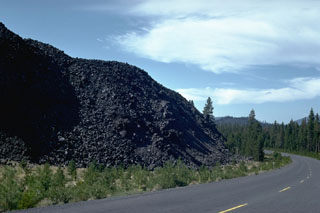 The steep margin of a lava flow from a scoria cone at the northern end of Davis Lake is skirted by a road in Deschutes National Forest. This and two other nearby lava flows mark the Holocene eruptive activity in the Cascades between Mount Bachelor and Crater Lake.
Photo by Lee Siebert, 1982 (Smithsonian Institution).
 The tip of Yellowstone Lake is seen at the upper left from Pelican Cone near the NE rim of Yellowstone caldera. The forested, snow-capped peaks in the center are rocks of the Sour Creek resurgent dome, an area of uplifted and faulted post-caldera rocks.
Photo by Dzurisin, 1985 (U.S. Geological Survey).
 Negit Island, capped by the dark-colored cinder cone at the right, was the source of one of the most recent eruptions of the Mono Lake volcanic field. Rhyodacitic lava flows overlie a 1240 CE tephra unit. The light-colored tufa deposits near the western shore of Mono Lake in the foreground were created by deposition of calcium carbonate beneath the waters of the lake.
Photo by Lee Siebert, 1973 (Smithsonian Institution).
 Griggs is the highest of a group of volcanoes in the Katmai area, located 10 km behind the volcanic arc. Active fumaroles are within the summit crater and along the upper SW flank. Tephra from the 1912 Novarupta eruption cover the flanks in this 1990 view from the SW.
Photo by Game McGimsey, 1990 (U.S. Geological Survey, Alaska Volcano Observatory).
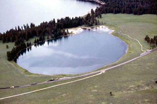 The 500-m-wide Indian Pond hydrothermal explosion crater immediately north of the NE shore of Yellowstone Lake formed about 3350 years ago. Deposits from this eruption extend 3 km from the crater and are up to 3-4 m thick. Yellowstone Lake is seen at the top, with the highway leading to Cody at the bottom in this aerial view from the NE.
Photo by Jim Peaco, 2001 (National Park Service).
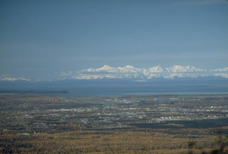 Mount Spurr is visible on the skyline 125 km W of Anchorage, Alaska. In 1992 three brief explosive eruptions from the Crater Peak vent deposited several millimeters of ash over south-central Alaska and on one occasion forced the closure of Anchorage International Airport for 20 hours.
Photo by Game McGimsey, 1988 (Alaska Volcano Observatory, U.S. Geological Survey).
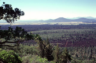 The sparsely vegetated lava flows in the foreground and the darker-colored forested flows in the middle of the photo were erupted from Brushy Butte, a low shield volcano capped by a cinder cone. The flows extend down the Falls River valley to the south. The two larger peaks in the right background, located south of the town of Fall River Mills, are Bald Mountain and Cinder Butte.
Photo by Lee Siebert, 1998 (Smithsonian Institution).
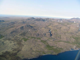 Pyroclastic cones dot the surface of the Kookooligit Mountains in north-central St. Lawrence Island in the Bering Sea. Kookooligit is a 30 x 40 km wide, 673-m-high shield volcano of Pleistocene-to-Holocene age overlain by more than 100 small cinder cones, most of which are aligned E-W along the crest of the elongated shield volcano. The cones were the source of dominantly alkali basaltic and basanitic lavas flows.
 Photo by Bob Webster.
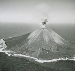 Explosive activity was frequently observed from Farallon de Pajoras volcano in October and November 1952. Lava flows were emplaced on the E and W sides of the summit in February-March 1953. This 1953 photo from the E shows a small plume rising above the summit crater and lighter-gray lava flows in the center that erupted in 1953. The lobe just left of center eventually reached the coast. Explosive activity continued until 15 April. The steep-sided peak on the SE coastline is a remnant of an older caldera.
Photo by U.S. Navy, 1953.
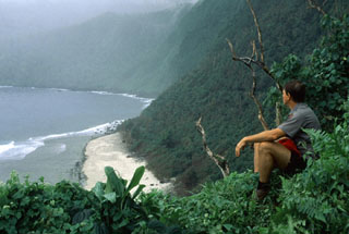 Sheer, forested cliffs form the southern side of Ta'u Island at the eastern end of the Samoan Islands. Partial collapse of the shield volcano formed a large arcuate depression open to the S. The 6 x 10 km Island is the emergent portion of the large Lata shield volcano, which also contains numerous Holocene post-caldera cones at the summit and flanks.
Photo by John Brooks, 1992 (U. S. National Park Service).
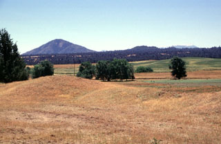 The many small Quaternary volcanic centers located between Lassen Peak and Medicine Lake volcanoes in northern California include Big Cave, a small low shield volcano seen on the horizon just right of center. Forests blanket a series of basaltic lava flows erupted from the summit of the inconspicuous shield volcano. The prominent peak at the left is Bald Mountain, seen here from the NE.
Photo by Lee Siebert, 1998 (Smithsonian Institution).
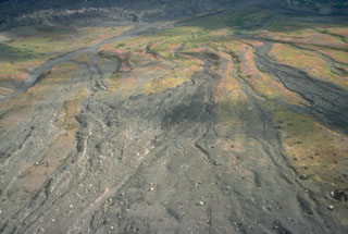 Pyroclastic flow deposits from the 18 August 1992 eruption of Crater Peak on Spurr formed overlapping lobes across the lower SE slopes. Bombs ejected during the eruption produced impact craters across the surface.
Photo by Christina Neal, 1992 (Alaska Volcano Observatory, U.S. Geological Survey).
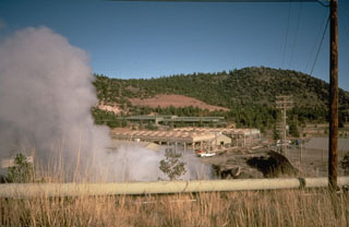 The Casa Diablo geothermal plant in the Long Valley caldera taps the high heat flow originating from the magma system below. Several commercial and scientific exploratory holes have been drilled here to depths of 100 to 2,000 m.
Photo by Larry Mastin, 1991 (U.S. Geological Survey).
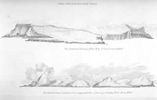 A 7 June 1792, sketch from the east shows Semisopochnoi Island with three "smoking" volcanic cones. The 20-km-wide Semisopochnoi volcano is truncated by an 8-km-wide caldera. Three post-caldera cones, Cerebus, Lakeshore Cone, and Sugarloaf may have had eruptions in historical time. It is not certain whether the "smoke" plumes seen in this somewhat stylized sketch depict an ash eruption, or merely increased steaming.
From the collection of Maurice and Katia Krafft.
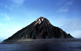 The eastern side of the 3-km-wide island of Chagulak island is shown here. This is one of two peaks of a larger underwater edifice located NE of Amukta, the other peak.
Photo by B. Anderson, 1992 (U.S. Fish and Wildlife Service).
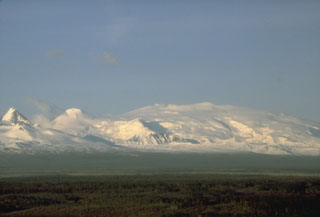 Mount Wrangell, on the right skyline, is part of the Wrangell volcanic field. There are two large calderas at the summit and the inner ice-filled caldera contains three craters. Minor, possibly phreatic eruptions have occurred during the 20th century. To the left is rounded Mount Zanetti, a flank cone. The sharp-topped peak to the far-left of this view from the SW is a flank cone of the neighboring Pleistocene Mount Drum.
Photo by B. Cella (National Park Service).
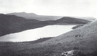 Lake-filled Crater Hill on the western side of St. Paul is one of many craters across the island. Caribou can be seen wading along the shores of the lake. The largest of the Pribilof Islands, St. Paul consists of a 110 km2 area of coalescing small edifices with a central scoria cone. The Fox Hill lava flow at the far western end of the island is estimated to be only a few thousand years old.
Photo by V.B. Scheffer (published in U.S. Geological Survey Bulletin 1028-F).
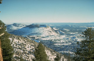 Snow-mantled Sunset Crater (left-center), seen from O'Leary Peak to the NW, is the youngest volcanic feature of the San Francisco Mountain volcanic field, which covers a vast area of northern Arizona between Flagstaff and the Grand Canyon. The Sunset Crater eruption began about 1100 CE from a chain of cinder cones and vents trending NW-SE, the largest of which is Sunset Crater. Three lava flows were erupted, the longest of which traveled 11 km to the NE.
Photo by Ed Wolfe, 1973 (U.S. Geological Survey).
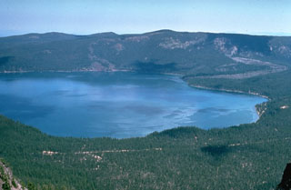 Paulina Lake is the westernmost of two lakes within Newberry caldera and is seen here from Paulina Peak, the high point of the southern caldera rim. The lava flow entering the lake to the upper right erupted about 6,400 years ago from the Central Pumice Cone. The flow split into two lobes, and the other lobe traveled into East Lake, just out of view to the right. This was one of several eruptive vents within the caldera that were active during this eruptive phase.
Photo by Willie Scott, 1974 (U.S. Geological Survey).
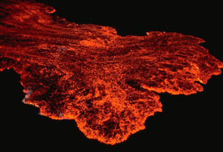 The toe of an April 1984 lava flow advances down the NE rift zone of Mauna Loa volcano in this nighttime view. The flow margin and much of the surface of the flow is incandescent; darker areas occur where the surface of the advancing lava flow has solidified.
Copyrighted photo by Katia and Maurice Krafft, 1984.
 South Inyo Crater, one of a chain of small phreatic explosion craters at the southern end of the Inyo Craters chain of lava domes and flows, is partially filled by a shallow lake. The 200-m-wide South Inyo Crater was formed when groundwater interacted with magma from a shallow dike. That interaction fed a powerful explosive eruption that concluded with the emplacement of obsidian lava domes and flows to the north of this crater.
Photo by Larry Mastin, 1992 (U.S. Geological Survey).
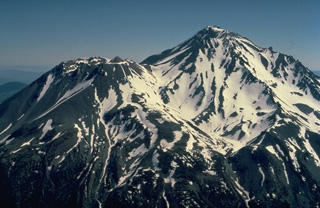 Mount Shasta in northern California, the largest volcano of the Cascade Range, is a complex stratovolcano composed of at least four overlapping volcanoes. From the SW, Shasta's prominent west flank lava dome, Shastina, appears at the left. Both it and the summit Hotlum cone were formed during the Holocene. The only historical eruption of Shasta occurred in 1786 and was observed from off the coast of California by the French explorer La Perouse.
Copyrighted photo by Katia and Maurice Krafft, 1989.
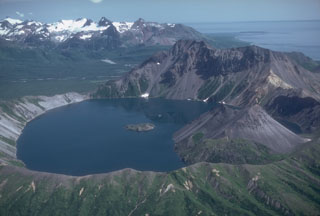 The small 2.5-km-wide Kaguyak caldera is filled by a lake that reaches 550 m below the caldera rim, seen here from the west. A lava dome extends into the lake on the SW side and another dome forms a small island in the center of the lake. The voluminous caldera-forming deposits have been radiocarbon dated at 5,800 years old. A large pre-caldera lava dome forms the high point on the eastern caldera rim. The broad valley of Big River descends to Shelikof Strait to the upper right.
Photo by Chris Nye, 1982 (Alaska Division of Geological and Geophysical Surveys, Alaska Volcano Observatory).
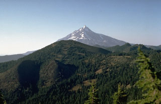 The latest eruption in the Mount Jefferson area occurred from the scoria cone at the lower left on the flank of South Cinder Peak in the center of the photo. The eruption, dated to about 1,000 years ago, formed the cone and produced a lava flow that split into two lobes. One traveled to the NW, and the other flowed 3.5 km W into Marion Lake.
Photo by Willie Scott, 1973 (U.S. Geological Survey).
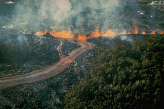 Lava fountains along an October 1968 East Rift Zone fissure at Kīlauea produced the lava flow in the foreground. Starting on 7 October a series of fissures extended from the E flank of Kane Nui o Hamo to 3.5 km E of Nāpau Crater. The eruption continued until the 21st, covering much of the March 1965 lava flows and again produced lava cascades into Nāpau Crater.
Photo by U.S. Geological Survey, 1968.
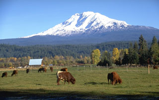 The farmlands of the Trout Lake valley SW of Mount Adams are underlain by a massive lahar produced by collapse of the upper SW flank of Adams about 6,000 years ago. Altered rocks up to several meters in diameter that originated from near the summit of the volcano littered the surface of the deposit, which covered 15 km2 of the Trout Lake lowland and reached as far as 60 km to the south. The source of the mudflow was a debris avalanche from the upper White Salmon glacier area, just left of the shadow beneath the summit.
Photo by Lee Siebert, 1995 (Smithsonian Institution).
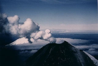 A gas-and-steam plume rises above the summit crater of Cleveland on 23 June 1987. The upper flanks are darkened by ashfall from an eruption that began on 19 June. Lava extrusion began on 23 June and a flow eventually descended 2.5 km down the ESE flank. Lava fountaining was observed on 22 July. A large explosive eruption took place on 28 August, the last day of the eruption. This view from the ENE shows part of Herbert volcano behind the plume to the left.
 Photo by Harold Wilson, 1987 (Peninsula Airways), courtesy of John Reeder (Alaska Div. Geology Geophysical Surveys).
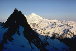 The glaciated surface of Mount Baker is seen here from neighboring Mount Shuksan. The peak in the shadow consists of metamorphosed basaltic rocks of the Shuksan Greenschist. The area to the right is the recently discovered Pleistocene Kulshan Caldera, which preceded the construction of Mount Baker. The 4.5 x 8 km caldera is largely filled by up to 1 km of non-welded tuffs and is capped by lava flows.
 Photo by Lee Siebert, 1971 (Smithsonian Institution).
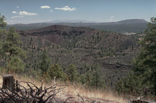 Bandera Crater in the center is part of the Zuni-Bandera lava field that covers a 2460 km2 area of central New Mexico. The lava field contains 74 vents that erupted voluminous lava flows, including the 90-km-long Fence Lake flow and the youngest flow of the lava field, the 3000-year-old McCartys lava flow. The McCartys flow traveled 60 km to the north, extending to the base of the Mount Taylor range, the peak in the distance.
Photo by Lee Siebert, 1987 (Smithsonian Institution).
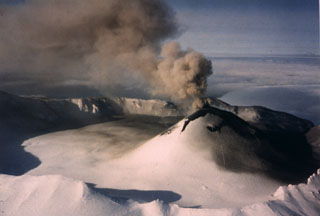 Intermittent explosive eruptions took place from the scoria cone in Akutan caldera during 31 January-2 March and 22-24 June 1987. This 11 February photo from the SE shows an ash plume rising from a crater at the top of the cone. Ash was deposited across the cone flank and the N side of the caldera floor.
Photo by Jerry Chisum (Mark Airways), 1987 (courtesy of John Reeder, Alaska Div. Geology & Geophysical Surveys).
 The material in the lateral blast from Mount St. Helens on 18 May 1980 had a velocity of at least 100 m/s (224 miles per hour), perhaps much higher. It completely removed large trees standing near the volcano, and reached a distance of 30 km, blowing down mature trees like matchsticks. The blast devastated 600 km2 over a broad area north of the volcano.
Photo by John Dvorak, 1980 (U.S. Geological Survey).
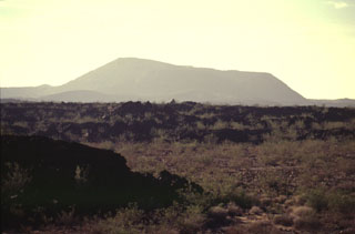 Pisgah Crater is the most prominent feature of the Lavic Lake volcanic field, which contains four Quaternary cinder cones. The 100-m-high Pisgah Crater, seen here from the NW, and its surrounding 100-sq-km lava field are easily seen from nearby Interstate highway 40. The crater and nearby vents were the source of dominantly pahoehoe lava flows that traveled as far as 18 km NW over alluvial-fan and playa-lake deposits. Pisgah Crater was initially considered to be Holocene in age, but more recent dating indicates it is about 25,000 years old.
 Photo by Paul Kimberly, 1997 (Smithsonian Institution).
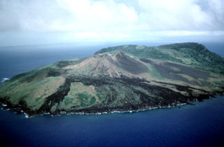 The 2.8-km-wide Guguan island in the central Marianas Islands, seen here from the NW, is composed of an eroded volcano at the south and a caldera with a post-caldera cone. The northern cone (foreground) was the site of an eruption in the 19th century. It has three coalescing cones and a summit crater that produced lava flows to the W and NW.
Photo by Dick Moore, 1992 (U.S. Geological Survey).
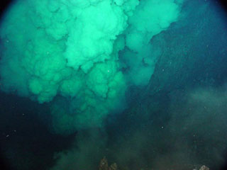 A dense, particle-laden plume rises above the NW Rota-1 Brimstone Pit vent in this 30 March 2004 photo taken from a remotely operated vehicle (ROV) during a NOAA bathymetric survey of the Mariana arc. The vent intermittently ejected a plume several hundred meters high containing ash and molten sulfur droplets that adhered to the surface of the ROV. At other times during the exploration venting slowed or ceased, allowing views of the funnel-shaped vent that was about 20 m wide and 12 m deep.
NOAA image, 2004 (courtesy of Bill Chadwick; http://oceanexplorer.noaa.gov/explorations/04fire/logs/march30/march30.html).
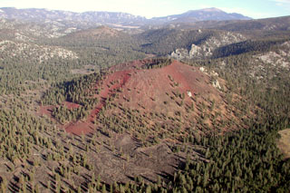 Groundhog cinder cone is the youngest of the Golden Trout volcanic field. It is seen here from the west with South Fork cone behind it at the upper left and Olancha Peak on the crest of the Sierra Nevada on the right horizon. Groundhog cone is breached to the NE and was the source of large lava flows (visible in the foreground) that traveled 6 km to the west. The flows filled the valley of Golden Trout Creek and displaced it to the north side, separating Golden Trout Creek from Volcano Creek at the southern margin of the flow.
 Photo by Rick Howard, 2002 (courtesy of Del Hubbs, U S Forest Service).
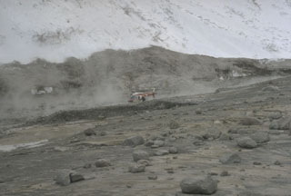 Hot avalanches down the steep north flank of Redoubt during the 1989-90 eruptions mixed with water derived from melted snow and ice to form lahars. These sediment-rich floods carried steaming debris many kilometers down the Drift River Valley. The top of the gray area marks the high-water line of the lahar that contrasts with the snow-covered slopes above it. Note the helicopter for scale.
Photo by Tom Miller, 1990 (Alaska Volcano Observatory, U.S. Geological Survey).
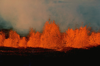 High gas pressure associated with fissure-fed eruptions of basaltic magma produce vigorous lava fountaining that creates a curtain of fire above the eruptive fissure. These fountains, several tens of meters high, occurred during eruptions along the NE rift zone of Mauna Loa on March 25, 1984.
Copyrighted photo by Katia and Maurice Krafft, 1984.
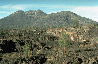 The rugged Bonito lava flow in the foreground was erupted from Sunset Crater in two stages. The flow originated from vents at the west to NW base of Sunset Crater, which is out of view to the right. The peak beyond the flow to the north is O'Leary Peak, which consists of two rhyodacitic lava domes of Pleistocene age. O'Leary Peak is the NE-most silicic center in the San Francisco Mountain volcanic field.
Photo by Richard Moore, 1975 (U.S. Geological Survey).
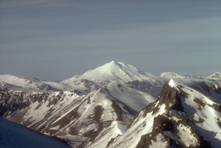 Mount Dutton, seen here from the NE with the wall of Emmons Lake caldera in the foreground, is located near the tip of the Alaska Peninsula. Successive lava domes form the summit; collapse events during the Holocene produced debris avalanches that traveled to the west and also reached Belkofski Bay to the south.
Photo by Betsy Yount, 1986 (Alaska Volcano Observatory, U.S. Geological Survey).
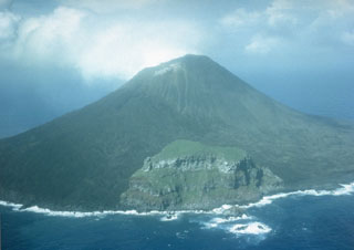 The 2-km-wide island of Farallon de Pajaros is the northernmost and most active volcano of the Mariana Islands. It has been referred to as the "Lighthouse of the western Pacific." The symmetrical, sparsely vegetated cone formed within a caldera, remnants of which form the peak seen here in 1980 in the center along the SE coast. Both summit and flank vents have been active during historical time; flank fissures formed lava flows along the coast.
Photo by Winfrey, 1980 (U.S. Navy).
 Lahars from the 1989-90 eruptions of Redoubt inundated a few structures in their path. The largest lahars traveled 35 km to the NE down the Drift River valley and reached the Cook Inlet.
Photo by Cynthia Gardner, 1990 (U.S. Geological Survey).
 Soda Lake maar in west-central Nevada was erupted through sediments of the glacial Lake Lahontan. It is the larger of two lake-filled maars located NW of the town of Fallon. The basaltic maars were estimated to be less than 10,000 years old and perhaps even less than 1500 years old. Soda Lake is about 1.3 x 2 km wide and is elongated in a NE-SW direction; its rim rises only about 35 m above the lake surface. The maars are the site of a geothermal prospect that may have discharged hot springs through the end of the 19th century.
Photo by Nevada Bureau of Mines and Geology.
 Flow-banded rhyolitic obsidian of the Panum Crater lava dome was erupted about 600 years ago at the northern end of the Mono Craters. The greenish-yellow areas are lichens on the surface of the dome.
Photo by Lee Siebert, 1973 (Smithsonian Institution).
 Cinnamon Butte (right center) rises above the shore of Diamond Lake, around 30 km N of Crater Lake. The cone is relatively young, having formed around 7,780 and 15,000 years ago. Lava flows from Cinnamon Butte traveled north and covered around 28 km2.
Photo by Lee Siebert, 1997 (Smithsonian Institution).
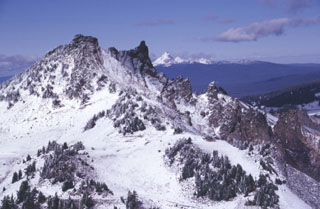 Hillman Peak, the westernmost andesitic stratovolcano of Mount Mazama, is partially dissected by Crater Lake caldera. The base of the cone consists of thin andesite lava flows; these are overlain by bedded fall deposits. The upper part of the cone, seen here, consists of andesitic lava flows erupted about 67,000 years ago. The snow-capped peak on the far horizon to the north is Mount Thielsen, a Pleistocene volcano.
Photo by Lee Siebert, 1997 (Smithsonian Institution)
 Snow-covered Forked Butte scoria cone in the center of the photo rises above the valley floor across from Bear Butte on the NE. A lava flow that was emplaced about 6,500 years ago can be seen down the left flank of the cone, one of two lobes that split around either side of Sugar Pine Ridge to the far left.
Photo by Willie Scott, 1972 (U.S. Geological Survey).
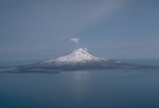 Augustine forms an 8 x 12 km island in Kamishak Bay, within the southern Cook Inlet. The cone is a complex of overlapping summit lava domes. An apron of pyroclastic debris, consisting mostly of large debris avalanche deposits produced by collapse of portions of the summit lava domes, extends to the sea on all sides. West Island, at front left in this 1989 view from the west, is a debris avalanche deposit that was emplaced roughly 250-450 years ago.
Photo by Tom Miller, 1989 (Alaska Volcano Observatory, U.S. Geological Survey).
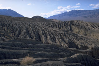 Erosional gullies furrow the surface of pyroclastic-surge deposits from the eruptions forming Ubehebe craters in Death Valley, California. The craters were erupted along a fault that forms the western boundary of the Tin Mountain range in the left background.
Photo by Lee Siebert (Smithsonian Institution).
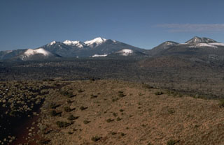 The snow-drapped symmetrical cinder cone at the left side of the photo is Sunset Crater, Arizona's most recently active volcano. The broad snow-capped mountain in the background to the west, behind and to the right of Sunset Crater, is San Francisco Mountain. It is the centerpiece of the San Francisco Mountain volcanic field, which covers 5000 km2 of northern Arizona. The massive eroded Pleistocene stratovolcano is Arizona's highest peak. The peak on the right horizon is O'Leary Peak, a Pleistocene rhyodacitic lava dome complex.
 Photo by Ed Wolfe, 1970 (U.S. Geological Survey).
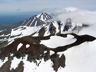 An aerial view from the WNW shows a young vent on the NE side of Kluichef, which was constructed within the Pleistocene Atka caldera.
Photo by Game McGimsey, 2004 (Alaska Volcano Observatory, U.S. Geological Survey).
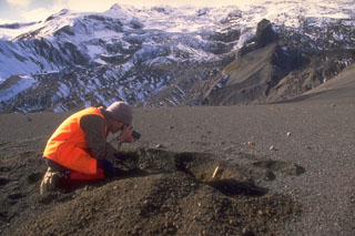 A scientist from the Alaska Volcano Observatory studies tephra from the 1992 eruptions of the Crater Peak vent of Mount Spurr volcano. Three brief explosive eruptions blanketed narrow swaths of the surrounding area with ash. Detailed investigations of deposits are necessary to understand eruption characteristics and magnitude. In this view, about 15 cm of coarse ash and lapilli is exposed in the pit and blocks from the 16-17 September 1992 eruption are scattered across the surface.
Photo by Game McGimsey, 1992 (Alaska Volcano Observatory, U.S. Geological Survey).
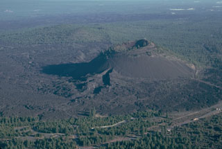 Lava Butte is a scoria cone on the NW flank of Newberry volcano at the end of fissure system that extended from the caldera rim about 7,000 years ago. Following construction of the cone, the SW flank fissure at the base of the cone (in the foreground) fed a voluminous lava flow that traveled to the north and changed the course of the Deschutes River.
Photo by Lee Siebert, 1981 (Smithsonian Institution).
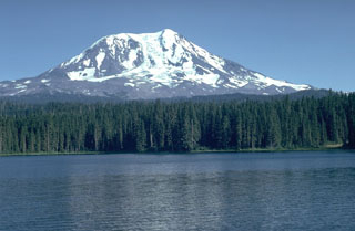 Adams Glacier descends from the summit of Mount Adams, seen here above Takhlakh Lake on the NW side. The main edifice was constructed primarily of lava flows during the Pleistocene, but flank vents produced lava flows and explosive eruptions during the Holocene. The Takh Takh Meadow lava flow originated from a vent low on the NW flank and traveled a total of 10 km, reaching several kilometers beyond the east (left) side of Takhlakh Lake.
Photo by Lee Siebert, 1981 (Smithsonian Institution).
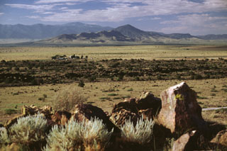 The dark-colored lava flow extending across the center of the photo is a lobe of the Carrizozo flow. This view looks SE from the Valley of Fires recreation area administered by the Bureau of Land Management to the Sierra Blanca in the distance. The recreation area lies on one of several kipukas of older rocks surrounded by the Carrizozo flow, which covers an area of about 330 km2.
Photo by Lee Siebert, 1999 (Smithsonian Institution).
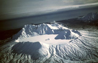 Snow and ice cover the Kaguyak caldera lake in this view from the NW. The caldera formed during a voluminous eruption about 5,800 years ago that produced pyroclastic flows that reached Shelikof Strait. Two lava domes, one large and the other seen just above the center of the lake, were built after the caldera-forming eruption.
Photo by Tom Miller, 1998 (Alaska Volcano Observatory, U.S. Geological Survey).
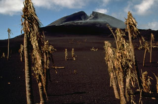 A fissure opened across the summit of Pagan on 15 May 1981, the first day of the eruption. It is seen here on 26 May 1981, looking across a N-flank scoria cone that formed along the fissure. The trees in the foreground are from a devastated coconut plantation.
Photo by Norm Banks, 1981 (U.S. Geological Survey).
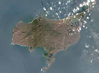 St. Paul island, one of the Pribilof Islands in the Bering Sea, is composed of overlapping scoria cones, spatter cones, and lava flows, shown in this October 2017 Planet Labs satellite image monthly mosaic (N is at the top; this image is approximately 23 km across). Cones include the westernmost Rush hill, Black Bluffs scoria cone on the southern peninsula, the Bogoslof Hill complex in the center, and North Hill along the northern coastline.
Satellite image courtesy of Planet Labs Inc., 2017 (https://www.planet.com/).
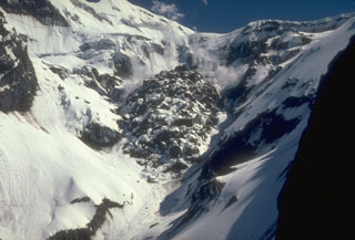 This view from the north shows the final lava dome of the 1989-90 eruption of Alaska's Redoubt volcano approximately one year after the end of the eruption. The dome measures 350-400 m across and contains around 10 million cubic meters of material. In this photo, snow is accumulating on the cooling lava blocks while hydrothermal activity continues to produce intermittent steam plumes. Periodic lava dome growth during the eruption was punctuated by strong explosions that destroyed earlier lava domes.
Photo by Game McGimsey, 1991 (Alaska Volcano Observatory, U.S. Geological Survey).
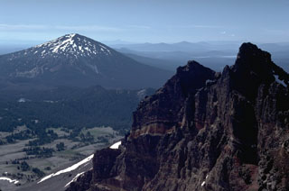 Mount Bachelor, seen here from the summit of Broken Top volcano to the north, was constructed during the late Pleistocene. Holocene eruptions occurred at a cone on the north flank.
 Photo by Lee Siebert, 1982 (Smithsonian Institution).
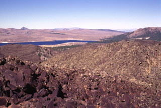 Blocky lava flows from near Miller Knoll reach nearly to Panguitch Lake in the distance to the NE. Lava flows from the same vent traveled down Black Rock Valley to the SE. This extensive lava field is one of the youngest of the Markagunt Plateau volcanic field.
Photo by Lee Siebert, 1996 (Smithsonian Institution).
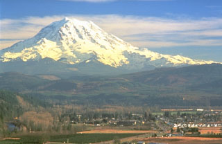 Mount Rainier towers above the town of Orting located 40 km NW in this 1995 photo. The plain underlying the town is composed of the Electron Mudflow, which formed the flat valley floor about 500 years ago. The mudflow, which originated from partial collapse of part of the western flank of Rainier, was about 30 m deep when it exited valleys at the mountain front and flowed onto the Puget Lowland.
Photo by Dave Wieprecht, 1995 (U.S. Geological Survey).
 The Mesa Falls Tuff is exposed in a quarry wall near Ashton, Idaho that shows light-colored airfall and pyroclastic-surge deposits overlain by orange-colored pyroclastic-flow deposits. The 280 cu km Mesa Falls Tuff, deposited about 1.3 million years ago during the second of Yellowstone's three largest eruptions, resulted in the formation of the 16-km-wide Henrys Fork caldera west of Yellowstone National Park.
Photo by Lee Siebert, 1994 (Smithsonian Institution).
 Early morning alpenglow gilds the summit of Mount Washington, one of the most distinctive landmarks of the central Oregon Cascades. Mount Washington is an extensively eroded basaltic shield volcano capped by a steep-sided central plug. The central edifice has not been active since the late Pleistocene, but a series of small spatter cones on its NE flank about 4 km from the summit erupted some 1300 years ago.
Photo by Lee Siebert, 1995 (Smithsonian Institution).
 Following the three eruptions of 1992, the interior of the Crater Peak vent at Mount Spurr contained tens of meters of new eruption deposits. All traces of the former lake had disappeared. A plume of steam and volcanic gas continued from the vent for several years. This photo was taken on 26 September, nine days after the eruption ended.
Photo by Cynthia Gardner, 1992 (U.S. Geological Survey).
 Negit (right-center) and Paoha (far right) islands in Mono Lake are seen from Black Point, a basaltic cone on the NW shore of the lake. The most recent eruptive activity from the Mono Lakes volcanic field took place 100-230 years ago, when lake-bottom sediments forming much of Paoha Island were uplifted by intrusion of a rhyolitic cryptodome. Black Point is an initially sublacustral cone that formed about 13,300 years ago when the lake was higher. The White Mountains form the far right horizon.
Photo by Lee Siebert, 1997 (Smithsonian Institution).
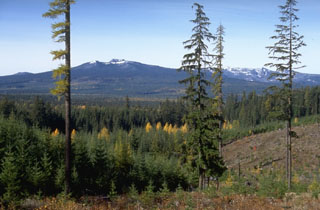 Berry Mountain (left), as well as Gifford Peak and East Crater (right), are small Pleistocene shield volcanoes with smaller cones. They are part of the Pleistocene-to-Holocene Indian Heaven volcanic field in the southern Cascade Range of Washington between Mount St. Helens and Mount Adams.
Photo by Lee Siebert, 1995 (Smithsonian Institution).
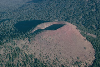 Kwohl Butte is one in a 25-km-long chain of scoria cones and small shield volcanoes south of Mount Bachelor in the central Cascade Range of Oregon. Despite the youthful appearance of the cone, geologic mapping indicates construction of the chain was completed about 12,000 years ago.
Photo by Lee Siebert, 1981 (Smithsonian Institution).
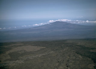 Hualalai shield volcano is seen here from the SE at the summit of Mauna Loa. Its latest eruption took place in 1800-01, when lava flows from vents on the NW rift zone reached the sea.
 Photo by Lee Siebert, 1987 (Smithsonian Institution).
 The Big Obsidian Flow erupted from Newberry caldera in central Oregon is composed of glassy rhyolite, formed when lava rapidly cools. The flow covers 20 km2 of the caldera floor. Obsidian flows are never entirely glassy, but also contain large amounts of frothy pumiceous material and devitrified (crystallized) spherulites, which commonly form bands alternating with layers of glass.
Photo by Lee Siebert, 1981 (Smithsonian Institution).
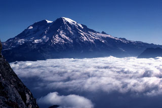 Mount Rainier is located east of the Puget Sound region, seen here from High Knob to the SW in 1981. Large Holocene mudflows from this heavily glaciated volcano have reached as far as the Puget Sound lowlands. Several postglacial tephras have erupted from Rainier, with tree-ring dating placing the last recognizable tephra deposit during the 19th century. Extensive hydrothermal alteration of the upper portion of the volcano has contributed to its structural weakness.
Photo by Lee Siebert, 1981 (Smithsonian Institution).
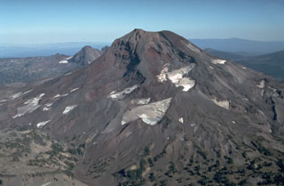 South Sister, seen here from the south, still contains a preserved summit crater although glaciers have eroded the flanks. Holocene eruptions have occurred from flank vents.
Photo by Dan Miller, 1977 (U.S. Geological Survey).
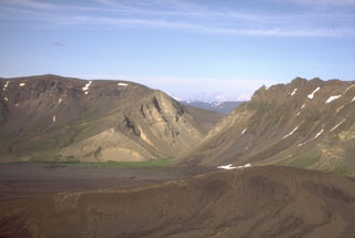 The Gates is a v-shaped notch in the 1-km-high eastern rim of Aniakchak caldera. Surprise Lake was once much larger but is now restricted to the NW part of the caldera floor. It is thought to have drained catastrophically through The Gates at the time of an eruption at Half Cone about 500 years ago.
Photo by Christina Neal, 1994 (Alaska Volcano Observatory, U.S. Geological Survey).
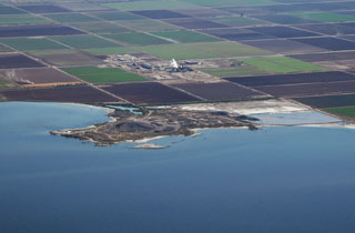 Obsidian Butte on the SE shore of the Salton Sea is seen in an aerial view from the NW. Obsidian Butte is one of five small rhyolitic lava domes extruded onto Quaternary sediments of the Colorado River delta; the summit of the dome lies 40 m below sea level. Two domes, Mullet Island and Red Island (not visible in this view), form small islands just offshore to the NE of Obsidian Butte. A steam plume rises from the Salton Sea geothermal field behind the dome.
 Photo by Bruce Perry, 2005 (California State University Long Beach).
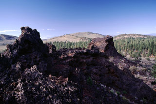 The Blowouts, the spatter vents in the foreground, are the source vents of the voluminous Devils Garden lava field. Devils Garden is the NW-most of a group of three lava fields SE of Newberry volcano and contains 117 km2 of overlapping pahoehoe lava flows erupted from fissure vents at the NE part of the field. The extremely fluid and inflated pahoehoe lavas typically left flows that increase from about a half meter thickness near the vent to about 5 m in the distal portion. The lava flows are either late Pleistocene or early Holocene in age.
Photo by Lee Siebert, 2000 (Smithsonian Institution).
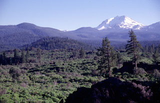 Potato Butte, the forested cinder cone at the left-center, is seen here from the rim of the Hat Creek vent with snow-covered Lassen Peak in the background. The Potato Butte cinder cones and lava flows were erupted around 65,000-75,000 years ago. The prominent 30,000-year-old Hat Creek lava flow traveled nearly 30 km from a fissure vent near the town of Old Station. An undated, but younger-looking flow originated from a cinder cone near West Prospect Peak, west of Potato Butte.
Photo by Lee Siebert, 1998 (Smithsonian Institution).
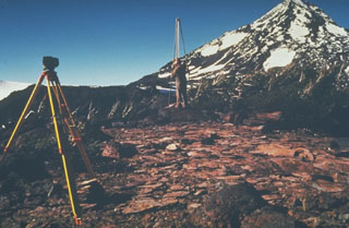 U.S. Geological Survey scientists monitor deformation on the Three Sisters volcanoes in the central Oregon Cascades, with Middle Sister volcano in the background. Precise leveling that permits detection of minor uplift is one of several monitoring techniques used to forecast eruptions.
Photo by John Ewert, 1985 (U.S. Geological Survey).
 A laze plume (hydrochloric acid, steam, and fine glass particles) rises from a lava flow entering the sea on 28 March 1955. The eruption began on 28 February and formed 24 vents across 15 km on the lower East Rift Zone. Three lava flows reached the sea, and a fourth flow stopped just short of the Puna coast near the eastern tip of the Island of Hawaii. The eruption lasted 88 days, ending on 26 May.
Photo by Jerry Eaton, 1955 (U.S. Geological Survey).
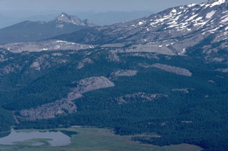 The Devils Hill chain of lava domes and flows erupted along a 5-km-long fissure on the SE flank of South Sister about 2,000 years ago, and can be seen diagonally across the center of this view to the NW. A similar, but more localized eruption produced the Rock Mesa lava flow, the light-colored area to the upper left. The eroded peak of The Husband volcano is in the distance.
Photo by Lee Siebert, 1982 (Smithsonian Institution).
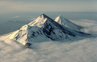 The twin volcanoes of Pavlof (left) and Pavlof Sister (right) rise above a sea of clouds on the southern Alaska Peninsula. The two conical stratovolcanoes are constructed on the same NE-SW line as Little Pavlof, a flank cone in the left center of this 1978 view from the SW. Pavlof, its NE slopes darkened by ash, is the most active volcano of the Aleutian arc. Ash-free Pavlof Sister is somewhat more glacially dissected than Pavlof and has had only one historical eruption.
Copyrighted photo by Katia and Maurice Krafft, 1978.
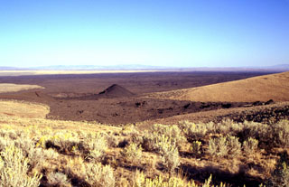 Coffeepot Crater (left of the cone) was the source of voluminous basaltic lava flows in the Jordan Craters volcanic field of SE Oregon. The roughly 200-m-wide crater lies at the NW end of the 1.6 km3 lava field. A WSW-ENE-trending line of spatter cones in the right foreground extends towards the crater. The lava field forms one of Oregon's youngest lava flows at less than 3,200 years old.
Photo by Lee Siebert, 2002 (Smithsonian Institution).
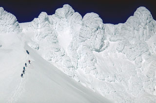 Oregon's Mount Hood is one of the most frequently climbed volcanoes in the Cascade Range. A group of climbers above the base of Crater Rock lava dome on the upper SW flank approaches Steel Cliffs that form the summit ridge.
Photo by Lee Siebert, 1968 (Smithsonian Institution).
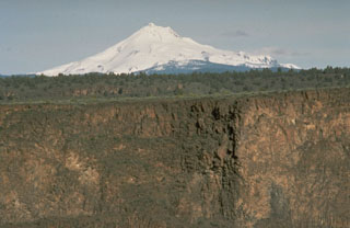 Mount Jefferson of the central Oregon Cascades rises above deep canyons eroded into thick lava flows of the Columbia River Basalt formation that covers a large area to the NE.
 Photo by Richard Waitt, 1984 (U.S. Geological Survey).
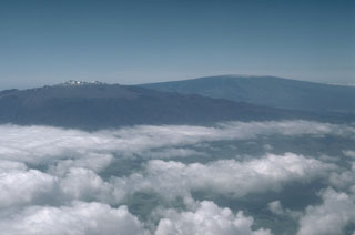 Mauna Kea (left) and Mauna Loa (right), both over 4,000 m above sea level, are also the world's largest active volcanoes, rising nearly 9 km above the sea floor around the island of Hawai’i. This aerial view from the NW shows the contrasting morphologies with the smooth profile of Mauna Loa, and Mauna Kea that was modified by the late-stage products of explosive eruptions.
Photo by Lee Siebert, 1987 (Smithsonian Institution).
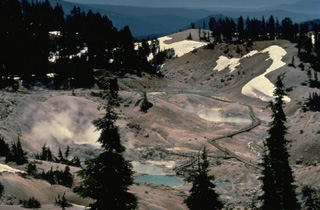 Bumpass Hell, the largest hydrothermal area at Lassen volcano, located south of Lassen Peak, contains steaming fumaroles and mudpots. It was named after its discoverer, a noted hunter and mountain man who suffered severe burns when he broke through the thin crust of the thermal area.
Copyrighted photo by Katia and Maurice Krafft, 1989.
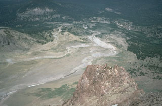 The Devastated Area swept by pyroclastic surges during an explosion on May 22, 1915 is seen here from the NE flank of Lassen Peak. The May 22 produced an eruption plume as high as 9 km, a pyroclastic surge that swept the area seen here, and a series of three lahars, the two largest of which swept down Lost Creek to the NE. The area as far as the distant flank of forested Raker Peak at the upper left was affected by the May 22 pyroclastic surge. Revegetation has begun to cover the distal parts of the May 1915 deposits.
 Photo by Bill Chadwick, 1981 (U.S. Geological Survey).
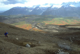 A volcanologist from the Alaska Volcano Observatory inspects an impact crater (left-foreground) formed by a dense block ejected during the 18 August 1992 eruption of the Crater Peak vent on Mount Spurr. Pyroclastic flow and lahar deposits from that eruption form the darker areas descending SE-flank valleys. This 1993 view looking away from Spurr shows glacier-covered plutonic and sedimentary rocks of the Alaska Range in the background.
Photo by Christina Neal, 1992 (Alaska Volcano Observatory, U.S. Geological Survey).
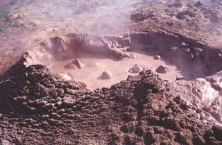 Bubbling mudpots are abundant in the Coso Hot Springs on the eastern margin of the Coso volcanic field. The hot springs occur along faults at the margins of a horst capped by rhyolitic rocks and are associated with fumaroles, mudpots, and widespread areas of hydrothermally altered ground.
Photo by Paul Kimberly, 1997 (Smithsonian Institution).
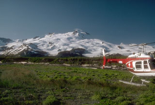 Mount Douglas is largely ice-covered and located at the northern tip of the Alaska Peninsula, is seen here from the north. The summit crater contains a warm, acidic lake.
Photo by Chris Nye (Alaska Division of Geological and Geophysical Surveys, Alaska Volcano Observatory).
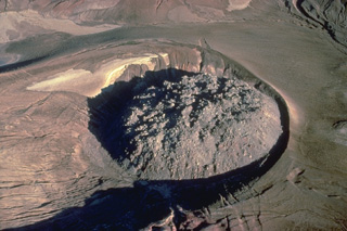 A 380-m wide lava dome caps the 1912 vent of Alaska's Novarupta volcano. The 65-m-high rhyolitic lava dome, which lies within a circular ejecta ring, was erupted at the end of a powerful explosive eruption that produced the voluminous Valley of Ten Thousand Smokes ash flows.
Copyrighted photo by Katia and Maurice Krafft, 1978.
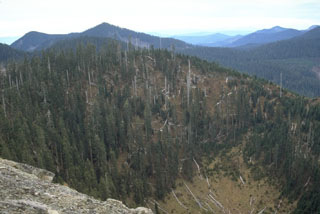 The forest-covered Bare Mountain crater in the foreground is 400 m wide and 275 m deep. It formed about 7,700 years ago during the youngest volcanic eruption in the West Crater volcanic field. West Crater itself is visible 4 km to the south to the extreme right side of the photo. The Bare Mountain phreatic crater formed in older Tertiary volcanic rocks, and unlike other Holocene eruptions in the West Crater area, was not accompanied by lava flows.
Photo by Lee Siebert, 1995 (Smithsonian Institution).
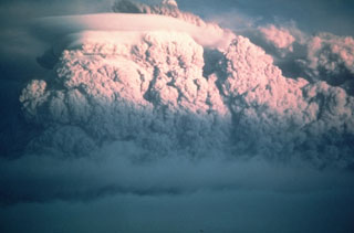 A second large explosive eruption took place from Mount St. Helens on 25 May 1980. It produced an ash plume that rose 14 km above the volcano, but the volume of ash was minor compared to the catastrophic eruption of 18 May a week earlier.
Photo by Darryl Lloyd, 1980 (courtesy U.S. Geological Survey).
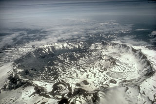 Aniakchak is a 10-km-wide summit caldera containing numerous cones, lava domes, and lava flows on the caldera floor. The largest intra-caldera cone is Vent Mountain that reaches 430 m in height and has a diameter at the base of 2.5 km. At least 20 Holocene eruptions may have occurred before the Aniakchak II caldera-forming eruption.
Photo by M. Woodbridge Williams (National Park Service).
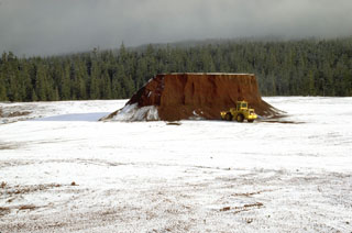 The flat summit of Little Nash Crater, a scoria cone of the Sand Mountain volcanic field in the central Oregon Cascades, has been extensively quarried to provide aggregate for highway construction. Red oxidized scoria from Little Nash Crater can be seen in road surfaces in the Santiam Pass area.
Photo by Lee Siebert, 1995 (Smithsonian Institution).
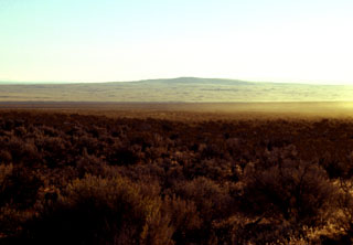 The low shield volcano of Jackies Butte, sometimes referred to as Bowden Crater, is seen here from the SW on the northern side of the Bowden Hills near the SE corner of Oregon. This small, relatively unstudied basaltic volcanic field consists of two small shield volcanoes and two cinder cones. The 1418-m-high Jackies Butte lies about 40 and 70 km from the borders with Idaho and Nevada, respectively. Lava flows of late Quaternary age cover an area of about 325 km2 SE of Burns Junction on Highway 95 and SW of Owyhee Canyon.
 Photo by Lee Siebert, 2002 (Smithsonian Institution).
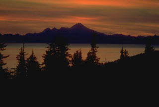 Iliamna rises across Cook Inlet, seen here at sunset from the Kenai Peninsula. It is the southernmost of three large volcanoes west of the inlet. The eroded summit ridge consists of four peaks along a 5-km-long ridge extending south (left) of the highest point.
Photo by Alaska Volcano Observatory, U.S. Geological Survey.
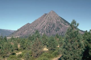 Black Buttes is a group of overlapping lava domes on the lower western flank of Mount Shasta that formed during the early Holocene, around the same time as the formation of Shastina on the upper west flank. Block-and-ash flows accompanying dome growth traveled over 10 km S. The notches on the western flank (left) mark the tops of several individual domes.
Photo by Lee Siebert, 1981 (Smithsonian Institution).
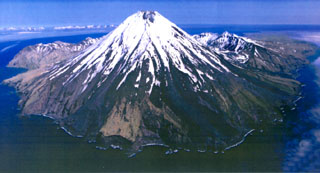 Kanaga is situated within the Kanaton caldera at the northern tip of Kanaga Island. The caldera rim forms a 760-m-high arcuate ridge, which can be seen S and E (left) of Kanaga. The two flows that reach the coast on either side of the sea cliffs in the lower center were produced during an eruptive period from mid-1993 through 1995.
Photo by Chris Nye, 2000 (Alaska Division of Geological & Geophysical Surveys, Alaska Volcano Observatory).
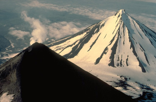 A steam plume rises from the summit of Pavlof volcano, whose upper slopes are snow-free as a result of its frequent eruptions. More-extensive glacial dissection of Pavlof Sister volcano (upper right) has produced a series of parasol-ribbed ridges that radiate from the summit. Only one historical eruption is known from Pavlof Sister.
Copyrighted photo by Katia and Maurice Krafft, 1978.
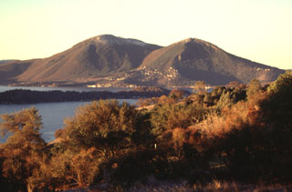 Mount Konocti, seen here beyond the southern shore of Clear Lake, is the largest feature of the Clear Lake volcanic field in the northern California Coast Ranges. The volcanic field contains lava dome complexes, scoria cones, and maars. It is located far to the west of the Cascade Range.
Photo by Lee Siebert, 1997 (Smithsonian Institution).
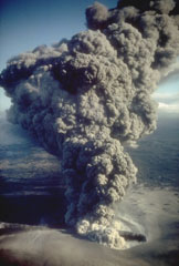 An ash plume erupts from eastern crater of the newly formed Ukinrek Maars on 6 April 1977. West Maar formed during the initial days of the eruption that began on 30 March. Three days later explosions began at East Maar, 600 m away. At the peak of the eruption ash plumes reached up to 6 km above the vent. On the 4th day of the eruption a lava dome appeared within East Maar.
Photo by R. Russell, 1977 (Alaska Department of Fish and Game).
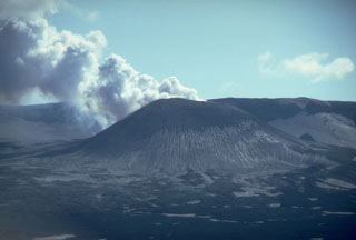 A steam-and-gas plume rises in December 1980 from a scoria cone in Alaska's Okmok caldera. Known only as Cone A, it is one of numerous unnamed cones within the 10-km-wide caldera. Erosional furrows produce linear stripes on the flank of the cone. Eruptions in 1945 and 1958 produced lava flows onto the caldera floor. The wall of Okmok caldera forms the skyline ridge.
Photo by Chris Nye, 1980 (Alaska Division of Geological & Geophysical Surveys, Alaska Volcano Observatory).
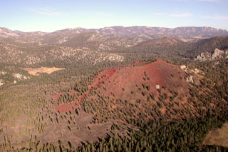 Reddish oxidized scoria mantles the slopes of Groundhog cinder cone, the youngest of Golden Trout Creek volcanic field. The cone is seen here from the west, with Tunnel cone (left center) and South Fork cone (beyond the right-hand rim of Groundhog) behind it. The light-colored area at the left center is Groundhog Meadow. Basaltic lava flows from Groundhog cone visible at the lower left extended 6 km down Golden Trout Creek.
Photo by Rick Howard, 2002 (courtesy of Del Hubbs, U S Forest Service).
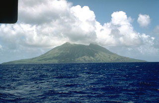 Alamagan, seen here from the W with two peaks on either side of a roughly 350-m-deep summit crater, is the emergent summit of a large submarine volcano. The exposed cone is largely Holocene in age and the SW flank contains a 1 x 1.6 km graben. Pyroclastic flow deposits have been dated at about 1,000 years old.
Photo by Norm Banks, 1981 (U.S. Geological Survey).
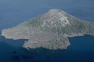 The Wizard Island scoria cone has a symmetrical 90-m-wide crater at its summit, formed above the west floor of Oregon's Crater Lake caldera within a few hundred years of caldera formation. A lava flow created the peninsula in the foreground on the NW side of the cone, which forms a small island on the west side of Crater Lake.
Photo by Lee Siebert, 1981 (Smithsonian Institution).
 Newberry shield volcano covers an area of about 1,600 km2 about 60 km E of the crest of the Cascade Range in central Oregon. The low-angle shield volcano covers an area of 60 km in a N-S direction and 30 km E-W. More than 400 scoria cones dot the flanks of the volcano, including Lava Butte at the left center of this photo, one of many cones formed around 6,100 years ago along the NW rift zone.
Photo by Lee Siebert, 1995 (Smithsonian Institution).
 Brilliantly colored, bright-red oxidized scoria deposits from a cinder cone near the SE end of Clear Lake are quarried for road aggregate. The basaltic-andesite cinder cone is one of a N-S-trending chain of young cones at the eastern margin of the Clear Lake volcanic field. This the northernmost of two quarried cinder cones bissected by the highway leading into the town of Clearlake Oaks.
Photo by Paul Kimberly, 1997 (Smithsonian Institution).
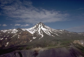 Yantarni is located on the Alaska Peninsula, with this view from the east showing the lava dome at the summit. On either side of the dome are remnants of a large crater that opens to the NE, which formed during flank collapse about 2,000-3,500 years ago.
Photo by Tom Miller, 1985 (Alaska Volcano Observatory, U.S. Geological Survey).
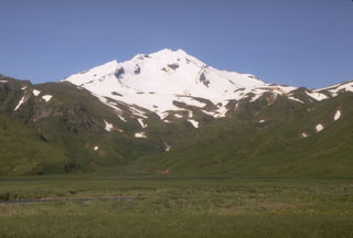 Russian Bay valley is located on the NE flank of the extensively eroded Recheschnoi volcano. Glacial erosion is most pronounced on this side and the flank also contains Holocene lava domes and a large thermal area.
Photo by Chris Nye (Alaska Division of Geological & Geophysical Surveys).
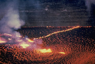 The Halema‘uma‘u lava lake is seen from the east on 31 May 1954. Several areas of vigorous lava fountaining occurred here as well as lower fountaining along nearby fissures. Later in the first day of the three-day-long eruption the fissures extended over the crater wall and to the ENE to produce lava flows on the caldera floor. Thin lava flows exposed in the Halema‘uma‘u pit crater walls appear in the background.
Photo by Jerry Eaton, 1954 (U.S. Geological Survey).
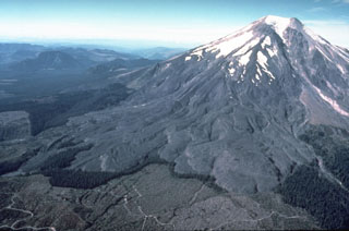 Overlapping lava flows that erupted from summit vents during the first half of the 16th century are seen here on the SE flank of Mount St. Helens. During the same eruptive period lava flows also extended down the E and W flanks, and pyroclastic flows traveled down the N, W, S, and SE flanks. A thin line of standing trees separates the SE-flank lava flows from logging areas at the bottom of this 1978 photo.
Photo by Rick Hoblitt, 1978 (U.S. Geological Survey).
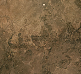 The Red Hill-Quemado Volcanic Field in New Mexico, USA, contains more than 40 scoria cones, some of which are in the area shown in this August 2019 Planet Labs satellite image monthly mosaic (N is at the top; this image is approximately 34 km across). There are also phreatomagmatic features including the 2-km-wide Zuni Salt Lake maar at the top of this Planet Labs satellite image monthly mosaic (N is at the top; this image is approximately 69 km across).
Satellite image courtesy of Planet Labs Inc., 2019 (https://www.planet.com/).
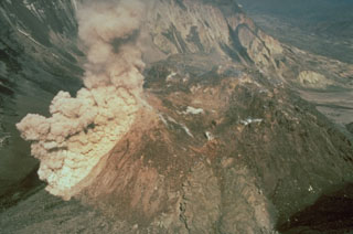 An ash plume rises above a rockfall on the south side of the Mount St. Helens dome during a period of lava dome growth in June 1985. Lava dome growth occurred intermittently from 1980 to 1986.
Photo by Gene Iwatsubo, 1985 (U.S. Geological Survey).
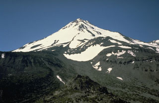 Hotlum cone, seen here from the NW, forms the main summit of Mount Shasta and is one of the largest Cascade Range volcanoes. Hotlum is composed of several overlapping edifices and formed during the Holocene.
Photo by Bill Chadwick, 1981 (U.S. Geological Survey).
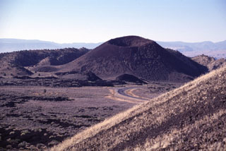 Two cinder cones in the Diamond Valley of SW Utah were the sources of the voluminous Santa Clara lava flow, one of the youngest in Utah. The symmetrical southern cone, capped by a pristine crater, is seen here from the flanks of the northern cone. Lava flows from the two cones filled the lower Diamond Valley in the foreground and then spilled through a narrow gap to the right of the southern cone into Snow Canyon.
Photo by Lee Siebert, 1996 (Smithsonian Institution).
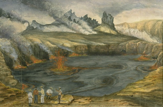 This September 1880 painting shows fountaining from the active lava lake in Halemaumau crater. Lava lake activity within Kīlauea's summit caldera was continuous from at least August 1823 until December 1894. With short periods of interruption, Halemaumau's lava lake remained active for a century before ceasing after an explosive eruption in 1924. This spectacular long-term activity, in which the magma conduit remained at the surface, drew visitors from around the world.
 From the collection of Maurice and Katia Krafft.
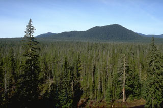 The forested slope in the foreground is part of the Big Lava Bed, a 0.9 km3 lava flow that erupted from the scoria cone in the background about 9,000 years ago. The lava flow traveled 13 km from the crater and is the youngest feature of the Indian Heaven volcanic field.
Photo by Lee Siebert, 1995 (Smithsonian Institution).
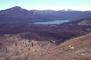 A series of lava flows from a vent on the SE flank of Cinder Cone traveled about 3.5 km to the north and south. Snag Lake, seen here to the south from the summit of Cinder Cone, was formed with the lava flow dammed up drainages. The colorful area at the lower left, known as the Painted Dunes, is an ash deposit oxidized by the heat of a still-hot underlying lava flow. The dark-colored main flow beyond the Painted Dunes was emplaced later during the same eruption, and is ash free.
Photo by Lee Siebert, 1998 (Smithsonian Institution).
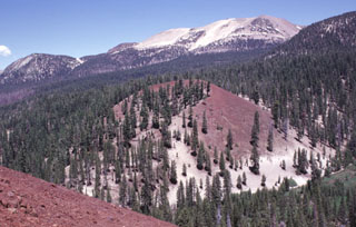 Mammoth Mountain, a Pleistocene trachydacitic lava-dome complex constructed on the SW topographic rim of the Long Valley caldera between about 200,000 and 50,000 years ago, forms the broad peak on the horizon. The Red Cones (center and lower left) are part of series of about three dozen mafic cones surrounding Mammoth Mountain. The oxidized reddish scoria of the cone, which was formed during the early Holocene, is mantled at its base by light-colored pumice erupted from the Inyo Craters about 650 years ago.
 Photo by Lee Siebert, 1998 (Smithsonian Institution)
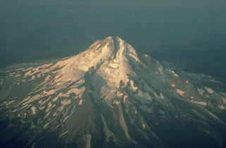 This aerial view from the NE shows Eliot Glacier descending the valley in the center, with glacial moraines at its base. During the late Pleistocene a major lahar from Mount Hood swept to the north across the Columbia River, temporarily filling it to a depth of 30 m.
Photo by Richard Waitt, 1983 (U.S. Geological Survey).
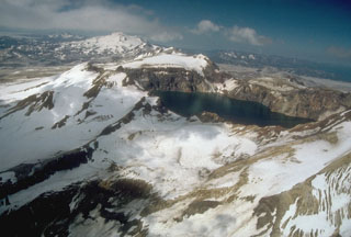 Katmai caldera, formed during the catastrophic eruption of the nearby Novarupta vent in June 1912, is seen here in an aerial view from the NE. The steep-walled, 1.5-km-wide caldera formed on a cluster of overlapping cones and is partially filled by a lake. Beyond the caldera are the multiple peaks of Trident volcano; Mageik volcano is the snow-and-ice-covered cone in the background.
Photo by Chris Nye, 1991 (Alaska Division of Geological and Geophysical Surveys, Alaska Volcano Observatory).
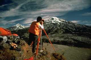 Electronic Distance Measurements (EDM) by the U.S. Geological Survey at South Sister volcano, with Middle Sister to the left, are conducted routinely to monitor these Cascades volcanoes for potential eruptive activity. By measuring the distance between two fixed points, these instruments can detect minor changes in the surface of the volcanic edifice that can occur prior to eruptions.
Photo by Lyn Topinka, 1985 (U.S. Geological Survey).
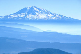 Mount Adams is seen in this view from Mount St. Helens to the west. Eruptive activity continued into the Holocene from both summit and vents on the N, NW, S and E flanks.
Photo by Lee Siebert, 1979 (Smithsonian Institution).
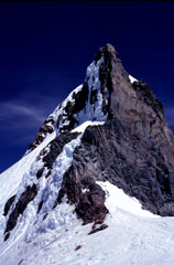 The steep summit pinnacle of Mount Jefferson, seen here from the south, is one of the most dramatic summits of a Cascade Range volcano. Jefferson has been inactive since the late Pleistocene, allowing glacial erosion to remove much of the original summit and exposing the more erosion-resistant rocks that cooled slowly in the central conduit.
Photo by Lee Siebert, 1996 (Smithsonian Institution).
 The Santa Clara lava flow fills the valley of Snow Canyon, cut in colorful rocks of the Navajo Sandstone. The young flow, covered only by scrubby vegetation, split into several lobes and flowed around several peninsulas and islands of the reddish Navajo Sandstone that protrude through the black basalt. The flow traveled through the narrow gap at the upper left and reached nearly to the Santa Clara River, 16 km from the source of the flow.
Photo by Lee Siebert, 1996 (Smithsonian Institution).
 A plume rises above Fourpeaked during its first observed eruption, on 7 September 2006, as seen from Main Street in Homer, across Cook Inlet. The plume rose to a maximum height of 6 km and resulted in a trace of ashfall at Nonvianuk Lake outlet (110 km WNW) and near Homer (150 km NE). The eruption produced a 1-km-long fissure that extended north from the summit.
Copyrighted photo by Lanny Simpson, 2006 (courtesy of USGS/AVO).
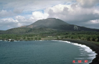 Pagan Island, the largest and one of the most active of the Mariana Islands, consists of two volcanoes connected by a narrow isthmus. Both North and South Pagan were constructed within calderas. North Pagan, the most active of the two, is seen here from the west coast of the isthmus, SW of the summit; it was constructed within a 7-km-wide caldera.
 Photo by Norm Banks, 1983 (U.S. Geological Survey).
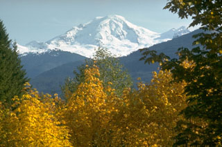 Glaciated Mount Baker rises above the North Fork Nooksack River valley below the NW flank.
Photo by Lee Siebert, 1973 (Smithsonian Institution).
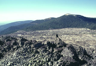 The Glass Mountain obsidian flow buries much of the eastern rim of Medicine Lake caldera. The massive 1 cu km flow traveled south towards Lyons Peak (upper right) before the bulk of the flow was diverted to the east and descended the caldera's outer flank. The latest event at Glass Mountain produced the craggy rhyolitic obsidian dome seen in the foreground. The roughly 900-year-old flow is the youngest and largest of a series of Holocene rhyolitic and dacitic lava flows at Medicine Lake.
Photo by Lee Siebert, 1998 (Smithsonian Institution).
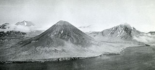 An aerial view of the SE coast of Semisopochnoi Island shows Sugarloaf peak (left-center) with a flank cone (foreground) that was the source of one of the more recent lava flows. Sugarloaf erupted outside the southern margin of an 8-km-wide caldera on Semisopochnoi. Mount Cerberus was constructed within the caldera and is on the left horizon. Pre-caldera Ragged Top is to the right.
 Photo by U.S. Navy (published in U.S. Geological Survey Bulletin 1028-O).
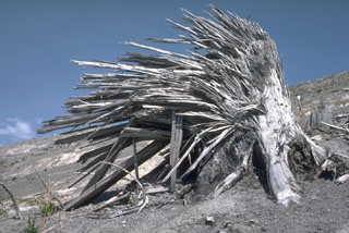 The lateral blast of the 18 May 1980 Mount St. Helens eruption removed large standing trees near the volcano. The high-velocity rocky flow left jagged stumps with splinters facing away from the volcano and parallel to the direction of movement of the flow. This tree is about 2 m high, located 9 km N of the crater on Harry’s Ridge.
Photo by Lee Siebert, 1984 (Smithsonian Institution).
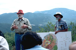 Volcanologists Bob Smith (left) and Roy Bailey (right) lead a geological field trip to Valles caldera. Redondo Peak at the upper right rises to 3430 m, 840 m above the caldera floor, and along with Redondo Border peak at the center, forms the western half of the uplifted resurgent dome seen at the center of the geologic map. The down-dropped Redondo Creek graben, which cuts diagonally through the center of the photo, has been the focus of geothermal exploration in the caldera.
Photo by Lee Siebert, 1989 (Smithsonian Institution).
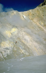 Two U.S. Geological Survey volcanologists (left center) take gas samples from a fumarole, one of many across the wall of Sherman Crater in 1981. Increased emissions had begun from Sherman Crater in 1975. The crater walls consist of brightly colored areas of hydrothermally altered rocks.
Photo by Bill Chadwick, 1981 (U.S. Geological Survey).
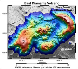 The summit of East Diamante volcano is modeled using bathymetric data collected on the NOAA Submarine Ring of Fire 2002 and 2003 expeditions. A large post-caldera cone lies on the SW caldera rim, and a complex of lava domes was constructed in the center of the caldera. Several hydrothermal areas on the central dome complex are labeled.
Image courtesy of Submarine Ring of Fire 2004 Exploration, NOAA Vents Program.
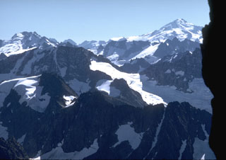 Glacier Peak, to the upper right from Forbidden Peak with Dome Peak to the upper left, rises above some of the most rugged terrain of the North Cascade mountain range.
 Photo by Lee Siebert, 1971 (Smithsonian Institution).
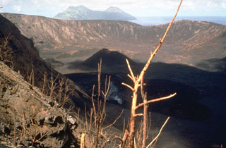 Two maars on the western flank of North Pagan volcano. Pyroclastic surge deposits from the latest eruption of the 1.5-km-wide eastern maar, seen here from the NE with South Pagan volcano in the distance, were radiocarbon dated to about 150 years old. This 24 May 1981 photo shows a lava flow (producing a gas plume) that originated from the summit crater during an eruption that began on 15 May.
Photo by Norm Banks, 1981 (U.S. Geological Survey).
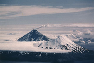 Herbert is a cone containing a 2-km-wide summit caldera that opens to NW. This 23 June 1987 view from the WSW shows a small plume originating from Cleveland in background, with darkened slopes from ashfall produced during an eruption that began on 19 June.
Photo by Harold Wilson (Peninsula Airways), 1987 (courtesy of John Reeder, Alaska Div. Geology Geophysical Surveys).
 An Alaska Volcano Observatory geologist sets up GPS (Global Positioning System) instrumentation on the N flank of Redoubt volcano. The GPS receiver calculates an extremely accurate location through satellite-based triangulation. This helps pinpoint locations for electronic distance measurements that detect deformation that may be related to eruptive activity. The Drift River valley extending away from the volcano to the NE was covered with pyroclastic-flow and mudflow deposits from the 1989-90 eruption.
Photo by Game McGimsey, 1991 (Alaska Volcano Observatory, U.S. Geological Survey).
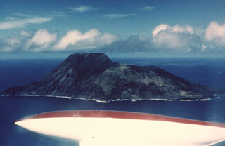 The 3-km-wide Sarigan volcano is seen here from the NE. The flat area to the right consists of a cone with a 750-m-wide summit crater that contains a small cone. The youngest eruptions produced two lava domes from vents on and near the S crater rim, forming the island's high point to the left. Holocene lava flows from the dome complex reached the coast to the left-center and formed the peninsula to the far left.
Photo by Dick Moore, 1990 (U.S. Geological Survey).
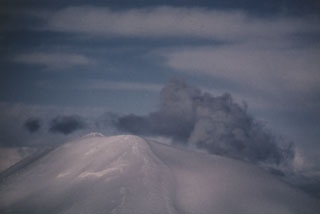 A gas-and-steam plume, possibly containing minor amounts of ash, rises above the summit of Korovin volcano on 4 March 1987. This view of Korovin, north of Atka, was taken from the south. A satellite image on 18 March showed three distinct plumes originating from Korovin and two vents to the south.
 Photo by Harold Wilson (Peninsula Airways), 1987 (courtesy of John Reeder, Alaska Div. Geology Geophysical Surveys).
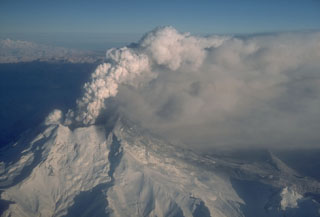 A gas-and-ash plume rises above Redoubt on 18 December 1989. The eruption began with a major explosion on 14 December that created a new vent in the summit crater. A lava dome was extruded in the new vent but was repeatedly destroyed by explosive eruptions. Pyroclastic flows and lahars often travel down the Drift River valley to the N and NE.
Photo by W. White, 1989 (Alaska Volcano Observatory, U.S. Geological Survey).
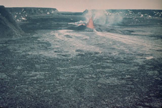 This 12 April 1940 photo shows a lava fountain within the Mauna Loa Moku‘āweoweo caldera from the SE. The eruption began during the night of 7 April from fissures that soon migrated down the SW rift zone. A 6-km-long fissure produced lava flows that covered two-thirds of the caldera floor. The eruption lasted until 18 August.
 Photo by G.O. Fagerlund (U.S. Geological Survey).
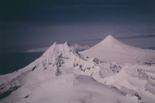 Three volcanoes are constructed along an E-W trend on the eastern half of Unimak Island. Roundtop in the foreground is glacially eroded and has Holocene pyroclastic flow deposits and a group of lava domes to the south. Isanotski is in the background and Shishaldin is in the midground.
Photo by Clayton and Marcia Brown, 1986 (courtesy of John Reeder, Alaska Div. Geology Geophysical Surveys).
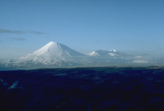 The effects of erosion are visible in this view from the SW of two prominent stratovolcanoes on SW Umnak Island in the Aleutians. Mount Vsevidof (left) is a near-symmetrical volcano where frequent eruptions, which have continued into historical time, have overcome the effects of erosion. In contrast, Recheschnoi volcano (right) has been inactive for longer periods of time and has been extensively dissected by glaciers. Only small pyroclastic cones and lava domes have erupted during the past 10,000 years.
Photo by Chris Nye, 1985 (Alaska Division of Geological & Geophysical Surveys).
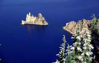 Phantom Ship is the eroded remnants of resistant dikes that now rise above the waters of Crater Lake. These dikes were feeders for lavas of Phantom Cone, the oldest of the known pre-collapse edifices forming Mount Mazama. Phantom Cone lavas have been dated to about 400,000 years before present and are exposed in the SE wall of the Crater Lake caldera.
Photo by Lee Siebert, 1997 (Smithsonian Institution)
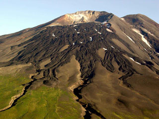 Gareloi in the western Aleutian Islands is seen here from the S. This photo shows lava flows with clear levees from a 1980s eruption. The 8 x 10 km diameter Gareloi Island consists of a stratovolcano with two peaks and a SE-trending fissure that formed during a 1929 eruption and extends to the sea.
Photo by Game McGimsey, 2003 (Alaska Volcano Observatory, U.S. Geological Survey).
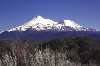 Massive Mount Shasta, the largest-volume volcano of the Cascade Range in northern California. It is seen here from the north, with Hotlum cone forming the summit and Shastina on the western flank. It is composed of at least four main edifices, of which the last two, Hotlum and Shastina, are of Holocene age.
Photo by Lee Siebert, 1998 (Smithsonian Institution).
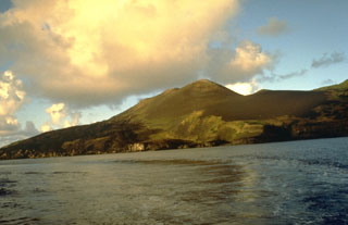 The northern volcano on the 2.8-km-wide island of Guguan is seen here from the west. An eruption between 1882 and 1884 formed the northern cone, which has three coalescing craters. Fresh lava flows that form the left coastline were produced during that eruption.
Photo by Norm Banks, 1981 (U.S. Geological Survey).
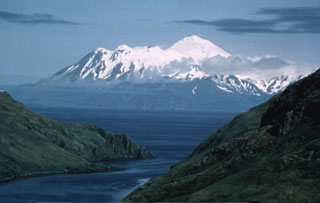 Great Sitkin in the Andreanof Islands is seen here from Finger Bay on Adak Island. The edifice was constructed within a caldera, part of which forms the high snow-covered peak to the right. The post-caldera cone contains a 0.8 x 1.2 km ice-filled summit crater. The rim forms the irregular summit on the left horizon. A lava dome 400-600 m wide was emplaced through a glacier in 1945.
Photo by Fred Zeillemaker, 1982 (U.S. Fish and Wildlife Service, courtesy of Alaska Volcano Observatory).
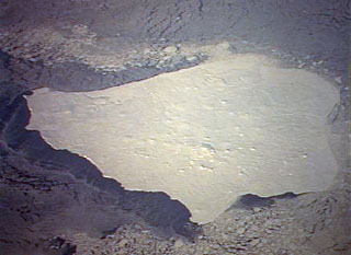 Low-angle sun accentuates small pyroclastic cones on snow-covered Nunivak Island. Shelf ice modifies the apparent northern coastline (top) in this January 1992 Space Shuttle image. The 110-km-wide island lies about 30 km off the coast of SW Alaska and contains about 60 cinder cones and four maars. Although the bulk of the volcanic field was formed during two Pleistocene eruptive periods ending about 300,000 years ago, activity continued into the Holocene. The latest eruptions occurred along an E-W line in the southern part of the island.
NASA Space Shuttle image STS42-82-33, 1992 (http://eol.jsc.nasa.gov/).
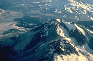 An aerial view from the east shows Mount Griggs in the foreground with the distal end of the Valley of Ten Thousand Smokes (VTTS) ash-flow deposit in the distance, forming the flat, light-colored valley floor at the upper left. The VTTS ash flow was erupted in 1912 from Novarupta volcano; it traveled 21 km to the location shown in this photo. Griggs volcano is the highest of a group of volcanoes in the Katmai area. Three concentric craters are breached to the SW, the largest of which was formed by edifice collapse during the early Holocene.
Copyrighted photo by Katia and Maurice Krafft, 1978.
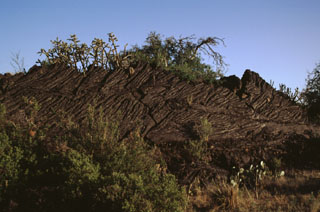 Slabs of basaltic pahoehoe lava are tilted along a pressure ridge of the Carrizozo lava flow in New Mexico. This massive tube-fed pahoehoe flow displays abundant evidence of inflation features such as tumuli, pressure ridges, and lava pits. Tumuli form when brittle crust buckles to accommodate the inflating core of the flow, thus creating a central crack along the length of the tumulus. These structures sometimes grade into elongated features called pressure ridges.
Photo by Lee Siebert, 1999 (Smithsonian Institution).
 The small grayish area at the center of this NASA Landsat image is a lava flow from the Silver Lake cinder cone. Lava flows from the cone dammed up drainages, forming two small black-colored lakes, Silver Lake and Arthur Lake. Another small dark-colored lake at the lower right, south of the two large elongated light-colored areas, was formed when lava flows from the Buckhorn Lake cinder cone blocked a stream valley.
NASA Landsat 7 image (worldwind.arc.nasa.gov)
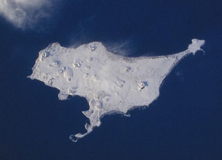 A Space Shuttle image of St. Paul Island shows Northeast Point to the upper right, Reef Point at the bottom-center, and Southwest Point to the left. Snow-covered Big Lake lies SW of Northeast Point, Bogoslof Hill near the center of the island, and Rush Hill is the cone along the NW coast. Rush Hill produced lava flows from NE-trending fissures. The 110 km2 island is the largest of the Pribilof Islands and contains more than a dozen scoria cones and associated lava flows.
NASA Space Shuttle image STS099-728-21, 2000 (http://eol.jsc.nasa.gov/).
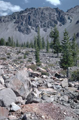 The blocky surface of Chaos Jumbles in the foreground was produced by collapse of a portion of the Chaos Crags lava dome complex in the background about 1650 CE. The cold rock avalanche traveled 5 km from its source, and may have occurred in the absence of any eruptive activity. Three successive lobes of the avalanche cover an area of 8 km2.
Photo by Lee Siebert, 1982 (Smithsonian Institution).
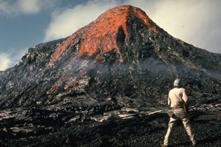 This eruption was observed by Hawaiian Volcano Observatory volcanologist Jack Lockwood on 28 February 1974, near the end of the 5-year-long Mauna Ulu eruption. As the erupting lava solidifies around the vent the feature gets progressively larger.
Photo by Robin Holcomb, 1974 (U.S. Geological Survey).
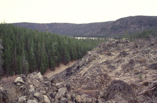 The East Lake obsidian flows and associated pumice deposits erupted from fissures parallel to the inner caldera wall. The westernmost of the two obsidian flows immediately south of East Lake is seen here. It traveled to the north towards East Lake, part of which can be seen beyond the forested area in the center of the photo, below the eastern caldera wall.
 Photo by Lee Siebert, 1997 (Smithsonian Institution).
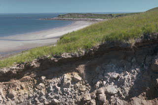 The recent history of Augustine has been characterized by repetitive collapse of the summit area, producing debris avalanches that often reached the sea on all sides of the island, forming rocky deposits. This gully near the east shoreline exposes one such debris avalanche deposit. The Northeast Point debris avalanche deposit forms the headland in the distance.
Photo by Lee Siebert, 1990 (Smithsonian Institution).
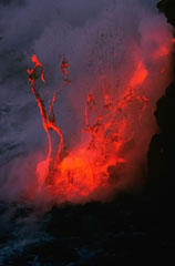 Explosions like this can occur when lava flows enter the ocean. This photo, taken along the Kalapana ocean entry point on 27 November 1989, documents a common occurrence during the East Rift Zone eruption of Kīlauea that began in 1983 and ended in 2018.
Photo by J.D. Griggs, 1989 (U.S. Geological Survey).
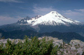 Mount Baker in the northern Cascades rises 1,500 m above a dissected basement complex of metamorphic and sedimentary rocks, exposed at Dock Butte in the foreground. On the left skyline is the glacially eroded core of the Pleistocene Black Buttes stratovolcano, a predecessor to Mount Baker. From left to right, the Deming, Easton, Squock, Talum, Boulder, and Park Glaciers drape the volcano's flanks.
Photo by Lee Siebert, 1990 (Smithsonian Institution).
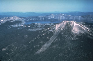 The 8 x 10 km wide Crater Lake caldera formed about 7,700 years ago during one of the world's largest Holocene eruptions. This eruption resulted in the collapse of ancestral Mount Mazama. This view from the east shows Mount Scott in the right foreground, one of the pre-caldera volcanoes. A post-caldera cone, Wizard Island, rises above the far lake surface.
Photo by Peter Lipman, 1981 (U.S. Geological Survey).
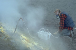 A volcanologist takes gas samples from a sulfur-encrusted fumarole at the summit of Augustine during a quiescent period of the 1986 eruption. Fumarole condensates had a pH of between 0 and 0.5. The maximum measured gas temperatures were 625-645°C.
Photo by Lee Siebert, 1986 (Smithsonian Institution).
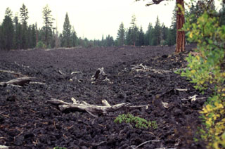 The small Forest Road lava flow that was erupted from fissures on the central NW rift zone of Newberry. This lava flow, one of the smallest from the NW rift zone of Newberry volcano, originated from a fissure vent immediately NW of the Lava Cast Forest flow.
Photo by Lee Siebert, 1997 (Smithsonian Institution).
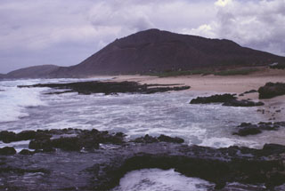 Koko crater, rising above the eastern coast of Oahu, is one a group of tuff cones and satellitic vents of late-Pleistocene to possible Holocene age on the eastern flank of the massive Koolau shield volcano. This elongated shield volcano of Pliocene-Pleistocene age forms much of the eastern half of Oahu. Koko crater is part of the Honolulu Series, a group of tuff cones, cinder cones, and spatter cones, many with associated lava flows.
Photo by Lee Siebert, 1997 (Smithsonian Institution).
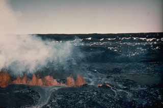 A line of lava fountains across the floor of Moku‘āweoweo caldera is seen from the western Mauna Loa caldera rim on 9 April 1940, two days after the start an eruption at the summit and upper SW flank. The fissure erupted in the SW portion of the caldera and propagated a total distance of 6 km across the caldera and down the SW rift zone. During the course of the eruption lava flows covered two-thirds of the caldera floor.
Photo by G.O. Fagerlund (U.S. Geological Survey).
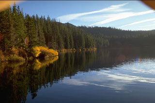 The 300 x 800 m wide Blue Lake Crater formed about 1,300 years ago during eruptions through pre-existing volcanic bedrock. A least three overlapping craters formed with ejecta forming a crater rim only 50 m above the pre-eruption surface.
Photo by Lee Siebert, 1995 (Smithsonian Institution).
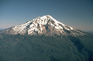 Mount Shasta in northern California, seen here from the SE, is one of the largest of the Cascades volcanoes and is constructed of at least four overlapping edifices. Hotlum cone (forming the summit), along with the Shastina and Black Buttes lava domes, were all constructed during the Holocene.
Photo by Lyn Topinka, 1984 (U.S. Geological Survey).
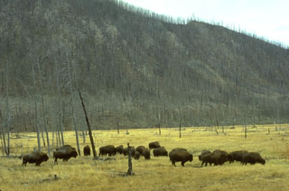 Bison graze in a meadow along the Madison River in front of rocks of the massive West Yellowstone lava flow that are visible in the cliff behind them as a result of the 1988 Yellowstone fires.
Photo by Lee Siebert, 1994 (Smithsonian Institution).
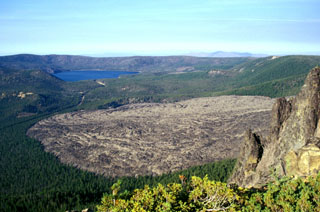 The Big Obsidian Flow covers 2.6 km2 of the floor of Newberry caldera and was emplaced about 1,300 years ago. The eruption began from a vent at the base of the southern caldera wall with a large pumice fall deposit followed by a pyroclastic flow that entered Paulina Lake, and finally with emplacement of the obsidian flow. East Lake lies in the background in this view from the southern caldera rim.
Photo by Lee Siebert, 2002 (Smithsonian Institution).
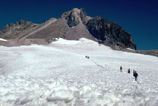 Hotlum cone forms the current Shasta summit and was constructed during the early Holocene.
Photo by Lee Siebert, 1981 (Smithsonian Institution).
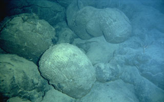 Submarine extrusion of lava produces a characteristic "pillow lava" morphology, as seen here on Lōʻihi seamount SE of the island of Hawaii. Thin streams of molten lava are extruded in a form that resembles toothpaste squeezed out of a tube. The outer surface of the lava is quickly chilled by the water and solidifies, while the interior remains molten and continues to flow, lengthening the tubes.
 Photo by the Hawaii Undersea Research Laboratory (University of Hawaii).
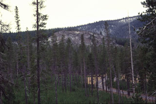 The easternmost of the two East Lake obsidian flows forms the sparsely vegetated area in the center of the photo near the SE shore of East Lake. This rhyolitic flow, another one to the west, and associated pumice deposits erupted from fissures parallel to the inner caldera wall.
 Photo by Lee Siebert, 1997 (Smithsonian Institution).
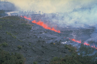 Fire fountains along fissures near the Pauahi Crater parking lot on the upper East Rift Zone on 16 November 1979. The eruption ended the following day, after producing lava flows across the Chain of Craters Road and moving about 500 m downslope west of the road into Pauahi Crater.
Photo by Bob Decker, 1979 (U.S. Geological Survey).
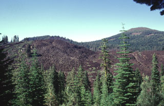 Devils Garden, part of which forms the jumbled blocky lava flows in the foreground, is part of the N-S-trending Tumble Buttes, a young volcanic field located north of Lassen Peak. The Tumble Buttes field contains some of the youngest volcanic features in this little known area partially within the Thousand Lakes Wilderness Area west of the Hat Creek Valley. The andesitic lava cone at the upper right is Logan Mountain, of Pleistocene age.
Photo by Lee Siebert, 1998 (Smithsonian Institution).
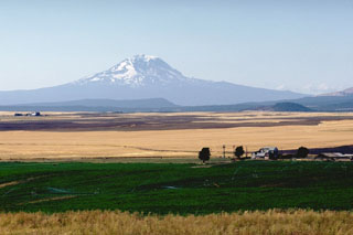 Mount Adams is seen here beyond farmlands on the east side of the Cascades. Mount Adams, known to local tribes as Pahto or Klickitat, featured prominently in tribal legends. The summit was said to have been flattened by a mighty blow from its southern brother, Mount Hood (Wyeast), when the damsel St. Helens (La-wa-la-clough) preferred Adams over Hood.
Photo by Lee Siebert, 1982 (Smithsonian Institution).
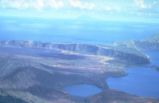 This south-looking view across Pagan Island shows Alamagan Island in the distance. The wall across the center of the photo is the southern rim of a 7-km-wide caldera containing North Pagan volcano. The lake in the foreground is the westernmost of two maars on the western flank of North Pagan. The black lava flow on the caldera floor at the left center in this 16 June 1981 photo erupted from a vent on the south rim beginning on 15 May 1981.
Photo by U.S. Navy, 1981.
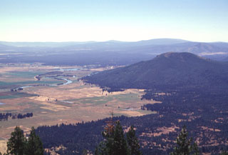 The broad forested area in the Falls River valley in the upper part of the photo beyond Saddle Mountain, the prominent forested peak at right-center, is the inconspicuous Big Cave shield volcano. The low shield volcano fed lava flows that extend primarily to the north, towards the Pit River. Big Cave is one of several poorly known young Quaternary volcanoes in northern California between Mount Lassen and Medicine Lake volcano. This view looks to the SE from Soldier Mountain, with the town of Fall River Mills in the valley left of Saddle Mountain.
Photo by Lee Siebert, 1998 (Smithsonian Institution).
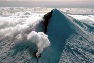 A steam plume (bottom center) rises from a lava flow front descending the flank of Pavlof on 23 September 1996. The eruption began on 15 September with lava fountains that fed the lava flow.
Photo by Susan Schulmeister, 1996 (U.S. Fish and Wildlife Service).
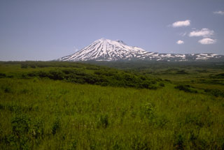 Mount Peulik was constructed immediately north of Ugashik caldera. It is seen here from NW near Ukinrek Maars. The hummocky terrain in the foreground is a debris avalanche deposit produced by the collapse of ancestral Peulik.
 Photo by Christina Neal, 1993 (Alaska Volcano Observatory, U.S. Geological Survey).
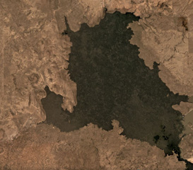 Lava flows covering 68 km2 of the Jordan Craters volcanic field in Oregon, USA, are seen in this September 2019 Planet Labs satellite image monthly mosaic (N is at the top; this image is approximately 15 km across). The Coffeepot Crater in the NW corner is the largest vent and once contained a lava pond.
Satellite image courtesy of Planet Labs Inc., 2019 (https://www.planet.com/).
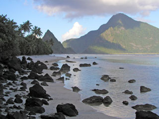 A narrow strait (just left of center) separates the two triangular islands of Ofu (left) and Olosega (right) in eastern Samoa. The islands are formed by two eroded, coalescing shield volcanoes. The narrow, steep-sided ridge forming the W side of Ofu Island is cut by volcanic dikes and an intrusive plug forms the sharp spire on Ofu Island to the left. A submarine eruption took place in 1866 at the far end of the two islands, 3 km SE of Olosega, along the ridge connecting Olosega with Ta'u Island.
Photo by Peter Craig, 1995 (U.S. National Park Service).
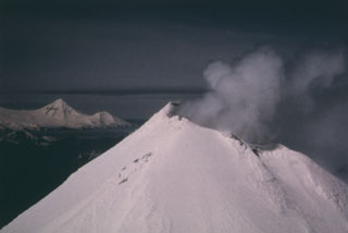 This view of the summit of Shishaldin shows its near- constant crater plume, with its high point on the south rim. Pogromni volcano, part of the Westdahl volcanic complex at the western end of Unimak Island, forms the peak in the distance.
Photo Clayton and Marcia Brown, 1987 (courtesy of John Reeder, Alaska Div. Geology & Geophysical Surveys).
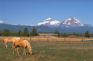 North Sister volcano on the right and Middle Sister to its left rise above ranch lands of eastern Oregon. These large volcanoes have not been active since the Pleistocene, but scoria cones on the north flank of North Sister have produced some of the youngest lava flows in the Cascade Range.
Photo by Dave Wieprecht, 1995 (U.S. Geological Survey).
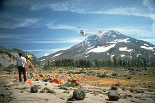 A helicopter delivers supplies to a U.S. Geological Survey field crew conducting Electronic Distance Measurement surveys on the flank of South Sister volcano in the central Cascades of Oregon.
Photo by Lyn Topinka, 1986 (U.S. Geological Survey).
 The small dark-colored pyroclastic cone on the right side of the Grand Canyon at the upper left is Vulcan's Throne, part of the Uinkaret volcanic field, which lies on the north rim of the canyon. Lava flows that originated from the cone can be seen cascading into the Grand Canyon. These flows formed temporary lava dams in the canyon up to 200 m high. Light-colored rocks of the Kaibab Limestone form the steep cliffs bounding the mesa at the right.
Photo by Lee Siebert, 2000 (Smithsonian Institution).
 The summit of Ice Springs volcano provides a perspective of the extensive lava field erupted from the volcano about 660 years ago. Ash and scoria from Crescent Crater on the east side of the cone complex was blown primarily to the east by prevailing winds and forms the lighter-colored material that mantles the lava flow in this direction. The eastern lava flows were erupted early during the Ice Springs eruption. The road in the foreground provides access to a quarrying operation at the cinder and spatter cone complex.
 Photo by Lee Siebert, 1996 (Smithsonian Institution).
 This is the NE margin of the Big Obsidian Flow, which erupted from a vent near the Newberry southern caldera wall about 1,300 years ago into this crater, whose forested rim is seen in the background.
 Photo by Lee Siebert, 1981 (Smithsonian Institution).
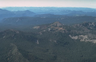 South Cinder Peak, the unvegetated scoria cone near the center of the photo, is the youngest volcanic feature in the Mount Jefferson area. A smaller cinder cone seen at the left on its south flank in this view from the SE, formed about 1,000 years ago and produced a lava flow that traveled to the west.
Photo by Dan Miller, 1977 (U.S. Geological Survey).
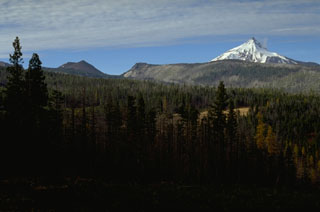 Forked Butte, the scoria cone on the left skyline south of snow-capped Mount Jefferson, formed about 6,500 years ago. It produced lava that flowed from the notch to the right of Forked Butte down valleys on both sides of Sugar Pine Ridge that forms the right skyline. The southern lobe traveled 8 km to the west down Cabot Creek below Sugar Pine Ridge.
Photo by Lee Siebert, 1995 (Smithsonian Institution).
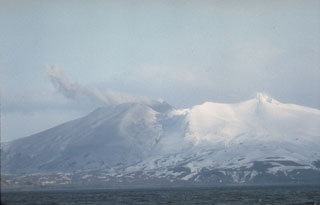 Akutan forms the west-central part of Akutan Island in the eastern Aleutians. The summit contains a 2-km-wide caldera with a large scoria cone, visible here through a low point in the northern caldera rim. The cone has been the site of frequent historical eruptive activity.
Photo courtesy of U.S. Geological Survey, Alaska Volcano Observatory.
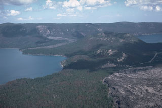 A major eruption about 6,400 years ago produced the large Central Pumice Cone in the center of Newberry caldera, a pumice ring, and obsidian lava flows. The Interlake obsidian flow (on the far side of the left-hand lake, Paulina) originated from a vent on the north caldera wall and flowed onto the caldera floor and divided around Central Pumice Cone. The west lobe (seen here) flowed into Paulina Lake, while the east lobe flowed behind Central Pumice Cone into East Lake. The Game Hut obsidian flow was also erupted at this time.
Photo by Lee Siebert, 1984 (Smithsonian Institution).
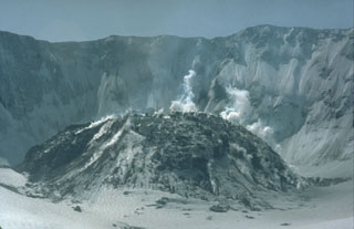 Beginning in October 1980, activity during 17 eruptive episodes built this lava dome that grew to 876 m above the crater floor, shown here in April 1983. During a 12-month period beginning in 1983 the dome primarily grew by magma rising into the interior of the dome, called endogenous dome growth. Hundreds of small gas-and-steam explosions occurred at the dome.
Photo by Bob Symonds, 1983 (U.S. Geological Survey).
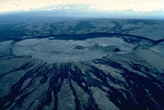 This aerial view of the summit of Mauna Loa from the NW shows the elongated, 2.4 x 4.8 km Mokuaweoweo caldera. The walls of the flat-bottomed caldera are 80-180 m high. Black lava flows visible on the flanks of the caldera were truncated when the caldera collapsed. Virtually the entire caldera floor in this April 1984 view is covered with light-colored lava flows produced during the first day of an eruption in March and April of that year. The cinder cone on the south (right) side of the caldera floor was formed during the 1940 eruption.
Copyrighted photo by Katia and Maurice Krafft, 1984.
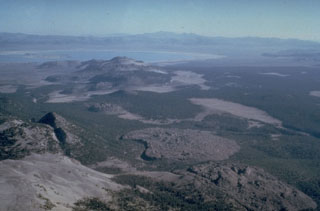 The Mono Craters volcanic field south of Mono Lake at the upper left, is a 17-km-long arcuate chain of rhyolitic lava domes and thick, viscous lava flows. Mono Craters has been frequently active throughout the Holocene, along with the Inyo Craters chain to the south. The Inyo Craters chain, which includes the Wilson Butte, Obsidian and Glass Creek domes, which are oriented diagonally along a N-S line from the left center to lower right of the photo. The latest eruptions of Mono Craters and Inyo Craters occurred nearly simultaneously around 600 years ago.
Photo by Roy Bailey, 1980 (U.S. Geological Survey).
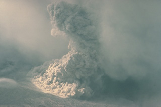 Near the end of the 1986 eruption, during August 19-31, summit lava dome growth was renewed and pyroclastic flows were again produced by collapse of the dome. This August 28 photo shows a pyroclastic flow descending the north flank of Augustine out of a cloud bank that obscures the summit. These pyroclastic flows were smaller than those earlier in the 1986 eruption, which had reached the north coast of the island.
Copyrighted photo by Katia and Maurice Krafft, 1986.
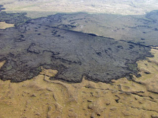 The dramatic Kings Bowl rift cutting diagonally across the top of the photo produced a small 6-sq-km lava field about 2250 years ago immediately north of the much larger Wapi lava field. Kings Bowl itself is the small elongated crater on the right-center side of the rift in this photo; it formed during a phreatic explosion that deposited lighter-colored tephra to the east (upper right). The massive Wapi lava field, located out of view south (right) of Kings Bowl, covers an area of about 325 km2 and originated from Pillar Butte, a small shield volcano.
 Photo by Susan Sakimoto (NASA, courtesy of Scott Hughes, Idaho State University).
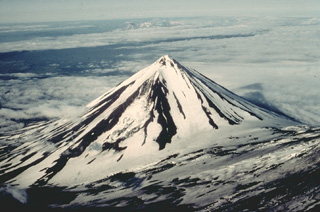 Pavlof Sister is a symmetrical stratovolcano that forms a twin volcano with Pavlof volcano, whose lower flank forms the slope at the lower right in this view from the SW. Despite its youthful profile, Pavlof Sister has had only one historical eruption, which began in 1762. Glacial dissection has produced a series of parasol-ribbed ridges that radiate from the 2142-m, sharp-peaked summit.
 Copyrighted photo by Katia and Maurice Krafft, 1978.
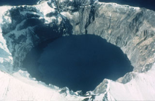 A 750-m-wide crater filled with a lake truncates the summit of Kasatochi. Crater walls rise to a maximum height of 314 m above the lake surface, which is less than 60 m above sea level in this 1961 photo. The volcano is located at the northern end of a shallow submarine ridge trending perpendicular to the Aleutian arc and occupies an island volcano 2.7 x 3.3 km wide.
 Photo by Dan Rogers, 1961 (courtesy of Alaska Volcano Observatory, U.S. Geological Survey).
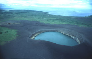 This lake-filled maar and another small crater (left) are the Ukinrek Maars, which formed during an eruption in 1977 in a lowland area of the Alaska Peninsula west of the main volcanic chain. The contact between lighter and darker material in the walls of the lake-filled eastern maar marks the original pre-eruption surface, which is now buried by a dark apron of ejecta produced during the eruption.
Photo by Christina Neal, 1993 (Alaska Volcano Observatory, U.S. Geological Survey).
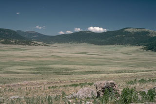 The 22-km-wide Valles caldera in northern New Mexico was formed during a series of major eruptions ending with the eruption of the Bandelier Tuff about 1 million years ago. Post-caldera uplift formed a large resurgent dome in the center of the caldera. The latest eruptions occurred about 130,000 years ago, but geothermal activity continues. This view from the caldera moat shows the rim of the 1.45 million-year-old Toledo embayment to the north, with the edge of the Cerro del Medio rhyolitic lava dome at the extreme left.
Photo by Lee Siebert, 1989 (Smithsonian Institution).
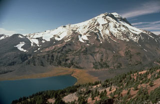 South Sister is the highest of the Three Sisters volcanoes and is seen here above Green Lake from the west flank of Broken Top volcano. The bare slope to the far-left is the Newberry lava flow, the northernmost of a series of SE-flank obsidian domes and flows.
Photo by Lyn Topinka, 1985 (U.S. Geological Survey).
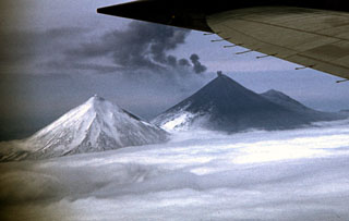 A small ash plume rises from the summit crater of Pavlof volcano on 28 May 1960 as the detached plume from an earlier explosion drifts away to the east. Ash deposits are visible on the flanks in this view from the north. Mild ash eruptions took place from about 1960 to 1963, especially during July 1962 to June 1963. The peak to the left is Pavlof Sister, and Little Pavlof forms the smaller peak to the right of Pavlof.
Photo by Ken Morin, 1960 (courtesy of Bill Rose, Michigan Technological University).
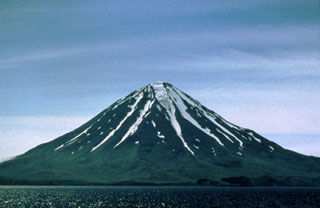 Carlisle rises above the Carlisle Pass strait across from Mount Cleveland. Several poorly documented eruptions have been recorded since the 18th century. Carlisle is one of group of volcanoes in the "Islands of Four Mountains" area of the central Aleutians.
Photo by Michelle Harbin, 1994 (courtesy of U.S. Geological Survey, Alaska Volcano Observatory).
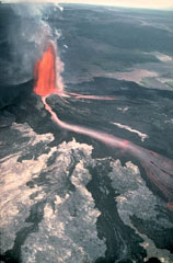 This tall lava fountain erupted from Pu‘u ‘Ō‘ō vent at Kīlauea on 30 June 1984, producing incandescent lava flows. An eruption on the East Rift Zone began on 3 January 1983, and with short interruptions remained active through to September 2018. Eruptions initially occurred in the Pu‘u ‘Ō‘ō area, but activity shifted to various locations on the East Rift Zone, including the Kūpaianaha vent 3 km farther down the rift. An extensive lava flow field formed between the east rift and the coast.
Photo by J.D. Griggs, 1984 (U.S. Geological Survey).
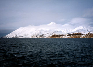 Tanaga is seen here from the SW with Cape Sajaka to the far left. The peak above the clouds is Tanaga, and Sajaka is to the left. Most Holocene eruptions originated from the central peak, which consists of two large cones constructed within a caldera with the 400-m-high rim to the SE.
Photo by Steve Ebbert (U.S. Fish and Wildlife Service).
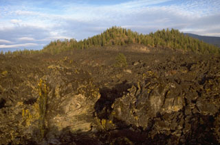 The northernmost of the three Davis Lake lava flows, each associated with a scoria cone, originated from the forested cone in the background. The lava flow spread across a broad area, creating a natural barrier that formed Davis Lake about 5,050-5,600 years ago.
Photo by Lee Siebert, 1995 (Smithsonian Institution).
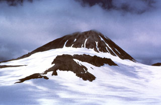 The SE side of a Holocene dome at Kialagvik rises 350 m above a surrounding glacier. It lies at the NE end of a segment of the Alaska Peninsula that includes neighboring Chiginagak and Yantarni volcanoes. Lava flows and overlying block-and-ash-flow deposits are exposed on the SW flank and in a small area on the NE flank.
Photo courtesy U.S. Geological Survey, Alaska Volcano Observatory.
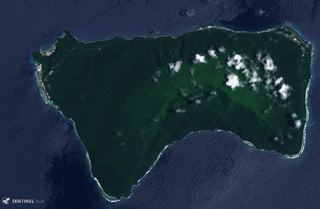 Ta’u Island in eastern American Samoa is the exposed portion of the Lata shield volcano, seen in this 29 October 2019 Sentinel-2 satellite image (N is at the top; this image is approximately 13 km across). Smaller cones and craters have formed across the flanks, and a major flank collapse event around 22 ka resulted in the steep scarps on the southern side of the island.
Satellite image courtesy of Copernicus Sentinel Data, 2018.
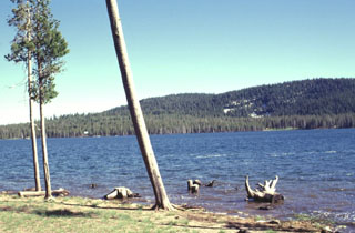 Medicine Lake, a popular camping and recreation destination in northern California, is a small 2-km-long lake that occupies the SW side of Medicine Lake caldera. The forested southern rim of the 7 x 11 km caldera forms the horizon. Medicine Lake volcano is known for its young obsidian flows within the caldera and on its flanks.
Photo by Lee Siebert, 1988 (Smithsonian Institution).
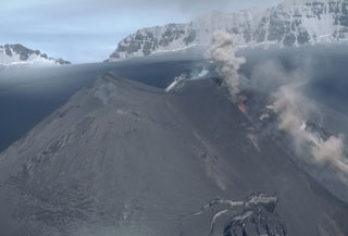 Ash and incandescent lava fragments rise above a fissure on a scoria cone at the summit of Veniaminof on 13 July 1983. The eruptions began on 2 June and covered the cone and much of the caldera floor with ash. Note the ash-covered glacial crevasses on the flanks of the cone to the lower right. The rim of the 8 x 11 km caldera appears in the distance to the NE.
Photo by Betsy Yount, 1983 (Alaska Volcano Observatory, U.S. Geological Survey).
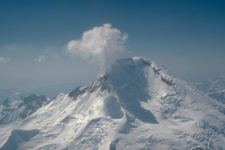 The north face of Iliamna, one of the Cook Inlet volcanoes monitored by the Alaska Volcano Observatory, is seen in this 6 May 1986 aerial view. Steam and volcanic gases rise from the near-continuously active fumaroles high on the eastern and southern flanks.
Photo by Game McGimsey, 1986 (U.S. Geological Survey, Alaska Volcano Observatory).
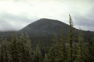 Nash Crater scoria cone, seen here from Little Nash Crater to the NW, is part of a line of cones that diverges to the NNW from Sand Mountain. Lava flows from Nash Crater were emplaced about 3,850 years ago and traveled to the west where they blocked a stream drainage, forming Fish Lake.
Photo by Lee Siebert, 1995 (Smithsonian Institution).
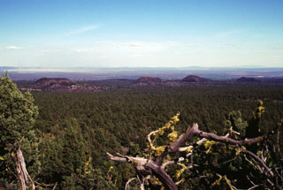 Craters of the aptly named Four Craters Lava Field are seen here from the NW on Green Mountain. The Four Craters field is the SE-most of a group of three lava fields SE of Newberry volcano in the High Lava Plains of central Oregon. Four pyroclastic cones were constructed along a roughly 4-km-long NW-SE-trending line. The age of the Four Craters lava field is not known precisely but could be latest Pleistocene or early Holocene.
 Photo by Lee Siebert, 2000 (Smithsonian Institution).
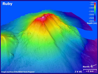 Ruby submarine volcano in the southern Mariana arc is seen in this bathymetric data looking from the NW with 2x vertical exaggeration. Depths in this image range from 184 to 2,955 m, and it rises to within 230 m of the ocean surface NW of Saipan. There was an eruption detected in 1966 by sonar signals. In 1995 submarine explosions were heard, accompanied by a fish kill, sulfurous odors, bubbling water, and the detection of volcanic tremor.
Image courtesy of Susan Merle (Oregon State University/NOAA Vents Program).
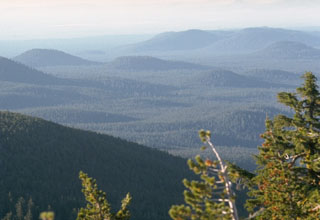 As many as 400 scoria cones that dot the flanks of the massive 30 x 60 km wide Newberry shield volcano in Oregon are seen in this view from Paulina Peak on the south rim of Newberry caldera. The scoria cones at Newberry are most abundant on the north and south flanks. Many are of Pleistocene age, but cones along a rift on the NW flank and some on the south flank have erupted during the Holocene.
Photo by Lee Siebert, 1972 (Smithsonian Institution).
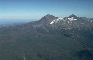 An aerial view from the NW shows North Sister (center) and Middle Sister (right) with young lava flows from N-flank scoria cones. The latest dated lava flow originated about 1,600 years ago from Collier Cone, near the center of the photo below the left flank of North Sister. One lava flow lobe traveled to the NW and levees on the western lobe are visible in the right foreground. They western lobe traveled 13.5 km down the White Branch Creek valley.
Photo by Dan Miller, 1977 (U.S. Geological Survey).
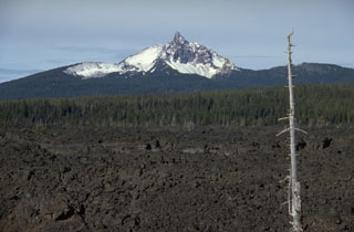 The dramatic summit pinnacle of Mount Washington is a central lava plug that caps a shield volcano. Mount Washington has been extensively dissected by glacial erosion, revealing the inner structure of the volcano. Fresh lava flows from cinder cones near North Sister volcano appear in the foreground of this view from the SE.
Photo by Lee Siebert, 1995 (Smithsonian Institution).
 Mount Adams (lower right) and Mount Rainier are the two southernmost of a N-S-trending chain of large stratovolcanoes in the Cascade Range of Washington state. Adams Glacier can be seen descending to the SE from the summit icecap of Mount Adams in this aerial view from the south. The 1,250 km2 Mount Adams volcanic field contains numerous flank cones and lava flows, several of which erupted during the Holocene. Mount Rainier, Washington's highest peak, has been less active during the Holocene, but erupted during the 19th century.
Photo by Lee Siebert, 1980 (Smithsonian Institution).
 The summit caldera rim of Yunaska is seen from an older volcanic center on the western side of the island. The younger eastern complex contains two nested calderas. A young lava flow to the far right descended through a notch in the caldera rim. The peaks in the background are (left-to-right) of Carlisle, Cleveland, and Herbert volcanoes.
Photo by Jim Meyers, 1992 (University of Wyoming, courtesy of Alaska Volcano Observatory).
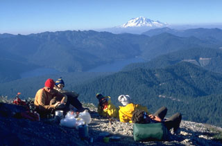 A climbing party rests on the lower N flank of Mount St. Helens in 1979, overlooking Spirit Lake and Mount Rainier. The old growth forests surrounding Spirit Lake were destroyed by the lateral blast on May 18, 1980, which covered a 600 km2 area on the north side of the volcano. Much of the area around the lake consisted of forests unaffected by logging operations prior to the 1980 eruption. Spirit Lake Lodge, owned by Harry Truman, was located W of the SW tip of the lake to the left.
Photo by Lee Siebert, 1979 (Smithsonian Institution).
 The two dark horizontal bands in the cliff on the left near Tower Junction in NE Yellowstone are lava flows that display prominent columnar jointing. The base of the cliff exposes volcanic materials of the Absaroka Formation. The light-colored rocks between the basaltic lava flows are stream-gravel sediments. The top of the hill consists of lake sediments.
Photo by Dan Dzurisin, 1983 (U.S. Geological Survey).
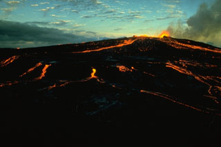 Pahoehoe lava flows on Kīlauea are fed from low lava fountains in June 1974, near the end of the major 1969-74 Mauna Ulu eruption. This final stage of the eruption ended on 22 July 1974 after producing a lava lake, lava fountains up to 80 m high, and lava flows.
Photo by Robin Holcomb, 1974 (U.S. Geological Survey).
 Red Cones, two closely spaced basaltic cinder cones SW of Mammoth Mountain, near Devils Postpile National Monument, are youthful unglaciated cones that were erupted about 8900 years ago. The two breached cones fed lava flows that joined to form a flow 2 km long and 2 km wide. The southern cone is seen here from the flanks of the northern cone. The reddish oxidized scoria of both cones is mantled by light-colored pumice erupted from the Inyo Craters about 650 years ago, visible here at the base of the northern cone.
Photo by Lee Siebert, 1998 (Smithsonian Institution)
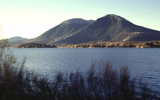 Mount Konocti, a composite dacitic volcano, rises above the southern shore of Clear Lake. The arcuate escarpment facing the lake on the the NW-most peak, Buckingham Peak (right), is a landslide scarp produced when part of the dome collapsed. A series of maars cuts the southern shore of Clear Lake, giving it a scalloped shoreline. Clear Lake itself, the largest natural freshwater lake entirely within California, is an elongated, irregular body of water more than 30 km long. It has a volcano-tectonic origin.
Photo by Lee Siebert, 1997 (Smithsonian Institution).
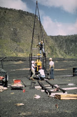 A Hawaiian Volcano Observatory team uses a drilling rig to extract drill core from the cooling lava lake in Kīlauea Iki crater. At the time of this 1968 project, nearly a decade after a lava lake filled Kīlauea Iki during the 1959 eruption, the crust had solidified to a depth of about 30 m. The drill core penetrated to 60 m depth without reaching the bottom of the still partially molten lava lake. This project, the first to use a drill rig to sample a lava lake, allowed study of vertical variations in chemistry, mineralogy, and temperature within a cooling lava lake.
Photo by Jean Tobin, 1968.
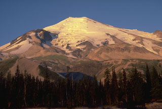 Four lava domes are visible in this 1979 photo from Timberline parking lot on the N flank of Mount St. Helens. In addition to the glacier-covered summit lava dome, the Dogs Head lava dome is the prominent mound on the left skyline, the Sugar Bowl lava dome is the flat mound below the glaciers to the right, and the 19th-century Goat Rocks dome (removed by the 1980 eruption) is to the far right.
Photo by Lee Siebert, 1979 (Smithsonian Institution).
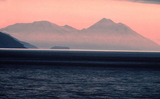 Takawangha volcano (left), seen here from the E, has an ice-filled caldera on northern Tanaga Island. Numerous small cones are located within the caldera, as well as on the rim and flanks. Tanaga volcano is to the right.
Photo by Tom Edgarton, 1986 (U.S. Fish and Wildlife Service).
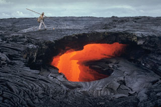 Lava flows are commonly fed through tubes beneath the crusted-over surface of the flow. The ceilings of lava tubes frequently collapse, producing skylights, through which the flowing lava is visible. This 21 October 1970 photo of a lava flow from Mauna Ulu at Hawaii's Kīlauea volcano shows several ledges within the lava tube that mark previous levels of flow. The walls and roofs of lava tubes are efficient thermal insulators that allow the lava to travel long distances without solidifying. Some tubes formed during the Mauna Ulu eruption were 11 km long.
Photo by Jeffrey Judd, 1970 (U.S. Geological Survey).
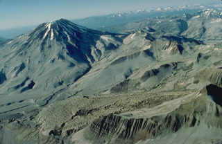 Mount Griggs is the prominent stratovolcano at the upper left in this aerial view from the SW. The slopes of the volcano are heavily mantled with ash from the 1912 eruption of Novarupta volcano. The 1912 pyroclastic-fall deposits also mantle the irregular surface of Knife Creek Glacier, which flows from right to left behind the ridge in the lower right foreground.
Copyrighted photo by Katia and Maurice Krafft, 1978.
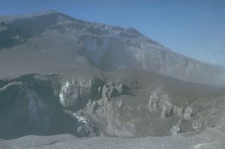 This 30 March 1980 photograph shows two new summit craters formed by phreatic eruptions at Mount St. Helens beginning on 27 March. Continued explosions soon merged the craters into a single crater 300 x 500 m wide and up to 250 m deep.
Photo by Don Swanson, 1980 (U.S. Geological Survey).
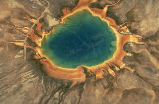 Grand Prismatic Spring, the largest of the geothermal pools in Yellowstone National Park, is 90 m across. The hot pool lies at the top of a broad, low mound formed by deposition of silica at its margins. Overflow channels radiate away from the pool. The colorful rings around the hot-spring pool are formed by algae and other organisms that are temperature dependent. The highest temperature organisms (70-73 degrees Centigrade) are white. Lower-temperature organisms grade to light yellow, orange, red, and then dark green.
Copyrighted photo by Katia and Maurice Krafft, 1984.
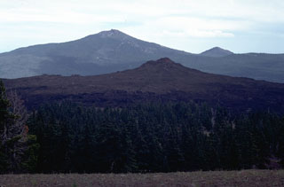 Little Belknap shield volcano, seen here from the side of Belknap on the west with Black Crater in the background, formed about 2,900 years ago. Lava flows from Little Belknap, buttressed against the higher Belknap volcano on the west, spread primarily to the east.
Photo by Lee Siebert, 1982 (Smithsonian Institution).
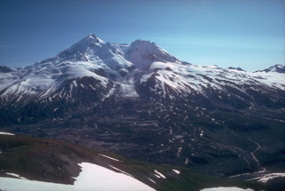 Redoubt is one of the most active volcanoes of the upper Cook Inlet region, viewed here from the north in 1980. Drift glacier flows from the summit into the Drift River valley. Thick lava flows partly form the summit and Holocene lahars have filled the Drift River valley to the NE and Crescent River valley to the SE.
Photo by Allison Till, 1980 (Alaska Volcano Observatory, U.S. Geological Survey).
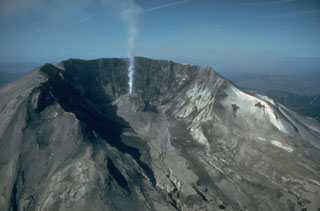 The large, horseshoe-shaped crater left by the collapse of Mount St. Helens on 18 May 1980, is typical of scarps created by massive volcanic landslides. The collapse removed nearly 1 km of the summit, leaving a 2 x 3.5 km crater open to the north. This June 1982 view shows a lava dome that began growing within the new crater.
Photo by Steve Brantley, 1982 (U.S. Geological Survey).
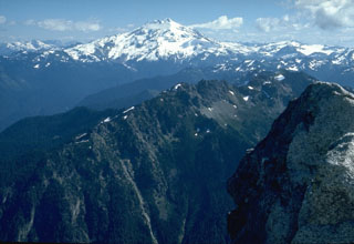 Glacier Peak, seen here from the summit of Mt. Pugh to the west, is located in the Glacier Peak Wilderness Area. It has produced voluminous eruptions that deposited thick pyroclastic flow and lahar deposits that blocked drainages, diverting the courses of the Suiattle and Swauk rivers northward into the Skagit River valley.
Photo by Lee Siebert, 1972 (Smithsonian Institution).
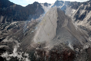 Moderate explosive eruptions beginning in October 2004 at Mount St. Helens were followed by the extrusion of a lava dome. This 21 June 2005 view from the NW shows the new dome with the 1980 crater wall in the background. The smooth-surfaced part of the dome, known informally as the Whaleback, formed by slow extrusion of viscous lava. The rougher surface to the right formed when portions of the dome collapsed, forming a talus slope. The crevassed, ash-covered surface of an uplifted glacier is visible to the left.
Photo courtesy of U.S. Geological Survey, Cascades Volcano Observatory.
 The dark-colored Santa Clara lava flow cutting diagonally across the photo to the left poured over cliffs of the Navajo Sandstone in lava cascades up to 120 m high. Several lava cascades occurred around sandstone islands in Snow Canyon State Park. The colorful Navajo cliffs display a transition between underlying reddish oxidized and overlying whitish unoxidized rocks.
Photo by Lee Siebert, 1996 (Smithsonian Institution).
 This roughly 50-cm-long volcanic bomb, erupted from Westdahl volcano in the Aleutians, is known as a spindle bomb. Molten masses of magma that are blown out of the crater commonly become aerodynamically rounded into a spindle shape as they are hurled through the air. Some bombs are still partially molten and become deformed when they impact onto the ground.
Copyrighted photo by Katia and Maurice Krafft, 1978.
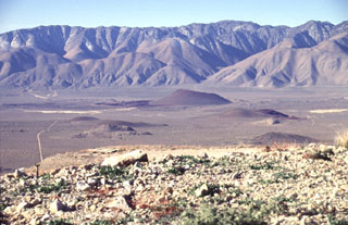 Red Cone (center) is the largest of a group of isolated basaltic scoria cones and lava flows on the floor of the Rose Valley in the western part of the Coso volcanic field. The late-Pleistocene scoria cone is seen here from the NE, with the towering fault scarp of the Sierra Nevada Range in the background. Highway 395 traverses Rose Valley between the cone and the Sierras.
 Photo by Lee Siebert, 1997 (Smithsonian Institution).
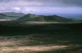 Crater Hill, on the western side of St. Paul Island, is one of many cones on the 110 km2 island. The complex crater is 200 m deep and has several smaller cones within it, as well as a 50-m-thick lava flow.
 Photo by Art Sowls, 1988 (U.S. Fish and Wildlife Service).
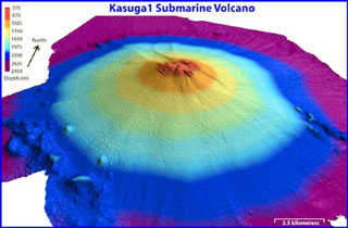 Kasuga, the northernmost of three seamounts in the Kasuga seamount chain (and also known as Kasuga 1), rises to within about 600 m of the sea surface SE of Fukujin submarine volcano. A series of flank vents are located low on the southern side of the edifice. Pumice from a submarine eruption was witnessed in 1959.
Image courtesy of NOAA, 2003 (http://oceanexplorer.noaa.gov/explorations/03fire/logs/mar02/media/kasuga.html).
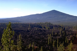 The middle of three andesite lava flows that erupted from three vents near Davis Lake has been radiocarbon dated at 5,050-5,600 years. The Pleistocene Odell Butte shield volcano is in the background, and the southernmost of the three lava flows can be seen in the distance below its left flank.
Photo by Lee Siebert, 1995 (Smithsonian Institution).
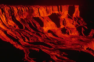 A cascade of lava flows down the walls of Alae crater on 5 August 1969. During the course of the 1969-1974 Mauna Ulu eruption lava entirely filled both Alae and nearby Aloi craters. Lava flows from this eruption traveled 12 km to the sea.
Photo by Jeffrey Judd, 1969 (U.S. Geological Survey).
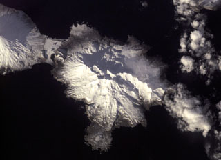 The Tana volcanic complex in the center of this NASA International Space Station image forms the eastern half of Chuginadak Island, across from Cleveland visible to the upper left. A young cone and crater form the western summit.
NASA International Space Station image ISS001-E-5957, 2001 (http://eol.jsc.nasa.gov/).
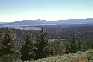 Forest-covered Brockman Flat, formed by lava flows from a chain of cinder cones in the Eagle Lake volcanic field, extends into Eagle Lake. The cinder cones, out of view to the right, were formed along N-S-trending faults within the Eagle Lake volcano-tectonic depression, whose SE margin forms the peaks beyond Eagle Lake. The flows from the depression represent the southernmost late-Quaternary magmatism associated with backarc spreading in the NW Great Basin.
Photo by Lee Siebert, 1998 (Smithsonian Institution).
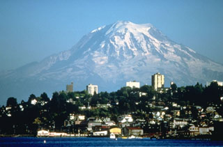 Mount Rainier, the highest peak in the Cascade Range, towers above the city of Tacoma and forms a prominent landmark seen from much of central Washington. Periodic collapse of the volcano during the past ten thousand years has produced debris avalanches and lahars that have reached the Puget Sound at the present locations of the cities of Tacoma and Seattle.
Photo by Lyn Topinka (U.S. Geological Survey).
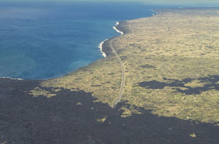 The Laeapuki lava flow on Kīlauea overran the coastal highway in April 1993, barely missing the Laeapuki ruins between the highway and the coast. After this June 1994 photo looking SW along the coast, lava flows overran the ruins. Lava flows from the East Rift Zone eruption that began in 1983 first reached the coast in 1986. By 1995 the flows had created 11 km of new coastline.
Photo by Paul Kimberly, 1994 (Smithsonian Institution).
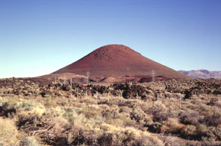 Red Cone, a basaltic cinder cone at the western margin of the Coso volcanic field, is a prominent landmark visible from Highway 395, which follows the eastern margin of the Sierra Nevada Range. The late-Pleistocene cinder cone is the largest of a group of isolated cones along the valley floor. An area of more concentrated young basaltic cones and lava flows occurs to the SE along the crest of the volcanic horst forming the Coso Range.
Photo by Paul Kimberly, 1997 (Smithsonian Institution).
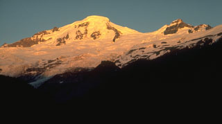 Mount Baker is seen here from the Glacier Creek valley on the NW side. Coleman Glacier is in the right-center of the photo with Coleman Saddle located between the summit and Colfax Peak on the right. The active Sherman Crater is on the opposite SE side of the summit.
Photo by Lee Siebert, 1972 (Smithsonian Institution).
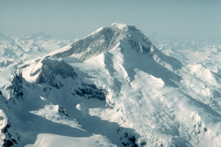 Iliamna volcano, seen here from the SE, is an ice-clad stratovolcano that has been extensively eroded by glaciers. Four peaks occur along a 5-km-long, N-S-trending summit ridge, ending with North Twin and South Twin peaks at the left center. No major Holocene tephras have been identified from Iliamna. Many reports of historical eruptions have mistaken powerful episodes of steam emission from fumaroles high on the south and east flanks.
Copyrighted photo by Katia and Maurice Krafft, 1986.
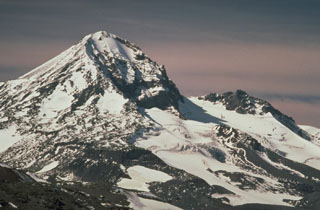 Middle Sister volcano, viewed from the west flank of Broken Top to the SE, has a smoother profile than North Sister volcano to the right but also shows evidence of glacial erosion on its eastern flank, exposing part of the dacitic lava dome that formed its central plug.
Photo by Lyn Topinka, 1985 (U.S. Geological Survey).
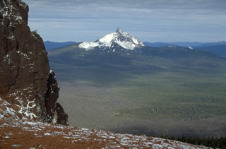 Mount Washington, seen here from Black Butte to the SE, is an eroded Pleistocene shield volcano capped by a steep central lava plug. NE flank spatter cones were active about 1300 years ago. Fresh lava flows in the foreground of this photo originated from Belknap volcano and cinder cones near North Sister volcano.
Photo by Lee Siebert, 1995 (Smithsonian Institution).
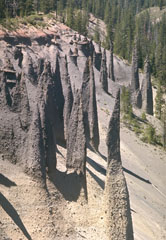 Erosion of the large pyroclastic flow deposit emplaced during the caldera-forming eruption of Crater Lake has exposed these pinnacles. The more resistant spires formed when the deposit was releasing hot gases after emplacement, forming fumarole pathways that cemented the grains together. The change in color of the deposit marks a change in the chemistry of the erupted rocks. The lighter-colored basal rhyodacite is overlain by gray (iron-and magnesium-rich) andesite.
Photo by Lee Siebert, 1972 (Smithsonian Institution).
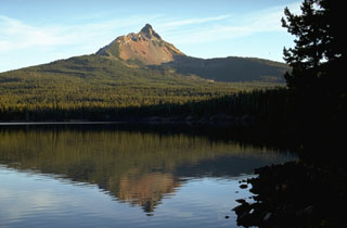 Mount Washington, reflected here in Big Lake on its NW side, is a Pleistocene shield volcano deeply dissected by glaciers. Erosion has exposed many dikes in the summit cone, which has not erupted since the late Pleistocene. Vents on the NE flank, behind the ridge on the left, erupted about 1300 years ago, probably as part of a a fissure-fed eruption at Blue Lake Crater.
Photo by Lee Siebert, 1995 (Smithsonian Institution).
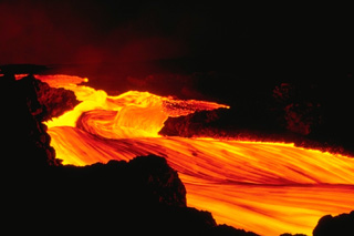 A stream of incandescent lava rapidly flows down the NE rift zone of Hawaii's Mauna Loa volcano during the early morning hours of an eruption that began on March 25, 1984. The eruptive fissures, which initially opened within the summit caldera and on the SW rift zone, then rapidly migrated across the summit caldera. Thereafter, activity was concentrated along the NE rift zone.
Copyrighted photo by Katia and Maurice Krafft, 1984.
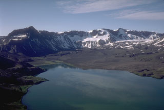 This view looks south across the caldera from the north rim of Aniakchak. The prominent dark peak on the skyline (left) is Black Nose, a remnant of pre-caldera volcaniclastics. A pumice-covered glacier and associated moraine is in the distance against the caldera wall. Surprise Lake once covered a much larger part of the caldera floor before catastrophically draining through a notch in the east caldera rim.
Photo by Tom Miller, 1985 (Alaska Volcano Observatory, U.S. Geological Survey).
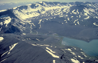 The 10-km-wide Aniakchak caldera is one of the most dramatic volcanoes on the Alaska Peninsula. It was formed about 3400 years ago during an eruption in which voluminous pyroclastic flows reached the Bering Sea, 80 km away. This view from the NE shows the largest post-caldera volcano, Vent Mountain (upper right) and Surprise Lake (lower right), which drains through The Gates (left center), a steep-walled notch in the 1-km-high eastern caldera rim. The only historical eruption of Aniakchak took place in 1931.
Copyrighted photo by Katia and Maurice Krafft, 1978.
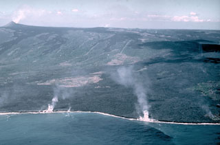 Laze (a plume of hydrochloric acid, steam, and fine glass particles) rises along the Puna coast where lava flows enter the sea in this 28 December 1987 photo. The flows originated from a fissure along Kīlauea's East Rift Zone from the Pu‘u ‘Ō‘ō scoria cone (upper left) to the Kūpaianaha lava lake (small gas plume in the center of the horizon). Lava flows traveled 10 km to the coast and inundated several subdivisions and villages.
Photo by J.D. Griggs, 1987 (U.S. Geological Survey).
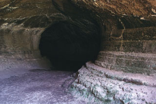 Lava Beds National Monument contains nearly 300 lava-tube caves associated with fluid basaltic lava flows on the flanks of Medicine Lake volcano in northern California. The sides of this large lava tube, known as Valentine Cave, show the pronounced "bathtub rings" left by lava flowing through the tube. Valentine Cave is an example of a lava tube from which lava almost completely drained. The Valentine lava flow was erupted about 10,850 radiocarbon years ago, and is one of the largest flows on the northern flank of Medicine Lake caldera.
Photo by Lee Siebert, 1998 (Smithsonian Institution).
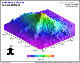 This view of Vailulu'u seamount to the NW displays three major rifts toward the W, SE, and W. The lower slopes of Vailulu'u and Ta'u merge along the W ridge, with a saddle at 3,200 m and a diameter of ~35 km at its base. An earthquake swarm in 1995 may have been related to an eruption at Vailulu'u, which was not discovered until 1975. It rises 4,200 m from the sea floor to a depth of about 600 m between Ta'u and Rose islands at the eastern end of the American Samoas.
Image by Hart and others (Global Volcanism Network Bulletin, 2001).
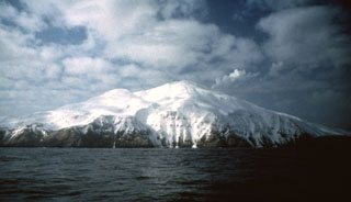 A steam plume rises from the summit of Kiska, one of the westernmost historically active volcanoes of the Aleutian Arc. Three sides of the volcano, including the northern side seen here, are bounded by steep cliffs up to 450 m high. A scoria cone on the flank formed in 1962 at the northern coast.
Photo by E.V. Kleff, 1985 (U.S. Fish & Wildlife Service, courtesy of Alaska Volcano Observatory).
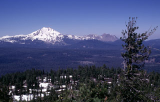 Snow-capped Lassen Peak is seen here from the summit of Prospect Peak shield volcano at the NE end of Lassen Volcanic National Park. The unvegetated, largely snow-free peaks on the right horizon are the Chaos Crags, a complex of dacitic lava domes last active about 1100 years ago. The Twin Lakes sequence of andesitic lava shields and cones forms the lake-studded area of the Central Plateau in the center of the photo.
Photo by Lee Siebert, 1998 (Smithsonian Institution).
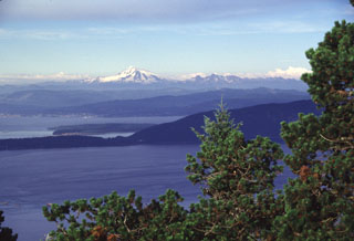 Mount Baker forms a prominent landmark visible throughout much of the northern Puget Sound region. Its glaciated slopes rise above Bellingham Bay, as seen here from Mount Constitution on Orcas Island. Lummi Island, another of the San Juan Islands, forms the ridge extending across the center of the photo. The Twin Sisters massif, composed of olivine-rich ultramafic rocks derived from the Earth's mantle, is located immediately SW (right) of Mount Baker.
Photo by Lee Siebert, 1998 (Smithsonian Institution).
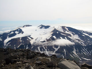 Takawangha is seen here looking E from the summit of East Tanaga. It lies across a saddle from historically active Tanaga volcano to the west. The summit has five Holocene craters that produced explosive eruptions and lava flows that reached the lower flanks during the last few thousand years.
 Photo by Michelle Coombs, 2003 (Alaska Volcano Observatory, U.S. Geological Survey).
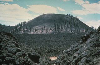 Medicine Lake Volcano's summit caldera is seen here from the east rim, with Mount Shasta in the background. The 7 x 12 km caldera, the source of Medicine Lakes largest eruption, (~180 ka) is partially filled by Medicine Lake, Medicine Lake Glass Flow (on the right) that erupted ~5,200 years ago, and the older Lake Basalt flow (~89 ka; in the foreground). During the Holocene several obsidian flows have erupted inside and along the rim of the caldera with large pumice deposits, and voluminous basalts have erupted on the flanks.
 Photo by Peter Lipman, 1981 (U.S. Geological Survey).
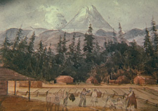 In 1845 the British Lieutenant Henry Warre sketched an eruption of Mount St. Helens from the west. The eruption plume is correctly shown originating from the N flank. The volcano was frequently observed in eruption from November 1842 until September 1845. Goat Rocks lava dome on the N flank was active at this time.
Sketch by Henry Warre.
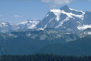 The flat-topped ridge in the center of this photo is Table Mountain, seen here from Skyline Divide. Table Mountain is a stack of andesitic lava flows, each about 100 m thick, that erupted from vents along the northern side of the Pleistocene Kulshan caldera. The buried northern caldera rim lies near the left-hand margin of the lava flows. The spectacular glacier-clad slopes of Mt. Shuksan form the right horizon, and Icy Peak at the head of the North Fork Nooksack drainage lies beyond it on the left-center horizon.
Photo by Lee Siebert, 1979 (Smithsonian Institution).
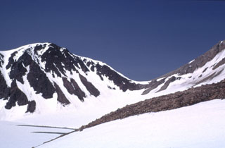 Snow-covered Knutson Lake (lower left) lies within a 1.5 x 2 km wide crater of Mount Dana. Dana is a small volcano consisting of a central dome complex surrounded by a fan of volcaniclastic debris. Lava domes are along the western crater rim and inside the crater east of Knutson Lake. A major eruption about 3,840 radiocarbon years ago produced a block-and-ash flow that filled valleys south and west of the crater.
Photo courtesy of U.S. Geological Survey, Alaska Volcano Observatory, 1973.
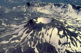 Vent Mountain, a post-caldera volcano that rises 450 m above the caldera floor, is the largest of a variety of volcanic features on the floor of the 10-km-wide caldera. In addition to Vent Mountain, the most prominent post-caldera features are Half Cone, on the NW side and a 1931 vent near the west rim. Lava flows, tuff cones, maars, cinder cones, and lava domes are all found within Aniakchak caldera. This view from the SW shows the east caldera rim, with The Gates, a steep-walled notch in the east rim, at the upper left.
Copyrighted photo by Katia and Maurice Krafft, 1978.
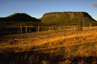 The contrasting morphology of rounded Hayrick Butte on the left and flat-topped Hoodoo Butte on the right, north of Mount Washington in the central Oregon Cascades, reflects dramatic differences in their origin. Hoodoo Butte is a "tuya," a volcanic cone formed by eruptions that ponded in a cavity melted through a glacial ice sheet. Hayrick Butte formed slightly later, when the Pleistocene ice sheet had melted, and formed the classic rounded profile of a scoria cone.
Photo by Lee Siebert, 1995 (Smithsonian Institution).
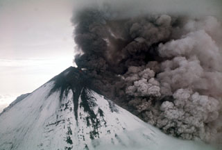 An ash plume rises above the surface of a pyroclastic flow descending the flanks of Pavlof on the Alaska Peninsula in 1975. Incandescent lava can be seen on the upper cone. Intermittent phreatomagmatic to magmatic eruptions began 13 September 1975 and continued until at least March 1977. Possible lava flows or lahars were reported in October 1975 and December 1976.
Photo by U.S. Geological Survey, 1975.
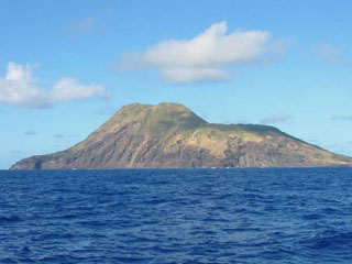 The 3-km-wide Sarigan volcano is seen here from the E during a 2003 NOAA expedition to the Marianas Islands.The cone has a 750-m-wide summit crater that forms the flat area to the right and it contains a small cone. More recent eruptions produced two lava domes from vents on and near the S crater rim, forming the island's high point at the left part of the summit. Holocene lava flows from the dome complex formed the peninsula to the far left.
Image courtesy of NOAA, 2003 (http://oceanexplorer.noaa.gov/explorations/03fire/).
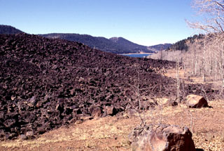 A group of basaltic cinder cones and lava vents on the Markagunt Plateau east of Cedar Breaks National Monument has produced youthful, sparsely vegetated lava flows. Several lines of NE-SW-trending cinder cones are present within the volcanic field, with the youngest flows occurring near Panguitch Lake on the north and Navajo Lake on the south. Navajo Lake (upper right) formed when a thick, blocky flow from a nearby vent dammed Duck Creek. The oldest trees on the youngest flows are about 900 years old.
Photo by Lee Siebert, 1996 (Smithsonian Institution)
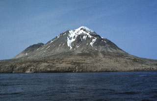 The southern half of 5 x 10 km Kagamil Island in the NE part of the "Islands of Four Mountains" group contains two postglacial cones with small summit craters. The larger cone (center) is seen here from the SW and is located at the SE end. Hot springs and fumaroles occur near the SE coast.
 Photo by G. Vernon Byrd, 1972 (U.S. Fish and Wildlife Service, courtesy of Alaska Volcano Observatory).
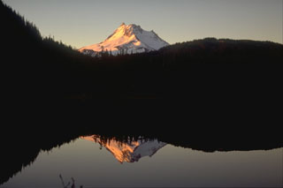 Mount Jefferson rises above Breitenbush Lake to the north. The glacially eroded volcano has not erupted since the late Pleistocene, although flank vents to the south that are not associated with the main edifice have been active since 7,700 years ago.
Photo by Lee Siebert, 1995 (Smithsonian Institution).
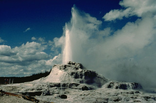 Castle Geyser in Yellowstone's Upper Geyser Basin erupts from a 4-m-high, 12-m-wide sinter mound. Eruptions of Castle Geyser are typically sustained for an hour or more.
Copyrighted photo by Katia and Maurice Krafft, 1984.
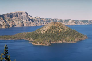 Wizard Island is a scoria cone in Crater Lake caldera, which formed about 7,700 years ago. A lava flow from a vent on its NW flank forms the peninsula to the left. Llao Rock, a massive lava flow that forms the peak on the caldera rim, was erupted about 100-200 years prior to formation of Crater Lake caldera.
Photo by Dave Wieprecht, 1995 (U.S. Geological Survey).
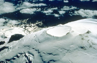 Two overlapping craters at the summit of Mount Rainier are viewed here from the NE in 1995. They are both about 400 m across and represent more recent activity after the collapse 5,600 years ago. Thermal activity formed a series of fumaroles and ice caves within the icecap filling the summit craters.
Photo by Dave Wieprecht, 1995 (U.S. Geological Survey).
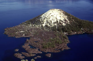 The Wizard Island cone formed while the lake was still filling the Crater Lake caldera. The cone grew near the western structural margin of the caldera on top of a broader central platform of lava flows, and the visible portion represents about 2% of post-caldera eruptive products, the rest of which are below the lake surface.
Photo by Lee Siebert, 1997 (Smithsonian Institution).
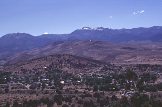 The Steamboat Hills in the center of the photo is an area of geothermal development in the Steamboat Springs volcanic field of western Nevada. The small light spot just right of the summit of the central hill is a steam plume from a geothermal well. Steamboat Springs lies in a structural trough in the eastern Sierra Nevada between the Virginia Range on the east and the western Carson Range in the background of the photo.
Photo by Lee Siebert, 1998 (Smithsonian Institution)
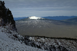 The McKenzie Pass area in the central Oregon Cascades contains one of the largest concentrations of recent volcanism in the United States. Belknap shield volcano, seen here from Black Crater to the SE, is capped by a smaller snow-covered cone. Lava flows from Belknap and the smaller Little Belknap shield volcano in front of it cover nearly 100 km2. Most of the largely unvegetated flows were erupted between about 2,900 and 1,500 years ago.
Photo by Lee Siebert, 1995 (Smithsonian Institution).
 Forked Butte scoria cone in the foreground formed about 6,500 years ago south of Mount Jefferson, whose flank appears to the right. A lava flow from the southern base of Forked Butte traveled 8 km to the west down Cabot Creek.
Photo by Dan Miller, 1977 (U.S. Geological Survey).
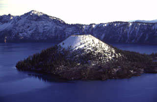 Wizard Island is the only one of three post-caldera cones within the Crater Lake caldera. The symmetrical scoria cone has a 90-m-wide summit crater. It formed several hundred years after the collapse of Mount Mazama about 7,700 years ago along the western structural margin of the caldera. Much of the cone lies beneath the nearly-600-m-deep waters of Crater Lake. A small dome is located on a central platform below the water and east of Wizard Island.
Photo by Lee Siebert, 1997 (Smithsonian Institution).
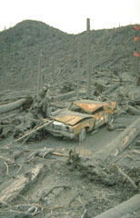 This vehicle was parked near Meta Lake, 13 km NE of Mount St. Helens, within the area affected by the devastating lateral blast of 18 May 1980. Tree blowdown occurred to distances of about 30 km from the volcano. Most of the 57 fatalities caused by the eruption resulted from the lateral blast.
Photo by Terry Leighley, 1980 (U.S. Geological Survey).
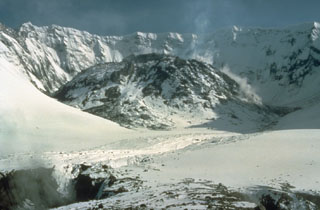 Four years after the powerful 18 May 1980 eruption of Mount St. Helens, a lava dome partially fills the crater. The dome, seen here from the north on 16 May 1984, grew during episodic periods of rapid growth that lasted from 1980 until 1986. By the end of the eruption the dome filled much of the crater floor, reaching a width of 1,100 m and a height of 250 m.
Photo by Lyn Topinka, 1984 (U.S. Geological Survey).
 This January 1968 photo of Halema‘uma‘u crater shows lava fountaining within the partly solidified crust of lava lake, and also overflowing below. This eruption began on 5 November 1967 and lasted until 13 July 1968.
Photo by Richard Fiske, 1968 (Smithsonian Institution).
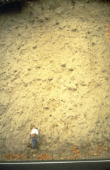 A thick lahar deposit resulted from a 100,000-year-old debris avalanche produced by a collapse of the N side of Mount Hood. It swept down the Hood River valley and traveled across the Columbia River, temporarily damming it to a depth of 30 m. This thick outcrop that contains rounded boulders in a clay-rich matrix, is located N of Underwood, Washington, on the other side of the Columbia River.
Photo by Willie Scott, 1994 (U.S. Geological Survey).
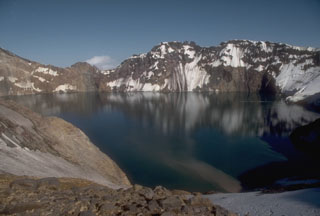 The 3 x 4.5 km Katmai caldera, seen here from its western rim, formed in 1912 by the hydraulic draining of magma away from Katmai to Novarupta 10 km W. Little if any eruptive activity took place at Katmai itself, which prior to collapse was a complex of four small overlapping stratovolcanoes. The 250-m-deep caldera lake covers a small lava dome and tuff ring that erupted on the caldera floor.
Photo by Game McGimsey, 1990 (Alaska Volcano Observatory, U.S. Geological Survey).
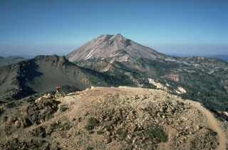 Lassen Peak, seen from Brokeoff volcano to the SW, is one of a series of dacitic lava domes erupted during the past 25,000 years along the northern edge of a caldera on the northern flank of Brokeoff volcano. Lassen Peak is the largest and most recently active of these domes.
Photo by Bill Chadwick, 1981 (U.S. Geological Survey).
 The Ingakslugwat Hills volcanic field covers an area of more than 500 km2 and contains over 32 scoria cones and 8 larger craters, some of which are seen in this Planet Labs June 2019 satellite image monthly mosaic (N is at the top; image is approximately 40 km across).
Satellite image courtesy of Planet Labs Inc., 2019 (https://www.planet.com/).
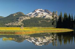 South Sister, reflected in the waters of Sparks Lake, is the highest and youngest of the Three Sisters volcanoes in the central Oregon Cascades. The summit cone of South Sister has not erupted since the late Pleistocene, but the light-colored rocks above the meadow at the left are part of a group of lava flows on the flank that were extruded about 2,000 years ago.
Photo by Dave Wieprecht, 1995 (U.S. Geological Survey).
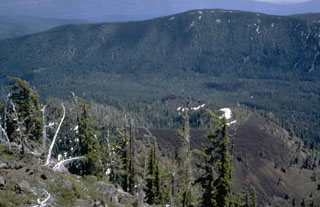 The unnamed scoria cone to the lower right, viewed from Bear Butte to the NW, was the source of a 13-km-long lava flow that traveled to the west down Jefferson Creek in the center of the photo. The lava flow overlies the northern lobe of a 6,500-year-old flow from Forked Butte, another Holocene scoria cone south of Mount Jefferson. The Forked Butte lava flow divided into lobes that traveled on either side of Sugar Pine Ridge in the background.
Photo by Willie Scott, 1972 (U.S. Geological Survey).
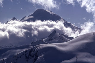 The historically active crater of Mount Baker, seen here from the NE rim of the Pleistocene Kulshan Caldera, lies between the summit and Sherman Peak (left horizon). The snow-mantled slopes in the foreground are located within Kulshan Caldera, which remained undiscovered until the 1990s because associated pyroclastic flow and ashfall deposits outside the caldera had been removed by Pleistocene glaciers. Coleman Pinnacle (center) is a remnant of a post-caldera fissure-fed lava flow.
Photo by Lee Siebert, 1974 (Smithsonian Institution).
 Kelsay Point scoria cone, seen here from the SW, is NNE of Diamond Lake. It erupted during or after deglaciation, around 7,780 and 15,000 years ago; the summit crater of is the site of a quarry for road aggregate.
Photo by Lee Siebert, 1997 (Smithsonian Institution).
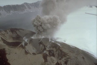 In this 3 August 1993 photo a small ash plume rises from a scoria cone within the Veniaminof caldera. Intermittent explosive eruptions began on 30 July and continued for more than a year. The eruptions also formed a new cone SE of the main western cone. As during the 1983-84 eruption, lava flows erupted onto the ice-covered caldera floor. Ash darkens the left side of the caldera floor in this view, with the caldera wall in the background.
Photo by D. Sellers, 1993 (Alaska Department of Fish and Game).
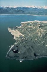 The Mono Lake volcanic field consists of rhyolitic lava domes and flows, phreatic explosion craters, and cinder cones on islands in Mono Lake and on its northern shore. This view shows explosion craters on Paoha Island, with the Mono Craters dome complex and the Sierra Nevada in the distance to the south. The ages of the most recent eruptions of the Mono Lake volcanic field range from about 2000 to about 200 years.
Photo by Dan Dzurisin, 1983 (U.S. Geological Survey).
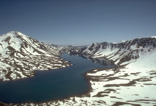 Emmons Lake is a 11 x 18 km caldera and is one of the largest calderas in the Aleutian arc. The caldera formed during two large Quaternary eruptions that produced welded tuffs extending to both the Bering Sea and Pacific Ocean. This 1988 view from the SW shows Emmons Lake, the southern caldera wall (right), and Mount Emmons, a post-caldera volcano (left). The post-caldera Mount Emmons, Double Crater, and Mount Hague cones are oriented along the same NE trend as the elongate caldera.
Photo by Tom Miller, 1988 (Alaska Volcano Observatory, U.S. Geological Survey).
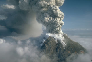 An ash plume rises above Augustine on 31 March 1986, eventually reaching a height of 12 km. Powerful explosions during the initial days of the 1986 eruption, which began on 27 March, removed portions of the 1976 summit lava dome. This view from the SW shows a darkened area of ash deposition downwind from the eruption plume.
Photo by Betsy Yount, 1986 (Alaska Volcano Observatory, U.S. Geological Survey).
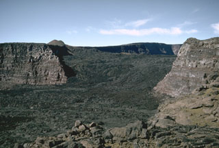 This view looks across Mauna Loa’s South Pit towards Moku’aweoweo caldera in 1966. The lava flows seen here erupted in 1949 within the caldera, then flowed into South Pit after covering the southern caldera floor and continued south for an additional 9 km beyond this crater. The small scoria cone on the horizon was constructed along the main fissure, which fed a lava flow that traveled 11 km down the west flank early in the eruption.
Photo by Richard Fiske, 1966 (Smithsonian Institution).
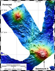 This bathymetric map shows both Forecast Seamount and Seamount X. The model is a combination of bathymetry collected on NOAA expeditions in 2004 and 2006. The contour interval is 200 m and the spatial resolution is 50 m.
Image courtesy of Susan Merle (Oregon State University/NOAA Vents Program).
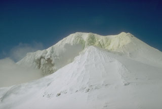 Mount Martin is located at the southern end of the group of volcanoes in the Katmai area. Gases rise from the summit crater and sulfur has accumulated on the snow and ice in this 1990 view. The crater, which opens to the east, is the site of intense fumarolic activity and sometimes contains a small crater lake.
Photo by Christina Neal, 1990 (U.S. Geological Survey, Alaska Volcano Observatory).
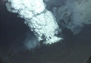 An eruption plume rises from a submarine vent on NW-Rota 1 volcano on 27 April 2006. This volcano was first detected during a 2003 NOAA bathymetric survey of the Mariana Island arc. The seamount rises to within about 500 m of the sea surface SW of Esmeralda Bank. During subsequent visits in 2005, 2006, and 2008, the volcano was seen to be in eruption.
Courtesy of Bill Chadwick, 2006 (Oregon State University/NOAA).
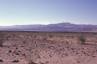 The dark-colored area seen in the distance across the dry Lavic Lake is a cinder cone and associated lava field that is one of the young vents of the Lavic Lake volcanic field. The youthful-looking lava flows originated from the Sunshine Peak area of the Lava Beds Mountains, south of the better known Pisgah Crater.
Photo by Paul Kimberly, 1997 (Smithsonian Institution).
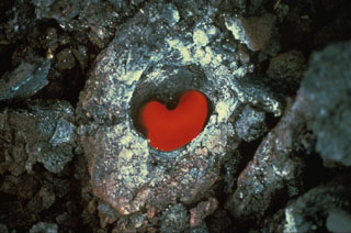 This heart-shaped tree mold was produced during an eruption along the East Rift Zone that began on 7 October 1968. Molten lava solidified around the tree, which eventually burned away, leaving the mold with incandescence from the hot rock below.
Photo by Don Swanson, 1968 (U.S. Geological Survey).
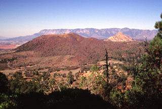 Firepit Knoll (left) is the largest and most well-preserved of a cluster of late-Pleistocene cinder cones on the upper Kolob Plateau in SW Zion National Park. These cones were erupted through sedimentary rocks of the Navajo Sandstone, which forms the light-colored peak of Red Butte at the right. The cinder cones erupted basaltic lava flows that traveled down valleys as far as 10-15 km to the south. The flat-topped summits of the Pine Valley Mountains form the skyline.
Photo by Lee Siebert, 1996 (Smithsonian Institution).
 The light-colored area at the left-center is the Main Terrace, which formed along the principal fissure of the Steamboat Springs geothermal field. The N-S-trending fissure deposited siliceous sinter from hot waters that issued from surface faults and traveled down slope towards U.S. Highway 395, which cuts diagonally across the bottom of the photo. The linear structure at the right-center is the power generating plant of the geothermal field. Out of view below the trees at the lower left is the Steamboat Resort, which dates back to the 1860s.
Photo by Lee Siebert, 1998 (Smithsonian Institution).
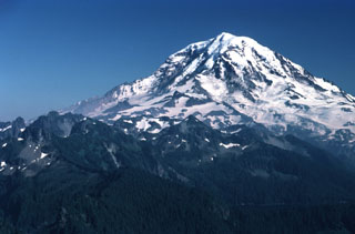 Stratovolcanoes are composed of accumulated layers of lava flows from effusive eruptions and fragmented rock from explosive eruptions. Glacier-clad Mount Rainier, seen here from the NW, is located in the northern Cascade Range. Most eruptions originate from a central conduit, which produces the common conical profile of stratovolcanoes, but flank eruptions also occur. Both isolated stratovolcanoes like Mount Rainier and compound volcanoes formed by overlapping cones are common.
Photo by Lee Siebert, 1983 (Smithsonian Institution).
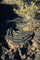 The ropy surface of pahoehoe lava flows is the dominant lava type at Craters of the Moon. The pahoehoe flows were typically erupted through lava tubes and tube systems. Locally collapse of tube roofs has formed skylights and entrances to lava tunnels that are popular among visitors to the national monument.
Photo by Lee Siebert, 1994 (Smithsonian Institution).
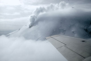 A large steam column rises from a fumarole at about 1,600 m elevation on the N flank of Chiginagak volcano on the Alaska Peninsula in May 1994. Strong steam emission is a common occurrence at this volcano and can be mistaken for eruptive activity.
Photo by Chris Nye, 1994 (Alaska Division of Geological and Geophysical Surveys).
 Lava flows from the 1955 eruption low on the East Rift Zone of Kīlauea destroyed 15 houses on the outskirts of Kapoho village. The main part of the village was not impacted, only to be destroyed by another eruption five years later.
Photo by Jerry Eaton. 1955 (U.S. Geological Survey).
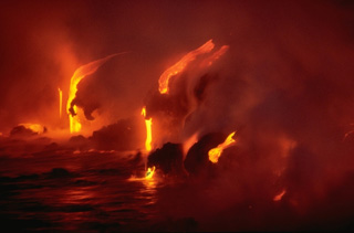 Lava flows dripping over low coastal cliffs are reflected in the sea in this May 1987 nighttime photo. Flows from Kīlauea's east rift zone have repeatedly reached the sea over a broad front during an eruption that began in 1983.
Copyrighted photo by Katia and Maurice Krafft, 1987.
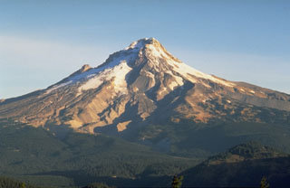 Mount Hood is seen here from Frog Butte on the SE side and shows the canyons of the White River drainage in the center. The smooth debris fan to its left formed during of growth and collapse of the Crater Rock lava dome just south of the summit. Illumination Rock forms the small peak midway up the left skyline.
Photo by Dave Wieprecht, 1993 (U.S. Geological Survey).
 A scoria cone on the Veniaminof western summit caldera floor was the source of the dark lava flow that melted through glacial ice. This photo was taken from the SE on 15 June 1984, two months after the eruption ended, and shows the rim of the 8 x 11 km wide caldera in the background. The caldera rim contains Cone Glacier on the west side (to the far left) and is overtopped by glaciers on the south and SE sides.
Photo by Alaska Volcano Observatory, U.S. Geological Survey, 1984.
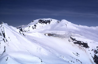 Gas-and-steam plumes (center) rise from the upper SSW flanks of Kupreanof. This is the largest and NE-most of a group of five relatively close Quaternary volcanic centers opposite Stepovak Bay. The only reported activity from Kupreanof consisted of minor steam and ash emission in 1987.
Photo by Tom Miller, 1973 (Alaska Volcano Observatory, U.S. Geological Survey).
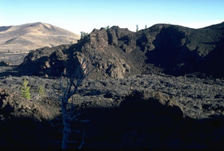 The Big Craters lava flow in the foreground, one of the youngest at the Craters of the Moon, originated about 2200 years ago from vents at the northern base of Big Craters. The flows traveled north before being deflected by the slopes of the Pioneer Mountains in the background and then flowed primarily to the SW.
Photo by Lee Siebert, 1994 (Smithsonian Institution).
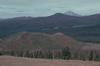 The Sand Mountain volcanic field contains a group of 23 scoria cones that erupted along a N-S line NW of Mount Washington. Two cone alignments diverge at the highest cone, Sand Mountain. This view looks along the NNE alignment with Mount Jefferson visible in the distance. The Sand Mountain cones and associated lava flows erupted between about 3,000 and 4,000 years ago.
Photo by Lee Siebert, 1981 (Smithsonian Institution).
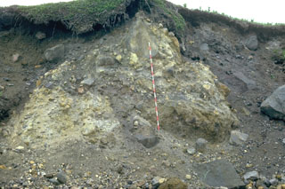 This wave-cut section exposes the interior of the Burr Point debris-avalanche deposit from the 1883 eruption of Augustine volcano. The different colors resulting from the transport of discrete segments of the volcano that are not thoroughly mixed are a characteristic appearance of debris avalanche deposits. The scale bar is 2 m high.
Photo by Lee Siebert, 1986 (Smithsonian Institution).
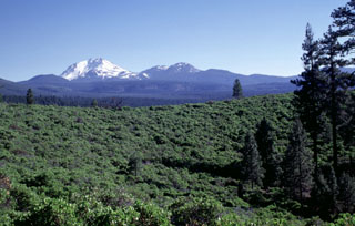 The green Manzanita-covered slope in the foreground is part of the circular rim of South Potato Butte, one of two cinder cones forming Potato Butte. The two cinder cones fed youthful-looking lava flows down the Hat Creek graben. Snow-covered Lassen Peak rises in the distance, with the Chaos Crags lava dome complex to its right.
Photo by Lee Siebert, 1998 (Smithsonian Institution).
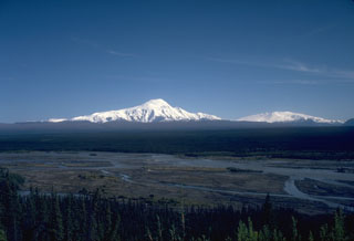 This view, across the Copper River to the SE, shows Mount Sanford (left) and Mount Wrangell (right). The eroded Sanford shield volcano has a broad, rounded top that is surrounded by steep glacial cirques. Most of the volcano formed during the Pleistocene. Eruptive activity at Wrangell has continued into historical time.
Photo by Donald Richter (Alaska Volcano Observatory, U.S. Geological Survey).
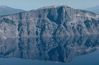 The massive Llao Rock lava flow, exposed in the NW wall of Crater Lake caldera, was emplaced at the end of a major eruption about 200 years prior to the formation of the caldera. The thin, light-colored unit at the base of the lava flow, seen prominently on the right, is a Plinian pumice deposit from that major explosive eruption. The lava flow is more than 350 m thick and is overlain by tephra from the caldera-forming eruption of Crater Lake.
Photo by Lee Siebert, 1981 (Smithsonian Institution).
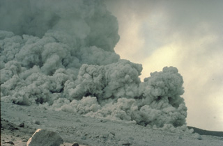 A pyroclastic flow produced by collapse of a growing lava dome sweeps down the flanks of Alaska's Augustine volcano on August 28, 1986. These high-temperature, high-velocity flows commonly travel silently because the sound of the moving blocks at the base of the flow is muffled by dense columns of gas and ash that roil up above the flow. This photo was taken at a distance of about 100 m from the margin of the pyroclastic flow.
Copyrighted photo by Katia and Maurice Krafft, 1986.
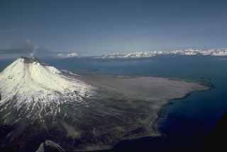 A small plume rises from the summit of glaciated Augustine in this July 1988 view from the east. The gray, unvegetated areas on the north flank are pyroclastic flow deposits from the 1986 and earlier historical eruptions. The pyroclastic flows reached the sea to the east and west. The Chigmit Mountains rise across Kamishak Bay in the distance.
Photo by Bill Rose, 1988 (Michigan Technological University).
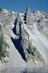 Devil's Backbone is a segmented dike that rises nearly 400 m from the shore of Crater Lake in the western rim of the caldera. The andesite dike was a feeder for a vent that was near Mount Hillman but has since been removed by glacial erosion.
 Photo by Lee Siebert, 1981 (Smithsonian Institution)
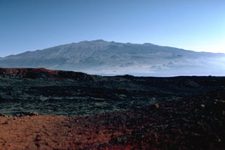 Mauna Kea is seen here from the north along the broad Mauna Loa NE rift zone. The scoria cones that formed during recent eruptions give the volcano an irregular profile.
Photo by Lee Siebert, 1987 (Smithsonian Institution).
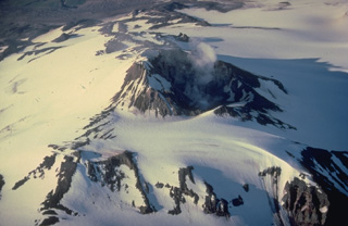 An almost-constant steam plume rises from the 500-m-wide summit crater of Mount Martin. High heat flux at the summit keeps the crater largely free of snow and ice despite the extensive glacial cover on the rest of the volcano. A small lake sometimes forms on the crater floor.
Copyrighted photo by Katia and Maurice Krafft, 1978.
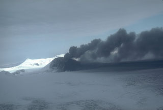 This weak, pulsating ash plume at Veniaminof, Alaska, on 7 October 1983 is being directed to the east by local winds. Dark ash deposits are visible on the cone and glacier, and a lava flow was traveling down the flank.
Photo by Betsy Yount, 1983 (Alaska Volcano Observatory, U.S. Geological Survey).
 Bogoslof is the summit of a largely submarine volcano located in the Bering Sea, 50 km behind the main Aleutian arc. The island is about 1.5 x 0.6 km wide and due to its frequent eruptive activity and energetic wave action, has changed shape dramatically since it was first mapped in the late 1700s. The rounded lava dome and offshore spire at the northern tip of the island (bottom-center) formed in 1992. The circular, flat area at the right is a remnant of the 1927 lava dome, and the steep pinnacle is Castle Rock, a 1796 dome remnant.
Photo by Terry Keith, 1994 (Alaska Volcano Observatory, U.S. Geological Survey).
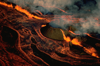 An en-echelon fissure cuts through Pohaku Hanalei, a pre-existing cinder cone on the NE rift zone of Mauna Loa volcano, at dawn on March 25, 1984, during the opening hours of the 1984 eruption. A line of lava fountains feeds incandescent lava flows that are diverted around the old cone and cover almost the entire field of view in this west-looking photo. A 2-km-long curtain of fire between about 3400 and 3470 m altitude was active on the morning of March 25, producing lava fountains 10-50 m high.
Copyrighted photo by Katia and Maurice Krafft, 1984.
 A plume rises from a vent at about 400 m depth on Daikoku seamount in this close-up view only about a few meters across. During a NOAA expedition in 2006 scientists observed a convecting, black pool of liquid sulfur with a partly solidified, undulating sulfur crust. The summit of lies along an E-W-trending ridge SE of Eifuku submarine volcano and rises to within about 300 m of the ocean surface.
Image courtesy of Submarine Ring of Fire 2006 Exploration, NOAA Vents Program.
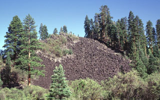 This steep-sided blocky lava flow originated from Potato Butte, twin cinder cones located immediately north of Lassen Volcanic National Park. The lava flows originated from vents that overlie the western side of the Hat Creek valley and traveled primarily to the north and west of the cones. The flows, once thought to be of possible Holocene age, have been dated at 65,000-75,000 years old.
Photo by Lee Siebert, 1998 (Smithsonian Institution).
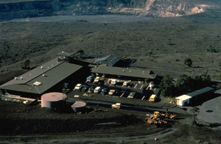 The Hawaiian Volcano Observatory sits on the rim of Kīlauea caldera. Staff scientists are responsible for monitoring the volcanoes on the island of Hawaii and Maui's active volcano, Haleakala. Volcanologists also conduct an active research and field mapping program to determine the geologic history of individual volcanoes. Halemaumau pit crater, at the top of the photo, was the site of long-term lava lake activity that continued at Kīlauea for a century prior to 1924. Brief, intermittent eruptions at Halemaumau have occurred since then, most recently in 1975.
Copyrighted photo by Katia and Maurice Krafft, 1984.
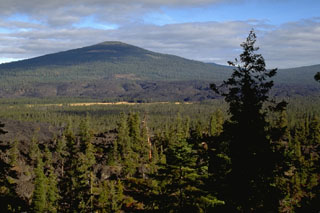 The middle of three scoria cones with associated andesite lava flows near Davis Lake is seen here from Black Rock Butte, which is the southernmost cone, with the Pleistocene Hamner Butte shield volcano in the background. The middle lava flow has an age of 5,050-5,600 years. The vent that produced the middle flow has a flat summit that has been quarried for road aggregate.
Photo by Lee Siebert, 1995 (Smithsonian Institution).
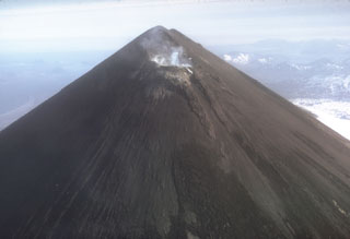 The entire upper flanks of Pavlof are darkened by ash in this November 1973 photo taken after a 12-13 November explosive eruption. Small plumes rise from the crater on the uppermost NE flank just below the normally snow-covered summit.
Photo by Tom Miller, 1973 (Alaska Volcano Observatory, U.S. Geological Survey).
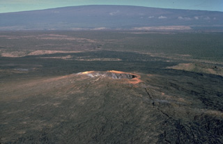 Two shield volcanoes of radically different scale appear in this photo. Mauna Ulu, a small, 120-m-high shield volcano on the east rift zone of Kīlauea volcano, is dwarfed by massive Mauna Loa in the background, the world's largest active volcano. Both volcanoes were constructed by the repetitive eruption of thin, overlapping lava flows, but over greatly differing time spans. Maunu Ulu was built during a 5-year eruption during 1969-1974, whereas Mauna Loa grew nearly 9 km up from the sea floor over a period of a few hundred thousand years.
Copyrighted photo by Katia and Maurice Krafft, 1979.
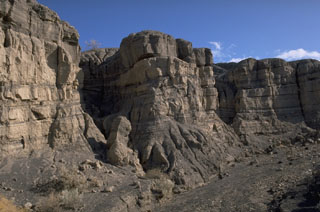 Bedded pyroclastic-surge deposits from the eruptions forming Ubehebe craters can be seen in this gully south of Little Ubehebe crater. The eruption formed two clusters of explosion craters and tuff rings along a N-S line.
Photo by Lee Siebert (Smithsonian Institution).
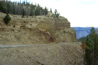 A roadcut at Golden Gate, north of Mammoth, cuts through the Huckleberry Ridge Tuff, the deposit produced by the gigantic eruption that created Yellowstone's first caldera about 2 million years ago. The 2500 cu km Huckleberry Tuff, one of the world's largest Quaternary eruptions, consists of welded tuffs and voluminous airfall deposits found as far away as southern California. The eruption created the 75-km-wide Island Park caldera, which extends from SE-Idaho into central Yellowstone.
Photo by Lee Siebert, 1994 (Smithsonian Institution).
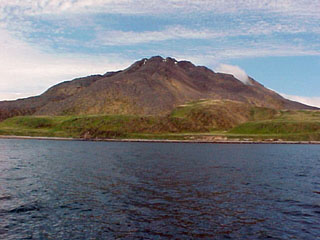 Amak, the easternmost of the Aleutian Islands, lies north of the tip of the Alaskan Peninsula. Like Bogoslof, it lies north of the main Aleutian volcanic front. Lava flows with prominent levees were emplaced in historical eruptions during 1700-1710 and in 1796.
Photo by Dave Roseneau, 2001 (U.S. Fish and Wildlife Service).
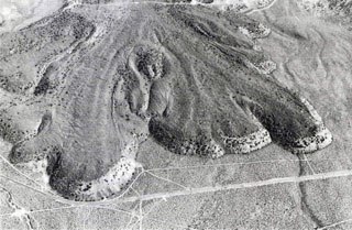 The Lava Park lava flow erupted about 9,300 years ago from a vent on the flank of Shastina, on the NW flank of Mount Shasta. The basaltic-andesite flow is about 6 km long and 110 m thick at the terminus. It overlies a wide apron of pyroclastic flow deposits emplaced about 9,700 years ago. The area shown is about 2 km wide and Highway 97 is seen near the bottom.
Photo by Dan Miller, 1980 (U.S. Geological Survey).
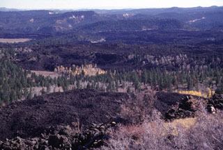 Blocky unvegetated lava flows known as the Black Rock Desert extend from near Miller Knoll to the SE. These flows, which also extend NE to near Panguitch Lake, are among the youngest features of the Markagunt Plateau volcanic field. This is one of several young volcanic fields in SW Utah.
 Photo by Lee Siebert, 1996 (Smithsonian Institution).
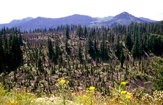 The large partially forested lava flow in the foreground originated from West Crater, out of view to the right, about 8,000 years ago. The blocky andesite flow traveled about 4.5 km to the SE, seen here about 2 km from the vent. In addition to this eastern flow, another lava flow traveled to the NW down the Hackamore Creek drainage. West Crater is a lava dome with a 200-m-wide summit crater and is on a topographic divide in southern Gifford Pinchot National Forest.
 Photo by Lee Siebert, 2002 (Smithsonian Institution).
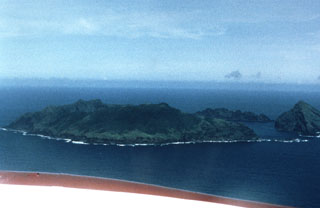 An aerial view of the Maug Islands from the NE shows Kitashima (North Island) at the right margin, Higashishima (East Island) in the foreground, and Nishishima (West Island) in the background. The islands enclose a 2.5-km-wide submarine caldera containing a lava dome that rises to within about 20 m of the ocean surface.
 Photo by Dick Moore, 1990 (U. S. Geological Survey).
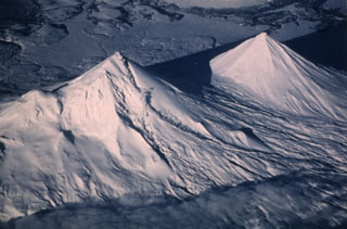 Pavlof (left) and Pavlof Sister (right) are shown in this 20 January 1987 view from the SW. Small steam plumes rise along the length of a lava flow descending a valley on the SE (right) flank of Pavlof. Recent snowfall covers ashfall that was frequently deposited on its slopes. This eruption began with explosive activity on 16 April 1986 and continued until 13 August 1988. Lava flows traveled down the N, NE, SE, ESE, and SSE flanks, the latter reaching to within 600 m of Pavlof Bay.
Photo by Jerry Chisum (Mark Air), 1987 (courtesy of John Reeder, Alaska Div. Geology Geophysical Surveys).
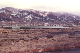 The elongated structure in the center of the photo is a power generating plant of the Steamboat Springs geothermal field. The plant is easily visible from U.S. Highway 395 and Nevada 341 south of Reno. Exploratory wells were drilled as early as the 1950s and 1960s, but the first successful well was drilled in 1979.
Photo by Paul Kimberly, 1997 (Smithsonian Institution).
 A group of cinder cones of the Kolob volcanic field were constructed on the upper Kolob Plateau in SW Zion National Park. Spendlove Knoll (left) and Firepit Knoll (partially hidden by behind the white sandstone of Pine Valley Peak at the right) are seen here from Northgate Peaks. Lava flows from Firepit Knoll traveled left down Lee Valley to the south. These late-Pleistocene basaltic cinder cones form a dramatic contrast to the colorful rad and white sedimentary rocks of the Navajo Sandstone.
 Photo by Lee Siebert, 1996 (Smithsonian Institution).
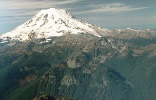 An aerial view from near the eastern margin of Mount Rainier National Park shows the volcano rising above glacially eroded terrain of the Ohanapecosh formation, composed of Tertiary volcanic rocks. The smooth, glaciated upper NE flank in this 1992 photo is the location of the post-collapse cone constructed within the failure scarp left by the Osceola debris avalanche and lahar about 5,600 years ago.
Photo by Dave Wieprecht, 1992 (U.S. Geological Survey).
 Farmlands encroach on the eastern margin of the Ice Springs lava flow, Utah's youngest. The 660-year-old lava flow originated from a complex of cinder and spatter cones and extends a maximum distance of 8 km from its source. The flow contains abundant xenoliths of partially fused granite.
Photo by Lee Siebert, 1996 (Smithsonian Institution).
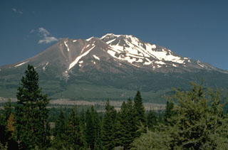 Shastina forms the largely snow-free ridge to the left of the summit of Shasta. During the growth of Shastina in the early Holocene, andesite lava flows traveled out to 14 km and pyroclastic flows swept down its flanks, covering much of the areas that are now the sites of the towns of Weed and Mt. Shasta.
Photo by Lyn Topinka, 1984 (U.S. Geological Survey).
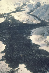 This 1992 view up the eastern flank of Westdahl was taken two months after the end of a major eruption that produced these lava flows. The eruption took place from an 8-km-long fissure that extended from the summit down the east flank and began on 29 November 1991 with a 6-km-high ash plume. The lava flow traveled as far as 7 km from the vent, widening as it reached the lower flanks.
Photo by C. Dau, 1992 (U.S. Fish and Wildlife Service, courtesy of Alaska Volcano Observatory).
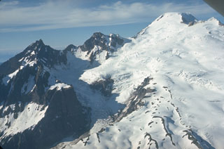 This view from the SW shows the Deming Glacier below Lincoln (left) and Colfax Peaks, which are remnants of the Pleistocene Black Buttes volcano that once stood where Mount Baker is now. Lavas from Black Buttes, which was active from about 500,000 to 300,000 years ago, dip towards Mount Baker with its flat-topped summit (upper right). Easton Glacier is on the S flank.
Photo by Lee Siebert, 1972 (Smithsonian Institution).
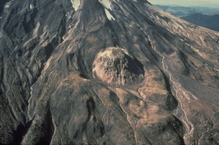 East Dome, the small lava dome at the center, is seen in this 1978 aerial photograph. An explosive eruption preceded emplacement of the dome on the lower E flank of Mount St. Helens about 1,800 years ago. Both the tephra deposit and the lava dome are of a hypersthene dacite composition unique to Mount St. Helens products. This eruption was part of the Sugar Bowl Eruptive Period.
Photo by Rick Hoblitt, 1978 (U.S. Geological Survey).
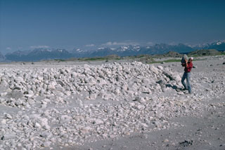 Volcanologist Jurgen Kienle holds a pumice clast at the toe of a 1986 pyroclastic flow deposit at Alaska's Augustine volcano. Thermal measurements more than 100 days after the eruption showed a maximum temperature of 525°C at a depth of 6 m. The flows traveled about 5 km from the summit and reached the sea on the N and NE coasts.
Photo by Lee Siebert, 1986 (Smithsonian Institution).
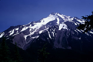 Deep glacial valleys cut the western flanks of Mount Jefferson. The original edifice was extensively eroded by glaciers prior to formation of a younger dacite cone on top of the older edifice. Lava dome growth was associated with the younger volcano and were accompanied by major ash-producing eruptions and pyroclastic flows, before activity ceased activity during the late Pleistocene.
Photo by Lee Siebert, 1996 (Smithsonian Institution)
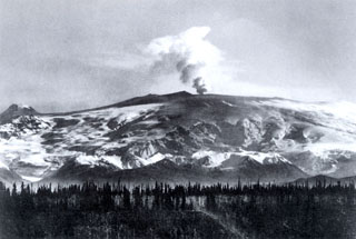 During a 1902 expedition in the Mount Wrangell area the U. S. Geological Survey scientist W.C. Mendenhall observed plumes and ash-covered snow. This photograph showing an ash plume rising above the summit crater was probably taken during the summer of 1902. Ash darkens the snow over a wide area of the southern flanks. The small cone on the far-left horizon is Mount Zanetti.
Photo by W.C. Mendenhall, 1902 (U. S. Geological Survey).
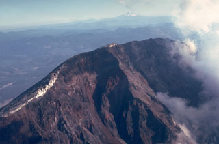 The steep headwall of the scarp created by collapse of St. Helens on 18 May 1980 towers 550 m above the crater floor. The white areas on the crater rim are glaciers that were truncated by the collapse. Steam rises at the right from the new crater in this August 1980 view. Mount Hood is visible in the distance to the south across the Columbia River.
 Photo by Lee Siebert, 1980 (Smithsonian Institution).
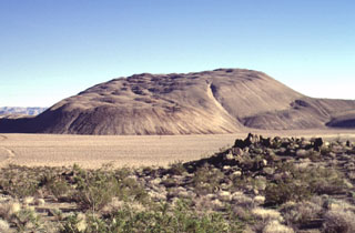 The Sugarloaf Mountain lava dome and associated lava flows, seen here from the west, is the largest of 38 rhyolitic lava domes of the Coso volcanic field, rising 300 m above its base. The high-silica rhyolite of Sugarloaf Mountain contains localized areas of obsidian that were used as a source of arrowheads for native Americans. The dome has been dated at about 41,000 ± 21,000 years and is one of the youngest volcanic vents at Coso.
Photo by Lee Siebert, 1997 (Smithsonian Institution).
 The broad 50-km-wide Medicine Lake volcano in the southern Cascade Range, seen here from the NE, is an example of a shield volcano in a continental margin setting. Its chemistry is more diverse than Hawaiian shield volcanoes and it has produced both basaltic lava flows, rhyolitic tephra, and obsidian flows during the Holocene. Eruptions have occurred during the past 6,000 years from vents within a 7 x 11 km summit caldera and from other vents on its flanks.
Photo by Lee Siebert, 1998 (Smithsonian Institution).
 A house near Hawaii's Puna coast burns in May 1987, one of many ignited by lava flows from Kīlauea's long-term east rift zone eruption. Lava flows overran the coastal village of Kalapana in 1990 and buried the popular black sand beach at Kaimu. Although some houses were removed before the housing lots were overrun, more than 75 houses were destroyed by lava flows in 1990.
Copyrighted photo by Katia and Maurice Krafft, 1987.
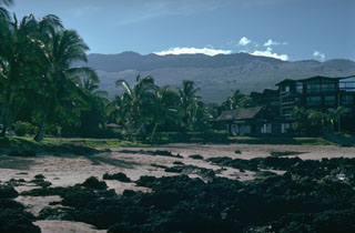 The broad Haleakalā shield volcano towers over the eastern part of the island of Maui, seen here from the beach at Kihei on the west flank. Its summit profile is irregular because of the many scoria cones that have erupted along the SW rift zone, which extends from the coast to the summit. The lava flow in the foreground also originated from Haleakalā.
 Photo by Lee Siebert, 1987 (Smithsonian Institution).
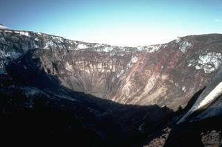 An explosive eruption February 4-9, 1978, produced an 8-10 km-high eruption column and blasted a new 1.5-km-wide, 0.5-km-deep crater through the summit icecap 1 km south of Westdahl Peak. This view from the west rim shows the summit icefield at the top of the new crater; the icefield was truncated by the explosions.
Copyrighted photo by Katia and Maurice Krafft, 1978.
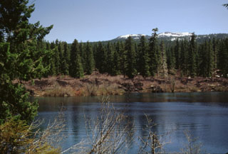 The snow-capped Sand Mountain scoria cones on the horizon were the source of the barren lava flow forming the far shore of Clear Lake. The lake formed when a series of lava flows erupted from the Sand Mountain volcanic field and traveled to the west, blocking the drainage of the ancestral McKenzie River. Standing stumps of the forest drowned by the rising lake waters have been radiocarbon dated to about 3,000 years ago and are still visible today.
Photo by Lee Siebert, 1999 (Smithsonian Institution).
 Pyroclastic flow deposits from the 15 April (lower 2/3 of section) and 21 April (upper 1/3 of section), 1990 eruptions of Redoubt in Alaska are exposed in a gully. The shovel at the base of the section provides scale. The larger 15 April pyroclastic flow carried large blocky fragments of a lava dome that had been growing in the summit crater.
Photo by Christina Neal, 1990 (Alaska Volcano Observatory, U.S. Geological Survey).
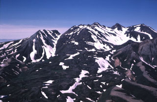 Most of the 3.5-km-wide caldera floor of Black Peak volcano, located NW of Chignik Bay, contains the complex of lava domes seen here. The ice-free mid-Holocene caldera contains two small lakes. Pyroclastic flow and block-and-ash-flow deposits from the caldera-forming eruption filled the Ash Creek and Bluff Creek valleys to the west and north less than about 4,000 years ago.
Photo courtesy of Alaska Volcano Observatory, U.S. Geological Survey, 1979.
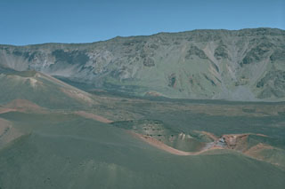 Halali'i (center foreground) and Pu’u o Maui (left center) are two of a series of young scoria cones erupted within the Haleakalā crater. Unvegetated lava flows form much of the crater floor, seen here looking NW from Pu’u Naue scoria cone. The crater is one of the few locations where the rare native-Hawaiian silversword ('ahinahina) plant is found.
 Photo by Lee Siebert, 1987 (Smithsonian Institution).
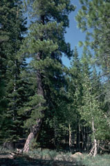 The trunks of the large ponderosa pine tree at the left and the smaller birch to the right in the Lost Creek valley NE of Lassen Peak were bent over by a mudflow from an eruption in May 1915. After the eruption vertical growth of the trees resumed. The mudflows traveled 50 km from the volcano, destroying bridges, farmlands, and farm buildings.
Photo by Lee Siebert, 1982 (Smithsonian Institution).
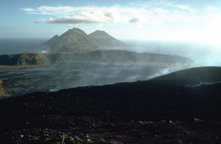 Gases rise from a lava flow that is advancing below the S flank of Pagan in 1981. The flow erupted during 15-26 May 1981 from a vent on the S crater rim and spread out over the broad caldera floor, eventually reaching the southern caldera wall. The foreground area on the flanks of Pagan consists of pyroclastic surge deposits from the 1981 eruption. This 21 May 1981 photo looks to the SW with South Pagan volcano forming the conical peak at the right.
Photo by Norm Banks, 1981 (U.S. Geological Survey).
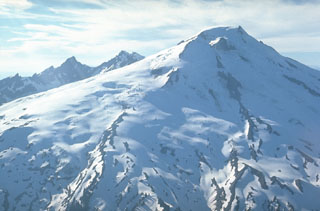 This view from the SE shows the extensive glacial cover on Mount Baker in 1972. Twelve glaciers cover the volcano with 114 km2 of ice, which is the largest glacial icecap of any Cascade volcano, including Mount Rainier. Part of Sherman Crater, the historically active vent, is lit by the sun just below the summit, to the right of Sherman Peak. The eroded Black Buttes volcano is in the background.
Photo by Lee Siebert, 1972 (Smithsonian Institution).
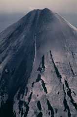 An aerial view of the Cleveland upper east flank taken at about 1100 local time on 24 June 1987 shows an active lava flow. Incandescent lava can be seen at several locations along the flow, which eventually traveled 2.5 km from the summit. The snow-covered flanks are darkened by ash deposition from an eruption that began on 19 June.
Photo by Harold Wilson, 1987 (Peninsula Airways), courtesy of John Reeder (Alaska Div. Geology Geophysical Surveys).
 These islands and peninsulas on the north coast of Augustine formed in 1883 when collapse of the summit produced a large debris avalanche. Deposits from the highly mobile avalanche extended the island up to 2 km beyond the pre-1883 shoreline. Pyroclastic flows from that eruption also reached the new coastline and emplaced the light-colored deposits to the lower left.
Photo by Lee Siebert (Smithsonian Institution).
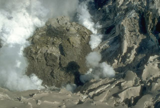 The south flank of the final lava dome in the summit crater produced during Redoubt's 1989-90 eruptions is seen here on 1 June 1990 during the waning phases of activity. A fractured lobe of blocky lava is visible at the center. Steam from interaction of meltwater with hot rock billows from the margins of the dome. Remnant glacial ice with a coating of gray ash surrounds the dome.
Photo by Cynthia Gardner, 1990 (U.S. Geological Survey).
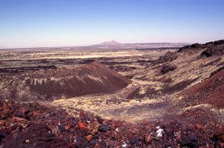 The Black Rock Desert volcanic field consists of a cluster of closely spaced small volcanic fields of Pleistocene-to-Holocene age in the Black Rock and Sevier deserts. This view shows Utah's youngest known lava flow, the 660-year-old Ice Springs flow, which originated from a series of nested cinder and spatter cones. The rim of Crescent Crater is at the right, with the symmetrical Pocket Crater at the left and Pavant Butte in the distance. This tuff cone erupted through the waters of Pleistocene Lake Bonneville about 16,000 years ago.
Photo by Lee Siebert, 1996 (Smithsonian Institution).
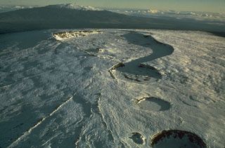 This 1975 photo of the snow-covered summit of Mauna Loa from the SW shows the 2.4 x 4.8 km wide Moku‘āweoweo caldera in the center, with three circular craters in the foreground. South Pit (merging with the SW caldera rim), Lua Hohonu, and Hua Hou (foreground), formed through collapse along the upper SW rift zone. Mauna Kea is in the distance.
Photo by Don Peterson (U.S. Geological Survey).
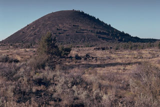 Schonchin Butte, a late-Pleistocene scoria cone on the north flank of Medicine Lake volcano, is one of the prominent landmarks of Lava Beds National Monument. A large number of lava tubes in the area fed late-Pleistocene and Holocene lava flows.
Photo by Lee Siebert, 1981 (Smithsonian Institution).
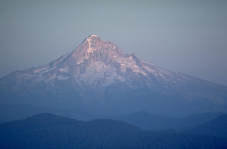 Mount Hood, seen here from Larch Mountain on the NW side, is a recently active volcano in Oregon. A major eruptive period occurred in the late 1700s, and 19th-century Pacific Northwest tribes and settlers observed minor eruptions.
Photo by Lee Siebert, 1980 (Smithsonian Institution).
 Soda Dam, along the Jemez River, is a travertine dam formed across a gorge in Precambrian granite-gneiss SW of the rim of Valles caldera. The travertine has been deposited over the past 5000 years by carbonated thermal waters discharged along the Jemez fault zone. About 15 hot springs related to the Valles caldera thermal system are found at this location.
Photo by Lee Siebert, 1989 (Smithsonian Institution).
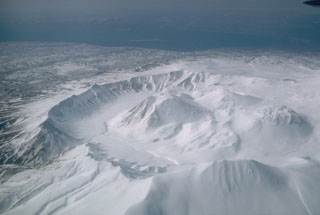 The 4.5-km-wide Ugashik caldera formed during the late Pleistocene. Five Holocene lava domes are in the caldera, seen here from the east with Upper Ugashik Lake in the background.
Photo by Betsy Yount (Alaska Volcano Observatory, U.S. Geological Survey).
 The rim of the Crater Lake caldera is seen in the distance from the summit of Mt. Thielsen to the north. The caldera formed about 7,700 years ago during a large explosive eruption that resulted in the collapse of ancestral Mount Mazama. Mount Scott forms the high point on the left skyline, and Timber Crater is the smaller cone below and left of the north caldera rim.
Photo by Lee Siebert, 1982 (Smithsonian Institution).
 A roadcut exposes the internal structure of the debris avalanche deposit that formed during collapse of Mount Shasta during the Pleistocene. This deposit contains large angular sections composed of rock and crushed matrix of similar material (like the light-gray area in this photo), in direct contact with other lithologies (brown) from other areas of the pre-collapse volcano. This is due to different sections mixing as the debris avalanche traveled across the landscape.
Photo by Lee Siebert, 1981 (Smithsonian Institution).
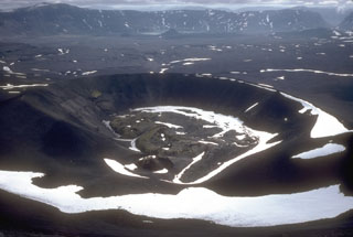 The primary Aniakchak 1931 eruption site is against the NW caldera wall. This 600-m-wide crater produced intermittent explosions of pumice-lithic tephra over the course of several weeks in May and June 1931. During the final phases of the eruption a small lava flow formed in the bottom of the crater. The fissure eruption cut through Vent Mountain and across the caldera floor to the western caldera wall.
Photo by Game McGimsey, 1992 (Alaska Volcano Observatory, U.S. Geological Survey).
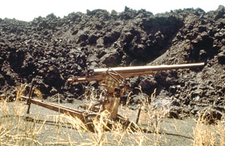 The SW-flank lava flow from the May 1981 eruption overran a Japanese World War II bunker and ashfall from the eruption partially buried this anti-aircraft gun. The lava flow traveled 3 km from its vent on the south crater rim. Other flows traveled down the north flank almost to the coast.
Photo by Norm Banks, 1981 (U.S. Geological Survey).
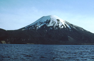 Amukta in the central Aleutians is located along the coast of the 8-km-wide island of the same name. It has had several eruptions since the late 18th century from both summit and flank vents.
Photo by U.S. Fish and Wildlife Service, 1972 (courtesy of Alaska Volcano Observatory).
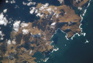 Sergief volcano on SW Atka Island lies below and to the left of the center of this NASA International Space Station image (with north to the lower right). The SW part of the Atka Island is older and less topographically rugged than the NE part of the island, and the age of this small stratovolcano is not precisely known. The large embayment at the right-center is Podsopochni Bay. Portage Lagoon and Sergief Bay at the upper right almost bisect the island.
NASA International Space Station image ISS005-E-18300, 2002 (http://eol.jsc.nasa.gov/).
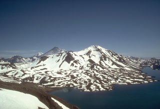 Mount Emmons is along the SW side of the 11 x 18 km Emmons Lake caldera. Youthful lava flows form the irregular shoreline of Emmons Lake in the foreground. The high peaks in the background (left center) are Pavlof just beyond the NE rim of the caldera, and Pavlof Sister.
Photo by Tom Miller (Alaska Volcano Observatory, U.S. Geological Survey).
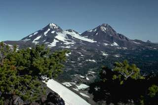 North Sister volcano to the right and Middle Sister to the left, seen from Broken Top volcano to the south, are the two northernmost volcanoes in the Three Sisters volcano group in the central Oregon Cascades. Glaciers have deeply eroded the Pleistocene North Sister volcano, but young Holocene lava flows from scoria cones on the north flank have erupted in the past few thousand years.
Photo by Lee Siebert, 1982 (Smithsonian Institution).
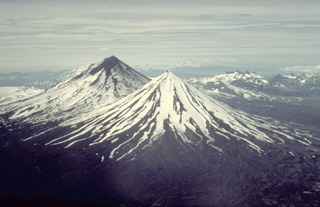 Pavlof Sister (center) and Pavlof (upper left) are twin stratovolcanoes whose summits are only 5 km apart. A low saddle about 1100-m high separates the conical volcanoes. They are the most prominent features along a NE-SW-trending line of vents that extends from Emmons Lake caldera, which is behind 2519-m Pavlof volcano in this view from the NE, to 2142-m Pavlof Sister volcano.
Copyrighted photo by Katia and Maurice Krafft, 1978.
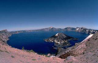 The spectacular 8 x 10 km wide Crater Lake caldera was formed about 6850 years ago when Mount Mazama, a complex of overlapping shield volcanoes and stratovolcanoes, collapsed following a major explosive eruption. The eruption blanketed a huge area with ash falls and produced pyroclastic flows that swept all sides of the volcano. This wide-angle view is from the west caldera rim with the post-caldera cone of Wizard Island in the foreground.
Copyrighted photo by Katia and Maurice Krafft, 1989.
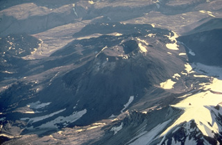 The prominent cone in the center of the photo was constructed during a series of eruptions from 1953 to 1968. Following the emission of four lobate lava flows from 1953 to 1960 that traveled up to 4.5 km from the vent, the cone grew to heights of 400-800 m above the sloping SW flank of Trident. A shallow, 250-m-wide crater caps the cone.
Copyrighted photo by Katia and Maurice Krafft, 1978.
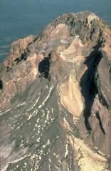 This aerial view of Mount Hood from the south shows the Crater Rock lava dome remnants in the center of the photo. The 400-m-wide, 170-m-high Crater Rock dome erupted around 1780 CE and produced block-and-ash flows and resulted in lahars during episodic dome growth. Deposits are distributed along the Sandy River and White River drainages.
Photo by Willie Scott, 1990 (U.S. Geological Survey).
 This ridge rising above pastures of the Klamath River valley is the rim of Crater Lake caldera in the Cascade Range. Formation of the caldera about 7,700 years ago removed the top of what was then Mount Mazama. The southern caldera rim is located at the point above the two larger trees at the left side of the photo. Mount Scott, an older volcano located east of the caldera rim, forms the small distant peak to the far right.
Photo by Lee Siebert, 1982 (Smithsonian Institution).
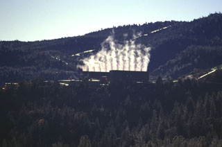 The Geysers steam field is located at the SW end of the Clear Lake volcanic field in the Coast Ranges of western California. A large silicic magma reservoir provides the heat source.
Photo by Paul Kimberly, 1997 (Smithsonian Institution).
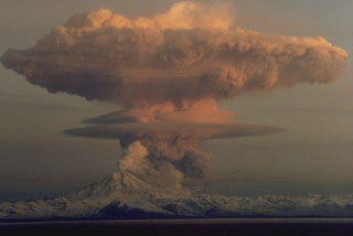 A series of powerful eruptions at Redoubt began on 14 December 1989. This 18 December view from the Kenai Peninsula across Cook Inlet shows an umbrella cloud that appears to originate from a vent on the N flank, but is actually ash from a pyroclastic flow that is traveling down the Drift River valley to the north. Ash plumes during the initial days of the eruption reached heights of about 10 km. Several episodes of strong explosive activity and lava dome growth lasted until June.
Copyrighted photo by Robert Clucas, 1990.
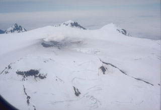 An aerial view of the summit area of Makushin volcano in the northern part of Unalaska Island in the eastern Aleutians, shows a small plume rising from a crater (left center). The broad summit contains a 2.5-km-wide Holocene caldera with a scoria cone that has produced minor explosive eruptions in historical time.
Photo by Chris Nye, 1982 (Alaska Division of Geological & Geophysical Surveys).
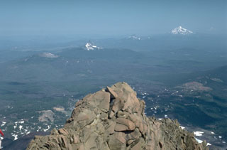 The summit of North Sister provides a panorama of Cascade volcanism that includes, from left to right, lava flows of the McKenzie Pass area in the foreground, the low Belknap shield volcano, the eroded summit pinnacles of Mount Washington and Three Fingered Jack volcanoes, and snow-capped Mount Jefferson to the upper right.
Photo by Lee Siebert, 1984 (Smithsonian Institution).
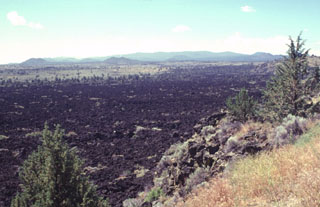 Despite its youthful appearance, the Devils Homestead lava flow in the foreground is slightly more than 10,000 years old. Erosional modification of lava flow surfaces proceeds slowly in arid regions. The Devils Homestead flow is one of the largest on the north flank of Medicine Lake volcano, the broad shield volcano on the horizon. Flank cinder cones dot the slopes of the chemically diverse shield volcano, which has produced both the basaltic cinder cones and lava flows seen here, and dacitic and rhyolitic pumice and lava flows.
Photo by Lee Siebert, 1998 (Smithsonian Institution).
 Round Mountain (center), seen here from the WNW with the hills of the California Coast Range in the background, is one of a series of basaltic-andesite cinder cones erupted along a N-S-trending line at the eastern margin of the Clear Lake volcanic field. These cones form some of the youngest products of the volcanic field. Lava flows from Round Mountain extend west into High Valley (lower right) and east to the North Fork Cache River. The background hills are composed of Cretaceous-Jurrasic metamorphic rocks of the Franciscan formation.
Photo by Paul Kimberly, 1997 (Smithsonian Institution).
 The inconspicuous hill on the left-center horizon to the SW is Ice Springs volcano, part of the Black Rock Desert volcanic field in central Utah. The black area extending across the photo from the cinder cone complex is a 660-year-old basaltic lava flow from Ice Springs volcano. An additional NNE-SSW chain of small volcanic vents is located NE of the main vent complex. The volcanic fields in the Black Rock Desert area were first described by pioneering U.S. Geological Survey geologist G.K. Gilbert in the late 19th century.
Photo by Lee Siebert, 1996 (Smithsonian Institution).
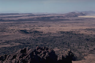 The summit of Schonchin Butte in Lava Beds National Monument provides a view of step-like Basin-and-Range faulting to the NW. The dark lava flow at the base of the closest scarp is the late-Pleistocene Devils Homestead lava flow. Parallel to, and just in front, of that are 3,000-year-old lava flows from fissures at Black Crater and Ross Chimneys.
Photo by Lee Siebert, 1981 (Smithsonian Institution).
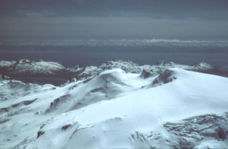 The almost completely ice-covered Kukak is near the NE end of a chain of volcanoes extending from Mount Katmai. Kukak, seen here from the NW with Shelikof Strait in the background, contains a vigorous fumarole field on its northern summit.
 Photo by Christina Neal, 1990 (U.S. Geological Survey, Alaska Volcano Observatory).
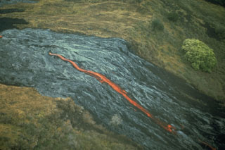 An incandescent lava flow from Mauna Ulu emerges from a lava tube and descends the Poliokeawe Pali cliff on 1 January 1973. Lava flows traveled 12 km to reach the coast over a 9-km-wide front during the 1969-74 eruption.
Photo by Don Peterson, 1973 (U.S. Geological Survey).
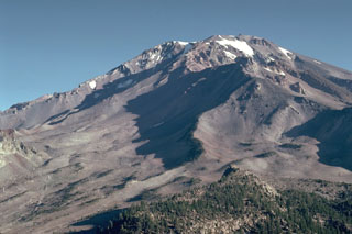 The extensively eroded Sargents Ridge (right of center), on the south side of Mount Shasta, is a remnant of the oldest of four major edifices that were constructed following the collapse of ancestral Mount Shasta. The Sargents Ridge cone formed during the Pleistocene, less than 250,000 years ago. Mount Misery was constructed less than 130,000 years ago and forms much of the upper part of the cone above the Sargents Ridge cone.
Photo by Lee Siebert, 1981 (Smithsonian Institution).
 The 70 km2 Diamond Craters volcanic field in Oregon, USA, is shown in this October 2019 Planet Labs satellite image monthly mosaic (N is at the top; this image is approximately 15 km across). The area was uplifted to produce graben structures cross-cutting the lavas in NW-SE direction. Numerous smaller vents including spatter and phreatomagmatic craters, and cones occur along the margins of the uplifted area aligned with the structural trend.
Satellite image courtesy of Planet Labs Inc., 2019 (https://www.planet.com/).
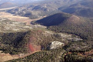 Tunnel cinder cone (lower left) and South Fork cone (upper right) are seen from the NW with Ramshaw Meadow at the upper left. The South Fork cone was erupted about 176,000 years ago and produced the largest lava flow of the volcanic field, which traveled 10 km to the west, possibly as far as the floor of Kern Canyon. Tunnel cone to the north of South Fork (Red Hill) cone is undated, but its lava flow is overlain by glacial deposits and it is thought to be only slightly younger than South Fork cone.
Photo by Rick Howard, 2002 (courtesy of Del Hubbs, U S Forest Service).
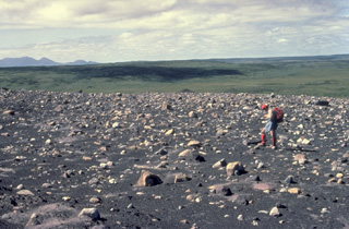 French volcanologist Katia Krafft observes blocky ejecta from the 1977 eruptions that formed Ukinrek Maars. The 10-day-long eruption produced two new maars, 170-m-wide West Maar and 300-m-wide East Maar. Phreatomagmatic explosions formed an ejecta blanket of ash and blocks that surrounded the new vents.
 Copyrighted photo by Katia and Maurice Krafft, 1978.
 A hot rock sample collected by U.S. Geological Survey scientists during a period of lava dome growth in the crater of Mount St. Helens in September 1981 burns a cloth sample bag.
Photo by Terry Leighley, 1981 (U.S. Geological Survey).
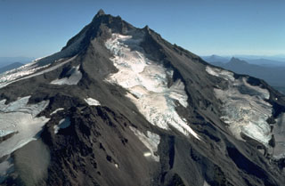 Mount Jefferson has been inactive since the late Pleistocene and shows the effect of extensive erosion by glaciers. The Jefferson Park Glacier on the N flank in the foreground and the Whitewater Glacier on the E flank are the two largest on Jefferson.
Photo by Dan Miller, 1977 (U.S. Geological Survey).
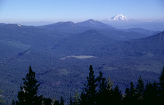 The two small Pleistocene cinder cones in the Hat Creek valley, just to the right of the two highest trees in the foreground, are viewed here from West Prospect Peak. The cones are among a series of young volcanic vents located north of Lassen Peak and fed lava flows that traveled to the north (right). Three forest-covered Pleistocene volcanoes can be seen in the background, Sugarloaf (above the green meadow in the center), Logan Mountain (left-center), and Burney Mountain (right-center). Snow-capped Mount Shasta is at the upper right.
Photo by Lee Siebert, 1998 (Smithsonian Institution).
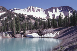 Water partially fills a phreatic crater formed on the northern flank of Mammoth Mountain, the snow-covered peak in the background. This and other nearby craters were formed by explosive eruptions about 700 years ago that were distinct from nearby eruptions at the southern end of the Inyo Craters. The Mammoth Mountain craters, some of which lie within the Mammoth Mountain ski area, are oriented NW-SE at the northern base of Mammoth Mountain.
 Photo by Lee Siebert, 1998 (Smithsonian Institution).
 Blocks of glassy obsidian reflect sunlight from the surface of a rhyolitic lava dome marking the latest eruptive event during extrusion of the Glass Mountain lava flow. The composite flow originated from more than a dozen NW-SE-trending vents near the eastern rim of the Medicine Lake caldera. Part of the massive obsidian flow seen on the left side of the photo traveled west into the caldera. Snow-capped Mount Shasta towers above the forested caldera rim to the west.
Photo by Lee Siebert, 1998 (Smithsonian Institution).
 Sahalie Falls formed when lava flows erupted about 3,000 years ago from the Sand Mountain volcanic field traveled to the west, blocking the channel of the ancestral McKenzie River.
 Photo by Lee Siebert, 1995 (Smithsonian Institution).
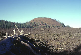 The andesitic Burnt Lava flow covering about 37 km2 of the SE flank of Medicine Lake volcano was erupted from the High Hole Crater cinder cone. The Burnt Lava flow was the largest from Medicine Lake during the Holocene and had a volume of 0.45 cu km. The symmetrical High Hole Crater contains a double summit crater. The Burnt Lava flow, which was erupted from both High Hole Crater and adjacent fissures, surrounded two older cinder cones, one of which forms the forested ridge at the left.
Photo by Lee Siebert, 1998 (Smithsonian Institution).
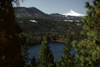 Blue Lake Crater in the foreground is one of three overlapping craters located east of Santiam Pass. The craters formed about 1,300 years ago during explosions through older volcanic bedrock; a chain of spatter cones about 6 km SSW of Blue Lake may have been active during the same eruption. The snow-covered summit of Pleistocene Mount Washington is visible in the background.
Photo by Lee Siebert, 1999 (Smithsonian Institution).
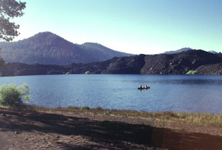 Butte Lake in NE Lassen Volcanic National Park was formed when the blocky lava flow seen across the lake dammed local drainages. The flow was one of five accompanying the eruption that formed Cinder Cone several hundred years ago. This marks the NW-most extent of lava flows from Cinder Cone.
Photo by Lee Siebert, 1998 (Smithsonian Institution).
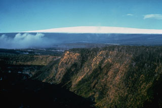 Kīlauea Iki crater in the foreground was the site of a major eruption in 1959. The crater is in Kīlauea's East Rift Zone and is seen here from the east with snow-capped Mauna Loa in the background. Gases rise from the Kīlauea caldera to the left.
 Photo by Richard Fiske, 1967 (Smithsonian Institution).
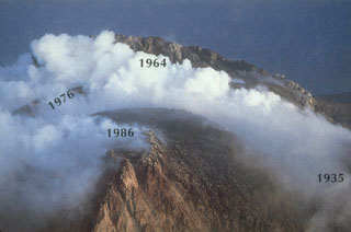 Remnants of four lava domes can be seen in this annotated July 1986 photo of the summit of Augustine taken from the north. Degassing of the 1986 lava dome produces a plume. Eruptions have often begun with the explosive removal of portions of lava domes at the summit and conclude with the extrusion of a new lava dome. Renewed extrusion of the 1986 dome occurred one month after the time of this photo.
Photo by Lee Siebert, 1986 (Smithsonian Institution).
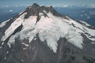 Volcanic activity at glacially eroded Mount Jefferson, Oregon's second highest peak, ended during the Pleistocene. However, scoria cones south of the volcano have been active as recently as about 1,000 years ago. The extensive Whitewater Glacier in the foreground has eroded deeply into the volcano across the E flank.
Photo by Willie Scott, 1981 (U.S. Geological Survey).
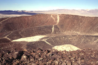 Amboy Crater is a complex cone formed of at least four nested craters. The rims of two relatively undissected inner cones can be seen in this view from the SE rim of the outer crater of the 75-m-high cinder cone. The two outer cones are breached on their western sides, out of view to the left. Amboy crater is surrounded by a 70-sq-km basaltic lava field. The Bristol Mountains form the skyline.
Photo by Lee Siebert, 1997 (Smithsonian Institution).
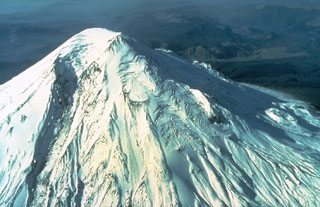 Prior to 1980 Mount St. Helens was a more symmetrical cone that was known as the Fuji of America. Much of the visible edifice formed during eruptions over the past 2,200 years. It is the most frequently active of the Cascade volcanoes and has repeatedly produced large eruptions that deposited ash and pumice over long distances. Pacific Northwest tribes and early settlers observed frequent eruptions during the first half of the 19th century.
Photo by U.S. Geological Survey, 1980.
 The 1980 eruption of Mount St. Helens dramatically altered the conical profile of the volcano. The eruption left a 2 x 3.5 km wide horseshoe-shaped crater, seen here from the NNE beyond Spirit Lake (center). The landslide of 18 May lowered the summit by 400 m and produced a highly mobile debris avalanche that swept into Spirit Lake and traveled down the North Fork Toutle River. The associated northward-directed lateral blast devastated about 600 km2.
Photo by Lyn Topinka, 1981 (U.S. Geological Survey, Cascades Volcano Observatory).
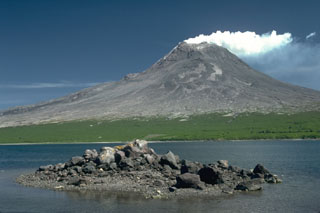 In the foreground is a hummock of a debris avalanche deposit produced by collapse of the Augustine summit about 450 years ago. The avalanche swept into Kamishak Bay and traveled a distance of 11 km from the summit, forming the 2 x 3 km wide West Island. The fine-grained component of this avalanche hummock has been removed by the powerful Cook Inlet tides. The eruption was accompanied by a small lateral blast.
Photo by Lee Siebert, 1987 (Smithsonian Institution).
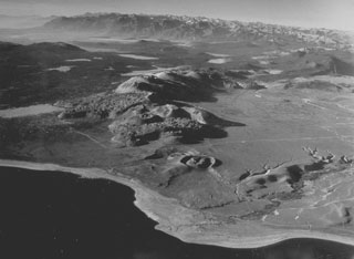 The Mono Craters volcanic field, between Mono Lake in the foreground and Long Valley caldera at the upper left, is a 17-km-long chain of rhyolitic lava domes and thick, viscous lava flows. Mono Craters have been frequently active during the Holocene. Panum crater (the vent nearest to Mono Lake), is partially filled by a lava dome and was the site of the latest eruption from Mono Craters, about 600 years ago.
 Photo by R. Von Huene, 1971 (U.S. Geological Survey).
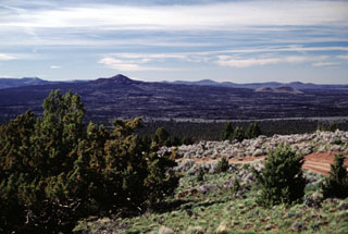 The Lava Mountain pyroclastic cone complex (left-center), seen here looking N from Green Mountain, forms a prominent topographic high on a shield volcano and lava field. This late Pleistocene lava fiel is the middle of a group of three young basaltic fields in the High Lava Plains SE of Newberry volcano. Lava flowed in all directions for distances up to 6 km from the summit cone complex, surrounding older cones such as the lighter colored Twin Buttes (right).
Photo by Lee Siebert, 2000 (Smithsonian Institution).
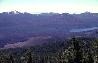 The unvegetated pyroclastic cone in the foreground, seen from near the summit of Prospect Peak, is Cinder Cone in NE Lassen Volcanic National Park. Cinder Cone, which was formed during an eruption several hundred years ago, was the source of an extensive series of lava flows that can be seen on the far side of the cone. The flows dammed up local drainages, forming two lakes, one of which is Snag Lake, seen here SSE of the cone.
Photo by Lee Siebert, 1998 (Smithsonian Institution).
 The two coalescing volcanoes forming the elongate 9-km-long island of Anatahan in the central Mariana Islands are seen here from the S. The low point in the center of the island results in part from overlapping 2.3 x 5 km calderas, the largest in the Mariana Islands. The larger western caldera is 2.3 x 3 km and extends eastward from the summit of the western volcano (left). The volcano's first historical eruption in 2003 took place from a small crater within the 2-km-wide eastern caldera.
Photo courtesy of U.S. Geological Survey, 1994.
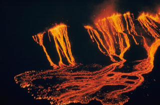 Lava fountains along a fissure on the SW side of the Kīlauea Iki crater erupted this lava that flowed down to the crater floor at the beginning of an eruption on 14 November 1959. This view, looking SW from Bryon's Ledge overlook, shows lava ponding on the crater floor. The initial fissure was about 1 km long and produced fountains about 15 m high. Lava from the western part of the fissure dropped 50 m onto a platform before reaching the crater floor; flows on the eastern side descended 90 m directly to the crater floor.
Photo by Jerry Eaton, 1959 (U.S. Geological Survey).
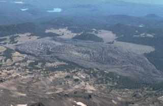 The Rock Mesa obsidian lava flow is seen here in an aerial view from the north above South Sister volcano. It is the largest of a series of lava flows which erupted about 2,300 to 2,000 years ago from vents on the SW and SE flanks.
Photo by Dan Miller, 1977 (U.S. Geological Survey).
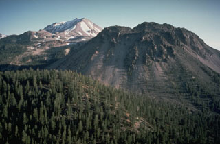 Chaos Crags in the foreground and Lassen Peak in the background are large lava dome complexes in the southern Cascade Range. Chaos Crags consists of a group of six overlapping rhyodacite lava domes that erupted around 1,100 years ago. Lassen last erupted during 1914-17.
Photo by Dan Dzurisin, 1982 (U.S. Geological Survey).
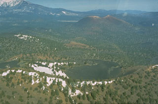 Sunset Crater at the upper right is seen in this aerial view along a 10-km-long eruptive fissure extending to its SE. An eruption from Gyp Crater, immediately behind the left rim of the snow-dappled Pleistocene Double Crater in the foreground, occurred along the SE-trending fissure. Snow-capped San Francisco Mountain appears in the background at the upper left.
Photo by Ed Wolfe, 1973 (U.S. Geological Survey).
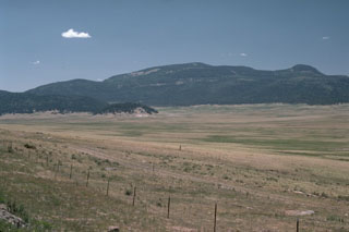 Redondo Peak in the center and Redondito peak on the right are the eastern half of a resurgent dome in the center of the Valles caldera, seen from the SE across the caldera moat, Valle Grande. The uplifted resurgent dome is formed primarily of densely welded Bandelier Tuff that was uplifted about 50-100,000 years after formation of the caldera. Cerro La Jara, the small hill on the caldera floor at the middle left, is a small rhyolitic lava dome erupted along ring-fractures.
 Photo by Lee Siebert, 1989 (Smithsonian Institution).
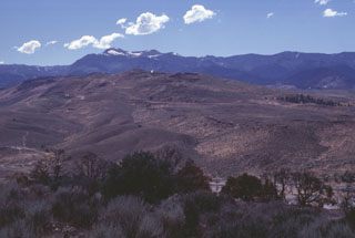 Steam rises from a geothermal well at the top of a lava-dome complex of the Steamboat Hills geothermal field in west-central Nevada south of Reno. U.S. Highway 395 traverses the valley beyond the trees in the foreground. This is the site of the Steamboat Resort, which dates back to the 1860s, when it was frequented by miners working on the nearby renowned Comstock Lode. The Carson Range forms the ridge on the horizon.
Photo by Lee Siebert, 1998 (Smithsonian Institution).
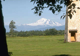 Mount Baker, seen here from the dairy farms of Whatcom County to the west, is a prominent landmark visible from much of NW Washington and SW British Columbia. Nineteenth-century eruptions were visible from as far away as Victoria Island across the Puget Sound.
Photo by Lee Siebert, 1972 (Smithsonian Institution).
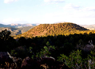 Bald Knoll is the youngest of a group of cinder cones on the SW part of the Paunsaugunt Plateau in southern Utah. It is seen here from the SW with the escarpment forming the Pink Cliffs of the renowned Grand Staircase of Paleozoic sedimentary rocks in the background. The proximal part of a voluminous blocky lava flow that traveled to the south from a vent at the base of the youthful-looking cinder cone forms the shaded area in the foreground.
Photo by Lee Siebert, 2002 (Smithsonian Institution).
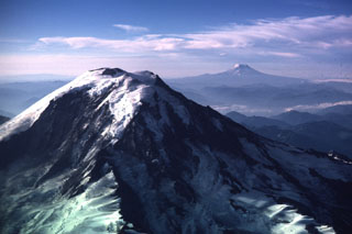 This view of Mount Rainier from the NW shows neighboring Mount Adams to the right in 1985. The steep Willis Wall, named after the 19th-century geologist Bailey Willis, is to the left and exposes relatively young lava flows.
 Photo by Lee Siebert, 1985 (Smithsonian Institution)
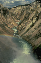 The brilliant hues of the Grand Canyon of the Yellowstone are cut through hydrothermally altered rhyolitic lava flows erupted within Yellowstone caldera. The Yellowstone volcanic field was created during three volcanic cycles over the past 2 million years, each culminating in a voluminous explosive eruption creating a large caldera. Yellowstone's impressive array of hot springs and geysers, part of the most vigorous hydrothermal system in the world, is evidence of a still-active magmatic system.
Copyrighted photo by Katia and Maurice Krafft, 1984.
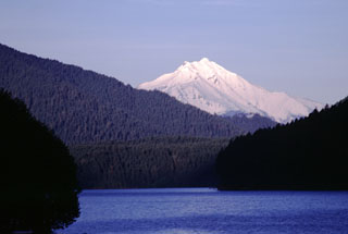 Snow-capped Mount Jefferson rises above Detroit Lake, a hydroelectric reservoir NW of the volcano. The Mount Jefferson region is a popular recreational area in the central Cascades and is in the Mount Jefferson Wilderness Area.
 Photo by Lee Siebert, 2000 (Smithsonian Institution)
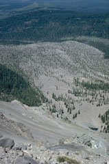 Chaos Jumbles, a debris avalanche-deposit formed by collapse of Chaos Crags about 1650 CE, is seen from the top of the avalanche scarp. The avalanche traveled up to 5 km in three lobes now covered with varying degrees of vegetation. The avalanche was emplaced as a cold rockfall avalanche; there is no direct evidence for an associated explosive eruption.
Photo by Lee Siebert, 1982 (Smithsonian Institution).
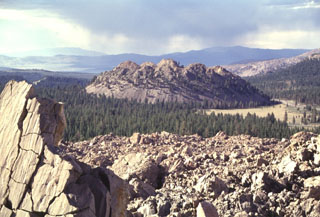 Wilson Butte, the northermost lava dome of the Inyo Craters, is seen from the Obsidian Flow lava dome to the south. The Inyo Craters are a 12-km-long chain of silicic lava domes, lava flows, and explosion craters along the eastern margin of Sierra Nevada south of Mono Craters near the town of Mammoth. Inyo Craters overtop the NW rim of the Pleistocene Long Valley caldera and extend onto the caldera floor, but are chemically and magmatically part of a different volcanic system. The latest eruptions at Inyo Craters took place about 600 years ago.
Photo by Lee Siebert, 1998 (Smithsonian Institution).
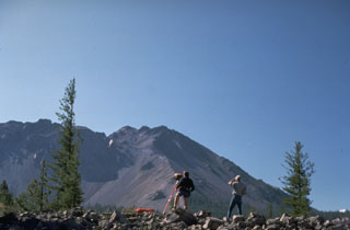 U.S. Geological Survey volcanologists conduct Electronic Distance Measurement surveys NW of Lassen Peak as part of a monitoring program at Lassen volcano. Chaos Crags lava dome rises in the background. The large scarp at the left was formed during collapse of part of Chaos Crags about 1650 CE.
Photo by Lyn Topinka, 1984 (U.S. Geological Survey).
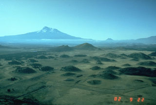 The hilly topography in the foreground is part of the massive debris avalanche deposit produced by collapse of Mount Shasta (in the background) during the Pleistocene. These hummocks represent relatively intact blocks of the volcano that were carried within a more mobile landslide matrix (smaller blocks and grains, snow and ice, and anything entrained during transportation). The debris avalanche covered an area of about 675 km2, reaching at least 45 km NNE.
Photo by Harry Glicken, 1982 (U.S. Geological Survey).
 Active smoker chimneys precipitating iron, copper and zinc sulfides from 230°C fluid are found at the Black Forest hydrothermal area within the submarine caldera of East Diamante volcano. They are 9 m tall from the base to the top. The submarine volcano contains an elongated NE-SW-trending caldera with a pronounced rim on the NE side. A complex of lava domes constructed in the center of the caldera is the site of several hydrothermal areas.
Image courtesy of Submarine Ring of Fire 2004 Exploration, NOAA Vents Program.
 This outcrop exposes a thick pyroclastic flow deposit from an eruption that formed a small caldera on the eastern edge of Black Peak volcano. This major eruption occurred about 4,200 to 4,700 years ago and filled adjacent valleys to depths of up to 100 m.
Photo by Tom Miller, 1985 (Alaska Volcano Observatory, U.S. Geological Survey).
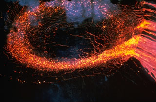 Lava flows from a fissure that opened on 5 March 1965 extended 13 km from Makaopuhi to beyond Nāpau crater. The lava cascaded into Makaopuhi crater, forming a lava lake more than 100 m deep.
Photo by Tom Wright, 1965 (U.S. Geological Survey).
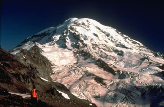 A volcanologist from the U.S. Geological Survey observes the glaciated NW flank of Mount Rainier during a field survey to conduct monitoring measurements on Ptarmigan Ridge. The North Mowich Glacier in the center of the photo descended to about 1,500 m elevation when this photo was taken in 1983.
Photo by Lyn Topinka, 1983 (U.S. Geological Survey).
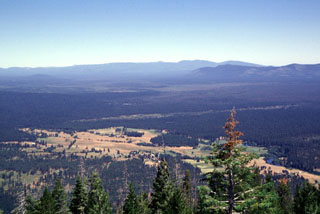 The broad Medicine Lake shield volcano, seen here on the horizon from Soldier Mountain to its south, is truncated by a 7 x 11 km caldera. Medicine Lake volcano has erupted lavas of widely varying composition ranging from basalt to rhyolite. The largest eruption of Medicine Lake during the past 11,000 years produced a massive basaltic lava flow from Giant Crater about 10,600 years ago. The flow traveled a distance of 45 km down the broad valley in the center of the photo from its vent on the SSW flank.
Photo by Lee Siebert, 1998 (Smithsonian Institution).
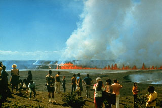 On 14 August 1971 a line of lava fountains erupted across the floor of Kīlauea caldera. The 10-hour eruption was observed by tourists from overlooks along the road around the caldera. The fissure that opened across Halema‘uma‘u crater produced lava flows both on its floor and within the caldera on either side.
Photo by Hawaii Volcanoes National Park, 1971.
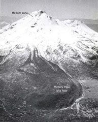 An aerial view shows the Military Pass lava flow on NE side of Mount Shasta, the longest known lava flow from the volcano, erupted about 9,200 years ago. It originated near the summit of the Hotlum cone and reached about 9 km, with a thickness of about 150 m thick near its terminus. The flow overlies the Red Banks pumice and a broad fan of pyroclastic flow deposits that were formed around 9,700 years ago.
Photo by Dan Miller, 1980 (U.S. Geological Survey).
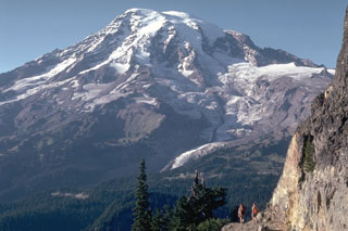 The south flank of Rainier is seen here from the Tatoosh Range, with the Nisqually Glacier below the snow line in this 1980 photo. Meadows and forests of the Paradise area lie immediately below and to the right of the glacier. This is one of 25 named glaciers on Rainier, with the snow, ice, loose rock, and hydrothermal alteration posing a risk of lahars and debris avalanches for surrounding areas.
Photo by Lee Siebert, 1980 (Smithsonian Institution).
 This hydrothermally active submarine volcano at the southern part of the Mariana arc was first detected during a 2003 NOAA bathymetric survey and named NW Rota 1. The seamount rises to within about 500 m of the ocean surface, about 100 km N of Guam. A minor eruption was witnessed in 2004 at the Brimstone Pit vent.
 Image courtesy of Susan Merle (Oregon State University/NOAA Vents Program).
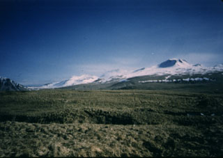 The Atka volcanic complex at the NE tip of Atka Island is one of the largest volcanic centers in the central Aleutians. It contains a caldera and is surrounded by 7 or 8 smaller cones. This view from the south near Atka village shows Korovin, the highest and northernmost of three Holocene cones of the Atka complex.
 Photo by James Dickson, 1986 (courtesy of John Reeder, Alaska Div. Geology Geophysical Surveys).
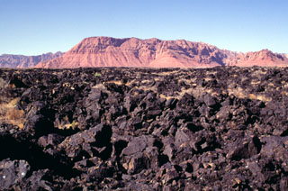 The Santa Clara lava flow exited the narrow Snow Canyon cut in cliff-forming rocks of the Navajo Sandstone in the background. When the basaltic lava flow reached the flat-lying valley of the Santa Clara River cut in less resistant shales of the Chinle formation, it spread out laterally, reaching a width of more than 1.5 km. The flow, one of the youngest in Utah, traveled a distance of 16 km from its source in the Diamond Valley. Housing developments near St. George, Utah now encroach on its distal margins.
Photo by Lee Siebert, 1996 (Smithsonian Institution).
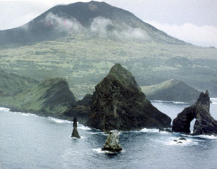 Pagan volcano rises above the Sengan Peninsula on its SSE flank. The peninsula in the foreground is eroded remnants of an older edifice that had a 7-km-wide caldera. North Pagan, the most active of two volcanoes on Pagan Island, was constructed within the past 3,000 years.
Photo by U.S. Navy, 1982.
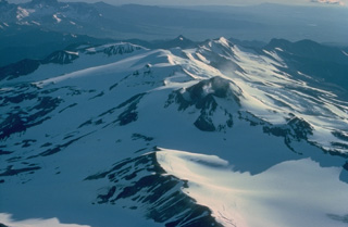 Mount Martin is a large glacier-mantled stratovolcano that anchors the SW end of NE-SW-trending chain of volcanoes cutting across Katmai National Park. A large postglacial lava flow extends 12 km to the NW. A 500-m-wide summit crater is largely ice-free because of strong fumarolic activity. This 1978 view looks down the long axis of elongated Mount Martin from the NE.
 Copyrighted photo by Katia and Maurice Krafft, 1978.
 A lava flow from the Silver Lake scoria cone is visible in this September 2020 satellite image monthly mosaic (N is at the top; this image is approximately 10 km across). Lava flows that erupted from the Silver Lake scoria cone dammed drainages, forming Silver and Author lakes.
Satellite image courtesy of Planet Labs Inc., 2020 (https://www.planet.com/).
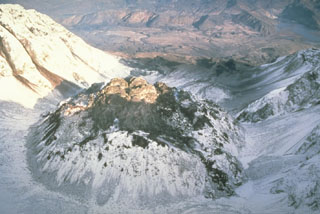 This view from above the south rim of the crater of Mount St. Helens shows the lava dome partially filling the crater on 28 October 1986, at the very end of the 1980-86 eruption. After six years of episodic growth the lava dome reached a height of 250 m and a diameter of 1,100 m.
Photo by Lyn Topinka, 1986 (U.S. Geological Survey).
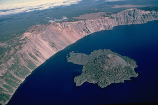 Wizard Island formed within a few hundred years of formation of Crater Lake caldera from a vent near the west caldera rim. This aerial view from the south shows the island, with a symmetrical cinder cone at its right side and lava flows forming small peninsulas on its flanks. Hillman Peak, in the center on the caldera rim, is the youngest of the pre-collapse Mount Mazama stratovolcanoes.
Copyrighted photo by Katia and Maurice Krafft, 1984.
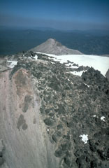 In May 1915, a year after the start of the eruption, lava flowed through low points in the eastern and western crater rims and descended the upper flanks. The western flow shown in this photo reached about 500 m down the flank. On 19-20 May 1915 the eastern flow fragmented and mixed with snowmelt, forming a debris flow that traveled 35 km down Lost Creek and Hat Creek valleys, destroying bridges and farm buildings.
Photo by Bill Chadwick, 1981 (U.S. Geological Survey).
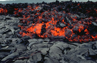 An `a`a lava flow, with a characteristic surface containing abundant angular chunks as it cools, advancing across a smooth-textured pahoehoe lava flow. The hot, incandescent flow interior is visible. The front of this 3 June 1994 flow at Laeapuki, near the Puna coast of Kīlauea volcano, is about 1 m thick.
 Photo by Paul Kimberly, 1994 (Smithsonian Institution).
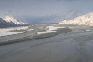 Lahars that formed during the 1989-90 eruptions of Redoubt in Alaska accumulated in the Drift River Valley NE of the volcano. The largest lahars, such as this one from the 15 February 1990 eruption, covered the valley floor nearly wall-to-wall and extended more than 35 km to the Cook Inlet.
Photo by Tom Miller, 1990 (Alaska Volcano Observatory, U.S. Geological Survey).
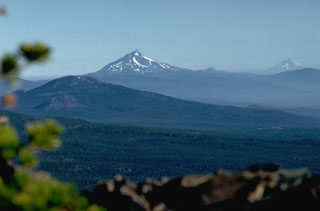 Mount Jefferson in the center and Mount Hood to the right, seen from Broken Top volcano to the south, are the two highest peaks in Oregon, towering above lower volcanic peaks of the High Cascades, such as Black Butte in the foreground. Mount Hood has been active in historical time and Mount Jefferson has Holocene scoria cones to its south, although previous eruptions of the main edifice occurred during the late Pleistocene.
Photo by Lee Siebert, 1982 (Smithsonian Institution).
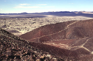 Amboy Crater is a composite cinder cone that contains at least four nested craters. The two outermost craters are breached to the west. A broad lava field that extends from the cone is visible beyond the breach. Light-colored windblown sand deposited by prevailing winds from the west fill in low spots on the surface of the lava flow.
Photo by Lee Siebert, 1997 (Smithsonian Institution).
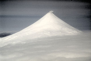 Shishaldin, located on central Unimak Island in the Aleutians, has a summit crater that emits a nearly continuous plume. It is the highest and one of the most active volcanoes of the Aleutian Islands. There have been frequent Strombolian eruptions, sometimes with lava flows, since the 18th century.
Photo by Chris Nye (Alaska Division of Geological & Geophysical Surveys, Alaska Volcano Observatory).
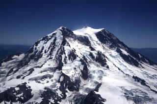 The Tahoma Glacier flows from the summit icecap of Mount Rainier between Liberty Cap (left) and Point Success (right) in this aerial view from the SW in 1969. The current summit was constructed within a scarp left by the collapse of the summit about 5,600 years ago. Slope failure of the summit or upper flanks of the hydrothermally altered volcano has occurred several times during the Holocene, producing massive debris avalanches and mudflows that swept into the Puget lowlands.
Photo by Lee Siebert, 1969 (Smithsonian Institution).
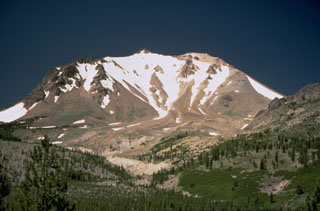 The sparsely vegetated Devastated Zone on the NE flank of Lassen Peak was swept by a pyroclastic surge on May 22, 1915, during the paroxysmal phase of the 1914-1917 eruption. The pyroclastic surge destroyed forests, and was accompanied by mudflows that traveled down Lost Creek and Hat Creek valleys.
Photo by Lyn Topinka, 1984 (U.S. Geological Survey).
 Pavlof, rising above low plains to its NW, is one of Alaska's most active volcanoes. It is part of a NNE-SSW-trending line of volcanoes near the tip of the Alaskan Peninsula. Little Pavlof is the small cone on the right horizon. The low saddle to the left separates Pavlof from Pavlof Sister, whose lower flanks are seen to the far left.
Photo by Steve McNutt, 1979 (University of Alaska, Alaska Volcano Observatory).
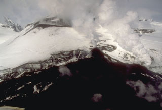 A new lava flow accumulates at the base of a scoria cone in Veniaminof caldera. This 9 May 1994 view from the west shows the snow-covered cone and the lava flow, which has melted through the glacial icecap on the caldera floor.
Photo by Chris Nye, 1994 (Alaska Division of Geological and Geophysical Surveys).
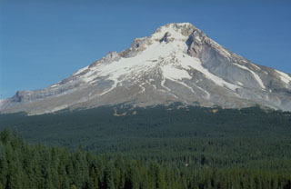 Trillium Lake provides a dramatic view of the broad debris fan on the S flank of Mount Hood that originated from growth of the Crater Rock lava dome, visible on the upper SW flank just below the summit. Dome growth and collapse produced block-and-ash flows and resulted in lahars down the Sandy River and White River drainages.
Photo by Dave Wieprecht, 1993 (U.S. Geological Survey).
 Basalt scoria was erupted from the Soda Lake maar in west-central Nevada. The pen points to an olivine phenocryst; the ejecta also contains abundant phenocrysts of plagioclase and less common clinopyroxene, as well as minor grains of magnetite.
Photo by Nevada Bureau of Mines and Geology.
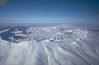 The summit of 35-km-wide Okmok has two largely overlapping 10-km-wide calderas. Both calderas formed by voluminous eruptions of tephra and pyroclastic flows during the Holocene, one about 8,250 years ago and the other about 2,400 years ago. Numerous cones and lava domes formed on the caldera floor and flanks. Historical explosive eruptions and lava flows have originated from cones within the caldera.
Photo by John Reeder (Alaska Division of Geological & Geophysical Surveys).
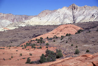 The sparsely vegetated Santa Clara lava flow traveled 16 km to the south down Snow Canyon, cut through the colorful red and white rocks of the Navajo Sandstone formation. The flow, originating from two youthful cinder cones in Diamond Valley above Snow Canyon, was produced during one of the youngest eruptions in the Colorado Plateau/Basin and Range region. This Pliocene-to-Quaternary volcanic field north of St. George in SW Utah contains numerous basaltic cinder cones and lava flows.
 Photo by Lee Siebert, 1996 (Smithsonian Institution).
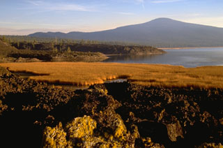 Three small scoria cones oriented along a N-S line produced large andesite lava flows. The northernmost flow formed the natural dam that created Davis Lake (right) and the two other flows are located behind Hamner Butte in the background. The middle flow has been radiocarbon dated to about 5,050-5,600 years old; the other two are considered to have erupted at around the same time and are possibly surface manifestations of the same dike.
Photo by Lee Siebert, 1995 (Smithsonian Institution).
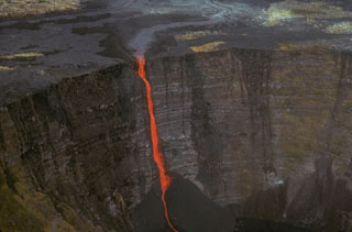 A stream of lava from a vent at Mauna Ulu (above the top of the photo) cascades into Makaopuhi crater during an early stage of the 1969-74 Mauna Ulu eruption. A thick stack of older lava flows that were erupted along Kīlauea's East Rift Zone is exposed in the Makaopuhi crater wall.
Photo by Jim Moore (U.S. Geological Survey).
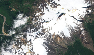 Stepovak Bay 3 is part of the Stepovak Bay Group on the western Alaska Peninsula. The group is located along a NE-trending ridge, seen here in this 17 August 2019 Sentinel-2 satellite image (N is at the top), which is approximately 14 km across.
Satellite image courtesy of Copernicus Sentinel Data, 2019.
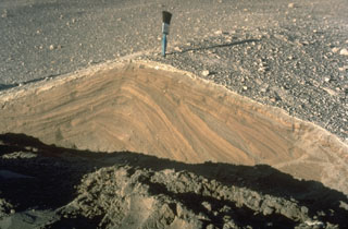 Pyroclastic surges are dilute pyroclastic flows with a high proportion of gas. They originated from secondary phreatic explosions at Mount St. Helens in 1980 and produced these cross-bedded layers. They were deposited from successive, rapidly moving horizontal clouds of gas, ash, and rock fragments that resulted from the interaction of hot pyroclastic flow deposits from the May 18 eruption with melt water produced by glacial ice carried down by the collapse of the summit.
Photo by Norm Banks, 1980 (U.S. Geological Survey).
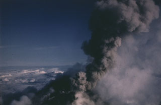 An ash plume rises from vents near the summit of Pavlof on 10 June 1987 in this view from the NNE. Intermittent explosive eruptions took place from vents at the summit and flanks from April 1986 until August 1988, and lava flows descended the flanks in several direction. One lava flow reached to within 600 m of Pavlof Bay and another descended to the saddle between Pavlof and Pavlof Sister.
Photo by Harold Wilson, 1987 (Peninsula Airways).
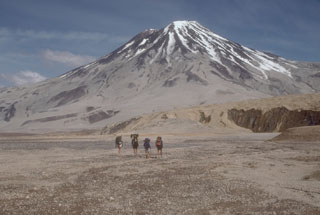 Geologists walk toward Griggs volcano from the base of Knife Creek Glacier to its south. Active fumarole fields persist in the summit crater and along the upper SW flank, and can be heard from the valley floor. The flanks of Griggs and the surface of Knife Creek Glacier have thick ash deposits from the 1912 Novarupta eruption.
Photo by Game McGimsey (Alaska Volcano Observatory, U.S. Geological Survey).
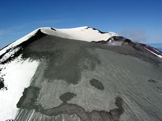 A satellite image on 4 July 2004 showed fresh ash deposits on the upper E flank of Korovin. This photo, taken from the SE, show ash emplaced on the upper slopes of the SE crater.
Photo by Game McGimsey, 2004 (Alaska Volcano Observatory, U.S. Geological Survey).
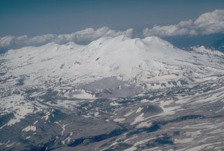 Mount Mageik is in the center of this aerial view from the east, south of Katmai Pass. Martin forms the skyline left of Mageik, and lava flows on the flanks of Trident volcano are visible to the middle right. The three volcanoes are part of a NE-SW chain across Katmai National Park. Much of the surface of Mageik is composed of Holocene lava flows.
Photo by Christina Neal, 1990 (U.S. Geological Survey, Alaska Volcano Observatory).
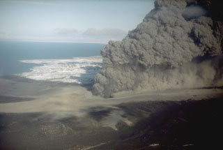 The interaction of magma with groundwater produced this dark, ash-rich eruption column in 1977 from the Ukinrek Maars on the Alaska Peninsula. The eruption occurred in an area without previous volcanic activity, through surficial glacial deposits. The phreatomagmatic explosions created two new craters, which were named after the Yupik words for "two holes in the ground." This photo was taken from the WSW on 6 April 1977.
Photo by R. Russell, 1977 (Alaska Department of Fish and Game).
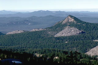 The center of the Devils Hill chain on the SE flank of South Sister contains several small lava domes and flows that are more widely spaced than those at the northern and southern ends. The flows are named for Devils Hill, the partially forested peak to the right.
Photo by Lee Siebert, 1982 (Smithsonian Institution).
 Glacier Peak, seen here from Buck Creek Pass on the west, is constructed on top of a high ridge. The eroded scarps at the base of the volcano are the head of the Suiattle River that eroded into thick pyroclastic flow and lahar deposits from recent eruptions.
Photo by Lee Siebert, 1985 (Smithsonian Institution).
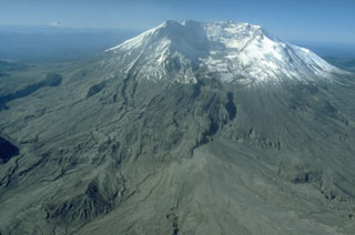 The 2 x 3.5 km horseshoe-shaped crater at Mount St. Helens is typical of scarps formed by massive landslides. On 18 May 1980 the upper 400 m of the summit was removed, leaving the crater open to the N. This event was the world's largest landslide during historical time. The missing portion of the volcano transitioned into the debris avalanche deposits filling the North Fork Toutle River below the volcano.
Photo by Terry Leighley, 1981 (U.S. Geological Survey).
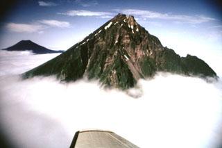 The eastern side of the Chagulak volcano is seen here in the foreground and Amukta is in the background. The two volcanoes join at depth but at the surface they are separated by 7 km of ocean.
Photo by Fred Deines, 1992 (U.S. Fish and Wildlife Service).
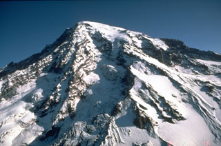 Stratovolcanoes, also referred to as composite volcanoes, are constructed of sequential layers of resistant lava flows and fragmented rock produced by explosive eruptions. An aerial view of the glacially dissected SW flank of Mount Rainier shows the layered interior of a stratovolcano.
Photo by Dan Dzurisin, 1982 (U.S. Geological Survey).
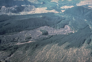 The Floating Island lava flow on the NNW flank of Mount St. Helens, named for an island of trees on the flow, has been dated to 1801 CE using tree-rings. This lava erupted shortly after the major explosive eruption of tephra layer "T" from a vent near the former Goat Rocks lava dome on the N flank. The Floating Island lava flow is now buried beneath the debris avalanche deposit from the 1980 eruption.
Photo by Rick Hoblitt, 1978 (U.S. Geological Survey).
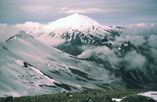 Mount Dutton near the tip of the Alaska Peninsula is seen here from the NE. Successive lava domes overlying lava flows form the summit. Dome and flank collapse during the Holocene produced debris avalanche that traveled to the west and also reached Belkofski Bay to the south.
 Photo by Betsy Yount (Alaska Volcano Observatory, U.S. Geological Survey).
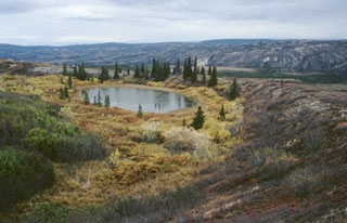 Moderate explosive eruptions radiocarbon dated to about 3,000 years ago formed two tuff rings in the central Alaska Range. A 300-m-wide ejecta blanket can be traced 1.6 km from the larger vent, seen in this photo. Ejecta on the crater rim consists of about 80% country rock fragments, with only 20% juvenile basaltic fragments. A geologist in a red jacket (right) and a helicopter (beyond the trees on the left side of the lake) on the crater rim, provide scale.
Photo by Chris Nye (Alaska Division of Geological & Geophysical Surveys, Alaska Volcano Observatory).
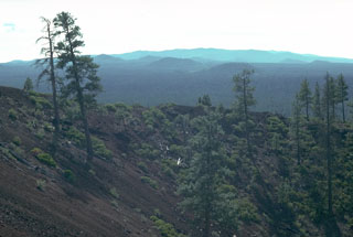 The crater rim of Lava Butte scoria cone on the NW flank provides a view of the broad Newberry shield volcano. Many other NW flank cones and associated lava flows erupted about the same time as the Lava Butte cone and lava flow. Over the past 7,700 years Newberry has erupted both mafic and silicic lavas from flank vents and within the caldera, respectively.
Photo by Lee Siebert, 1981 (Smithsonian Institution).
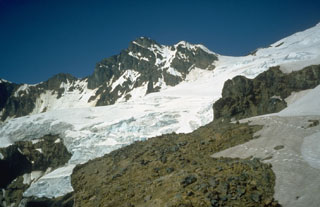 Colfax Peak (center) is an erosional remnant of Black Buttes volcano, a predecessor to Mount Baker that was active from about 500,000 to 300,000 years ago. Coleman Saddle (right center) divides the NE-dipping lavas of Black Buttes from Mount Baker, whose summit lies out of view to the upper right. Easton Glacier descends diagonally across the photo to the SW.
Photo by Bill Chadwick, 1981 (U.S. Geological Survey).
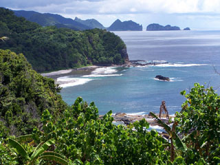 Cliffs and an offshore island mark the rugged coastline of Tutuila Island. The elongated, extensively eroded Tutuila in the center of the Samoan Islands consists of five Pliocene-to-Pleistocene volcanoes constructed along rifts trending SSW-NNE. Following a lengthy period of erosion, submergence, and the construction of a barrier reef, the Leone volcanics were erupted during the Holocene along a 5-km-long N-S-trending fissure, forming a group of scoria cones that produced pahoehoe lava flows.
Photo by Tavita Togia, 2004 (U. S. National Park Service).
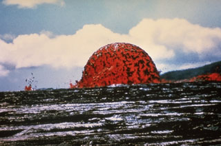 A dome fountain reached heights of about 20 m for hours on 11 October 1969. This unusual activity, produced by fountaining from a circular, vertical conduit at relatively constant gas pressures, occurred early during the Mauna Ulu eruption. This East Rift Zone eruption lasted from 1969 until 1974.
Photo by Jeffrey Judd, 1969 (U.S. Geological Survey).
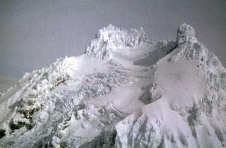 Glaciers descend the upper flanks of Isanotski between the summit pinnacles. Locally known as Ragged Jack, this is at the center of an E-W-trending group of three volcanoes on Unimak Island.
 Photo courtesy of Alaska Volcano Observatory, 1994.
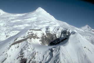 Crater Peak, a flank vent of Mount Spurr, is seen from the south with the snow-and-ice-covered summit lava dome complex in the background. Both the summit lava dome and Crater Peak were constructed within a 5-6 km wide scar formed by an earlier collapse. Crater Peak has been the source of about 40 Holocene tephra layers identified in the Cook Inlet basin.
Photo by Game McGimsey, 1991 (Alaska Volcano Observatory, U.S. Geological Survey).
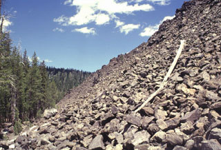 The western terminus of the Hoffman dacite lava flow forms a steep blocky slope up to about 50 m in height. The flows originated from six or more NW-SE-trending vents. The larger of the two flows (seen here) was erupted near the eastern caldera rim and flowed primarily west into the caldera, although a smaller portion traveled to the east.
Photo by Lee Siebert, 1998 (Smithsonian Institution).
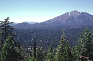 Twin Buttes, the two cinder cones at left-center, were formed SE of Burney Mountain, the prominent andesitic lava dome complex at the right. Blocky, partially vegetated lava flows extend to the north from the cinder cones. The twin cones are part of a large area of young volcanism located north of Lassen National Park. Burney Mountain is a large dacitic complex of five overlapping lava domes of Pleistocene age.
Photo by Lee Siebert, 1998 (Smithsonian Institution).
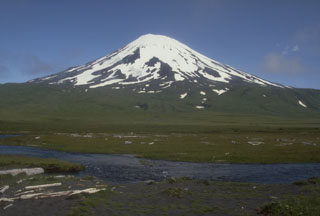 Mount Vsevidof is allocated on SW Umnak Island. The historically active volcano, seen here from the south, contains an E-W zone of scoria cones on the W flank that fed many lava flows, including a large flow that reached the west coast of the island and formed Cape Kigushimkada.
 Photo by Chris Nye (Alaska Division of Geological & Geophysical Surveys).
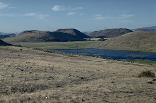 These hills below the north flank of Mount Shasta are hummocks resulting from the massive Shasta Valley debris avalanche deposit, which formed during a major volcanic flank collapse event in the Pleistocene. Individual hummocks, composed of remnants of the ancestral Shasta volcano, are up to 200 m high and some are more than 1 km long.
Photo by Lee Siebert, 1981 (Smithsonian Institution).
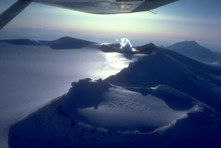 An aerial view shows a portion of the 4 x 6 km, ice-filled, summit caldera of Mount Wrangell. It is the part of the Wrangell volcanic field and has documented historical eruptions. Fumaroles (right-center) remain active at one of three scoria cones on the caldera rim.
Photo by Chris Nye (Alaska Division of Geological and Geophysical Surveys, Alaska Volcano Observatory).
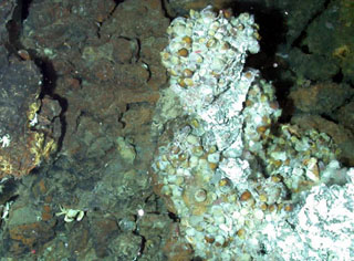 A view from a submersible during a 2006 NOAA Vents Program expedition shows a glimpse of a biological community at a Forecast Seamount vent site. Hydrothermal fluid temperatures were measured up to 200°C, one of the highest temperature vent systems known in the Mariana arc.
Image courtesy of Submarine Ring of Fire 2006 Exploration, NOAA Vents Program.
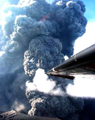 An ash plume rises from the east crater of Anatahan on 16 June 2003. The plume reached a maximum height of about 2.5 km in less than 40 seconds. This pulse of activity was accompanied by intense tremor and earthquakes that were recorded by the single seismic station on the island.
Photo by U.S. Geological Survey, Hawaiian Volcano Observatory, 2003.
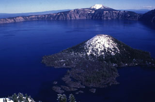 The lake within Crater Lake is the deepest in the USA at nearly 600 m, within the caldera that formed during a major eruption of its predecessor Mount Mazama around 7,700 years ago. Snow mantles the summit of the Wizard Island cone in the foreground.
Photo by Lee Siebert, 1997 (Smithsonian Institution).
 Tutuila Island is in the center of the Samoan Islands, shown in this 3 March 2019 Sentinel-2 satellite image (N is at the top; this image is approximately 44 km across). The extensively eroded island has multiple eruptive centers that have produced domes, cones, craters, and calderas.
Satellite image courtesy of Copernicus Sentinel Data, 2019.
 A roughly 3-m-high rounded glacial erratic at the Bumpass Hell parking lot is witness to the extensive glacial erosion that has affected much of Lassen Volcanic National Park. Brokeoff volcano in the background is the glacially eroded remnant of a large stratovolcano that formed begining about 600,000 years ago. At its peak the volcano may have reached a height of 3350 m. Glacial erosion of hydrothermally altered rocks at the core of the volcano has produced a large central depression.
Photo by Lee Siebert, 1998 (Smithsonian Institution).
 The Lava Cast Forest lava flow on the NW flank of Newberry formed about 7,000 years ago. It contains hollow tree molds that stand above the surface of the flow. These features formed when flowing lava chilled around standing tree trunks that subsequently burned from the heat of the lava. Horizontal tree molds formed around trees that had either previously fallen or were toppled by the advancing lava flow.
 Photo by Lee Siebert, 1972 (Smithsonian Institution).
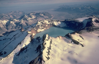 Alaska's lake-filled Katmai caldera, seen here from the SE, collapsed during a catastrophic eruption in 1912 of Novarupta volcano, hidden behind the far caldera wall 10 km to the west. Little tephra was erupted from Katmai itself, but Novarupta produced the Valley of Ten Thousand Smokes ash flow, whose deposits form the broad flat valley in the right distance. Prior to 1912, Mount Katmai was a 2290-m-high complex of 4 small stratovolcanoes, similar to Trident volcano to the SW.
Copyrighted photo by Katia and Maurice Krafft, 1978.
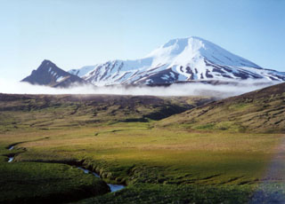 Little Sitkin is seen here on the NW of the island and the peak to the left is part of the Williwaw Cove Formation, consisting of Tertiary to Quaternary lava flows. Two nested calderas lie between this peak and Little Sitkin. An older Pleistocene caldera lies just beyond the cloud in the center.
Photo by Steve Ebbert, 2000 (U.S. Fish and Wildlife Service).
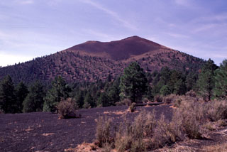 Sunset Crater, seen here from the NE, is the centerpiece of Sunset Crater National Monument. During the 1920's, geologist H.S. Colton successfully lobbied to prevent a Hollywood movie company from blowing up the cone to simulate a volcanic eruption. The monument was subsequently established to protect the cone. The proximal part of the Kana-a lava flow, erupted from a vent on the NE flank, is buried here by tephra. The flow was the longest from the Sunset Crater vent system and traveled 11 km to the NE.
Photo by Lee Siebert, 1996 (Smithsonian Institution).
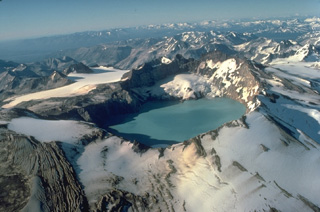 Mount Katmai, seen here from the south, is truncated by a caldera that formed in 1912 during a catastrophic eruption at Novarupta volcano, 10 km to the west. Little eruptive activity occurred at Katmai itself during the collapse. Prior to 1912, Mount Katmai was a 2290-m-high complex of 4 small overlapping stratovolcanoes. The 3 x 4.5 km wide caldera is filled by a lake that was 250-m deep by 1976 and is still rising. The small glaciers on the bench on the north caldera wall began forming shortly after the 1912 eruption.
 Copyrighted photo by Katia and Maurice Krafft, 1978.
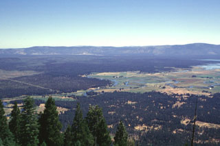 The broad forested area in the center of the photo, below the Big Valley Mountain fault scarp on the horizon, is a series of youthful lava flows erupted from Brushy Butte, a small low shield volcano barely distinguishable in this photo. Big Lake, at the extreme right, was formed by numerous springs issuing from the margin of the basaltic lava flows. This view from the SW is from the summit of Soldier Mountain.
Photo by Lee Siebert, 1998 (Smithsonian Institution).
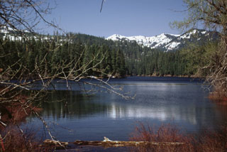 Fish Lake is an ephemeral lake on the western side of the Cascade Range crest that fills with water (seen here after spring snow-melt) but dries up during the summer. The lake formed when the Fish Lake lava flow from Nash Crater of the Sand Mountain volcanic field dammed local drainages. This flow and the Lava Lake flow from scoria cones at the northern half of the chain were both extruded about 3,850 radiocarbon years ago.
Photo by Lee Siebert, 1999 (Smithsonian Institution).
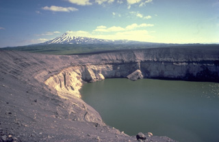 The Ukinrek Maars were formed during an eruption in 1977 at a Bering Sea lowland area without previous volcanic activity. Powerful phreatomagmatic explosions formed the 170-m-wide West Maar and 300-m-wide East Maar. The maars were named from the Yupik Eskimo words for "two holes in the ground." Late in the 10-day-long eruption a lava dome formed in East Maar, seen here from the NW rim with Peulik volcano in the background. The dome is now submerged beneath a 60-m-deep lake.
Copyrighted photo by Katia and Maurice Krafft, 1978.
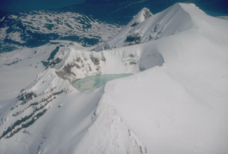 The summit of Douglas volcano on the northern tip of the Alaska Peninsula contains a warm and highly acidic crater lake approximately 160 m wide. An active fumarole field is also found on the shores of the lake.
Photo by Christina Neal (Alaska Volcano Observatory, U.S. Geological Survey).
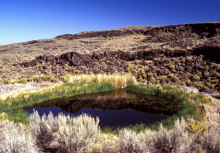 Lava flows of West Dome, one the structural highpoints of Diamond Craters, rise NE of lake-filled Malheur Maar. The shallow 2-m-deep lake occupies one of many maars (the rest of which are dry) of the Diamond Craters volcanic field at the time of this 2002 photo. Diamond Craters consists of a 70 km2 area of basaltic lava flows, scoria cones, and maars. The initial eruptions of pahoehoe lava flows and later activity involved magma injection that produced six structural highs of up to 150 m.
Photo by Lee Siebert, 2002 (Smithsonian Institution).
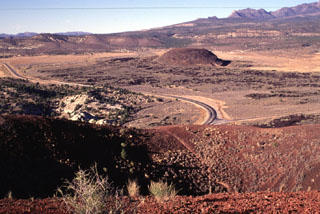 Reddish scoria caps the circular rim of the southernmost of two cinder cones in the lower Diamond Valley of SW Utah. The northern cone in the middle distance is surrounded by a basaltic lava field. Light-colored rocks of the Navajo Sandstone at the left lie across a narrow gap from the southern cone; lava flows from the two cones spilled through this gap into Snow Canyon. The Pine Mountains rising in the distance are in part covered by older lava flows in the St. George basin.
Photo by Lee Siebert, 1996 (Smithsonian Institution).
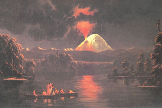 A painting by Paul Kane in the 1840s shows a nighttime eruption of Mount St. Helens as hypothetically viewed from near the mouth of the Lewis River to the west. The eruption is accurately shown originating from Goat Rocks on the N flank.
Painting by Paul Kane (Royal Ontario Museum, Toronto, Canada).
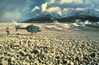 Pumice clasts from the 18 May 1980 eruption form the pumice plain immediately north of Mount St. Helens, shown in this 23 May photo. Pumiceous pyroclastic flows on 18 May traveled 8 km from the crater, as far as Spirit Lake. A geologist can be seen holding a large, light-weight block of pumice. Pumiceous pyroclastic flows were also erupted on 25 May, 12 June, 22 July, 7 August, and 16-18 October 1980.
Photo by Dan Miller, 1980 (U.S. Geological Survey).
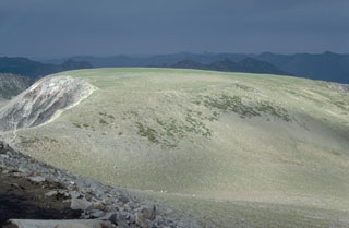 A large lava flow forms Burroughs Mountain on the NE flank of Mount Rainier. The 3.4 km3 flow is up to 350 m thick and is 11 km in length. The flow erupted about 500,000 years ago at the onset of an initial growth period of modern Mount Rainier and overlies block-and-ash flow deposits. The flow is perched on a ridge top and has ice-contact features, indicative of its emplacement against the margins of a thick Pleistocene glacier.
Photo by Lee Siebert, 1982 (Smithsonian Institution).
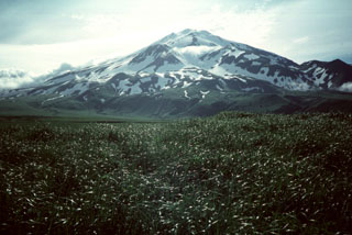 Pyre Peak was constructed within a 3-km-wide caldera and is seen from near the western tip of Seguam Island. The 11.5 x 24 km island contains two calderas, each with a Holocene cone. A third Holocene cone is at the eastern end of the island. The cone rises 1 km above the caldera floor and has been the source of many of the historical eruptions.
Photo by Steve Ebbert, 1996 (U.S. Fish and Wildlife Service).
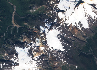 Stepovak Bay 2 is part of the Stepovak Bay Group on the western Alaska Peninsula. The group is located along a NE-trending ridge, seen here in this 14 September 2018 Sentinel-2 satellite image (N is at the top), which is approximately 14 km across. Several of the volcanoes have produced debris flows and lava flows in the Holocene.
Satellite image courtesy of Copernicus Sentinel Data, 2018.
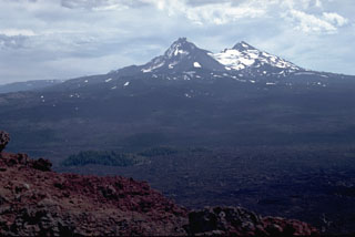 The Belknap Crater scoria cone provides a panorama of recent volcanism in the McKenzie Pass area. Younger lava flows from scoria cones on the north flanks of North and Middle Sister volcanoes in the background merge with flows from the Belknap shield volcano. Most of these flows were erupted in the past few thousand years. In the left foreground, lava flows from Belknap diverge around kipukas, islands of older rocks.
Photo by Lee Siebert, 1982 (Smithsonian Institution).
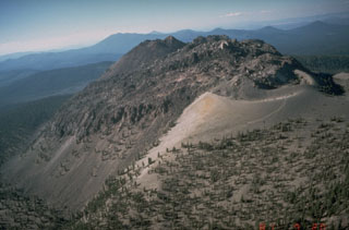 The Chaos Crags lava dome complex on the north flank of Lassen Peak, seen here from the south, was formed at the end of an eruptive period about 1100-1000 years ago. A tephra ring from associated explosive eruptions forms the light-colroed area at the middle right.
Photo by Dan Dzurisin, 1981 (U.S. Geological Survey).
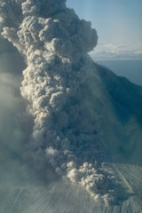 A pyroclastic flow travels down the north flank of Augustine volcano in Alaska on 30 March 1986, three days after the start of a five-month long eruption. An ash plume rises above the pyroclastic flow. As with many Augustine eruptions, early pyroclastic flows were pumice rich; later in the eruption block-and-ash flows were produced by collapse of a growing lava dome.
Photo by Betsy Yount, 1986 (Alaska Volcano Observatory, U.S. Geological Survey).
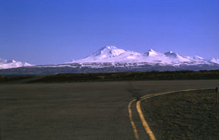 Mt. Dutton viewed from the airport runway at Cold Bay at the tip of the Alaska Peninsula.
Photo by Christina Neal, 1997 (Alaska Volcano Observatory, U.S. Geological Survey).
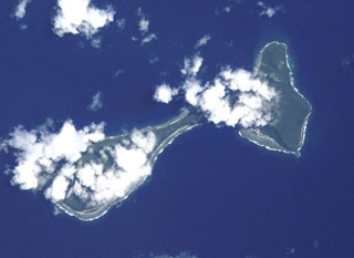 Clouds drape the tops of the two islands of Ofu (left) and Olosega (right) in eastern Samoa in this International Space Station image (N is to the top left). The islands, 6 km in combined length, are separated by a narrow strait. They are formed by two eroded, coalescing basaltic shield volcanoes truncated by mostly-submarine calderas. A submarine eruption took place in 1866 about 3 km SE of Olosega, along the ridge connecting Olosega with Ta'u Island.
NASA International Space Station image ISS002-E-6878, 2001 (http://eol.jsc.nasa.gov/).
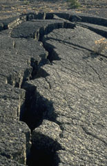 Pressure ridges, formed when moving, still-fluid magma buckled the solidified surfaces of pahoehoe lava flows, are one of the many lava flow features easily observed at Craters of the Moon National Monument in Idaho.
Photo by Lee Siebert, 1994 (Smithsonian Institution).
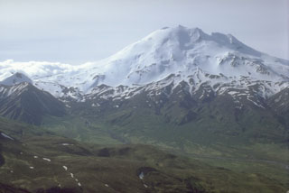 Chiginagak is a glacier-covered edifice with hot springs near the base of the N flank. Recent eruption products include an unglaciated lava flow and an overlying block-and-ash-flow deposit on the east side.
 Photo by Alaska Volcano Observatory, U.S. Geological Survey
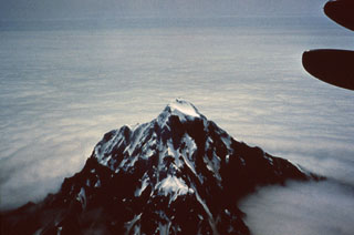 Chagulak forms a small 3-km-wide island NE of Amukta. The two volcanoes coalesce at depth although they are separated by 7 km of ocean.
Photo by Dan Rogers, 1961 (courtesy of Alaska Volcano Observatory).
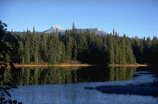 Lemei Rock, seen from the Forlorn Lakes to the SE, forms the high point of the Indian Heaven volcanic field midway between Mount St. Helens and Mount Adams. The 600 km2 field consists of overlapping small shield volcanoes with smaller cones and lava flows. The field was active from about 730,000 to about 9,000 years ago and contains some volcanic features that originated beneath a glacial icecap.
Photo by Lee Siebert, 1995 (Smithsonian Institution).
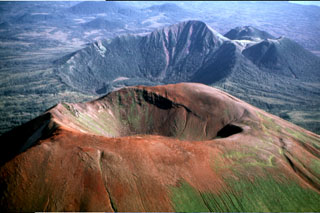 The Pleistocene-to-Holocene Mount Edgecumbe volcanic field covers about 260 km2 of Kruzov Island west of Sitka in the SE panhandle of Alaska. This aerial view shows oxidized scoria of the Edgecumbe volcano in the foreground. Crater Ridge in the background contains a 1.6-km-wide, 240-m deep caldera. And rhyolite domes (top right) The youngest eruptions from Mount Edgecumbe, the largest feature in the Edgecumbe field, are about 4,000 years old.
Photo by Jim Riehle (U.S. Geological Survey, Alaska Volcano Observatory).
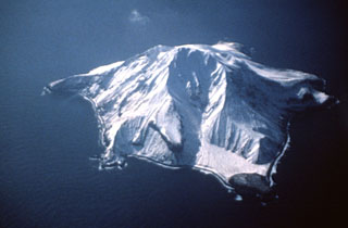 The small 3 x 4 km Bobrof volcanic island lies 50 km W of Adak and 15 km W of Kanaga volcano. The irregular shoreline has a half-dozen small cliff-bound peninsulas. The geology and timing of volcanism on Bobrof are unknown, but pyroclastic flow deposits are present.
Photo courtesy of Alaska Volcano Observatory, U.S. Geological Survey.
 The NE caldera wall of the 17 x 32 km Long Valley caldera, seen from Lookout Mountain on the west, forms a curved ridge that rises more than 1 km above the caldera floor. The caldera was formed following the eruption of the voluminous Bishop Tuff about 760,000 years ago. Uplift and renewed eruptions then formed a resurgent dome in the center of the caldera. The caldera is thermally active and has been the site of seismic swarms and other unrest for more than a decade.
Photo by Larry Mastin, 1991 (U.S. Geological Survey).
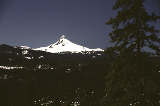 Early spring snows linger on the dramatic spine of Mount Washington, seen here from the east, north of Santiam Pass. Washington is of several major Pleistocene Cascade volcanoes, including Mount Thielsen, North Sister, and Mount Jefferson, whose resistant central conduit has been exposed by erosion.
Photo by Lee Siebert, 2000 (Smithsonian Institution).
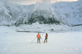 U.S. Geological Survey scientists make precision leveling measurements in the crater of Mount St. Helens in February 1982 with the steaming lava dome in the background. Repeated measurements of deformation was one of several methods used by scientists to successfully forecast later eruptions from the crater.
Photo by Terry Leighley, 1982 (U.S. Geological Survey).
 Sunset Crater (left) and adjacent cinder cones are seen here from the west across the meadows of Bonito Park. Sunset Crater and adjacent cones were erupted along a 10-km-long, NW-SE-trending line, with Sunset Crater being the NW-most vent. The Sunset Crater eruptions severly affected Sinagua Indians living in the area, who temporarily evacuated the region.
Photo by Lee Siebert, 1996 (Smithsonian Institution).
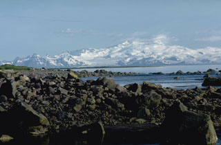 The broad, glacier-covered Mount Douglas rises across Kamishak Bay as seen from Augustine Island to its NE. The rocks in the foreground are part of a young debris avalanche deposit from Augustine.
Photo by Lee Siebert, 1986 (Smithsonian Institution).
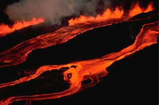 The en-echelon character of the 1984 eruptive fissure at Mauna Loa volcano can be appreciated in this March 25 view from the north along the NE rift zone. The lava fountain at the upper left feeds a lava flow that travels downslope out of view to the left. In the center, a lava flow can be seen that originated from the adjacent offset fissure segment immediately up slope, while the flow to the right originates from another fissure segment farther up slope beyond the photo margin.
Copyrighted photo by Katia and Maurice Krafft, 1984.
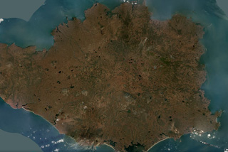 The 108-km-wide Nunivak Island volcanic field in the Bering Sea off Alaska is shown in this October 2019 Planet Labs satellite image monthly mosaic (N is at the top; this image is approximately 96 km across). There are around 60 scoria cones and four maars across the island, with lava flows 3-15 m thick and less than 3.5 km long forming much of the Island surface.
Satellite image courtesy of Planet Labs Inc., 2019 (https://www.planet.com/).
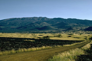 This view of Mauna Kea from the north shows the irregular profile of the summit. The scoria cones in the center of this photo were constructed during eruptions about 4,500 years ago.
Photo by Richard Fiske, 1967 (Smithsonian Institution).
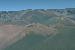 Kamoa o Pele (left) and Pu’u o Maui (right) are two of a group of young scoria cones along the southwest rift zone within the Haleakalā crater, seen here looking westward towards the Haleakalā summit.
Photo by Lee Siebert, 1987 (Smithsonian Institution).
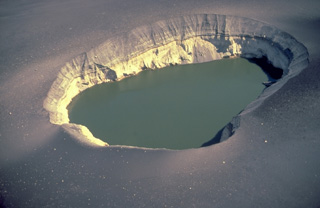 The 300-m-wide East Maar is one of the two Ukinrek Maars, which were formed during an eruption in 1977 through glacial deposits on the Alaska Peninsula. This fresh maar, in contrast to older ones whose rims have been modified by slumping and erosion, has steep-sided walls. The explosions blasted through the pre-existing, light-colored glacial till forming the bottom half of the distant crater wall and then deposited the dark, bedded layers in the upper half of the crater wall as well as the dark blanket of blocks and ash surrounding the maar.
Copyrighted photo by Katia and Maurice Krafft, 1978.
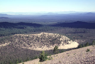 The back side of light-colored Paint Pot Crater and Pumice Stone Mountain, from where the photo was taken, are mantled by white pumice from the eruption that preceded the extrusion of the nearby Little Glass Mountain obsidian flow. The formation of Paint Pot Crater and the associated extrusion of the lava flow that forms the sparsely vegetated area south (right) of the cone occurred about 1100-1150 years ago, only shortly before the major Little Glass Mountain eruption.
Photo by Lee Siebert, 1998 (Smithsonian Institution).
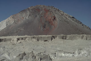 The hill in the background is one of many hummocks forming the surface of the massive debris avalanche deposit produced by collapse of the summit of Mount St. Helens on 18 May 1980. The different colored rocks represent portions of the volcano that were transported relatively intact over great distances. The avalanche traveled 25 km, filling the upper North Fork Toutle River to a maximum depth of nearly 200 m. The lighter-colored rocks in the foreground are pyroclastic flow deposits.
Photo by Lee Siebert, 1982 (Smithsonian Institution).
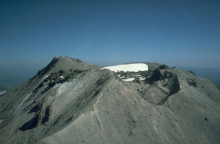 The summit of Lassen Peak contains a lava flow and several craters that formed during the 1914-1917 eruption. Lava flowed out of the crater through low points in the eastern and western crater rims. The NW crater in the foreground (right) formed during explosions near the end of the eruption in 1917.
 Photo by Bill Chadwick, 1981 (U.S. Geological Survey).
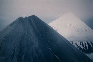 Both Cleveland (left) and Carlisle (right) volcanoes in the Aleutian islands are snow-covered, but the flanks of Cleveland in this 24 June 1987 photo, seen from the ESE, are darkened by ashfall deposits from an explosive eruption that began on 19 June.
Photo by Harold Wilson, 1987 (Peninsula Airways), courtesy of John Reeder (Alaska Div. Geology Geophysical Surveys).
 Groundhog cinder cone (center) is seen from the NE with Tunnel Meadow in the foreground. Peaks of the Great Western Divide across Kern Canyon in Sequoia National Park are visible on the right horizon. Groundhog cone is the youngest of the group of cinder cones forming the Golden Trout Creek volcanic field in the Golden Trout Wilderness Area. This nomenclature derives from the renowned Golden trout, which is a sub-species of rainbow trout and has been designated as the official state fish of California.
 Photo by Rick Howard, 2002 (courtesy of Del Hubbs, U S Forest Service).
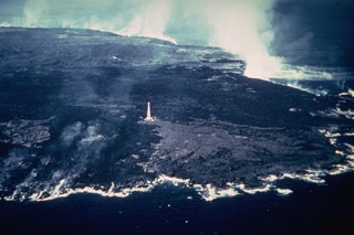 An aerial view from the SE on 11 February 1960 shows steam rising from Kīlauea lava flows that reached the coast. The lava flows extended the shoreline at the NE tip of the island of Hawaii up to nearly 1 km along a 5-km-long front. The entire area of this photo, with the exception of the wedge-shaped lighter-gray area extending to the coast from the Cape Kumukahi lighthouse, was inundated by 1960 lava flows. The eruption ended eight days after this photo was taken.
Photo by Hawaii Volcanoes National Park, 1960.
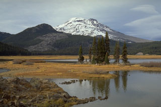 The southernmost of a series of obsidian lava domes and flows erupted about 2,000 years ago along a 5-km-long N-S fissure on the SE flank of South Sister, with the end of the flow visible to the left near Sparks Lake. The barren lower right skyline of South Sister is the Newberry lava flow, the largest and northernmost of the lava flows erupted along the 5-km-long chain named after Devils Hill, the forested peak to the left.
Photo by Lee Siebert, 1995 (Smithsonian Institution).
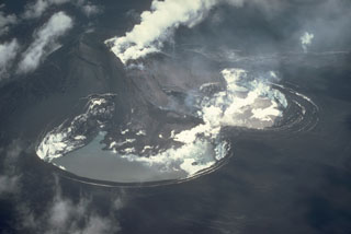 Strombolian eruptions from a scoria cone (upper left) produced heavy ashfall that darkens the entire Veniaminof caldera floor in this 26 July 1983 view from the SW. A plume rises above a vent near the top of the cone that is producing a lava flow down the flank and melting a large pit in the glacial ice Two meltwater lakes have formed in the depressions and steam rises from the margins of the lava flow. Concentric fractures are visible around the margin of the pit due to exposed glacial ice from the collapse.
Photo by Betsy Yount, 1983 (Alaska Volcano Observatory, U.S. Geological Survey).
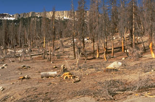 In 1995 soil gas fluctuations caused tree dieback at Horseshoe Lake on the SE side of Mammoth Mountain. A period of unrest including uplift and seismic swarms has continued for more than a decade.
Photo by Dave Wieprecht, 1995 (U.S. Geological Survey).
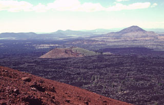 The basaltic Callahan lava flow, erupted from the Cinder Butte cone, is the largest Holocene lava flow on the north flank of Medicine Lake volcano. The broad Callahan flow is seen here from the reddish oxidized rim of Cinder Butte diverging around an older cinder cone to the north. The flow was dated from radiometric and paleomagnetic evidence at about 800 CE. The Callahan flow is chemically zone, with initial lavas being andesitic and later lavas basaltic.
Photo by Lee Siebert, 1998 (Smithsonian Institution).
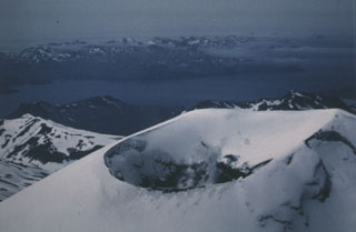 This view from the NE in June 1986 shows steam rising from the summit crater of Korovin, north of Atka. It has been reported to have a cylindrical vent of greatly variable depth depending on the presence of a lake.
Photo by Harold Wilson (Peninsula Airways), 1986 (courtesy of John Reeder, Alaska Div. Geology & Geophysical Surveys).
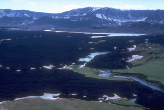 Lava flows cover large parts of the Okmok caldera floor on NE Umnak Island, some of which erupted during historical time. The small lakes within the caldera are remnants of a larger lake that filled the caldera to depths of more than 200 m before overtopping the rim and eroding a 180-m-deep notch through the northern caldera wall.
Photo by Chris Nye, 1980 (Alaska Division of Geological & Geophysical Surveys, Alaska Volcano Observatory).
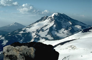 The close proximity of the Three Sisters volcanoes, in contrast to the other large Cascade volcanoes that are typically 60-100 km apart, can be seen in this view of South Sister volcano from the summit of North Sister with the glacier-covered slopes of Middle Sister to the lower right. Mount Bachelor is in the distance to the left.
Photo by Lee Siebert, 1984 (Smithsonian Institution).
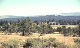 Big Cave shield volcano, at the northern end of an area of late-Quaternary volcanism extending north from Lassen Peak, is a small shield with young pyroclastic cones at the summit and north flank. The volcano is seen here from the west, with the summit cones forming the low forested hills right of the photo center. Forested lava flows extend from the summit of the low shield volcano. The age of Big Cave volcano is not known precisely, but it formed in either the Holocene or latest Pleistocene.
Photo by Lee Siebert, 1998 (Smithsonian Institution).
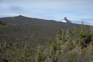 Little Belknap (upper left) is an example of a small shield volcano in a continental margin setting. Little Belknap was constructed on the E flank of Belknap volcano and erupted lava flows over the McKenzie Pass area of the central Oregon Cascades about 2,900 years ago. Collapsed lava tubes that fed the flows diverge radially away from the summit. The summit of Mount Washington appears above the horizon to the right.
Photo by Lee Siebert, 1995 (Smithsonian Institution).
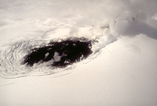 On 9 May 1994, a fresh black lava flow is erupted onto the glacier-covered caldera floor of Veniaminof volcano on the Alaska Peninsula. The source of the lava flow is a cinder cone that is obscured by steam to the upper right. Concentric fractures on the glacier surface are created as the lava flow melts through the glacial ice.
 Photo by Chris Nye, 1994 (Alaska Division of Geological and Geophysical Surveys).
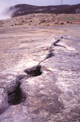 A now-inactive fissure cuts the surface of a sinter mound at Steamboat Springs in Nevada. Steam from a hot springs rises at the upper left. Steamboat Springs, an area of active geothermal development, currently displays hot springs, a large number of steam vents and fumaroles structurally related to regional faults. The area once contained about 20 small geysers, but none are currently active.
Photo by Paul Kimberly, 1997 (Smithsonian Institution).
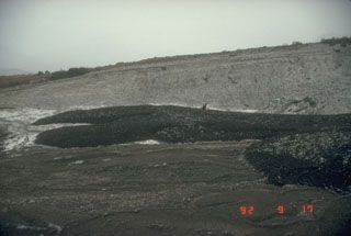 An Alaska Volcano Observatory scientist examines lahar deposits originating from the 1992 eruption of the Crater Peak vent at Mount Spurr. These deposits were emplaced the night of 16-17 September during the last of three short, but powerful, explosive eruptions from June to September.
Photo by Game McGimsey (Alaska Volcano Observatory, U.S. Geological Survey).
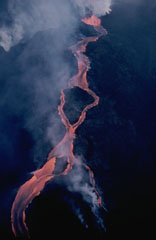 A lava flow from the Mauna Loa NE rift zone travels down the eastern flank on 30 March 1984. The flow developed a braided morphology as it moved around topographic highs. These flows originated from the easternmost vents of the 1984 fissure that opened during the afternoon of 5 March just below Pu'u 'Ula'ula; that remained the only active vent through to the end of the eruption on 15 April.
Photo by J.D. Griggs, 1984 (U.S. Geological Survey).
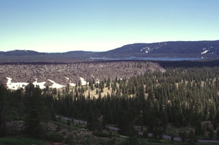 The Medicine Lake lava flow, seen here from the NW with Medicine Lake in the background, was erupted onto the caldera floor from a vent near the northern caldera rim. The flat-lying, viscous 0.08 km3 lava flow is not precisely dated, but is known from stratigraphic evidence to have been emplaced sometime between the roughly 780 BCE Burnt Lava flow and the roughly 720 CE Hoffman flow.
Photo by Lee Siebert, 1998 (Smithsonian Institution).
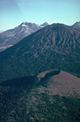 Kwohl Butte scoria cone in the foreground is part of a 25-km-long chain of small shield volcanoes and scoria cones extending north to Mount Bachelor. South and Middle Sister volcanoes are visible to the left behind the eroded slopes of Bachelor.
Photo by Lee Siebert, 1981 (Smithsonian Institution).
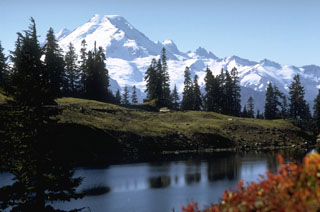 Glaciated Mount Baker is seen here from Twin Lakes to the north. Sherman Crater, the source of historical eruptions from Mount Baker, is visible on the left side between the summit and the smaller Sherman Peak. The older eroded Black Buttes volcano forms the two peaks below and to the right of the summit.
Photo by Lee Siebert, 1971 (Smithsonian Institution).
 A line of lava fountains rises above a fissure on the lower East Rift Zone of Kīlauea in January 1960. The eruption originated near the village of Kapoho, which was overrun by lava flows. Lava flows traveled to the coast, reaching the ocean along a broad front.
Photo by Hawaii Volcanoes National Park, 1960.
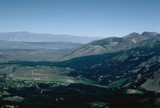 The south wall of the 17 x 32 km Long Valley caldera, seen from Mammoth Mountain on the SE topographic caldera rim, is composed of Paleozoic and Mesozoic metamorphic and igneous rocks. Recent seismic swarms and soil gas anomalies have occurred on the flat caldera floor in the center of the photo.
Photo by Victoria Avery, 1996 (Smithsonian Institution).
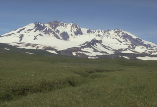 Mount Recheschnoi on Umnak Island has been extensively eroded by glaciers. This 1985 view from the SW shows the NE-SW-trending summit ridge, which is contains deep valleys. Holocene cones and lava domes are on the E and W flanks, and a large thermal area including hot springs and a geyser is on the NE flank.
Photo by Chris Nye (Alaska Division of Geological & Geophysical Surveys).
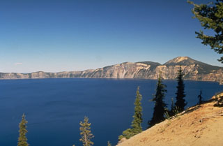 The 8 x 10 km wide Crater Lake caldera was formed about 7,700 years ago when Mount Mazama, a complex of overlapping stratovolcanoes, collapsed following a major explosive eruption. The eruption produced widespread ashfall and pyroclastic flows that traveled as far as 70 km. The caldera, seen here from the S rim, is 1,200 m deep and filled to half its depth by Crater Lake.
Photo by Dave Wieprecht, 1995 (U.S. Geological Survey).
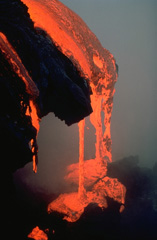 A lava flow drips into the sea, a common sight during the long-term eruption from Kīlauea's east rift zone that began in 1983. This closeup view was taken in May 1987.
Copyrighted photo by Katia and Maurice Krafft, 1987.
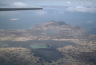 Ukinrek Maars are two phreatomagmatic explosion craters that were created in an area without previous volcanic activity during a 10-day-long eruption that began on 30 March 1977. A greenish lake fills East Maar, the largest of the two in this 1994 view from the south. The smaller West Maar is surrounded by dark tephra near the left margin. Gas Rocks, an older volcanic center, forms the peninsula extending into Becharof Lake in the background.
Photo by Chris Nye, 1994 (Alaska Division of Geological and Geophysical Surveys, Alaska Volcano Observatory).
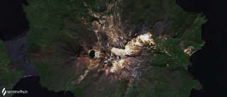 The Tana volcanic complex is the eastern part of Chuginadak Island, shown in this 23 August 2020 Sentinel-2 satellite image (N is at the top; this image is approximately 17 km across). The summit area is a nearly E-W alignment of volcanic centers, with the lake-filled summit crater on the western end. From the western rim of that crater is the E-W Tana fissure, and from there down into the Chuginadak isthmus are additional younger fissures and scoria cones. Cleveland volcano forms the western part of the island.
Satellite image courtesy of Planet Labs Inc., 2020 (https://www.planet.com/).
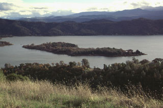 Elongated Rattlesnake Island near the NE tip of Clear Lake is seen here from the NW. Most of the flat-lying western side of the island is a basaltic-andesite lava flow of late-Pleistocene age. The flow was erupted to the NE and NW from a cinder cone that is the gently rounded ridge that forms the far southern tip of the island at the left. The scoriaceous aa flow was erupted subaerially above the lake level.
Photo by Lee Siebert, 1997 (Smithsonian Institution).
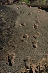 These footprints in hardened ash are those of Hawaiian warriors and their families who were crossing the Kau Desert, SW of Kīlauea caldera, at the time of a violent explosive eruption in 1790. The eruption produced pyroclastic surges that killed 80-100 people. The rest of the party of 250 warriors and family members survived, leaving these and other footprints in the muddy ash. Explosive eruptions are not unknown at Kīlauea. They have occurred on several occasions when collapse of the summit allowed groundwater access to the magma column.
Copyrighted photo by Katia and Maurice Krafft, 1987.
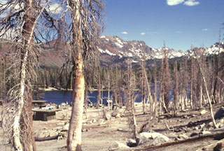 An area of extensive tree kill at Horseshoe Lake, SE of Mammoth Mountain, is seen in July 1998. Dead trees on the NW side of the lake contrast with undamaged trees on the opposite side of the lake. The Horseshoe Lake area is the largest of seven areas of elevated carbon dioxide concentrations located on the southern, northern, and western flanks of Mammoth Mountain. Trees began taking up of magmatic carbon dioxide in early 1990 following the 1989 Mammoth Mountain earthquake swarm.
Photo by Lee Siebert, 1998 (Smithsonian Institution).
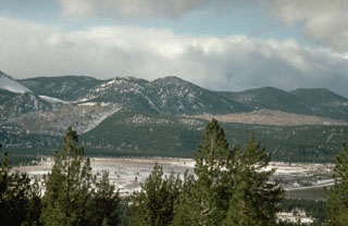 The unvegetated Glass Creek lava flow on the left and Obsidian Flow on the right are among a group of obsidian lava flows and domes that were emplaced during a major eruption from the Inyo Craters about 600 years ago. The eruption, originating from a shallow dike, began with powerful explosive activity, pyroclastic flows, and a series of phreatic explosions, and ended with effusion of the lava domes and flows.
Photo by Larry Mastin, 1991 (U.S. Geological Survey).
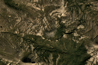 A small unnamed lava dome and an associated lava flow is located near the center of this Planet Labs September 2019 satellite image mosaic (N is at the top). The dome lies near the head of Big Alinchak Creek, NW of Alinchak Bay, and does not show evidence of glacial erosion.
Satellite image courtesy of Planet Labs Inc., 2019 (https://www.planet.com/).
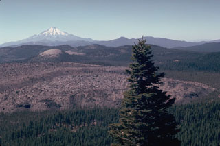 The Little Glass Mountain obsidian flow is seen from Little Mount Hoffman on the western rim of Medicine Lake caldera with Mount Shasta in the background. The flow was erupted on the SW flank of Medicine Lake volcano a little more than 950 years ago. The light-colored rounded peak in line with Mount Shasta is Pumice Stone Mountain, which is overlain by pumice from the Little Glass Mountain eruption. A series of smaller flows to the NE known as the Crater Glass Flows were erupted at about the same time.
Photo by Lee Siebert, 1981 (Smithsonian Institution).
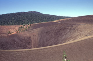 The summit of Cinder Cone contains nested craters with several crater rims created as a result of changes in vent location and eruption intensity. The scoria cone was formed during eruptions several hundred years ago in NE Lassen Volcanic National Park. Prospect Peak, an andesitic shield volcano capped by a small pyroclastic cone, is the forested peak in the background NW of Cinder Cone.
Photo by Lee Siebert, 1998 (Smithsonian Institution).
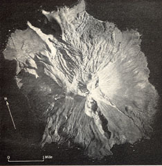 A prominent N-S-trending fissure that extends to sea level at both ends across Segula, located near the western end of the Aleutian Arc. The irregular topography on the N side of the island is an extensive lava field that erupted from the summit crater along the NE flank to the coast. A smaller lava field to the lower right originated from a scoria cone on the lower SE flank. A scoria cone constructed along the S rim of a small caldera forms the high point of the island.
Photo by U.S. Air Force (published in U.S. Geological Survey Bulletin 1028-K).
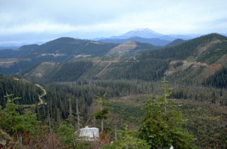 The valley floor in the foreground of this area of extensive logging SE of Mount St. Helens, in the distance, is covered by lava flows from West Crater and the Hackamore Creek scoria cone just NW of West Crater. Carbon fragments from a black tephra deposit produced by the Hackamore Creek scoria cone were dated to about 8,000 years.
Photo by Lee Siebert, 1995 (Smithsonian Institution).
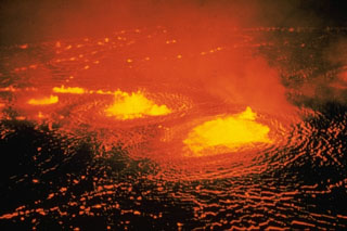 Low lava fountains rise above an active lava lake in Halema‘uma‘u crater on 31 May 1954, near the beginning of a three-day eruption. About a half hour after the start of the eruption lava flows effused from a fissure that opened across the floor of the Kīlauea caldera, ENE of Halema‘uma‘u.
Photo by Jerry Eaton, 1954 (U.S. Geological Survey).
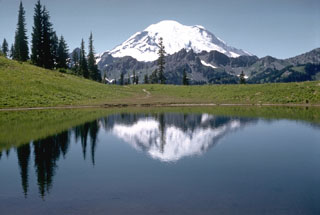 Mount Rainier rises beyond Tipsoo Lake, near Chinook Pass at the eastern end of Mount Rainier National Park. The snow-free peaks of the Cowlitz Chimneys below Rainier are composed of volcanic rocks of the Oligocene Ohanapecosh Formation which underlies the volcano.
Photo by Richard Fiske, 1959 (Smithsonian Institution).
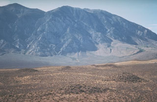 The light-colored area in the foreground is the surface of the Bishop Tuff, 500 cu km of airfall-pumice and pyroclastic-flow deposits related to the formation of the Long Valley caldera about 760,000 years ago. The low mounds formed as a result of degassing of the deposit while it cooled.
Photo by Larry Mastin, 1992 (U.S. Geological Survey).
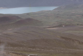 This 1974 view shows part of the interior of Fisher caldera on Unimak Island in the eastern Aleutian Islands. Fisher is an 11 x 18 km caldera that formed about 9,100 years ago during the eruption of pyroclastic flows that overtopped topographic barriers more than 500 m high. The caldera contains several lakes, maars, and other vents.
Photo by Tom Miller, 1974 (Alaska Volcano Observatory, U.S. Geological Survey).
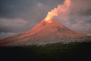 A plume rises from the degassing Augustine summit lava dome during its 1986 eruption. This June 1986 view from the NW shows ashfall and pyroclastic flow deposits covering the upper flanks, which would normally be partially covered with snow fields at this time of year.
Photo by Lee Siebert, 1986 (Smithsonian Institution).
 Paoha Island in the center of Mono Lake at the left is seen from the flanks of Panum Crater on the south, at the northern end of the Mono Craters. The Mono Lake volcanic field consists of multiple volcanic vents on the northern shore of the lake and on Paoha and Negit Islands, which were last active a few hundred years ago.
Photo by Dan Dzurisin, 1982 (U.S. Geological Survey).
 Darker-colored layers of basaltic ash drape the northern rim of Ubehebe Crater in the northern part of Death Valley National Park and spill down the crater walls. The 235-m-deep Ubehebe Crater is the largest of a series of more than a dozen overlapping maars formed by explosive eruptions through fanglomerate deposits, which form the light-colored areas below the ash layers. The Amargosa Range rises on the horizon across Death Valley to the east.
Photo by Paul Kimberly, 1997 (Smithsonian Institution).
 The youngest volcanic eruptions in Utah took place from the Ice Springs volcanic center. Root fragments from soil beneath the lava flow are C-14 dated at 660 ± 170 years old. Lava flows from the Ice Springs crater complex traveled about 4 km to the west and north, overlapping late-Pleistocene flows from the Pavant volcano. This view looks to the west from the rim of Crescent Crater, the largest of the overlapping cinder and spatter cones that fed the flows. Pocket Crater is the symmetrical cone in the center of the photo.
 Photo by Lee Siebert, 1996 (Smithsonian Institution).
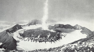 This September 1946 photo of Great Sitkin from the E rim of the summit crater shows a plume rising above a lava dome emplaced in the crater in March 1945. The fissures in the ice were produced as the dome grew through the summit glacier.
Photo courtesy of U.S. Geological Survey (published in USGS Bulletin 1028-B).
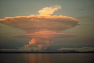 An ash plume from the pyroclastic flow descending the N flank of Redoubt volcano on 21 April 1990. The ash plumes produced during the 1989-1990 eruption damaged five commercial jet liners, with an incident on 15 December 1989 causing a Boeing 747-400 aircraft to temporarily lose power of all four engines.
Photo by Joyce Warren, 1990 (courtesy of U.S. Geological Survey).
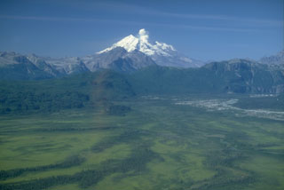 Glaciated Redoubt towers above the Drift River valley NE of the volcano. The summit crater opens to the north and has funneled eruptive products into the valley. A plume rises from the crater in this 1990 photo after the end of the 1989-90 eruption.
Photo by Cynthia Gardner, 1990 (U.S. Geological Survey).
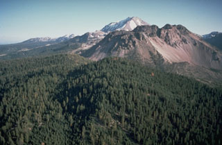 Lassen Peak rises in the background behind the Chaos Crags, a group of dacitic lava domes on Lassen's north flank. The Chaos Crags were formed during a series of eruptions about 1100 to 1000 years ago in which early explosive eruptions and pyroclastic flows were followed by growth of a complex of five lava domes. The area of light-colored talus on the right side is the source of a large debris avalanche from Chaos Crags about 1650 CE.
Photo by Dan Dzurisin, 1982 (U.S. Geological Survey).
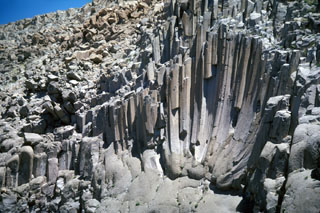 These curved columnar joints in the Bishop Tuff are exposed in Owens River Gorge SW of Long Valley caldera in California. The 5- to 6-sided columns are about 1-3 m wide and curve downward to a common point, forming a feature known as a joint rosette. The rosettes are the site of large fossil fumaroles and often are overlain by fumarole mounds. These mounds may have formed as a result of volatiles produced when the hot Bishop pyroclastic flows overran and vaporized the ancestral Owens River.
Photo by R.V. Fisher, 1984 (University of California Santa Barbara).
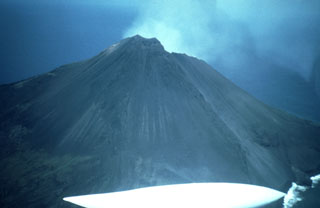 An aerial view from the SW shows the upper slopes of Asuncion in the northern Mariana Islands. It forms a circular 3-km-wide island that has had no permanent residents since the late 17th century. An explosive eruption in 1906 produced lava flows that descended about halfway down the W and S flanks.
Photo by Dick Moore, 1992 (U.S. Geological Survey).
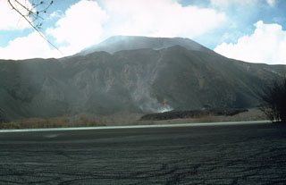 A black lava flow advances across the floor of a maar on the W flank of North Pagan volcano on 23 May 1981. The flow originated from the summit crater of North Pagan (background) on 15 May. Most of the surface of a lagoon within the maar in the foreground is covered by black floating material from the explosive eruption on the 15th.
Photo by Norm Banks, 1981 (U.S. Geological Survey).
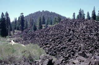 Sparsely vegetated andesitic lava flows issued from South Twin Butte, the tree-covered cinder cone in the background. The two Twin Butte cinder cones and associated lava flows are part of a broad area of little-known youthful Quaternary volcanic features north of Lassen Volcanic National Park.
Photo by Lee Siebert, 1998 (Smithsonian Institution).
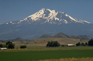 The foreground hills are part of the Shasta Valley debris avalanche deposit produced by one of the largest known Quaternary volcanic landslides. Roughly 46 km3 of an ancestral Mount Shasta collapsed about 350,000 year ago, producing a massive debris avalanche that swept some 50 km to the north, filling the broad Shasta Valley with hummocky debris.
Photo by Dave Wieprecht, 1995 (U.S. Geological Survey).
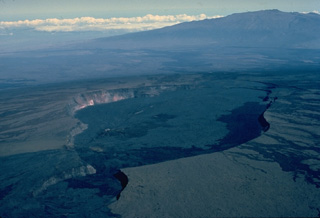 Calderas at the summits of basaltic shield volcanoes, such as this one at Hawaii's Mauna Loa volcano differ from those formed at more silicic stratovolcanoes. The 2.4 x 4.8 km wide Mokuaweoweo caldera, seen here from the south with Mauna Kea volcano in the background, formed when the summit collapsed after large amounts of magma were siphoned away from the summit region by flank eruptions or lava intrusions. The elongate, scalloped form of the caldera reflects both the influence of rift systems and the incremental growth of the caldera.
Copyrighted photo by Katia and Maurice Krafft, 1984.
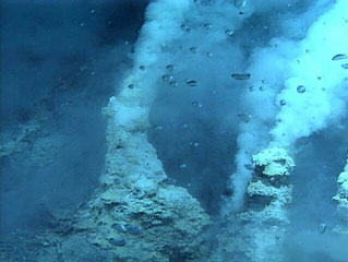 White smokers at NW Eifuku submarine volcano that were photographed by a NOAA expedition in 2006. The bubbles are carbon dioxide; this is one of two places where natural liquid carbon dioxide emission has been observed. It is a small submarine volcano about 1,500 m below the ocean surface that displays vigorous thermal activity.
Image courtesy of Submarine Ring of Fire 2006 Exploration, NOAA Vents Program.
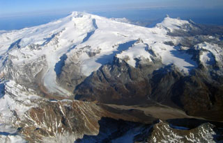 Glaciated Fourpeaked volcano in NE Katmai National Park is seen here from the south with the Swikshak River in the foreground. Holocene eruptions at Fourpeaked had not been confirmed prior to its first recorded eruption in September 2006.
Photo by Jennifer Adleman, 2006 (U S Geological Survey, Alaska Volcano Observatory).
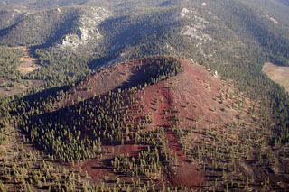 Groundhog cinder cone, the youngest of the Golden Trout Creek volcanic field, is breached to the NE. Groundhog cone was the source of a Holocene lava flow that traveled 6 km to the west down Golden Trout Creek The volcanic field consists of a group of Quaternary alkali olivine basaltic cinder cones and lava flows in the Sierra Nevada about 25 km south of Mount Whitney. Lava flows erupted through light-colored Mesozoic granitic rocks of the Sierra Nevada batholith visible behind Groundhog cone and on its upper right side.
Photo by Rick Howard, 2002 (courtesy of Del Hubbs, U S Forest Service).
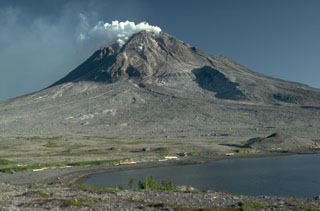 Several features from the Augustine 1883 eruption can be seen in this 1987 photo of the N flank. The hill across the shallow lagoon to the lower right is a debris avalanche hummock produced by collapse of the summit and N flank in 1883. The result of the avalanche was a large open crater that is largely filled by 20th-century lava domes; the outer wall is in the shadow to the left. The area covered with sparse green vegetation is a pyroclastic flow deposit from the 1883 eruption.
Photo by Lee Siebert, 1987 (Smithsonian Institution).
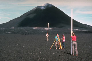 Among the many monitoring techniques used by Hawaiian Volcano Observatory staff at Kīlauea volcano is precision leveling. Millimeter-scale changes can be detected with an optical-level instrument by measuring the precise difference in elevation on leveling rods placed above two fixed points. Slight changes in the shape of a volcanic edifice commonly occurs prior to eruptions. Measurements such as these in 1968, with the Puʻu ʻŌʻō scoria cone in the background, are one of several techniques used to help forecast eruptive events.
Photo by Richard Fiske, 1986 (Smithsonian Institution).
 Red Mountain, seen here from the NE, is the southernmost of a N-S line of small shield volcanoes with smaller cones that form the Pleistocene-to-Holocene Indian Heaven volcanic field in the southern Cascades of Washington. The field covers 600 km2.
Photo by Lee Siebert, 1995 (Smithsonian Institution).
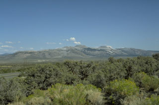 The Mono Craters volcanic field, seen here from the NW, is a 17-km-long arcuate chain of lava domes, lava flows, and tephra rings. The latest eruptions took place about 600 years ago from several vents at the northern end of the chain, producing rhyolitic lava domes and flows.
Photo by Victoria Avery, 1992 (Smithsonian Institution).
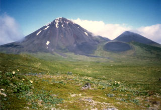 The western slopes of Sugarloaf Peak (left) are seen here on Semisopochnoi Island. One of the largest subaerial volcanoes of the western Aleutians, Semisopochnoi is 20 km wide at sea level and contains an 8-km-wide caldera. Mount Cerberus was constructed within the caldera during the Holocene, along with Sugarloaf Peak outside the caldera to the SSE. Many documented historical eruptions originated from Cerberus.
Photo by Steve Ebbert, 1997 (U.S. Fish and Wildlife Service).
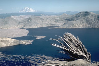 The powerful lateral blast that swept across Spirit Lake removed giant trees, leaving splintered stumps such as this one on Harry's Ridge. The areas around the lake were stripped of soil and trees down to bedrock by a tsunami wave produced when the debris avalanche slammed into Spirit Lake. The flat brownish area on the left surface of the lake is a large raft of floating trees swept into the lake. Mount Adams is visible on the horizon beyond the eastern blast margin.
Photo by Lee Siebert, 1984 (Smithsonian Institution).
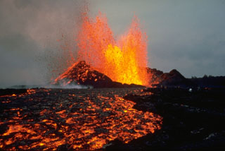 Lava fountains on 30 September 1977 produced lava flows from the Pu`u Kiai vent at Kīlauea. The eruption began along the East Rift Zone near Kalalau Crater on 13 September. The eruption ended on 1 October after producing lava flows that traveled 10 km SE to within 1 km of the coastal town of Kalapana.
Photo by Peter Lipman, 1977 (U.S. Geological Survey).
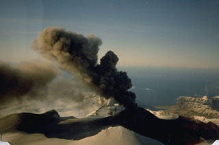 An ash plume rises about 1 km and drifts to the NW above the Akutan caldera scoria cone on 2 June 1988. Dark ash deposits on the flanks extend across the caldera floor and western rim. The snow-covered ridge in the foreground is the SW caldera rim. Intermittent eruptions such as these are typical of Akutan. The 1988 eruption lasted from 26 March to 20 July.
Photo by Tom Madsen (Aleutian Air), 1988 (courtesy of John Reeder, Alaska Div. Geology & Geophysical Surveys).
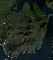 Lava flows of the Tlevak Strait-Suemez Island volcanic group are located near Tlevak Strait (lower right) and on the SW end of Suemez Island. The largest deposits are located north of Trocadero Bay, the large embayment on the southern side of Suemez Island.
Satellite image courtesy of Planet Labs Inc., 2019 (https://www.planet.com/).
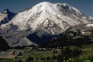 Mount Rainier rises above Yakima Park on the north side of the volcano in this 1972 photo. Emmons Glacier descends to the left from the summit within a broad valley alongside Little Tahoma Peak (far left). The valley formed when part of Mount Rainier collapsed during an eruption episode about 5,600 years ago, producing the Osceola mudflow that reached the Puget Sound area.
 Photo by Lee Siebert, 1972 (Smithsonian Institution).
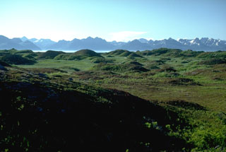 This hummocky terrain is the surface of the debris avalanche deposit from summit collapse at Augustine about 250-450 years ago, which forms the entire 2 x 3 km wide West Island. There are more than 1,000 hummocks with heights up to 30 m across the island. Bathymetric surveys suggest that the avalanche traveled an additional 3 km beyond the margin of West Island. Kamishak Bay and the Chigmit Mountains are on the horizon to the NW.
Photo by Lee Siebert, 1986 (Smithsonian Institution).
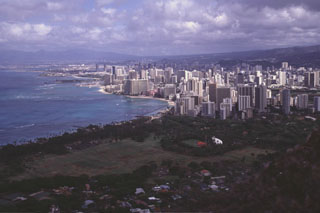 The city of Honolulu, seen here from the rim of Diamond Head tuff cone, overlies the southern flank of the massive Koolau shield volcano, whose slopes rise to the right. Koolau shield volcano was constructed during the Pliocene to Pleistocene and has been extensively eroded. Diamond Head is part of the Honolulu Series, a group of tuff cones, cinder cones, and spatter cones constructed on the eastern flanks of Koolau following a long period of quiescence.
Photo by Lee Siebert, 1998 (Smithsonian Institution).
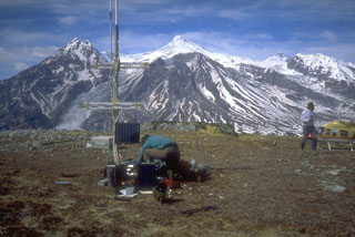 Seismometers such as this one installed near Mount Spurr volcano (on skyline in background) provide the Alaska Volcano Observatory with a continuous, telemetered record of volcanic earthquakes. Scientists use this data to monitor earthquake types, locations, and magnitudes to decipher different processes under and within a volcano.
 Photo by Christina Neal, 1993 (Alaska Volcano Observatory, U.S. Geological Survey).
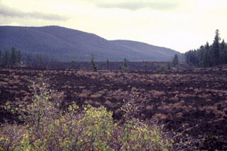 The Lava Cascade lava flow erupted from the Newberry NW rift zone about 7,000 years ago and traveled about 8 km NW from its vent. The forested area to the far right is one of three large kipukas composed of older lavas that were surrounded by the flow. The flow in the foreground, called the Lava Cast Forest flow, originated from another fissure at about the same time. The NW rim of Newberry caldera rises in the distance.
Photo by Lee Siebert, 1977 (Smithsonian Institution).
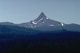 The sharp-topped pinnacle of Mount Washington, seen here from east of Santiam Pass on its NE, is a lava plug that caps a heavily eroded shield volcano. The steep-sided lava plug forming the summit was the last major Oregon peak to be climbed, resisting ascent until 1923.
Photo by Lee Siebert, 1982 (Smithsonian Institution).
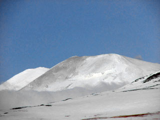 This photo taken on 3 March 2007 shows a light-gray ash deposit on the W flank of Korovin. In late November 2006 satellite images showed a light dusting of ash on the E flank of the main crater along with several plumes and/or their shadows visible along the N side of the crater. On 11 and 21 December 2006 Atka residents again witnessed steam plumes, possibly containing ash on the latter date.
Photo by Kerry Moore, 2007 (courtesy of Alaska Volcano Observatory).
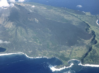 An aerial view of Pagan volcano from the W in August 1981 shows dark lava flows from the May 1981 eruption that descended the S flank as far as the arcuate caldera wall. The flows originated from a vent along a notch on the south rim of the summit crater early in an eruption that began on 15 May. This was the southernmost of three vents that were active during the 1981 eruption.
Photo by U.S. Navy, 1981.
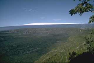 The 3 x 5 km caldera at the summit of Kīlauea is home of the Goddess Pele and has been Hawaii's most active volcano during historical time. Kīlauea is a shield volcano on the east flank of Mauna Loa, visible in the distance. Eruptions originate both from within the summit caldera and from SW and E rift zones that extend to the sea and predominately produce lava flows, with occasional explosive eruptions.
Photo by Richard Fiske, 1967 (Smithsonian Institution).
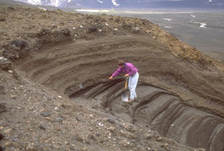 A geologist examines pyroclastic deposits (above hand) from a violent eruption of Half Cone less than 500 years ago. The Half Cone layers overlie dark gray phreatomagmatic deposits from Surprise tuff cone in Aniakchak caldera. The Half Cone eruption produced about 1 km3 of tephra and resulted in truncation of the SE side of the cone.
Photo by Game McGimsey (Alaska Volcano Observatory, U.S. Geological Survey).
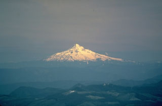 Mount Hood, seen here from the north across the Columbia River Gorge, rises above low hills of older volcanic rocks. Located only 75 km ENE of Portland, Mount Hood is near communities, infrastructure, and transportation routes, posing risk from eruptive activity and debris flows. The morphology of the summit area has been modified by flank collapse events that formed debris avalanches.
Photo by U.S. Geological Survey, 1983.
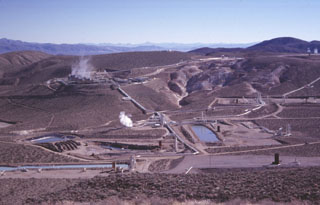 A cooperative program of the U.S. Navy China Lake Naval Weapons Station and private industry has developed geothermal power at the Coso volcanic field. The first well was drilled in 1981 and production now exceeds 250 megawatts, greatly reducing energy costs to the Navy and providing additional electricity to the southern California power grid. This view from the NW shows turbine plants and production well ponds at Coso. Devils Kitchen, a fumarolic area with extensively hydrothermally altered ground, appears at the upper right.
Photo by Paul Kimberly, 1997 (Smithsonian Institution).
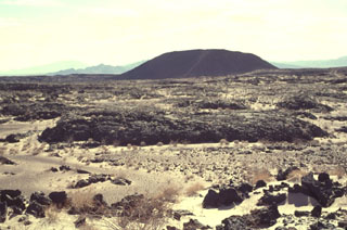 Amboy Crater is an isolated 75-m-high cinder cone seen here from the NW with the Bullion Mountains in the background. Amboy was the source of a 70-sq-km basaltic lava field that was erupted during the late Pleistocene onto a flat-lying alluvial valley. The dominantly pahoehoe lava field divided the Bristol Dry Lake into two playas. Depressions on the surface of the lava flow are filled with light-colored windblown sand distributed by prevailing winds from the west. The light-colored diagonal stripe on the flank of the cone is a trail leading to the crater rim.
 Photo by Lee Siebert, 1997 (Smithsonian Institution).
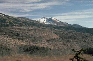 Broken Top volcano provides a backdrop to the margin of the 0.5 km3 Rock Mesa lava flow, which erupted from a vent on the SW flank of South Sister volcano about 2,300 years ago. Emplacement of the lava flow was the final stage of an eruption that began with strong explosions accompanied by pyroclastic flows and surges.
Photo by Lyn Topinka, 1985 (U.S. Geological Survey).
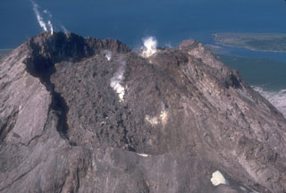 The 1976 lava dome, seen from the east in this 1982 photo of Augustine, formed within an arcuate crater rim that was produced by explosive removal of part of the 1964 lava dome during an earlier phase of the 1976 eruption. The small peak to the upper right is a remnant of the 1935 lava dome. Small plumes rise from the 1976 dome (center) and from fumaroles at the summit of the 1964 dome remnant (upper left).
Photo by Chris Nye, 1982 (Alaska Division of Geological and Geophysical Surveys).
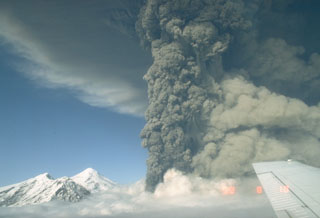 This photo shows an ash plume during the eruption of Spurr on 18 August 1992. A lighter plume rises above pyroclastic flows descending the SE flank to the right, and the summit lava dome complex is to the left. The 18 August event was the second of three brief powerful explosive eruptions in 1992.
Photo by Game McGimsey, 1992 (Alaska Volcano Observatory, U.S. Geological Survey).
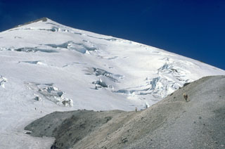 Climbers in 1979 traverse from the top of Dogs Head lava dome on the N flank onto crevassed Forsyth Glacier, with the False Summit of Mount St. Helens to the upper left. The 1980 landslide removed the summit of the volcano.
Photo by Lee Siebert, 1979 (Smithsonian Institution).
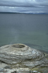 The West Thumb Geyser Basin at the SW end of Yellowstone Lake contains thermal features, such as this sinter mound, both above and below the lake shore. The West Thumb embayment of Yellowstone Lake is a smaller caldera that formed as a result of an explosive eruption during a period of mainly lava-producing eruptions during the past 150,000 years.
Photo by Lee Siebert, 1994 (Smithsonian Institution).
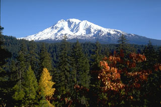 Mount Adams in the southern Cascade Range of Washington in seen from the SW in this view. The large cirque below the left side of the summit is occupied by the White Salmon and Avalanche Glaciers and was the source of a large mudflow that traveled 60 km down the White Salmon River valley about 6,000 years ago.
Photo by Lee Siebert, 1995 (Smithsonian Institution).
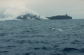 Plumes produced by degassing of a growing lava dome rise from the northern tip of Bogoslof on 21 July 1992. The 1992 eruption was first observed on 6 July when pilots saw steam and ash rising above the volcano. On 20 July an ash plume rose to 8 km. A new lava dome grew to a height of 100-m by the time the eruption ended in late July. The 1927 lava dome forms the dark land to the right with the pinnacle of Castle Rock behind it.
Photo by Larry Shaishnikoff, 1992 (courtesy of John Reeder, Alaska Div. Geology & Geophysical Surveys).
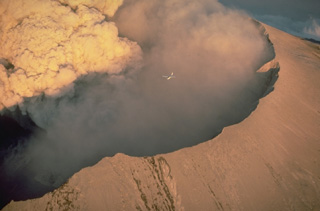 A small plane (center) flying over the west rim of the crater of Mount St. Helens provides scale for a powerful eruption column rising from the vent on the crater floor on July 22, 1980.
Copyrighted photo by Katia and Maurice Krafft, 1980.
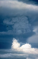 An ash plume towers above Pagan volcano on 18 May 1981, three days after the onset of the eruption. The initial eruption on 15 May produced ash plumes that rose to estimated heights of 16-20 km. Three vents along a fissure formed across the summit on 15 May. An upper NE flank cone produced a new scoria cone, and vents on the N and S summit crater rims produced lava flows that traveled down the flanks. Intermittent explosive activity continued until 1985.
Photo by Gary Haust, 1981 (courtesy Norm Banks, U.S. Geological Survey).
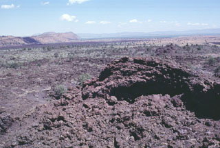 Minor amounts of basaltic lava were erupted about 3000 years ago from spatter cones at Black Crater and Ross Chimneys on the lower northern flank of Medicine Lake volcano. The spatter cone in the foreground was the vent for the sparsely vegetated small overlapping pahoehoe lava flows in the middle part of the photo. The dark lava flow in the distance in front of a fault block of older lavas, is the late-Pleistocene Devils Homestead lava flow.
 Photo by Lee Siebert, 1988 (Smithsonian Institution).
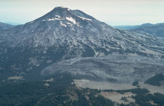 The large lava flow to the lower right is the Rock Mesa lava flow on the SW flank of South Sister. The rhyodacite flow erupted about 2,300 years ago from a vent now filled by a small lava dome. Lava extrusion was preceded by explosive eruptions that produced airfall tephra and pyroclastic flows.
 Photo by Willie Scott, 1981 (U.S. Geological Survey).
 Forested cinder cones of the Eagle Lake volcanic field rise above the SW shore of Eagle Lake. The volcanic field occupies the junction of the Cascades, Sierra Nevada, and Basin and Range geologic provinces. The Eagle Lake field consists of 15 cinder cones and basaltic lava flow vents within a larger Quaternary basaltic field. The vents are aligned along faults defining the Eagle Lake volcano-tectonic depression. The latest eruptive period occurred during the late-Pleistocene or early Holocene.
Photo by Lee Siebert, 1998 (Smithsonian Institution).
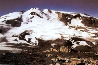 Snowy Mountain volcano lies 15 km NE of Mount Katmai. An ice-topped Holocene lava dome on the central skyline partly fills an ice-mantled scar that formed as a result of edifice collapse of the NE flank. The summit (Peak 7090) lies just behind the dome to its right. The Serpent Tongue glacier flows from the amphitheater.
Photo courtesy of U.S. Geological Survey, 1999 (published in Hildreth et al., 2001).
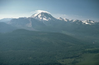 An aerial view of cloud-capped Lassen Peak from the NW shows the Chaos Crags lava dome complex on its left, the source of rockfall avalanche in 1650 CE, and the older Brokeoff stratovolcano and post-caldera lava domes on the right. Lassen Peak was the source of California's latest eruption, that lasted from 1914 to 1917.
Photo by Lyn Topinka, 1984 (U.S. Geological Survey).
 Recent activity at Haleakalā took place from vents low on the SW rift zone. The lava flows that form the coastline below originated from two vents, one near where this photo was taken and the other below the scoria cone near the center. Kaho’olawe is in the distance to the SW.
Photo by Lee Siebert, 1987 (Smithsonian Institution).
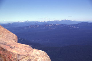 The snow-mantled peaks on the northern horizon are the remnants of Mount Mazama, seen here from the summit of Mt. McLoughlin. Mount Mazama was a complex of overlapping edifices that was once one of Oregon's largest volcanoes, until it collapsed about 7,700 years ago and formed the 8 x 10 km Crater Lake caldera. The highest peak to the right is Mount Scott, part of a pre-caldera edifice east of the caldera rim.
 Photo by Lee Siebert, 1998 (Smithsonian Institution)
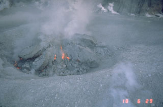 Incandescence is visible in fractures in a growing lava dome in the crater of Mount St. Helens on 18 October 1980. Several earlier lava domes that formed after 18 May 1980 had been removed by explosive eruptions. This photo shows the beginning stages of the lava dome that grew incrementally until the end of the eruption in October 1986.
Photo by Terry Leighley, 1980 (U.S. Geological Survey).
 The hackly surfaced Panum lava dome, filling a tephra ring at the northern end of the Mono Craters chain, was one of five rhyolitic lava domes and flows emplaced at the end of a major eruption about 600 years ago. The eruption, which began with powerful plinian explosive eruptions accompanied by pyroclastic flows and surges, occurred just a year or two prior to another major eruption at Inyo Craters to the south.
Photo by Dan Dzurisin, 1982 (U.S. Geological Survey).
 The steep walls of Lua Poholo pit crater, immediately NE of Mokuʻāweoweo caldera, expose a small portion of the accumulation of thin, overlapping lava flows that form Mauna Loa. This view from the NE shows the caldera rim to the upper right. Lava flows from recent eruptions fill crater floor, including the most recent 1984 eruption.
Photo by Paul Kimberly, 1994 (Smithsonian Institution).
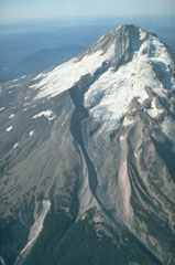 The north flank of Mount Hood contains the Eliot Glacier, with a series of prominent glacial moraines at its base in this 1987 photo. During the past 1,800 years eruptions have been restricted to vents on the SW flank and have included dome growth, collapse, and debris flows.
Photo by Willie Scott, 1987 (U.S. Geological Survey).
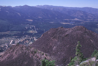 Four overlapping dacite domes form the Black Buttes lava dome on the lower western flank of Mount Shasta. This view looks NW from the summit of Black Buttes, at the tops of two of the domes with the outskirts of the town of Weed below. Pyroclastic flows accompanying formation of Black Buttes extend 10 km S and 5 km N, and underlie currently populated areas.
Photo by Lee Siebert, 1998 (Smithsonian Institution).
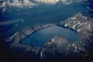 Kaguyak caldera was formed following powerful dacitic explosive eruptions about 5800 years ago. An extensive apron of pyroclastic-flow deposits surrounds the 2.5-km-wide caldera. This view from the SW shows two post-caldera lava domes that form a peninsula into the lake and another lava dome that forms a small island that rises about 10 m above the center of the lake. The low notch at the far end of the caldera is a pre-caldera stream valley that was beheaded by caldera formation.
Copyrighted photo by Katia and Maurice Krafft, 1978.
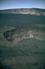 Lua Poholo pit crater is immediately NE of Moku’aweoweo caldera. The crater walls expose a small portion of the massive pile of thin, overlapping lava flows that have formed the summit of Mauna Loa. This 1987 view from the NE shows the western Moku’aweoweo caldera rim. The lava flows covering the caldera floor of the caldera were erupted in 1984.
Photo by Richard Fiske, 1987 (Smithsonian Institution).
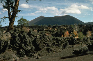 The Sunset Crater eruption is considered from paleomagnetic evidence to have begun about 1080-1150 CE. The Bonito lava flow in the foreground originated from Sunset Crater, the cinder cone in the background. The Sunset Crater eruption produced a blanket of ash and lapilli covering an area of more than 2100 km2 and forced the abandonment of settlements of the indigenous Sinagua Indians.
Photo by Ed Wolfe, 1977 (U.S. Geological Survey).
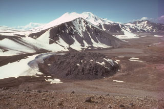 A lava dome 65 m high and 380 m wide lies within a circular ejecta ring and caps the 1912 vent of Novarupta volcano. A 60-hour-long eruption that began on 6 June 1912 was the largest eruption during the 20th century, producing The Valley of Ten Thousand Smokes pyroclastic flow deposit which forms the flat ground to the right. The face of Falling Mountain, behind Novarupta dome, was sheared off by a 2-km-wide collapse around the vent. This view from the NE shows snow-capped Mageik in the background.
Photo by Tom Miller (Alaska Volcano Observatory, U.S. Geological Survey).
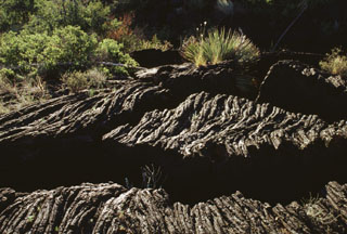 Fractures cut the surface of a roughly 5000-year-old ropy pahoehoe lava flow in south-central New Mexico. Lava flow textures such as these are formed when molten lava continues to flow underneath the cooled plastic skin, causing the surface to bunch up or wrinkle into a form that resembles coiled rope. Highway 380 cuts across the northern part of the Carrizozo lava flow, providing access to the flow.
 Photo by Lee Siebert, 1999 (Smithsonian Institution).
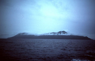 Two coalescing volcanoes form the 9-km-long island of Anatahan in the central Mariana Islands. The rim of a 2.5 x 5 km E-W-trending summit depression consisting of overlapping summit calderas forms the low point at the center of the island.
Photo by Dick Moore, 1990 (U.S. Geological Survey).
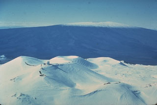 Hawaii's two largest shield volcanoes are Mauna Loa (in the background to the S) and Mauna Kea. Mauna Loa has the classic low-angle profile of a shield volcano constructed by repetitive eruptions of thin, overlapping lava flows. Mauna Kea’s profile has been modified by late-stage explosive eruptions that constructed a series of cones at the summit.
Photo by Don Swanson (U.S. Geological Survey).
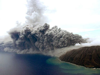 An ash plume rises from a vent at the E crater (far right) of Anatahan as seen from a helicopter looking NW on 24 August 2005. Eruptive activity had begun in 2004, when a new lava dome was seen on 12 April, along with fresh ejecta within the crater. Intermittent explosive activity occurred throughout the year. In 2005 the crater floor was almost entirely covered by fresh lava out to a diameter of ~1 km. Explosive eruptions in April, June, and July 2005 produced ash plumes to as high as 15 km.
Photo by Takeshi Matsushima, 2005 (Kyushu University).
 Riverside Geyser in the Upper Geyser Basin is the most regular of Yellowstone's geysers. About every six hours it ejects a 25-m-high inclined jet from a small vent hole on the east bank of the Firehole River 2 km downstream from Old Faithful.
Photo by Lee Siebert, 1968 (Smithsonian Institution).
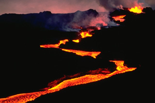 An incandescent lava flow winds its way down the NE rift zone of Mauna Loa volcano early in the morning of March 25, 1984. The flow direction varies as the lava flow detours around higher areas and follows topographic lows along the broad crest of the NE rift zone.
Copyrighted photo by Katia and Maurice Krafft, 1984.
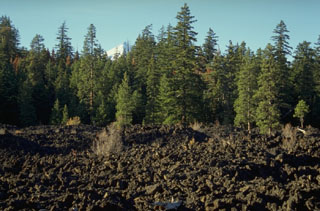 The Jefferson Creek lava flow traveled 13 km down Jefferson and Candle Creeks from an unnamed cinder cone NE of Forked Butte and is younger than the nearby 6,500-year-old Forked Butte lava flow. The two flows traveled down different drainages and joined near this point. The snow-covered summit of Mount Jefferson is visible above the trees.
Photo by Lee Siebert, 1995 (Smithsonian Institution).
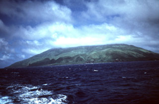 Agrigan is the highest of the Marianas arc volcanoes, seen here from the south. The island is 8 km long and its summit is the top of a large 4-km-high submarine volcano. The summit caldera is 1 x 2 km wide and 500 m deep, and the vegetated flanks consist almost entirely of pyroclastic deposits that are more than 100 m thick on the SW flank.
Photo by Dick Moore, 1990 (U.S. Geological Survey).
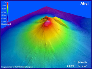 Ahyi submarine volcano is seen in a bathymetric view looking from the NE with 2x vertical exaggeration. It rises to within about 150 m of the sea surface about 18 km SE of the island of Farallon de Pajaros (Uracas) in the northern Marianas. Water discoloration has been observed over the volcano and an explosive eruption was seismically detected in April 2001.
Image courtesy of Susan Merle (Oregon State University/NOAA Vents Program).
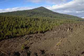 The southernmost of three andesite lava flows near Davis Lake originated from Black Rock Butte and banks up against the slopes of the Pleistocene Odell Butte shield volcano. The lava flow is considered to have erupted at about the same time as a nearby lava flow with a radiocarbon age of 5,050-5,600 years.
Photo by Lee Siebert, 1995 (Smithsonian Institution).
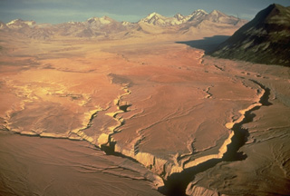 This entire valley floor consists of deposits of the Valley of Ten Thousand Smokes (VTTS) ash flow, which was erupted from Alaska's Novarupta volcano, out of view to the left. The massive, 11-15 cu km VTTS ash-flow covers 120 km2 of the valley to a distance of 12 km from the Novarupta vent. The bowl-shaped portion of the left-half skyline is the rim of Katmai caldera, which collapsed as a result of the eruption of the VTTS ash flow. The four skyline peaks on the right side of this aerial view from the NW are those of Trident volcano.
Copyrighted photo by Katia and Maurice Krafft, 1978.
 The Rock Mesa lava flow in the foreground erupted from a vent on the SW flank of South Sister volcano about 2,300 years ago. Emplacement of the lava flow was the final stage of an eruption that began with strong explosions accompanied by pyroclastic flows and surges.
Photo by Lyn Topinka, 1985 (U.S. Geological Survey).
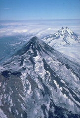 Despite its extensive glacial cover, Shishaldin volcano maintains its symmetrical profile because of frequent eruptions. Aa lava flows, erupted from summit and satellitic vents, spread over the NW flank, the location of more than 2 dozen pyroclastic cones. The dominantly basaltic volcano is the highest peak in the Aleutian Islands. The rugged, dissected Isanotski volcano rises to the east behind Shishaldin.
Copyrighted photo by Katia and Maurice Krafft, 1978.
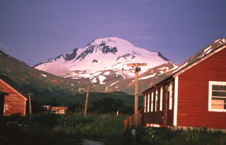 Glacier-covered Roundtop volcano is seen here to the west of False Pass village, is the easternmost and lowest of an E-W-trending line of volcanoes on Unimak Island. Roundtop has produced Holocene pyroclastic flows, and a group of lava domes to the south.
Photo by Game McGimsey, 1998 (Alaska Volcano Observatory, U.S. Geological Survey).
 An aerial view in 1985 looks from Kīlauea caldera in the foreground down the East Rift Zone to the Puʻuʻōʻō vent producing a gas plume in the background. The Hawaiian Volcano Observatory lies at the lower left on the western rim of Kīlauea's 5-km-wide summit caldera with the inner Halema’uma’u crater to the lower right. Lava flows cover the floor of the summit caldera and can be seen extending downslope from multiple vents along the rift zone, including the dark-colored most recent flows erupted beginning in 1983 from the Kupaianaha vent.
Photo by Jim Griggs, 1985 (U.S. Geological Survey).
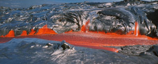 The black, newly solidified glassy surface of pahoehoe lava flows commonly has a silvery or iridescent color. Pahoehoe lavas form during eruptions that are characterized by the upwelling of hot, low-viscosity magma. This smooth-textured pahoehoe flow at Kīlauea volcano was photographed in August 1994.
 Photo by Paul Kimberly, 1994 (Smithsonian Institution).
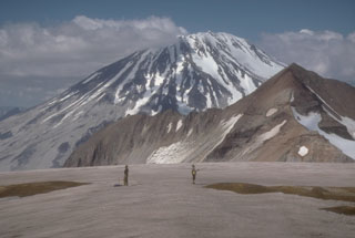 Griggs, seen here from the west rim of Katmai caldera, lies west of a NE-trending arc of volcanoes cutting across Katmai National Park. Noisy fumarolic jets at the summit can be heard across long distances.
Photo by Game McGimsey (Alaska Volcano Observatory, U.S. Geological Survey).
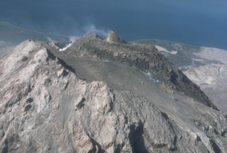 A 50-m-high spine formed on the 1986 lava dome at Augustine, seen here in 1987. The lava dome at the summit formed within an arcuate crater on the 1976 dome. As seen in this view from the SE, the surface of the 1976 dome is covered with pyroclastic ejecta from the 1986 eruption. The high point of the volcano (left) is a crater rim of the 1964 dome.
Photo by Alaska Volcano Observatory, U.S. Geological Survey, 1987.
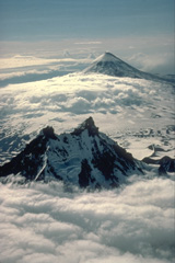 The effects of differential erosion are dramatically seen in this aerial view of two Alaskan volcanoes. Isanotski volcano in the foreground, sometimes referred to as "Ragged Jack," has been extensively dissected by glaciers that have excavated steep walls separated by narrow ridges. The symmetrical Shishaldin volcano in the background is sometimes referred to as the Mount Fuji of the Aleutians. In contrast to Isanotski, Shishaldin is one of Alaska's most active volcanoes. Frequent eruptions maintain the young, constructional profile of the volcano.
Copyrighted photo by Katia and Maurice Krafft, 1978.
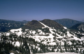 Forked Butte, viewed here from the SW, is a Holocene scoria cone south of Mount Jefferson that produced an 8-km-long lava flow down Cabot Creek about 6,500 years ago. Forked Butte is one of three cones south of Jefferson that have produced Holocene lava flows.
Photo by Willie Scott, 1973 (U.S. Geological Survey).
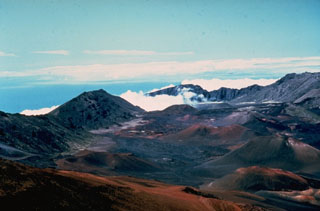 The summit of Haleakalā on the island of Maui contains a large crater that opens towards the ENE. It formed by the erosion of two large valleys that eventually coalesced, along with collapse events. This view to the NE from near the summit shows the Ko’olau Gap in the distance and scoria cones on the crater floor from eruptions along a major rift zone that extends across the summit from the SW to eastern coasts.
Photo by Dick Stoiber, 1976 (Dartmouth College).
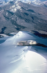 The summit crater of glacier-covered Mount Mageik appears in the foreground of this 1978 view looking NE across Katmai Pass to Trident volcano. These two volcanoes stand guard at the head of the Valley of Ten Thousand Smokes. Mageik's young crater contains a shallow turbulent lake. The fresh, black lava flows descending the SW flank of Trident volcano were emplaced in a series of eruptions during 1953-1966.
Copyrighted photo by Katia and Maurice Krafft, 1978.
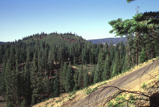 North Potato Butte, seen here from South Potato Butte, is a 65,000-75,000-year-old cinder cone located in the Hat Creek valley north of Lassen Peak. The Potato Butte cinder cones are among a series of small Quaternary basaltic volcanic vents located between Lassen and Medicine Lake volcanoes.
Photo by Lee Siebert, 1998 (Smithsonian Institution).
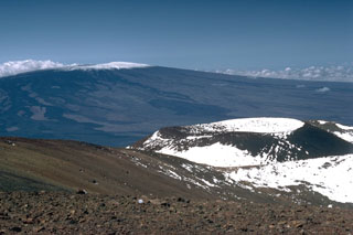 The Pu‘u Haukea scoria cone is one of many recent cones that have formed near the Mauna Kea summit. Mauna Loa is in the background with unvegetated lava flows visible down its flanks. Nearly the entire Mauna Loa surface seen here consists of lava flows erupted during the past 4,000 years.
Photo by Lee Siebert, 1987 (Smithsonian Institution).
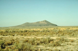 Pavant Butte, a large tuff cone in the Black Rock Desert volcanic field, was constructed on top of pahoehoe and aa lava flows about 16,000 years ago. Pavant Butte owes its morphology to the fact that it was erupted through a water depth of 85 m in Pleistocene Lake Bonneville. A prominent wave-cut shoreline is visible on the flanks of the cone. The subaerial portion of the 275-m-high cone consists of palagonite, formed by alteration of volcanic glass. The Pavant field is the northernmost in the Black Rock Desert.
Photo by Willie Scott, 1991 (U.S. Geological Survey).
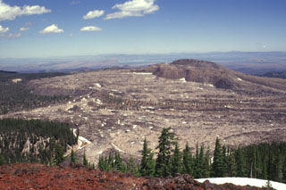 The Glass Mountain obsidian flow, seen here from Lyons Peak on the east rim of Medicine Lake caldera, was erupted from a series of vents just outside the buried inferred eastern rim of the caldera. The youthful, steep-sided rhyolitic and dacitic flow is both the largest and youngest of a series of Holocene rhyolitic and dacitic flows at Medicine Lake. The 1 cu km flow was erupted about 900 years ago. The flow traveled a short distance west (left) into the caldera, but mostly flowed down the eastern flank, reaching a point about 6 km from its source.
Photo by Lee Siebert, 1998 (Smithsonian Institution).
 Davidof Island is seen here across the strait from the western side of Little Sitkin Island. Five small islands, the largest of which is Davidof, are remnants of a volcano that collapsed during the late Tertiary to form a 2.7-km-wide caldera. The islands include Khvostof (top-right horizon), Pyramid, Lopy, and Davidof. The latter three islands form the eastern rim of the caldera.
Photo by Steve Ebbert, 2000 (U.S. Fish and Wildlife Service).
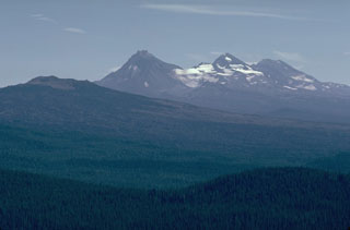 The broad Belknap shield volcano to the left seen here from Sand Mountain volcano to its NW, with the Three Sisters volcanoes in the background, is one of the youngest volcanoes in the central Oregon Cascades. The latest dated lava flow traveled 15 km W to the McKenzie River from a vent on the NE side of Belknap about 1,500 years ago.
Photo by Lee Siebert, 1981 (Smithsonian Institution).
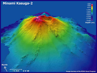 Minami Kasuga (South Kasuga) submarine volcano is seen in this bathymetric image, looking from the SW with 2x vertical exaggeration. Bathymetic contours are overlain on SeaBat data courtesy of Koichi Nakamura (National Institute of Advanced Science and Technology, Japan). It rises from about 3,000 m depth to within about 170 m of the sea surface. Two smaller cones are located low on the eastern flank. Active hydrothermal fields are located at the summit of and lower flanks.
Image courtesy of NOAA vents program, 2006 (http://oceanexplorer.noaa.gov/explorations/06fire).
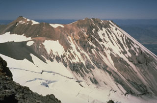 Shastina forms the west flank of Mount Shasta with Whitney Glacier at its base. It is composed of overlapping lava flows and domes. Emplacement of the Shastina domes about 9,700-9,400 years ago was accompanied by pyroclastic flows and lava flows that traveled long distances down its flanks.
Photo by Bill Chadwick, 1981 (U.S. Geological Survey).
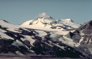 A steam plume is a nearly constant feature at the summit of Mount Martin, seen here from the NE in the Valley of Ten Thousand Smokes. Martin volcano is extensively covered by glaciers, but is only moderately dissected. Its youngest and largest lava flow traveled from the summit 12 km down the upper Angle Creek valley, behind the ridge at the right. The slopes at the left are the northern flank of Mount Mageik.
 Copyrighted photo by Katia and Maurice Krafft, 1978.
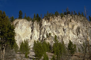 The thick cliffs are composed of massive ash-flow deposits of the Lava Creek Tuff, erupted about 640,000 years ago. Eruption of the 1000 cu km Lava Creek Tuff resulted in the formation of the present 45 x 85 km wide caldera, the latest of three large calderas formed at Yellowstone during the past 2 million years.
Photo by Lee Siebert, 1994 (Smithsonian Institution).
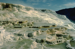 The dramatic travertine terraces of Mammoth Hot Springs in NW Yellowstone are formed by redeposition of dissolved limestone rock underlying the Mammoth area that is carried in solution in hot spring waters. Changes in hot spring passageways can produce very rapid changes in terrace morphology.
Copyrighted photo by Katia and Maurice Krafft, 1984.
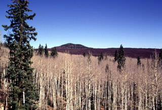 This unnamed cinder cone in the Sage Valley SE of Cedar Breaks National Monument was the source of one of the youngest lava flows in the Markagunt Plateau volcanic field in SW Utah. Extensive blocky lava flows cover broad areas near Navajo and Panguitch lakes.
Photo by Lee Siebert, 1996 (Smithsonian Institution).
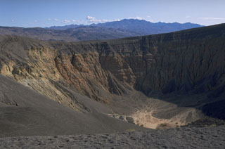 Ubehebe craters are an isolated group of maar volcanoes erupted through nonvolcanic sediments of Death Valley National Park. The craters were formed by hydrovolcanic explosions along a fault. The contact between pre-eruption yellowish- and orange-colored sedimentary rocks and overlying black ash deposits from an early stage scoria cone can be seen at the upper part of the western wall of 800-m wide, 235-m deep Ubehebe crater, the youngest and largest crater.
Photo by Lee Siebert, 1974 (Smithsonian Institution).
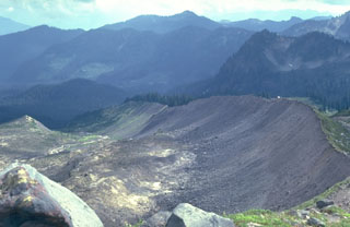 The forested scoria cone in the left of the photo is Schreibers Meadow Cone on the SE flank of Mount Baker. It erupted about 9,800 years ago, producing a scoria deposit and a lava flow that traveled 12 km to the present location of Baker Lake. The ridge in the foreground is a glacial moraine from Mount Baker known as the "Railroad Grade."
Photo by Lee Siebert, 1981 (Smithsonian Institution).
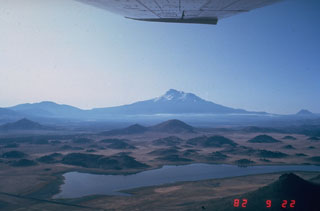 The hilly topography in the foreground is part of the massive debris avalanche deposit produced by collapse of Mount Shasta (center horizon). The roughly 46 km3, rapidly-moving debris avalanche swept some 50 km N. The hummocky area represents relatively intact segments of the volcano that were carried within a more fluidized, mixed bulk of the avalanche. Individual hummocks range up to a few hundred meters in height and roughly 1 km in length.
Photo by Harry Glicken, 1982 (U.S. Geological Survey).
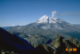 Redoubt is on the west side of Cook Inlet, 170 km SW of Anchorage. It was constructed over a basement of glacially eroded Mesozoic granitic rocks, seen here in the foreground. The volcano has been very active during the Holocene, producing at least 30 tephra layers in the Cook Inlet basin stratigraphy. A plume rises from the summit crater in this view from the NE following its 1989-90 eruption. Iliamna is visible in the distance to the left.
Photo by Christina Neal (U.S. Geological Survey, Alaska Volcano Observatory).
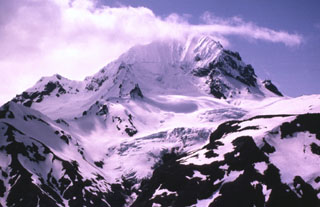 Atmospheric clouds obscure the summit of Devils Desk, an extensively eroded stratovolcano in the NE part of Katmai National Park. The volcano, which rises 450 m above the top of Hook Glacier, is the eroded neck of a former stratovolcano, most of which has been removed. The age of the volcano is not known precisely, but a Potassium-Argon date of about 245,000 years was obtained.
Photo by Betsy Yount, 1983 (U.S. Geological Survey, Alaska Volcano Observatory).
 The Lost Lake scoria cones, seen here from the east across Lost Lake near Santiam Pass, are the youngest known volcanic products of the Sand Mountain volcanic field. The cones formed about 1,950 radiocarbon years ago during eruptions along a N-S-trending fissure at the northern end of the Sand Mountain group. Growth of the cones blocked Lost Creek, forming Lost Lake.
Photo by Lee Siebert, 1997 (Smithsonian Institution).
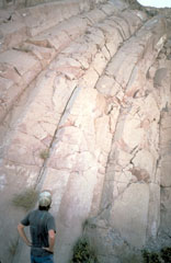 Curved cooling joints in the Bishop Tuff deposit form a dramatic pattern in the Owens River Gorge of the Long Valley caldera. Eruption of 500 cu km of material about 760,000 years ago resulted in collapse of the 17 x 32 km caldera.
Photo by Larry Mastin, 1992 (U.S. Geological Survey).
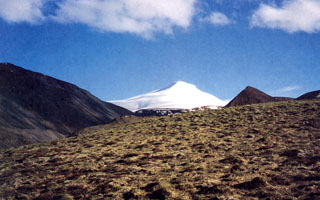 Snow-capped Mount Gordon is viewed here from the north. The composite cinder-lava cone is 5 km in diameter and 625 m high. A lava flow (out of view to the right) traveled from the base of the cone to the NW; tephra deposits from Mount Gordon are exposed primarily to the SW. Mount Gordon is the most prominent of a group of Pleistocene and Holocene cinder cones in the northern Wrangell Mountains between Mount Drum and the Nabesna Glacier river system.
 Photo by Donald Richter, 1994 (U.S. Geological Survey, published in Richter et al., 1995).
 A tree-ring core shows a pronounced narrowing of tree rings dated about 1480 CE resulting from reduced growth rates following an eruption that occurred sometime between the end of August 1479 and the end of May 1480. This eruption was the second largest Holocene eruption of Mount St. Helens, producing the "Wn" tephra layer. Another major eruption two years later that produced the "We" tephra layer, which also affected this tree.
Photo by David Yamaguchi (University of Washington).
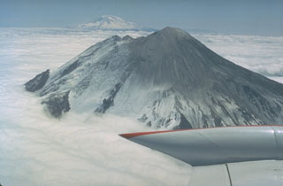 This 16 May 1980 photo, taken two days before the catastrophic eruption, shows Mount St. Helens from the west with Mount Adams in the background. The two notches immediately to the north of the summit crater mark the top of the N-flank bulge, an uplifted and deformed area that collapsed in a massive landslide on 18 May, triggering the lateral blast that devastated areas to the north.
Photo by Bob Christiansen, 1980 (U.S. Geological Survey).
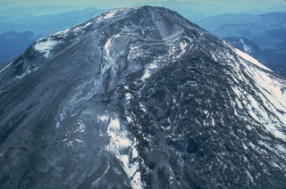 The highly fractured area on the right side of this 3 May 1980 photo is the renowned N-flank "bulge" of Mount St. Helens. Intense deformation producing northward displacements up to 2.5 m per day and reduction of rock strength by hydrothermal alteration caused the catastrophic collapse of the N flank, triggering the devastating magmatic explosive eruptions of 18 May.
Photo by William Melson, 1980 (Smithsonian Institution).
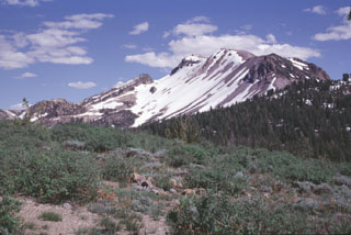 Mammoth Mountain rises to the SE of Minaret Summit. The 3369-m-high volcano formed between about 111,000 and 57,000 years ago and consists of a series of trachydacitic and rhyodacitic lava flows and lava domes. Magmatic activity at Mammoth Mountain overlapped the latest eruptions of the Long Valley caldera and ended prior to the onset of eruptions at the Mono-Inyo chain, although phreatic eruptions on the northern flank of Mammoth Mountain took place during the Holocene.
 Photo by Lee Siebert, 1998 (Smithsonian Institution).
 Newberry caldera is one of the largest volcanoes in the conterminous United States, covering an area of about 3,200 km2. Two lakes, Paulina Lake (top) and East Lake (bottom) partially fill the 6.5 x 8 km wide caldera, which formed following the eruption of major pyroclastic flows during the Pleistocene. Subsequent eruptions have taken place from vents within the caldera, near its rim, and from fissures on its flanks. The light-colored lobate lava flow south (left) of Paulina Lake is one of several obsidian flows erupted during the Holocene.
Photo by Lee Siebert, 1998 (Smithsonian Institution).
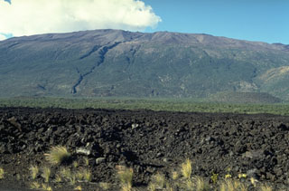 Mauna Kea is seen here from the S at the broad Humu'ulu Saddle between Mauna Kea and Mauna Loa. The lava flow in the foreground was emplaced during an 1843 eruption that originated on the NE rift zone of Mauna Loa. The flow traveled directly N to the Mauna Kea saddle, where it was deflected to the W. The irregular profile of the summit region of Mauna Kea is due to scoria cones and pyroclastic ejecta that are not present at Mauna Loa.
Photo by Paul Kimberly, 1994 (Smithsonian Institution).
 This lava flow was erupted in 1996 along the North Gorda Ridge, the northernmost of five segments of the Gorda Ridge located immediately south of the Blanco Transform Fault, which offsets the Gorda and Juan de Fuca spreading ridges. Submarine cameras revealed new lava flows about 100-200 m wide along a fissure that was at least 3.5 km long. The 65-km-long North Gorda Ridge segment is located about 200 km W of the southern Oregon coast and has an hourglass shape in plan view, with a shallower narrow axial valley at the center.
Image courtesy of National Oceanic and Atmospheric Administration, 1996 (http://www.pmel.noaa.gov/vents/home.html).
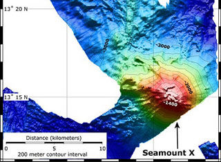 A bathymetric map showing Seamount X was produced using data from 2004 and 2006 NOAA submarine vents expeditions. The seamount lies about 70 km WSW of Guam and displays areas of hydrothermal venting. The contour interval is 200 m.
Image courtesy of Susan Merle (Oregon State University/NOAA Vents Program).
This is a compilation of United States volcano information sources, such as official monitoring or other government agencies.
| Civil Protection Agencies | |
|---|---|
| Hawaiʻi County Civil Defense Agency | |
| Alaska Division of Homeland Security and Emergency Management | |
| Additional Information Sources | |
|---|---|
| Commonwealth of Northern Mariana Islands | |